
Memorials & monuments · Yorkshire & the Humber
The Tower, Approximately 100 Metres To North East Of Bolton Hall
In or near Aysgarth.
The Tower, Approximately 100 Metres To North East Of Bolton Hall — Grade II listed building-listed memorial in england-yorkshire, United Kingdom.

T Eyre — CC BY-SA 2.0 via Wikimedia Commons licence

Plan your visit
- Typical visit
- 15 min–45 min
- Nearest railway station
- Redmire · 3.4 km
- Free entry
- Dog-friendly
Getting there & planning your visit
To visit The Tower, Approximately 100 Metres To North East Of Bolton Hall, the nearest railway station is Redmire, located 3.4 km away. The postcode for sat-nav is DL8 4UF, and entry to the site is free.
About
The Tower, Approximately 100 Metres To North East Of Bolton Hall is a Grade II listed building-listed memorial in england-yorkshire, United Kingdom, registered on the National Heritage List for England (NHLE entry 1130866). Listed status protects buildings and structures of special architectural or historic interest. See the linked Wikipedia article for further details.
Photo gallery
Heritage listing
Details SE 08 NE PRESTON-UNDER-SCAR BOLTON HALL 9/57 The Tower, approximately 100 metres to north-east of Bolton Hall GV II Gothic folly. Late C18. Rubble with ashlar dressings. Hexagonal in plan, 3 storeys, plus smaller central turret. Paired bands between storeys. Board door in architrave on north side. First floor: a light vent in chamfered surround on each side. Second floor: a double light vent in chamfered surround on each side. Cornice. Battlemented parapet. Turret in ashlar, with light vents, cornices, and 5-sided openings in parapet. Flagstaff. Listing NGR: SE0768489859 Legacy The contents of this record have been generated from a legacy data system. Legacy System number: 321804 Legacy System: LBS
From the Historic England List Entry under OGL v3.
Place summary
The Tower, approximately 100 metres to the north east of Bolton Hall, is a Grade II listed memorial located in the parish of Preston-under-Scar, Yorkshire. Its designation reflects architectural and historical significance, contributing to the region's heritage.
AI-generated from the structured facts on this page (operator, designation, listing, era). Not a substitute for visiting.
- Coordinates
- 54.3043, -1.8834
- District
- North Yorkshire
- Parish
- Preston-under-Scar
- Postcode
- DL8 4UF
- Parliamentary constituency
- Richmond and Northallerton
- Nearest railway station
- Redmire — 3.4 km
Sources
- wikidata: Q26423847 (CC0)
Other places nearby
Bolton Hall
Historic houses · 0.2 km

Hellgill Bridge
Historic bridges · 0.5 km

Roman fort at Wensley
Archaeological sites · 0.7 km

Roman fort at Wensley
Archaeological sites · 0.7 km
_(geograph_7327928).jpg?width=1200)
Preston Mill
Mills · 0.9 km

Keld heads lead smelt mill
Historic houses · 1.0 km

Keld heads lead smelt mill
Archaeological sites · 1.0 km

Wensley Bridge
Historic bridges · 1.5 km
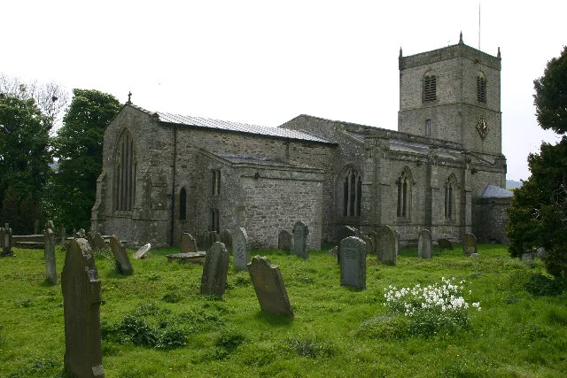
Holy Trinity Church, Wensley
Historic churches · 1.6 km

The Old Vicarage
B&Bs · 2.0 km

West Witton
Villages · 2.1 km
Fox And Hounds Inn
Historic pubs · 2.1 km
Nearby
📷 5Historic houses · Yorkshire & the Humber
Bolton Hall
Bolton Hall — a Grade II*-listed historic house in england-yorkshire, United Kingdom.
📷 3Historic bridges · Yorkshire & the Humber
Hellgill Bridge
Hellgill Bridge — Grade II listed building-listed bridge in england-yorkshire, United Kingdom.
📷 3Archaeological sites · Yorkshire & the Humber
Roman fort at Wensley
Roman fort at Wensley — a archaeological in england-yorkshire, United Kingdom.
📷 5Archaeological sites · Yorkshire & the Humber
Roman fort at Wensley
Roman fort at Wensley — archaeological in england yorkshire.
📷 3Mills · Yorkshire & the Humber
Preston Mill
Preston Mill — mill in Preston-under-Scar, Richmondshire, North Yorkshire, England, UK.
📷 3Historic houses · Yorkshire & the Humber
Keld heads lead smelt mill
Keld heads lead smelt mill — a historic house in england-yorkshire, United Kingdom.
Where to eat & stay near The Tower, Approximately 100 Metres To North East Of Bolton Hall
Places to stay
📷 7B&Bs · Yorkshire & the Humber
The Old Vicarage
The Old Vicarage — a bed-and-breakfast in england yorkshire.
 📷 7
📷 7Hotels · Yorkshire & the Humber
The Wensleydale Heifer
The Wensleydale Heifer — a hotel in england yorkshire.
 📷 5
📷 5Caravan parks · Yorkshire & the Humber
Leyburn Caravan Park
Leyburn Caravan Park — a caravan park in england yorkshire.
 📷 5
📷 5 📷 7
📷 7Hotels · Yorkshire & the Humber
Black Swan Hotel
Black Swan Hotel — a hotel in england yorkshire.
 📷 5
📷 5Campsites · Yorkshire & the Humber
Swan Farm Camp Site
Swan Farm Camp Site — a campsite in england yorkshire.
Places to eat & drink
📷 7Historic pubs · Yorkshire & the Humber
Fox And Hounds Inn
Fox And Hounds Inn in England Yorkshire, United Kingdom.
 📷 7
📷 7Cafés · Yorkshire & the Humber
Kim's Cafe & Bistro
Kim's Cafe & Bistro — a café in england yorkshire.
 📷 5
📷 5Restaurants · Yorkshire & the Humber
The Sandpiper Inn
The Sandpiper Inn — a restaurant in england yorkshire.
 📷 5
📷 5Historic pubs · Yorkshire & the Humber
Foresters Arms Inn
Foresters Arms Inn in England Yorkshire, United Kingdom.
 📷 7
📷 7Cafés · Yorkshire & the Humber
The Castle Keep Tea Room
The Castle Keep Tea Room — a café in england yorkshire.
 📷 6
📷 6Historic pubs · Yorkshire & the Humber
The Blue Lion
The Blue Lion in England Yorkshire, United Kingdom.
More memorials in this region
 📷 3
📷 3Memorials & monuments · Yorkshire & the Humber
Disley War Memorial
Disley War Memorial — War memorial, dating to 1920.
 📷 3
📷 3Memorials & monuments · Yorkshire & the Humber
Hyde war memorial
Hyde war memorial is a memorial in the United Kingdom.
 📷 3
📷 3Memorials & monuments · Yorkshire & the Humber
Audenshaw War Memorial
Audenshaw War Memorial — Grade II listed building-listed memorial in england-west-midlands, United Kingdom.
 📷 3
📷 3Memorials & monuments · Yorkshire & the Humber
War memorial to front of Church of St Paul
War memorial to front of Church of St Paul — Grade II listed building-listed memorial in england-west-midlands, United Kingdom.
Frequently asked questions
- Where is The Tower, Approximately 100 Metres To North East Of Bolton Hall?
- The Tower, Approximately 100 Metres To North East Of Bolton Hall is in Yorkshire, United Kingdom (postcode DL8 4UF), in the parish of Preston-under-Scar.
- What is The Tower, Approximately 100 Metres To North East Of Bolton Hall?
- The Tower, Approximately 100 Metres To North East Of Bolton Hall — Grade II listed building-listed memorial in england-yorkshire, United Kingdom.
- How do I get to The Tower, Approximately 100 Metres To North East Of Bolton Hall?
- The nearest railway station is Redmire, about 3.4 km away. Drivers can use postcode DL8 4UF.
- Is The Tower, Approximately 100 Metres To North East Of Bolton Hall a listed building?
- The Tower, Approximately 100 Metres To North East Of Bolton Hall is officially recognised as Grade II listed building listed.
- Is The Tower, Approximately 100 Metres To North East Of Bolton Hall free to visit?
- Yes, The Tower, Approximately 100 Metres To North East Of Bolton Hall is free to enter.
- How do I get to The Tower, Approximately 100 Metres To North East Of Bolton Hall?
- The nearest railway station is Redmire, about 3.4 km away. Drivers can navigate to postcode DL8 4UF.