
Gardens · East Midlands
The Slopes
In or near Harpur Hill.
The Slopes — gardens in Buxton, Derbyshire, England, UK.

Wikimedia Commons contributors — see linked file page for photographer and licence licence

Plan your visit
- Typical visit
- 1 h–2.5 h
- Best time of year
- Spring & summer (Apr–Sep)
- Nearest railway station
- Buxton · 0.3 km
- Dog-friendly
Getting there & planning your visit
The Slopes is located in High Peak, Derbyshire, with the nearest railway station being Buxton, just 0.3 km away. The postcode for sat-nav is SK17 6BH. Entry details are not specified, so please check in advance for any fees, and accessibility information is not provided.
About
The Slopes is a public garden in the United Kingdom. It covers approximately 3 km². Heritage designation: Grade II listed park and garden. Wikidata describes it as: "gardens in Buxton, Derbyshire, England, UK". Coordinates: 53.2582°, -1.9143°.
Photo gallery
From the Wikipedia article
The Slopes (formerly known as The Terrace) is a Grade-II-listed public park in Buxton, Derbyshire in England. The area was laid out by landscape architect Jeffry Wyatville in 1811 for William Cavendish, 6th Duke of Devonshire, as pleasure grounds for the guests of The Crescent hotel to promenade. The design of The Terrace was modified further by Sir Joseph Paxton in 1859. The grassed bank of The Slopes lies between the Town Hall and Higher Buxton at the top and St Ann's Well and the Pump Room (into which the Buxton spring mineral waters were piped) at the bottom, facing The Crescent hotel, the Victorian spa baths and the Old Hall Hotel. The terraced area is intersected with numerous footpaths. The Terrace had previously been a bare hillside known as St Ann's Cliff. In 1787 Major Hayman Rooke uncovered a long section of the Roman town wall, which is now beneath the landscaped hillside of The Slopes. At the same time Rooke also documented details of the base of a temple in the same area, overlooking the site of the baths and springs. The temple was dedicated to the water deity Arnemetia. It had a shrine room set on a rectangular podium, with a columned portico at the front. Twelve Grade-II*-listed 18th-century decorated limestone urns (originally from Lord Burlington's estate at Londesborough Hall in Yorkshire) are set on gritstone plinths along walled footpaths and stone steps. Buxton Town Hall looks down from the top of The Slopes. It was designed by William Pollard in a French Renaissance style and built between 1887 and 1889. The Grade-II-listed war memorial from c.1920 commemorates the soldiers from Buxton who perished in the two World Wars. An ashlar obelisk on a stepped platform is fronted by a bronze statue of Winged Victory holding a sword and a laurel wreath. The sculptor was Louis Frederick Roslyn. The Met Office climatological station for Buxton is situated on The Slopes directly above the war memorial. The instruments at the station record various…
Excerpt from Wikipedia under CC BY-SA 4.0. See the source article linked in Sources below.
- Coordinates
- 53.2582, -1.9143
- County
- Derbyshire
- District
- High Peak
- Parish
- High Peak, unparished area
- Postcode
- SK17 6BH
- Parliamentary constituency
- High Peak
- Nearest railway station
- Buxton — 0.3 km
Sources
- wikidata: Q80961457 (CC0)
- wikipedia: The Slopes, Buxton (CC BY-SA 4.0)
- commons: The Slopes, Buxton.jpg (CC BY-SA 4.0)
Featured in these 2 guides
Other places nearby

War Memorial on the Slopes
Memorials & monuments · 0.0 km
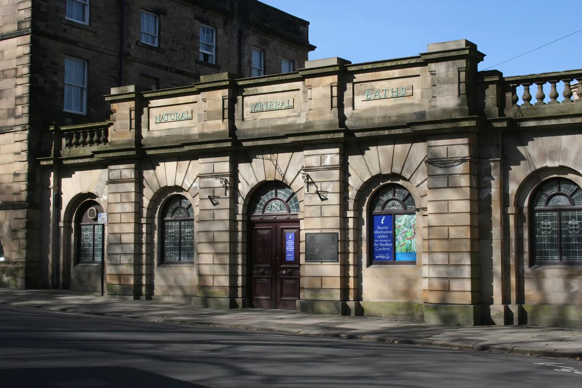
Natural Mineral Baths
Museums · 0.1 km

Old Hall Hotel
Hotels · 0.1 km

Buxton Natural Mineral Baths
Lidos & outdoor pools · 0.1 km

William Cavendish
Public art & sculpture · 0.1 km

Buxton Crescent
Historic houses · 0.1 km

Roman temple in Buxton
Follies · 0.1 km
Aquae Arnemetiae
Vineyards · 0.1 km
Buxton Opera House
Theatres · 0.1 km
1-6, The Square
Gardens · 0.1 km

Buxton Baths
Museums · 0.1 km

Buxton Brewery
Breweries · 0.1 km
Nearby
📷 3Memorials & monuments · East Midlands
War Memorial on the Slopes
War Memorial on the Slopes — Grade II listed building-listed memorial in england-east-midlands, United Kingdom.
📷 3Museums · East Midlands
Natural Mineral Baths
Natural Mineral Baths — public bath in High Peak, Derbyshire, England, UK.
📷 5Hotels · East Midlands
Old Hall Hotel
Old Hall Hotel — a hotel in england east midlands.
📷 5Lidos & outdoor pools · East Midlands
Buxton Natural Mineral Baths
Buxton Natural Mineral Baths — a lido in england east midlands.
📷 3Public art & sculpture · East Midlands
William Cavendish
William Cavendish — a public art in england-east-midlands, United Kingdom.
📷 4Historic houses · East Midlands
Buxton Crescent
Buxton Crescent — a Grade I-listed historic house in england-east-midlands, United Kingdom.
Where to eat & stay near The Slopes
Places to stay
📷 5Hotels · East Midlands
Old Hall Hotel
Old Hall Hotel — a hotel in england east midlands.
 📷 5
📷 5Caravan parks · East Midlands
Lime Tree Park
Lime Tree Park — a caravan park in england east midlands.
📷 5 📷 5
📷 5Caravan parks · East Midlands
Buxton Caravan and Motorhome Club
Buxton Caravan and Motorhome Club — a caravan park in england east midlands.
 📷 5
📷 5Campsites · East Midlands
Cold Springs Farm Campsite
Cold Springs Farm Campsite — a campsite in england east midlands.
 📷 5
📷 5Caravan parks · East Midlands
Clover Fields Touring Caravan Park
Clover Fields Touring Caravan Park — a caravan park in england east midlands.
Places to eat & drink
 📷 5
📷 5Historic pubs · East Midlands
Cat and Fiddle Inn
Cat and Fiddle Inn in England South East, United Kingdom.
 📷 7
📷 7Historic pubs · East Midlands
The Three Stags' Heads
The Three Stags' Heads in England South East, United Kingdom.
 📷 5
📷 5Historic pubs · East Midlands
The Hare And Hounds Hotel
The Hare And Hounds Hotel in England Yorkshire, United Kingdom.
 📷 5
📷 5Historic pubs · West Midlands
Ye Olde Rock Inn
Ye Olde Rock Inn in England West Midlands, United Kingdom.
 📷 5
📷 5Restaurants · West Midlands
Sutton Hall
Sutton Hall — a restaurant in england west midlands.
 📷 5
📷 5More gardens in this region
 📷 5
📷 5 📷 5
📷 5Gardens · East Midlands
Elgood's Brewery Visitor Centre and Gardens
Elgood's Brewery Visitor Centre and Gardens — a garden in england-london, United Kingdom.
 📷 5
📷 5Gardens · East Midlands
Buxton Pavilion Gardens
Buxton Pavilion Gardens is a Victorian landscaped public park in the spa town of Buxton in Derbyshire. The River Wye flows through the gardens, which are a Grade II* listed public park of Special Hist
 📷 3
📷 3Gardens · East Midlands
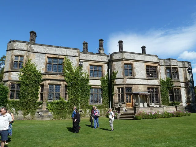
Thornbridge Hall
Thornbridge Hall — Grade II listed house in Ashford in the Water, Derbyshire, England, UK.
Frequently asked questions
- Where is The Slopes?
- The Slopes is in Derbyshire, the East Midlands, United Kingdom (postcode SK17 6BH), in the parish of High Peak, unparished area.
- What is The Slopes?
- The Slopes — gardens in Buxton, Derbyshire, England, UK.
- How do I get to The Slopes?
- The nearest railway station is Buxton, about 0.3 km away. Drivers can use postcode SK17 6BH.
- Is The Slopes a listed building?
- The Slopes is officially recognised as Grade II listed park and garden listed.
- How do I get to The Slopes?
- The nearest railway station is Buxton, about 0.3 km away. Drivers can navigate to postcode SK17 6BH.