Historic houses · North East England
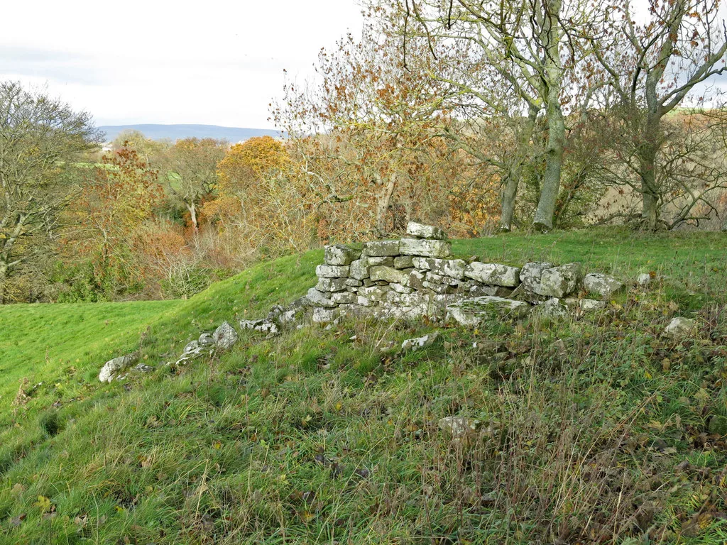
The Christening Stone, 160m east of Doe Park
In or near Startforth.
The Christening Stone, 160m east of Doe Park — a Grade II*-listed historic house in england-north-east, United Kingdom.

Eirian Evans — CC BY-SA 2.0 via Wikimedia Commons licence
Plan your visit
- Typical visit
- 1 h–2 h
- Family-friendly
- Limited wheelchair access
About
The Christening Stone, 160m east of Doe Park is a Grade II*-listed building in england-north-east, United Kingdom. Grade II* status is conferred by Historic England (or Cadw, Historic Environment Scotland or NIEA equivalents) on buildings of exceptional national interest. See the linked Wikipedia article for full historical and architectural details.
Photo gallery
Protected designations
- Site of Special Scientific Interest: Shipley and Great Woods SSSI
- Area of Outstanding Natural Beauty: North Pennines
Designations sourced from Natural England open data under OGL v3.
Place summary
The Christening Stone is a historic site located 160 metres east of Doe Park in Cotherstone, North-East England. This Grade II* listed structure is notable for its historical significance, reflecting the area's cultural heritage.
AI-generated from the structured facts on this page (operator, designation, listing, era). Not a substitute for visiting.
- Coordinates
- 54.5777, -1.9900
- District
- County Durham
- Parish
- Cotherstone
- Postcode
- DL12 9QS
- Parliamentary constituency
- Bishop Auckland
Sources
- wikidata: Q17675053 (CC0)
Other places nearby
Doe Park Cross
Memorials & monuments · 0.0 km

Doe Park Caravan Site
Caravan parks · 0.3 km

Doe Park Mill
Archaeological sites · 0.3 km
Cotherstone Castle
Castles · 0.7 km

Cotherstone
Castles · 0.7 km

River Balder
Natural landmarks · 0.8 km

Percy Myre Rock
Viewpoints · 0.8 km

Marwood Caravan Park
Caravan parks · 0.8 km

Fairy Cupboards
Natural landmarks · 0.9 km
Shipley and Great Woods
Natural landmarks · 1.0 km

Balder Viaduct
Castles · 1.2 km

Cotherstone railway station
Castles · 1.3 km
Nearby
📷 3Memorials & monuments · North East England
Doe Park Cross
Doe Park Cross — a memorial in england-north-east, United Kingdom.
📷 5Caravan parks · North East England
Doe Park Caravan Site
Doe Park Caravan Site — a caravan park in england north east.
📷 3Archaeological sites · North East England
Doe Park Mill
Doe Park Mill — a archaeological in england-north-east, United Kingdom.
📷 3Castles · North East England
Cotherstone Castle
Cotherstone Castle — Castle in Durham, England.
📷 5Castles · North East England
Cotherstone
Cotherstone in England North East, United Kingdom.
📷 5Natural landmarks · North East England
River Balder
River Balder in England North East, United Kingdom.
Where to eat & stay near The Christening Stone, 160m east of Doe Park
Places to stay
📷 5Caravan parks · North East England
Doe Park Caravan Site
Doe Park Caravan Site — a caravan park in england north east.
📷 5Caravan parks · North East England
Marwood Caravan Park
Marwood Caravan Park — a caravan park in england north east.
 📷 5
📷 5Caravan parks · North East England
Pecknell Farm Caravan Site
Pecknell Farm Caravan Site — a caravan park in england north east.
 📷 5
📷 5Campsites · North East England
Barnard Castle Camping and Caravanning Club Site
Barnard Castle Camping and Caravanning Club Site — a campsite in england north east.
 📷 5
📷 5Campsites · North East England
Hill Top Huts
Hill Top Huts — a campsite in scotland lowlands.
 📷 5
📷 5Caravan parks · North East England
Teesdale Barnard Castle Caravan & Motorhome Club Campsite
Teesdale Barnard Castle Caravan & Motorhome Club Campsite — a caravan park in england north east.
Places to eat & drink
 📷 6
📷 6Historic pubs · North East England
Commercial Hotel
Commercial Hotel in England North East, United Kingdom.
 📷 6
📷 6Historic pubs · North East England
Cricketers' Arms Public House
Cricketers' Arms Public House in England North East, United Kingdom.
 📷 5
📷 5Historic pubs · North East England
The White Swan Public House And Swan Cottage
The White Swan Public House And Swan Cottage in England North East, United Kingdom.
 📷 5
📷 5 📷 5
📷 5Historic pubs · North East England
Turk's Head Public House
Turk's Head Public House in England North East, United Kingdom.
 📷 5
📷 5Historic pubs · North East England
Blue Bell Public House
Blue Bell Public House in England North East, United Kingdom.
More historic houses in this region
 📷 3
📷 3Historic houses · North East England
Wayside cross known as Jenny Bradley 1000m north west of Bloworth Crossing on Greenhow Moor
Wayside cross known as Jenny Bradley 1000m north west of Bloworth Crossing on Greenhow Moor — a Grade II*-listed historic house in england-yorkshire, United Kingdom.
 📷 3
📷 3Historic houses · North East England
Crackpot Hall
Crackpot Hall — a historic house in england-north-west, United Kingdom.
 📷 3
📷 3Historic houses · North East England
Bunton Mine shop
Bunton Mine shop — a historic house in england-north-west, United Kingdom.
 📷 3
📷 3Historic houses · North East England
Blakethwaite Mine
Blakethwaite Mine — a historic house in england-north-west, United Kingdom.
Frequently asked questions
- Where is The Christening Stone, 160m east of Doe Park?
- The Christening Stone, 160m east of Doe Park is in North-East England, United Kingdom (postcode DL12 9QS), in the parish of Cotherstone.
- What is The Christening Stone, 160m east of Doe Park?
- The Christening Stone, 160m east of Doe Park — a Grade II*-listed historic house in england-north-east, United Kingdom.
- How do I get to The Christening Stone, 160m east of Doe Park?
- Drivers can use postcode DL12 9QS.
- Is The Christening Stone, 160m east of Doe Park a listed building?
- The Christening Stone, 160m east of Doe Park is officially recognised as Grade II* listed.
- Is The Christening Stone, 160m east of Doe Park a protected site?
- Yes — The Christening Stone, 160m east of Doe Park is part of the Shipley and Great Woods SSSI Site of Special Scientific Interest and the North Pennines National Landscape (AONB).
- How do I get to The Christening Stone, 160m east of Doe Park?
- Drivers can navigate to postcode DL12 9QS. It sits within the Bishop Auckland parliamentary constituency.