
Mountains & hills · South Wales
The Blorenge
Also known as: Blorens
The Blorenge — Named summit at 561 m.

Wikimedia Commons contributors — see linked file page for photographer and licence licence

Plan your visit
- Typical visit
- 3 h–8 h
- Best time of year
- Late spring – early autumn (May–Oct)
- Nearest railway station
- Abergavenny · 4.0 km
- Free entry
- Dog-friendly
About
The Blorenge is a named summit in the United Kingdom. Wikidata describes it as: "Named summit at 561 m.". Coordinates: 51.8007°, -3.0600°.
Photo gallery
See it from the streetimagery from 2023
Imagery © Mapillary contributors, CC BY-SA 4.0
Official information
The Blorenge is a prominent hill in South Wales, offering scenic views and various walking paths for visitors. It is popular for hiking and provides a relatively easy ascent from nearby car parks, making it accessible for casual walkers and families.
Protected designations
- Site of Special Scientific Interest: River Wye SSSI
Designations sourced from Natural England open data under OGL v3.
From the Wikipedia article
Blorenge, also called The Blorenge (; Welsh: Blorens), is a prominent hill overlooking the valley of the River Usk near Abergavenny, Monmouthshire, southeast Wales. It is situated in the southeastern corner of the Brecon Beacons National Park. The summit plateau reaches a height of 561 metres (1,841 ft).
Excerpt from Wikipedia under CC BY-SA 4.0. See the source article linked in Sources below.
Background
Visiting
Most of the hill is open access for walkers and there are a number of footpaths and bridleways which run to and over it. There is a hillwalking trail that runs around Blorenge and is a very popular destination for tourists and walkers alike. The ascent on foot to the summit from Llanfoist / Abergavenny via Cwm Craf is very steep but the effort is repaid by the panoramic views from the summit across the valley of the River Usk to Abergavenny and the Black Mountains, Wales. Easier access both to the summit and the northern edge of the plateau can be had from the Foxhunter car park.
Sourced from Wikipedia under CC BY-SA 4.0.
- Coordinates
- 51.8007, -3.0600
- District
- Monmouthshire
- Parish
- Llanfoist Fawr
- Postcode
- NP7 9RW
- Parliamentary constituency
- Monmouthshire
- Nearest railway station
- Abergavenny — 4 km
- Official site
- www.hill-bagging.co.uk
Sources
- osm: n582796015 (ODbL)
- wikipedia: Blorenge (CC BY-SA 4.0)
- commons: Blorenge from Abergavenny, Monmouthshire - geograph.org.uk - 84043.jpg (CC BY-SA 4.0)
Other places nearby

Blorenge
Mountains & hills · 0.1 km

Remains - Garnddyrys Forge
Historic houses · 1.3 km

Pen-ffordd-goch Pond
Reservoirs & lochs · 1.8 km

Govilon Yard Bridge ( Canal Bridge No 97 )
Historic bridges · 1.8 km

Bridge 97A
Historic bridges · 1.8 km

Bridge over Canal at Llanfoist Wharf
Historic bridges · 1.9 km

Bridge 97B
Historic bridges · 1.9 km
.jpg?width=1200)
Llanwenarth Baptist Chapel
Chapels · 1.9 km
Govilon Bridge (Canal Bridge no 98)
Historic bridges · 1.9 km

Pwll Du Limestone Quarry & Water Balance Lift
Quarries · 1.9 km
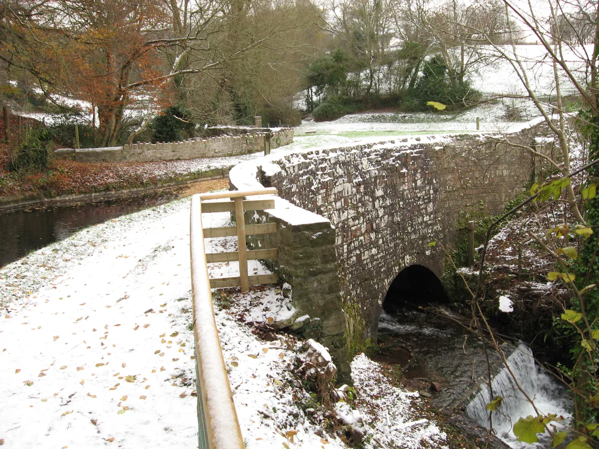
Embanked Aqueduct SW of Govilon ( including Wall & Gate-piers to W )
Aqueducts · 1.9 km

Siambri Ddu
Caves · 2.0 km
Nearby
📷 5📷 3Historic houses · South Wales
Remains - Garnddyrys Forge
Remains - Garnddyrys Forge — a historic house in wales-south, United Kingdom.
📷 3Reservoirs & lochs · South Wales
Pen-ffordd-goch Pond
Pen-ffordd-goch Pond — pond in Monmouthshire, Wales, UK.
📷 5Historic bridges · South Wales
Govilon Yard Bridge ( Canal Bridge No 97 )
Govilon Yard Bridge ( Canal Bridge No 97 ) — Grade II listed building-listed bridge in wales-south, United Kingdom.
📷 4Historic bridges · South Wales
Bridge 97A
Bridge 97A is a historic bridge in the United Kingdom.
📷 5Historic bridges · South Wales
Bridge over Canal at Llanfoist Wharf
Bridge over Canal at Llanfoist Wharf — Grade II listed building-listed bridge in wales-south, United Kingdom.
Where to eat & stay near The Blorenge
Places to stay
 📷 5
📷 5 📷 7
📷 7Hotels · South Wales
Kings Arms Hotel
Kings Arms Hotel — a hotel in wales south.
 📷 5
📷 5Campsites · South Wales
Pyscodlyn Camping and Caravan Site
Pyscodlyn Camping and Caravan Site — a campsite in wales south.
📷 5Caravan parks · South Wales
Pyscodlyn Camping and Caravan Site
Pyscodlyn Camping and Caravan Site — a caravan park in wales south.
 📷 5
📷 5 📷 5
📷 5Places to eat & drink
 📷 5
📷 5Restaurants · South Wales
The Walnut Tree
The Walnut Tree — a restaurant in wales south.
 📷 7
📷 7 📷 7
📷 7 📷 5
📷 5Restaurants · South Wales
Little Crown
Little Crown — a restaurant in wales south.
 📷 5
📷 5Historic pubs · South Wales
Skirrid Mountain Inn
Skirrid Mountain Inn — Historic pub — listed building or notable heritage status.
 📷 3
📷 3More mountains in this region
 Flagship📷 3
Mountains & hills · South Wales
Milford Haven Waterway
Milford Haven Waterway — ria, or flooded valley, in Pembrokeshire, south-west Wales, UK.
 📷 5
📷 5Mountains & hills · South Wales
Ogof Ffynnon Ddu
Ogof Ffynnon Ddu — cave in the Upper Swansea Valley in South Wales.
 📷 3
📷 3 📷 3
📷 3Frequently asked questions
- Where is The Blorenge?
- The Blorenge is in South Wales, United Kingdom (postcode NP7 9RW), in the parish of Llanfoist Fawr.
- What is The Blorenge?
- The Blorenge — Named summit at 561 m.
- How do I get to The Blorenge?
- The nearest railway station is Abergavenny, about 4.0 km away. Drivers can use postcode NP7 9RW.
- Is The Blorenge a protected site?
- Yes — The Blorenge is part of the River Wye SSSI Site of Special Scientific Interest.
- Is The Blorenge free to visit?
- Yes, The Blorenge is free to enter.
- How do I get to The Blorenge?
- The nearest railway station is Abergavenny, about 4.0 km away. Drivers can navigate to postcode NP7 9RW.