
Historic houses · South Wales
The Argoed
In or near Wyesham.
The Argoed — house in Penallt, Monmouthshire, Wales.

Wikimedia Commons contributors — see linked file page for photographer and licence licence

Plan your visit
- Typical visit
- 1 h–2 h
- Nearest railway station
- Rookwood · 5.7 km
- Family-friendly
- Limited wheelchair access
Getting there & planning your visit
To visit The Argoed, the nearest railway station is Rookwood, located 5.7 km away. The postcode for sat-nav is NP25 4RY. Entry has limited wheelchair accessibility.
About
The Argoed is a historic house in the United Kingdom — typically a country seat, manor, or town house with notable architecture or history. Heritage designation: Grade II* listed building. Wikidata describes it as: "house in Penallt, Monmouthshire, Wales". Coordinates: 51.7726°, -2.6927°.
Photo gallery
Heritage listing
http://cadwpublic-api.azurewebsites.net/reports/listedbuilding/FullReport?lang=en&id=2892
From Cadw under OGL v3.
Protected designations
- Site of Special Scientific Interest: River Wye SSSI
- Area of Outstanding Natural Beauty: Wye Valley
- Ramsar wetland: Severn Estuary
Designations sourced from Natural England open data under OGL v3.
From the Wikipedia article
The Argoed, Penallt, Monmouthshire, Wales, is a Victorian country house dating from the 1860s, with earlier origins from the late 16th and early 17th centuries. It is a Grade II* listed building and the garden is listed on the Cadw/ICOMOS Register of Parks and Gardens of Special Historic Interest in Wales. The English meaning of the Welsh word argoed is 'by a wood'.
Excerpt from Wikipedia under CC BY-SA 4.0. See the source article linked in Sources below.
Background
History
In the 17th century the house was the home of the Proberts, local landowners, members of parliament and High Sheriffs of Monmouthshire. Richard Potter, Chairman of the Great Western Railway and father of Beatrice Webb, bought the house in 1865 and undertook extensive rebuilding. Beatrice Webb was a founder member of the Fabian Society and, in the later 19th and early 20th centuries, she entertained many prominent friends at the Argoed, including George Bernard Shaw. In the 1980s, the Argoed was owned by Robert Plant of the rock band Led Zeppelin.
Architecture
The architectural historian John Newman describes the Argoed as "a large, two-storeyed stone house (and) a tantalizing one." The central block is original and irregular, its "windows all 18th century sashes." Potter's re-building included a larger block to the south and a service wing to the north. The interior has been greatly reconstructed. The grounds are largely from the 19th and 20th centuries, though they include "17th century terraces of potential archaeological interest." The triangular plot has gardens which include wide gravel drives, formal lawns, terraces and ha-has which look out over the Wye valley. and are recorded by the RCAHMW on their Coflein database.
Sourced from Wikipedia under CC BY-SA 4.0.
- Coordinates
- 51.7726, -2.6927
- District
- Monmouthshire
- Parish
- Trellech United
- Postcode
- NP25 4RY
- Parliamentary constituency
- Monmouthshire
- Nearest railway station
- Rookwood — 5.7 km
Sources
- wikidata: Q7714224 (CC0)
- wikipedia: The Argoed, Penallt (CC BY-SA 4.0)
- commons: The Argoed Penallt.jpg (CC BY-SA 4.0)
Other places nearby

First Day at School
Public art & sculpture · 0.6 km

Penallt War Memorial
Memorials & monuments · 0.7 km

Pentwyn Farm Grasslands
Forests & woodlands · 1.1 km

Prisk Wood
Wildlife reserves · 1.1 km

Highlands Camping and Caravan Site
Campsites · 1.3 km

The Whitebrook
Restaurants · 1.5 km

Penallt Viaduct
Historic bridges · 1.9 km

Meend
Mountains & hills · 2.1 km

Redbrook Incline Bridge
Historic bridges · 2.3 km
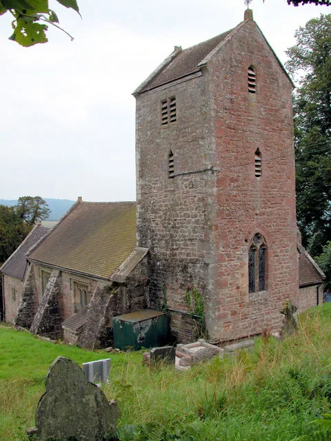
Penallt Old Church
Historic churches · 2.3 km

Heather Dean
Campsites · 2.4 km

Old Hills
Mountains & hills · 2.5 km
Nearby
📷 3Public art & sculpture · South Wales
First Day at School
First Day at School — a public art in South Wales, United Kingdom.
📷 3Memorials & monuments · South Wales
Penallt War Memorial
Penallt War Memorial — a memorial in South Wales, United Kingdom.
📷 4Forests & woodlands · South Wales
Pentwyn Farm Grasslands
Pentwyn Farm Grasslands is a forest or woodland in the United Kingdom.
📷 3📷 4Campsites · South Wales
Highlands Camping and Caravan Site
Highlands Camping and Caravan Site — a campsite in wales south.
📷 5Restaurants · South Wales
The Whitebrook
The Whitebrook — a restaurant in wales south.
Where to eat & stay near The Argoed
Places to stay
📷 4Campsites · South Wales
Highlands Camping and Caravan Site
Highlands Camping and Caravan Site — a campsite in wales south.
📷 5 📷 5
📷 5Campsites · South Wales
Glen Trothy C. & C. Park
Glen Trothy C. & C. Park — a campsite in wales south.
 📷 5
📷 5Campsites · South Wales
Broadstone Park Camping and Fishery
Broadstone Park Camping and Fishery — a campsite in wales south.
 📷 5
📷 5Hotels · South Wales
The Riverside Hotel
The Riverside Hotel — a hotel in wales south.
 📷 5
📷 5Campsites · South Wales
Monnow Bridge Caravan Site
Monnow Bridge Caravan Site — a campsite in wales south.
Places to eat & drink
📷 5Restaurants · South Wales
The Whitebrook
The Whitebrook — a restaurant in wales south.
 📷 5
📷 5 📷 5
📷 5Historic pubs · South Wales
The Green Dragon, Monmouth
The Green Dragon, Monmouth in Wales South, United Kingdom.
 📷 5
📷 5Historic pubs · South Wales
The Gatehouse
The Gatehouse in Wales South, United Kingdom.
 📷 6
📷 6 📷 6
📷 6Historic pubs · South Wales
Queens Head
Queens Head in Wales South, United Kingdom.
More historic houses in this region
 📷 3
📷 3Historic houses · South Wales
Agincourt House
Agincourt House — Grade II* listed building in Monmouth. Building in Monmouth, Wales.
 📷 3
📷 3Historic houses · South Wales
Big House, Landshipping
Big House, Landshipping — house in Martletwy, Pembrokeshire, Wales, UK.
 📷 3
📷 3Historic houses · South Wales
Boverton Place
Boverton Place — building in Llantwit Major, United Kingdom.
 📷 3
📷 3Historic houses · South Wales
Brynderi House
Brynderi House — house in Llantilio Crossenny, Monmouthshire, Wales.
Frequently asked questions
- Where is The Argoed?
- The Argoed is in South Wales, United Kingdom (postcode NP25 4RY), in the parish of Trellech United.
- What is The Argoed?
- The Argoed — house in Penallt, Monmouthshire, Wales.
- How do I get to The Argoed?
- The nearest railway station is Rookwood, about 5.7 km away. The nearest town is Wyesham. Drivers can use postcode NP25 4RY.
- Who owns The Argoed?
- The Argoed is owned by Private.
- Is The Argoed a listed building?
- The Argoed is officially recognised as Grade II* listed building listed.
- Is The Argoed a protected site?
- Yes — The Argoed is part of the River Wye SSSI Site of Special Scientific Interest and the Wye Valley National Landscape (AONB).
- How do I get to The Argoed?
- The nearest railway station is Rookwood, about 5.7 km away. Drivers can navigate to postcode NP25 4RY.