
Historic bridges · South Wales
Redbrook Incline Bridge
In or near Wyesham.
Redbrook Incline Bridge — scheduled monument-listed bridge in wales-south, United Kingdom.

Jaggery — CC BY-SA 2.0 via Wikimedia Commons licence

Plan your visit
- Typical visit
- 15 min–30 min
- Nearest railway station
- Rookwood · 4.2 km
- Free entry
- Dog-friendly
Getting there & planning your visit
Redbrook Incline Bridge is located in the Forest of Dean, Gloucestershire, with the postcode NP25 4LL. The nearest railway station is Rookwood, which is 4.2 km away. Entry to the bridge is free.
About
Redbrook Incline Bridge is a scheduled monument-listed bridge in wales-south, United Kingdom, registered on the National Heritage List for England (NHLE entry 1299263). Listed status protects buildings and structures of special architectural or historic interest. See the linked Wikipedia article for further details.
Photo gallery
See it from the streetimagery from 2024
Imagery © Mapillary contributors, CC BY-SA 4.0
Heritage listing
The Redbrook Incline Bridge is a nineteenth-century tramway bridge that crosses the B4231 road at Redbrook on the England–Wales border. The bridge straddles the border and stands in the counties of Monmouthshire in Wales and Gloucestershire in England. It was built as a branch line from the Monmouth Tramroad to transport coal to the Redbrook Tinplate Works and was constructed on a significant incline as a consequence of its standing well below the main tramway.
From the Historic England List Entry under OGL v3.
Protected designations
- Site of Special Scientific Interest: River Wye SSSI
- Area of Outstanding Natural Beauty: Wye Valley
Designations sourced from Natural England open data under OGL v3.
From the Wikipedia article
The Redbrook Incline Bridge is a nineteenth-century tramway bridge that crosses the B4231 road at Redbrook on the England–Wales border. The bridge straddles the border and stands in the counties of Monmouthshire in Wales and Gloucestershire in England. It was built as a branch line from the Monmouth Tramroad to transport coal to the Redbrook Tinplate Works and was constructed on a significant incline as a consequence of its standing well below the main tramway. It is separately a listed building in Wales (Grade II*) and England (Grade II) and a scheduled monument.
Excerpt from Wikipedia under CC BY-SA 4.0. See the source article linked in Sources below.
Background
History
The Monmouth Tramroad opened from 1812 and closed in the late 19th century. The Redbrook Incline Bridge was constructed as part of a branch line from the main tramroad to serve the Redbrook Tinplate Works.
Description
The bridge's purpose was to deliver coal to the metal works. It is constructed of Old Red Sandstone, and forms a single sloping arch. It is approximately 3.25 metres high, over the B4231 Road. The gradient of the bridge was a consequence of the works' location further down the valley than the main tramway. It is also a scheduled monument. According to Cadw, the Welsh listing authority, the bridge is of "special interest as an unusual and rare tramway bridge built on a steep incline".
Sourced from Wikipedia under CC BY-SA 4.0.
- Coordinates
- 51.7891, -2.6732
- County
- Gloucestershire
- District
- Forest of Dean
- Parish
- Newland
- Postcode
- NP25 4LL
- Parliamentary constituency
- Forest of Dean
- Nearest railway station
- Rookwood — 4.2 km
- Opening
- |closed= mid-19th century
Sources
- wikidata: Q17737980 (CC0)
- wikipedia: Redbrook Incline Bridge (CC BY-SA 4.0)
Other places nearby

Penallt Viaduct
Historic bridges · 0.4 km

Old Hills
Mountains & hills · 0.6 km

Prisk Wood
Wildlife reserves · 1.3 km

Pentwyn Farm Grasslands
Forests & woodlands · 1.3 km
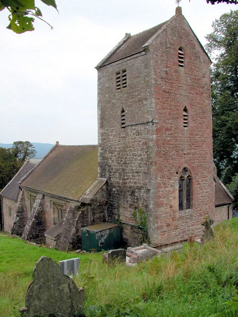
Penallt Old Church
Historic churches · 1.5 km

Newland
Villages · 1.7 km
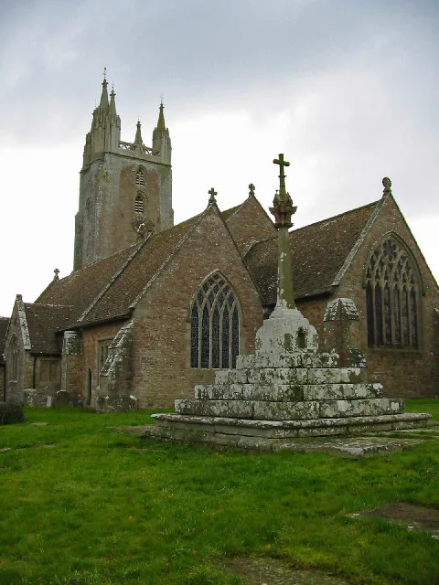
Church of All Saints, Newland
Historic churches · 1.8 km

The Ostrich
Historic pubs · 1.8 km

Penallt War Memorial
Memorials & monuments · 1.9 km

Buck Stone
Memorials & monuments · 2.1 km

First Day at School
Public art & sculpture · 2.1 km

Broadstone Park Camping and Fishery
Campsites · 2.1 km
Nearby
📷 3Historic bridges · South Wales
Penallt Viaduct
Penallt Viaduct is a historic bridge in the United Kingdom.
📷 5📷 3📷 4Forests & woodlands · South Wales
Pentwyn Farm Grasslands
Pentwyn Farm Grasslands is a forest or woodland in the United Kingdom.
📷 3Historic churches · South Wales
Penallt Old Church
Penallt Old Church — church in Penallt, Monmouthshire, Wales.
📷 5Where to eat & stay near Redbrook Incline Bridge
Places to stay
📷 5Campsites · South Wales
Broadstone Park Camping and Fishery
Broadstone Park Camping and Fishery — a campsite in wales south.
 📷 5
📷 5 📷 4
📷 4Campsites · South Wales
Highlands Camping and Caravan Site
Highlands Camping and Caravan Site — a campsite in wales south.
 📷 5
📷 5 📷 5
📷 5Hotels · South Wales
The Riverside Hotel
The Riverside Hotel — a hotel in wales south.
 📷 5
📷 5Hostels · South West England
Braceland Bunkhouse
Braceland Bunkhouse — a hostel in wales south.
Places to eat & drink
📷 5
Restaurants · South Wales
The Whitebrook
The Whitebrook — a restaurant in wales south.
 📷 6
📷 6Historic pubs · South Wales
Queens Head
Queens Head in Wales South, United Kingdom.
 📷 6
📷 6 📷 5
📷 5 📷 5
📷 5More bridges in this region
.jpg?width=1200) 📷 3
📷 3Historic bridges · South Wales
Afon Taff Viaduct
Afon Taff Viaduct is a historic bridge in the United Kingdom.
 📷 3
📷 3Historic bridges · South Wales
Avonmouth Bridge
Avonmouth Bridge is a historic bridge in the United Kingdom.
 📷 5
📷 5Historic bridges · South Wales
Biblins Bridge
Biblins Bridge is a historic bridge in the United Kingdom.
 📷 3
📷 3Historic bridges · South Wales
Blackweir Bridge
Blackweir Bridge is a historic bridge in the United Kingdom.
Frequently asked questions
- Where is Redbrook Incline Bridge?
- Redbrook Incline Bridge is in Gloucestershire, South Wales, United Kingdom (postcode NP25 4LL), in the parish of Newland.
- What is Redbrook Incline Bridge?
- Redbrook Incline Bridge — scheduled monument-listed bridge in wales-south, United Kingdom.
- How do I get to Redbrook Incline Bridge?
- The nearest railway station is Rookwood, about 4.2 km away. Drivers can use postcode NP25 4LL.
- Is Redbrook Incline Bridge a listed building?
- Redbrook Incline Bridge is officially recognised as scheduled monument listed.
- Is Redbrook Incline Bridge a protected site?
- Yes — Redbrook Incline Bridge is part of the River Wye SSSI Site of Special Scientific Interest and the Wye Valley National Landscape (AONB).
- Is Redbrook Incline Bridge free to visit?
- Yes, Redbrook Incline Bridge is free to enter.
- How do I get to Redbrook Incline Bridge?
- The nearest railway station is Rookwood, about 4.2 km away. Drivers can navigate to postcode NP25 4LL.