
Gardens · South West England
The Abbot's Fish House
In or near Godney.
The Abbot's Fish House — a garden in england-south-west, United Kingdom.

Neil Owen — CC BY-SA 2.0 via Wikimedia Commons licence

Plan your visit
- Typical visit
- 1 h–2.5 h
- Best time of year
- Spring & summer (Apr–Sep)
- Family-friendly
- Dog-friendly
About
The Abbot's Fish House is a garden of interest in england-south-west, United Kingdom — drawn from open-data sources for visitor reference. See the linked Wikipedia article for the full description.
Photo gallery
See it from the streetimagery from 2023
Imagery © Mapillary contributors, CC BY-SA 4.0
Protected designations
- National Nature Reserve: SOMERSET WETLANDS
- Ramsar wetland: Severn Estuary
Designations sourced from Natural England open data under OGL v3.
From the Wikipedia article
The Abbot's Fish House in Meare, Somerset, England, was built in the 14th century and has been designated as a Grade I listed building and scheduled monument. It is the only surviving monastic fishery building in England. Fishing was an important source of food for the monks of Glastonbury Abbey. Fishing was carried out in artificial ponds, which were mentioned at Meare in the Domesday Book and from the River Brue and Meare Pool. The present rectangular stone building was constructed by the abbot between 1322 and 1335 for the storage and processing of the fish and as a residence for the chief fisherman. After the Dissolution of the Monasteries the building fell into disrepair and it was seriously damaged by fire in the 1880s. Some restoration has been undertaken during the 20th century, including the replacement of the roof in the 1920s.
Excerpt from Wikipedia under CC BY-SA 4.0. See the source article linked in Sources below.
Background
History
, 1826.]] The fish ponds surrounding the Fish House were recorded in the Domesday Book of 1086 when they were tended by ten fishermen. The fishponds, which were connected with drains and gullies were up to 30 m long and 5 m wide. These were connected to the Meare Pool and the River Brue. Pike, bream and "white fish" were also caught. Meare Pool was formed by water ponding-up behind the raised peat bogs between the Wedmore and the Polden Hills, and coring has shown that it is filled with at least 2 m of detritus mud, especially in the Subatlantic climatic period (1st millennium BC). Early drainage work was carried out in the later years of the 12th century, with the responsibility for…
Architecture
The rectangular Blue Lias stone building has a stone tiled roof. It is 12.4 m long and 6.6 m wide. There were two rooms on the first floor, which were damaged in the fire of 1884, which also has a small entrance door which was accessed via exterior stone steps which no longer exist. There was also a latrine in a turret which no longer exists. There are small traceried arched windows.
Sourced from Wikipedia under CC BY-SA 4.0.
- Coordinates
- 51.1718, -2.7760
- District
- Somerset
- Parish
- Meare
- Postcode
- BA6 9SW
- Parliamentary constituency
- Wells and Mendip Hills
Sources
- wikidata: Q7712109 (CC0)
- wikipedia: The Abbot's Fish House, Meare (CC BY-SA 4.0)
Other places nearby
Meare Fish House
Historic houses · 0.0 km
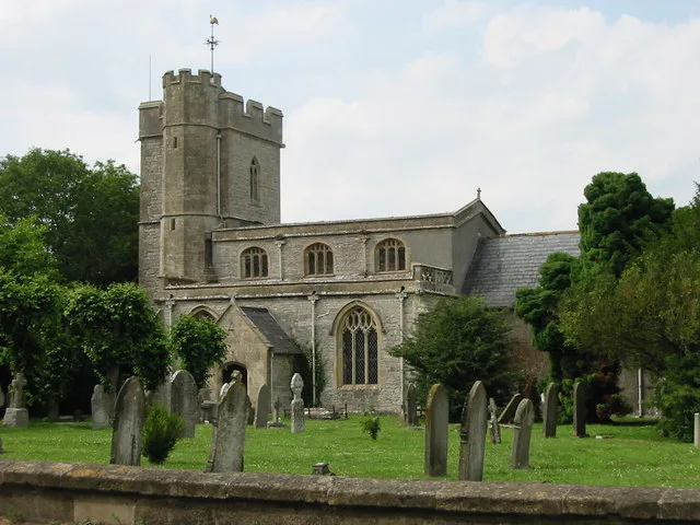
Church of St Mary, Meare
Historic churches · 0.3 km

Meare
Villages · 0.6 km

Lake Village (site)
Archaeological sites · 1.3 km

Meare Lake Villages
Hill forts · 1.4 km

River Sheppey
Museums · 1.5 km
Whitelake River
Museums · 1.6 km
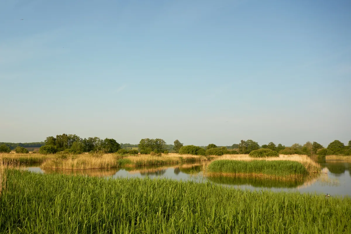
Ham Wall
Wildlife reserves · 1.9 km

Viewing Platform 2
Viewpoints · 2.0 km

RSPB Ham Wall
Forests & woodlands · 2.0 km

Westhaý
Natural landmarks · 2.0 km

Viewing Platform 1
Viewpoints · 2.0 km
Nearby
📷 3Historic houses · South West England
Meare Fish House
Meare Fish House — a other in england-south-west, United Kingdom.
📷 5Historic churches · South West England
Church of St Mary, Meare
Church of St Mary, Meare — church in Meare, Somerset, England, UK.
📷 5📷 3Archaeological sites · South West England
Lake Village (site)
Lake Village (site) — a archaeological in england-south-west, United Kingdom.
📷 5Hill forts · South West England
Meare Lake Villages
Meare Lake Villages — historic site in Somerset, England, UK.
📷 5Museums · South West England
River Sheppey
River Sheppey — a museum in england-south-west, United Kingdom.
Where to eat & stay near The Abbot's Fish House
Places to stay
 📷 5
📷 5Caravan parks · South West England
Isle Of Avalon Touring Caravan Park
Isle Of Avalon Touring Caravan Park — a caravan park in england south west.
 📷 5
📷 5 📷 5
📷 5Campsites · South West England
Orchard View
Orchard View — a campsite in england south west.
 📷 5
📷 5 📷 5
📷 5Campsites · South West England
Paddington Farm Trust
Paddington Farm Trust — a campsite in england south west.
 📷 5
📷 5Campsites · South West England
Wookey Farm Camp Site
Wookey Farm Camp Site — a campsite in england south west.
Places to eat & drink
 📷 7
📷 7Historic pubs · South West England
The George & Pilgrim's Hotel
The George & Pilgrim's Hotel in England South West, United Kingdom.
 📷 7
📷 7Historic pubs · South West England
Rifleman's Arms Public House
Rifleman's Arms Public House in England South West, United Kingdom.
 📷 7
📷 7 📷 7
📷 7Historic pubs · South West England
King William Inn
King William Inn in England South West, United Kingdom.
 📷 5
📷 5Restaurants · South West England
Bekynton Brasserie
Bekynton Brasserie — a restaurant in england south west.
 📷 5
📷 5More gardens in this region
 📷 5
📷 5Gardens · South West England
Avebury Manor and Garden
Avebury Manor and Garden is a garden in the United Kingdom.
.jpg?width=1200) 📷 5
📷 5Gardens · South West England
Compton Acres
Compton Acres — garden in Poole, United Kingdom.
 📷 5
📷 5Gardens · South West England
Corsham Court
Corsham Court — Grade I listed English country house in Wiltshire, England, UK.
 📷 5
📷 5Gardens · South West England
Cranborne Manor
Cranborne Manor — Grade I listed English country house in East Dorset, England, UK.
Frequently asked questions
- Where is The Abbot's Fish House?
- The Abbot's Fish House is in South-West England, United Kingdom (postcode BA6 9SW), in the parish of Meare.
- What is The Abbot's Fish House?
- The Abbot's Fish House — a garden in england-south-west, United Kingdom.
- How do I get to The Abbot's Fish House?
- Drivers can use postcode BA6 9SW.
- Who owns The Abbot's Fish House?
- The Abbot's Fish House is owned by English Heritage.
- Is The Abbot's Fish House a protected site?
- Yes — The Abbot's Fish House is part of the SOMERSET WETLANDS National Nature Reserve and the Severn Estuary Ramsar wetland.
- How do I get to The Abbot's Fish House?
- Drivers can navigate to postcode BA6 9SW. It sits within the Wells and Mendip Hills parliamentary constituency.