
Mountains & hills · Scottish Islands
Thacla
Thacla — Named summit at 606 m.

Wikimedia Commons contributors — see linked file page for photographer and licence licence

Plan your visit
- Typical visit
- 3 h–8 h
- Best time of year
- Late spring – early autumn (May–Oct)
- Free entry
- Dog-friendly
About
Thacla is a named summit in the United Kingdom. Wikidata describes it as: "Named summit at 606 m.". Coordinates: 57.2906°, -7.2715°.
Photo gallery
From the Wikipedia article
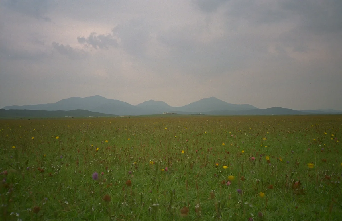
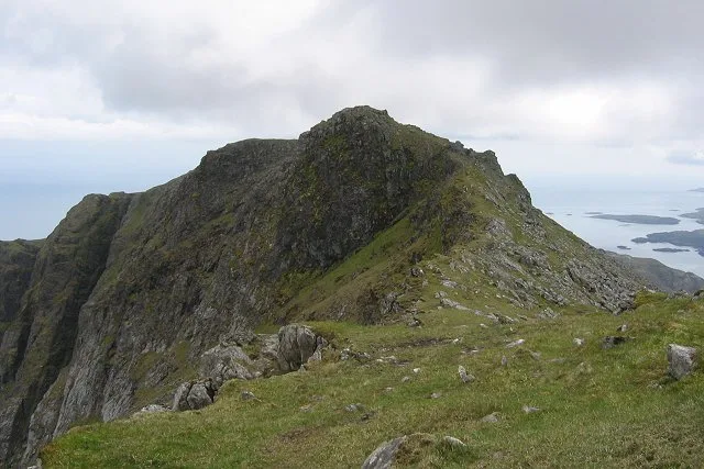
Hecla or Thacla is a mountain on the island of South Uist in the Outer Hebrides of Scotland. With a height of 606 metres (1,988 ft), it is the second-highest hill on the island. The name Hecla is Norse for "serrated".
Excerpt from Wikipedia under CC BY-SA 4.0. See the source article linked in Sources below.
- Coordinates
- 57.2906, -7.2715
- Address
- South Uist, Outer Hebrides, Scotland
Sources
- osm: n3395190181 (ODbL)
- wikipedia: Hecla (South Uist) (CC BY-SA 4.0)
- commons: Hecla from bealach below Beinn Corradail. - geograph.org.uk - 188709.jpg (CC BY-SA 4.0)
Other places nearby

Hecla
Mountains & hills · 0.0 km

Beinn na Laire
Mountains & hills · 0.6 km

Beinn Choradail
Mountains & hills · 1.7 km

Beinn a' Deas
Mountains & hills · 3.5 km

Beinn Ghot
Mountains & hills · 3.6 km
South Uist
Islands · 3.8 km
Beinn Mhòr
Mountains & hills · 3.8 km

Beinn Mhor
Mountains & hills · 3.8 km
Beinn Mhòr
Natural landmarks · 3.8 km

Ushenish
Lighthouses · 4.1 km
Spin
Mountains & hills · 4.3 km
Loch Druidibeag
Natural landmarks · 4.4 km
Nearby
📷 5📷 5Mountains & hills · Scottish Islands
Beinn na Laire
Beinn na Laire — mountain in scotland highlands. Elevation: 564 m.
📷 3Mountains & hills · Scottish Islands
Beinn Choradail
Beinn Choradail — a mountain in scotland-highlands, United Kingdom.
📷 5Mountains & hills · Scottish Islands
Beinn a' Deas
Beinn a' Deas — a hill or mountain in scotland highlands.
📷 5Mountains & hills · Scottish Islands
Beinn Ghot
Beinn Ghot — a hill or mountain in scotland highlands.
Flagship📷 4Islands · Scottish Islands
South Uist
South Uist — island of the Outer Hebrides, Scotland, UK.
Where to eat & stay near Thacla
Places to stay
 📷 5
📷 5Hostels · Scottish Islands
Osdail Òigridh
Osdail Òigridh — a hostel in scotland highlands.
📷 5 📷 5
📷 5Campsites · Scottish Islands
Shellbay Caravan & Camping Park
Shellbay Caravan & Camping Park — a campsite in scotland highlands.
 📷 5
📷 5Hostels · Scottish Islands
South Uist Hostel
South Uist Hostel — a hostel in scotland highlands.
📷 5Caravan parks · Scottish Islands
(3 pitches - booking advisable)
(3 pitches - booking advisable) — a caravan park in scotland highlands.
 📷 5
📷 5Hostels · Scottish Islands
Ostail Bhaile nan Cailleach
Ostail Bhaile nan Cailleach — a hostel in scotland highlands.
More mountains in this region
 📷 3
📷 3Mountains & hills · Scottish Islands
Acairseid Mhor
Acairseid Mhor — bay in Outer Hebrides, Scotland, UK.
 📷 3
📷 3Mountains & hills · Scottish Islands
Ainshval
Ainshval — Named summit at 781 m.
 📷 3
📷 3 📷 5
📷 5Mountains & hills · Scottish Islands
An Cliseam
An Cliseam — Named summit at 799 m.
Frequently asked questions
- Where is Thacla?
- Thacla is in the Scottish Highlands, United Kingdom.
- What is Thacla?
- Thacla — Named summit at 606 m.
- How do I get to Thacla?
- Its coordinates are 57.2906°, -7.2715°.
- Is Thacla free to visit?
- Yes, Thacla is free to enter.