
Farms (open to visitors) · North East England
Teesside Wind Farm
In or near Warrenby.
Teesside Wind Farm in England North East, United Kingdom.

Wikimedia Commons licence
Plan your visit
- Typical visit
- 2 h–4 h
- Nearest railway station
- Redcar Central · 3.9 km
- Family-friendly
- Limited wheelchair access
Getting there & planning your visit
To visit Teesside Wind Farm, the nearest railway station is Redcar Central, which is approximately 3.9 km away. Entry details are not provided, and accessibility is limited for wheelchair users.
About
Teesside Wind Farm is a place of interest in England North East, United Kingdom — drawn from open-data sources for visitor reference. See the linked Wikipedia article for the full description.
Photo gallery
Protected designations
- Site of Special Scientific Interest: Teesmouth and Cleveland Coast SSSI
Designations sourced from Natural England open data under OGL v3.
From the Wikipedia article
Teesside Wind Farm, or alternatively referred to as Redcar Wind Farm, is a 27 turbine 62 MW capacity offshore wind farm constructed just to the east of the mouth of the River Tees and 1.5 km north of Redcar off the North Yorkshire coast, in the North Sea, England. Construction of the windfarm began in February 2011 and was complete by June 2013. The wind farm was developed by EDF Energy (Northern Offshore Wind) Ltd., and is operated by Teesside Windfarm Ltd.; the owner (100%) is EDF Energy Renewables.
Excerpt from Wikipedia under CC BY-SA 4.0. See the source article linked in Sources below.
Background
History
In 2004 EDF was awarded a 22-year lease from The Crown Estate to develop a wind farm at Teesside during the first phase of UK offshore wind farm development. (See also Round 1 wind farm.) The wind farm site was located 1.5 km offshore of Coatham Sands, Redcar in Cleveland, UK on a 10 km2 site; initial plans were to install 3 rows of 10 turbines of rating 2.3–3.6 MW, with electrical power supplied to shore with landfall at South Gare / Coatham Sands with a land substation and control room at Warrenby; connection to the existing electrical grid was to be made to Northern Electric Distribution (NEDL)'s (see Northern Electric) electricity network at Lackenby The windfarm was planned to operate…
Sourced from Wikipedia under CC BY-SA 4.0.
- Coordinates
- 54.6480, -1.0950
- Address
- 1.5km north of Redcar, Teesside
- Established
- 2013
- Nearest railway station
- Redcar Central — 3.9 km
Sources
- wikidata: Q7694582 (CC0)
- wikipedia: Teesside Wind Farm (CC BY-SA 4.0)
Other places nearby

Coatham Sands
Beaches · 1.7 km

Tees Bay
Beaches · 1.9 km

South Gare & Coatham Sands SSSI
Wildlife reserves · 2.1 km

2021 North-East England shellfish die-off
Other places · 2.7 km
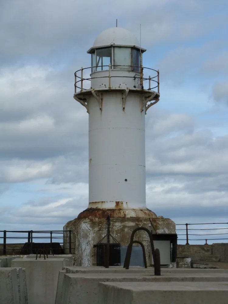
South Gare Lighthouse
Lighthouses · 2.7 km

Teesport
Harbours & ports · 2.8 km

South Gare
Beaches · 3.0 km

Teesmouth Lifeboat Station
Other places · 3.1 km

Redcar Beach Caravan Park
Caravan parks · 3.1 km

Coatham Pier
Piers · 3.2 km

Mo Mowlam Mosaic
Public art & sculpture · 3.3 km

Sinterlation
Public art & sculpture · 3.3 km
Nearby
📷 2📷 4📷 3Wildlife reserves · North East England
South Gare & Coatham Sands SSSI
South Gare & Coatham Sands SSSI in England North East, United Kingdom.
📷 3Other places · North East England
2021 North-East England shellfish die-off
2021 North-East England shellfish die-off in England North East, United Kingdom.
📷 3Lighthouses · North East England
South Gare Lighthouse
South Gare Lighthouse — lighthouse in North Yorkshire, England, UK.
📷 5Where to eat & stay near Teesside Wind Farm
Places to stay
📷 5Caravan parks · North East England
Redcar Beach Caravan Park
Redcar Beach Caravan Park — a caravan park in scotland lowlands.
 📷 5
📷 5Caravan parks · North East England
New Coatham Caravan Park
New Coatham Caravan Park — a caravan park in scotland lowlands.
 📷 7
📷 7Hotels · North East England
Seaton Hotel
Seaton Hotel — a hotel in scotland lowlands.
 📷 6
📷 6 📷 5
📷 5 📷 5
📷 5Places to eat & drink
 📷 5
📷 5Cafés · North East England
Mary Rowntrees Tea Rooms
Mary Rowntrees Tea Rooms — a café in scotland lowlands.
 📷 4
📷 4 📷 6
📷 6Historic pubs · North East England
The Zetland
The Zetland in England North East, United Kingdom.
 📷 5
📷 5 📷 5
📷 5Historic pubs · North East England
The Stainton Public House
The Stainton Public House in England North East, United Kingdom.
 📷 5
📷 5Historic pubs · North East England
The Royal Oak Hotel
The Royal Oak Hotel in England North East, United Kingdom.
More places in this region
 📷 3
📷 3Farms (open to visitors) · North East England
Milecastle 38
Milecastle 38 in England North East, United Kingdom.
 📷 5
📷 5Farms (open to visitors) · North East England
Mowhaugh
Mowhaugh in England North East, United Kingdom.
 📷 4
📷 4Farms (open to visitors) · North East England
Milecastle 34
Milecastle 34 in England North East, United Kingdom.
 📷 3
📷 3Farms (open to visitors) · North East England
Phoenix Row
Phoenix Row in England North East, United Kingdom.
Frequently asked questions
- Where is Teesside Wind Farm?
- Teesside Wind Farm is in North-East England, United Kingdom.
- What is Teesside Wind Farm?
- Teesside Wind Farm in England North East, United Kingdom.
- How do I get to Teesside Wind Farm?
- The nearest railway station is Redcar Central, about 3.9 km away. Its coordinates are 54.6480°, -1.0950°.
- When was Teesside Wind Farm built?
- Built or established in 2013.
- Who owns Teesside Wind Farm?
- Teesside Wind Farm is owned by | operator =.
- Is Teesside Wind Farm a protected site?
- Yes — Teesside Wind Farm is part of the Teesmouth and Cleveland Coast SSSI Site of Special Scientific Interest.
- How do I get to Teesside Wind Farm?
- The nearest railway station is Redcar Central, about 3.9 km away.