Beaches · North East England
South Gare
In or near Warrenby.
South Gare in England North East, United Kingdom.

habiloid — CC BY-SA 2.0 via Wikimedia Commons licence
Plan your visit
- Typical visit
- 1 h–3 h
- Best time of year
- Summer (Jun–Aug)
- Nearest railway station
- Seaton Carew · 4.4 km
- Free entry
- Family-friendly
- Dog-friendly
Getting there & planning your visit
To visit South Gare, the nearest railway station is Seaton Carew, located 4.4 km away. Entry to the beach is free. The postcode for navigation is TS10 5NX.
About
South Gare is a place of interest in England North East, United Kingdom — drawn from open-data sources for visitor reference. See the linked Wikipedia article for the full description.
Photo gallery
Protected designations
- Site of Special Scientific Interest: Teesmouth and Cleveland Coast SSSI
- Ramsar wetland: Teesmouth and Cleveland Coast
Designations sourced from Natural England open data under OGL v3.
From the Wikipedia article
South Gare is an area of reclaimed land and breakwater on the southern side of the mouth of the River Tees in Redcar and Cleveland, England. It is accessed by taking the South Gare Road (private road) from Fisherman's Crossing at the western end of Tod Point Road in Warrenby. Before the building of South Gare, permanent dry land stopped at Tod Point, at the western end of Warrenby, and there was only Coatham Sands and the mudflats of Bran Sands. The creation of South Gare extends this by a further 2.5 miles (4.0 km). The building of South Gare offers a safe harbour in stormy weather to ships off the coast and allowed for the dredging of the River Tees entrance. South Gare itself was a settlement but the houses there were demolished many years ago.
Excerpt from Wikipedia under CC BY-SA 4.0. See the source article linked in Sources below.
Background
Architecture
Building the 22 mi of slag training walls in the Tees was started in 1859. Blocks of solid blast furnace slag were cast and moved into position along the banks of the River Tees, then back filled using 70,000 tons of material dredged from river bed. using 5 million tonnes of blast furnace slag and 18,000 tons of cement at a total cost of £219,393. Work was planned and supervised by John Fowler, engineer to the Tees Commissioners. With construction complete, the breakwater was formally opened by the Right Hon W. H. Smith, First Lord of the Treasury on 25 October 1888.
Sourced from Wikipedia under CC BY-SA 4.0.
- Coordinates
- 54.6403, -1.1392
- District
- Redcar and Cleveland
- Parish
- Redcar and Cleveland, unparished area
- Postcode
- TS10 5NX
- Parliamentary constituency
- Redcar
- Nearest railway station
- Seaton Carew — 4.4 km
Sources
- wikidata: Q7567330 (CC0)
- wikipedia: South Gare (CC BY-SA 4.0)
Other places nearby

Teesmouth Lifeboat Station
Other places · 0.1 km

2021 North-East England shellfish die-off
Other places · 0.5 km

Teesport
Harbours & ports · 0.7 km
South Gare Lighthouse
Lighthouses · 0.8 km

Redcar Bulk Terminal
Harbours & ports · 2.0 km

Seaton Dunes and Common Local Nature Reserve
Forests & woodlands · 2.6 km

Hartlepool Nuclear Power Station
Mountains & hills · 2.7 km

Coatham Sands
Beaches · 2.8 km

NWL jetty
Piers · 2.9 km

South Gare & Coatham Sands SSSI
Wildlife reserves · 3.0 km

Teesside Wind Farm
Farms (open to visitors) · 3.0 km
Seal Sands
Beaches · 3.0 km
Nearby
📷 4Other places · North East England
Teesmouth Lifeboat Station
Teesmouth Lifeboat Station in England North East, United Kingdom.
📷 3Other places · North East England
2021 North-East England shellfish die-off
2021 North-East England shellfish die-off in England North East, United Kingdom.
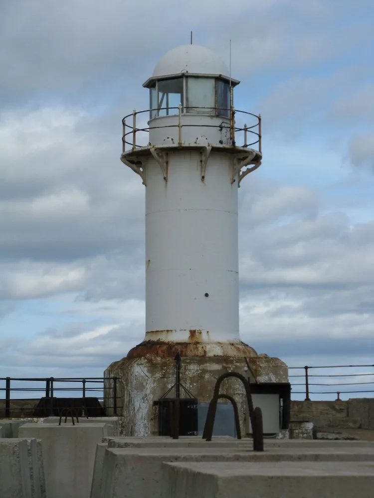
📷 5📷 3Lighthouses · North East England
South Gare Lighthouse
South Gare Lighthouse — lighthouse in North Yorkshire, England, UK.
📷 3Harbours & ports · North East England
Redcar Bulk Terminal
Redcar Bulk Terminal is a harbour in the United Kingdom.
📷 3Forests & woodlands · North East England
Seaton Dunes and Common Local Nature Reserve
Seaton Dunes and Common Local Nature Reserve is a forest or woodland in the United Kingdom.
Where to eat & stay near South Gare
Places to stay
 📷 7
📷 7Hotels · North East England
Seaton Hotel
Seaton Hotel — a hotel in scotland lowlands.
 📷 6
📷 6 📷 5
📷 5Caravan parks · North East England
Redcar Beach Caravan Park
Redcar Beach Caravan Park — a caravan park in scotland lowlands.
 📷 5
📷 5Caravan parks · North East England
New Coatham Caravan Park
New Coatham Caravan Park — a caravan park in scotland lowlands.
 📷 3
📷 3Caravan parks · North East England
Ashfield Caravan Park
Ashfield Caravan Park — a caravan park in scotland lowlands.
 📷 5
📷 5Hotels · North East England
Baltimore Hotel
Baltimore Hotel — a hotel in england north east.
Places to eat & drink
 📷 5
📷 5Cafés · North East England
Mary Rowntrees Tea Rooms
Mary Rowntrees Tea Rooms — a café in scotland lowlands.
 📷 4
📷 4 📷 6
📷 6Historic pubs · North East England
The Zetland
The Zetland in England North East, United Kingdom.
 📷 5
📷 5 📷 5
📷 5Historic pubs · North East England
The Stainton Public House
The Stainton Public House in England North East, United Kingdom.
 📷 5
📷 5Historic pubs · North East England
The Royal Oak Hotel
The Royal Oak Hotel in England North East, United Kingdom.
More beaches in this region
 📷 3
📷 3 📷 3
📷 3Beaches · North East England
Cattersty Sands
Cattersty Sands is a beach in the United Kingdom.
 📷 3
📷 3 📷 3
📷 3Beaches · North East England
Saltburn Sands
Saltburn Sands is a beach in the United Kingdom.
Frequently asked questions
- Where is South Gare?
- South Gare is in North-East England, United Kingdom (postcode TS10 5NX), in the parish of Redcar and Cleveland, unparished area.
- What is South Gare?
- South Gare in England North East, United Kingdom.
- How do I get to South Gare?
- The nearest railway station is Seaton Carew, about 4.4 km away. Drivers can use postcode TS10 5NX.
- Is South Gare a protected site?
- Yes — South Gare is part of the Teesmouth and Cleveland Coast SSSI Site of Special Scientific Interest and the Teesmouth and Cleveland Coast Ramsar wetland.
- Is South Gare free to visit?
- Yes, South Gare is free to enter.
- How do I get to South Gare?
- The nearest railway station is Seaton Carew, about 4.4 km away. Drivers can navigate to postcode TS10 5NX.