Mountains & hills · Scottish Lowlands
Tates Hill
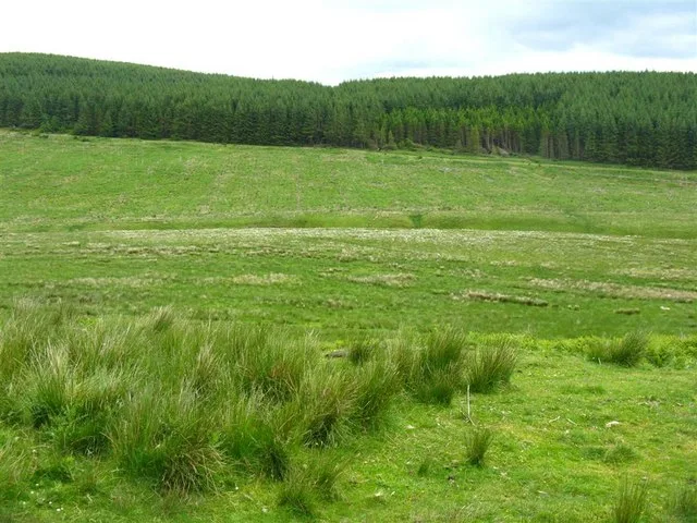
Tates Hill — mountain in scotland lowlands. Elevation: 401 m.

Bob Cowan — CC BY-SA 2.0 via Wikimedia Commons licence
Plan your visit
- Typical visit
- 3 h–8 h
- Best time of year
- Late spring – early autumn (May–Oct)
About
Tates Hill is a mountain located in scotland lowlands. Elevation: 401 m. A named British peak recorded in OpenStreetMap. Peaks are typically named on Ordnance Survey 1:50k mapping.
Photo gallery
Place summary
Tates Hill is a mountain located in the Scottish Lowlands. It offers a range of outdoor activities for visitors, including hiking and nature observation. The surrounding area features diverse landscapes typical of the region, providing opportunities for exploration and appreciation of the local flora and fauna.
AI-generated from the structured facts on this page (operator, designation, listing, era). Not a substitute for visiting.
- Coordinates
- 55.2909, -3.2618
Sources
- osm: n3546857833 (ODbL)
Other places nearby
Loading nearby places…
Nearby
 📷 5
📷 5Mountains & hills · Scottish Lowlands
Spots Law
Spots Law — a hill or mountain in scotland lowlands.
📷 5Mountains & hills · Scottish Lowlands
Drowningdub Knowes
Drowningdub Knowes — a hill or mountain in scotland lowlands.
 📷 5
📷 5Vineyards · Scottish Lowlands
Long Knowe, settlement 905m SW of Monkenshaw
Long Knowe, settlement 905m SW of Monkenshaw — a UK vineyard in scotland lowlands, producing English or Welsh wine from cool-climate grape varieties.
 📷 3
📷 3Archaeological sites · Scottish Lowlands
Long Knowe, Settlement
Long Knowe, Settlement — a archaeological in scotland-lowlands, United Kingdom.
 📷 3
📷 3Archaeological sites · Scottish Lowlands
Eskdalemuir Forest
Eskdalemuir Forest — forest in southern Scotland.
 📷 5
📷 5Mountains & hills · Scottish Lowlands
Cockplay Hill
Cockplay Hill — a hill or mountain in scotland lowlands.
Where to eat & stay near Tates Hill
Places to stay
 📷 5
📷 5Hostels · Scottish Lowlands
Johnstone House
Johnstone House — a hostel in scotland lowlands.
 📷 5
📷 5Campsites · Scottish Lowlands
Green Frog
Green Frog — a campsite in scotland lowlands.
 📷 5
📷 5Campsites · Scottish Lowlands
Moffat Camping & Caravanning Club site
Moffat Camping & Caravanning Club site — a campsite in scotland lowlands.
 📷 5
📷 5Hotels · Scottish Lowlands
Buccleuch Arms Hotel
Buccleuch Arms Hotel — a hotel in scotland lowlands.
 📷 5
📷 5Caravan parks · Scottish Lowlands
Angecroft Caravan Park
Angecroft Caravan Park — a caravan park in scotland lowlands.
 📷 5
📷 5Hostels · Scottish Lowlands
Rivox Bunkhouse
Rivox Bunkhouse — a hostel in scotland lowlands.

More mountains in this region
 📷 3
📷 3Mountains & hills · Scottish Lowlands
Andrewhinney Hill
Andrewhinney Hill — Named summit at 677 m.
 📷 3
📷 3Mountains & hills · Scottish Lowlands
Arbory Hill
Arbory Hill — Named summit at 429 m.
 📷 3
📷 3Mountains & hills · Scottish Lowlands
Auchenton Hill ( East Mount Lowther)
Auchenton Hill ( East Mount Lowther) — Named summit at 631 m.
 📷 3
📷 3Mountains & hills · Scottish Lowlands
Bakestall
Bakestall — Named summit at 673.5 m.
Frequently asked questions
- Where is Tates Hill?
- Tates Hill is in the Scottish Lowlands, United Kingdom.
- What is Tates Hill?
- Tates Hill — mountain in scotland lowlands. Elevation: 401 m.
- How do I get to Tates Hill?
- Its coordinates are 55.2909°, -3.2618°.