
Campsites · North East England
TANDO
In or near Walbottle.
TANDO — a campsite in scotland lowlands.

Graham Robson — CC BY-SA 2.0 via Wikimedia Commons licence

Plan your visit
- Typical visit
- 1 h–2 h
- Nearest railway station
- Wylam · 4.5 km
About
TANDO is a campsite located in scotland lowlands. Phone: +44 7970 328144. Address: Newcastle upon Tyne, NE15 9QT. Campsite listed with verified location and OSM metadata. Pitch availability, facilities (toilets, showers, electric hookup) and seasonal opening vary — confirm directly.
Photo gallery
Place summary
TANDO is a campsite located in the Scottish Lowlands, postcode NE15. Visitors can expect a natural setting suitable for outdoor activities and relaxation. The site offers basic amenities for camping, catering to those looking to experience the countryside. It provides a convenient base for exploring the surrounding landscapes and nearby attractions.
AI-generated from the structured facts on this page (operator, designation, listing, era). Not a substitute for visiting.
- Coordinates
- 55.0036, -1.7649
- District
- Newcastle upon Tyne
- Parish
- Newcastle upon Tyne, unparished area
- Postcode
- NE15 9QT
- Parliamentary constituency
- Hexham
- Phone
- +44 7970 328144
- Nearest railway station
- Wylam — 4.5 km
- Official site
- www.tandoclub.org
Sources
- osm: n4568637252 (ODbL)
Other places nearby

Former Valve House
Historic houses · 0.8 km

Milecastle 11
Archaeological sites · 0.8 km
Bank Top
Other places · 0.9 km

Throckley
Mines & mining heritage · 1.1 km
Throckley War Memorial
Memorials & monuments · 1.1 km

Hadrian's Wall and vallum from Throckley to East Town House, Heddon-on-the-Wall in wall mile 11
Archaeological sites · 1.2 km

Throckley Hall Commemorative Plaque
Memorials & monuments · 1.3 km
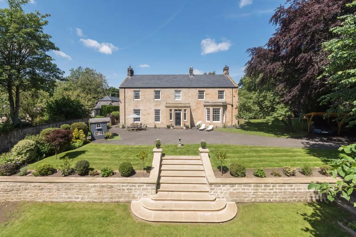
Throckley Hall
Stately homes · 1.5 km

Milecastle 10
Historic houses · 1.6 km
Milecastle 10 (Walbottle Dene)
Archaeological sites · 1.6 km

Walbottle Campus
Other places · 1.7 km

Milecastle 12
Historic houses · 1.8 km
Nearby
📷 3Historic houses · North East England
Former Valve House
Former Valve House — house in Newcastle upon Tyne, Tyne and Wear, England, UK.
📷 4Archaeological sites · North East England
Milecastle 11
Milecastle 11 in England North East, United Kingdom.
📷 4📷 5Mines & mining heritage · North East England
Throckley
Throckley in England North East, United Kingdom.
📷 3Memorials & monuments · North East England
Throckley War Memorial
Throckley War Memorial — Grade II listed building-listed memorial in scotland-lowlands, United Kingdom.
📷 3Archaeological sites · North East England
Hadrian's Wall and vallum from Throckley to East Town House, Heddon-on-the-Wall in wall mile 11
Hadrian's Wall and vallum from Throckley to East Town House, Heddon-on-the-Wall in wall mile 11 — archaeological site in Heddon-on-the-Wall, Northumberland, England, UK.
Where to eat & stay near TANDO
Places to stay
 📷 5
 📷 5
Hotels · North East England
DoubleTree by Hilton Newcastle International Airport
DoubleTree by Hilton Newcastle International Airport — a hotel in scotland lowlands. 4-star. Brand: DoubleTree.
 📷 5
Caravan parks · North East England
High Hermitage Caravan Park
High Hermitage Caravan Park — a caravan park in scotland lowlands.
📷 5Campsites · North East England
High Hermitage Caravan Park
High Hermitage Caravan Park — a campsite in scotland lowlands.
 📷 5
 📷 5
Campsites · North East England
Derwent Caravan Park
Derwent Caravan Park — a campsite in scotland lowlands.
Places to eat & drink
 📷 5
 📷 5
Historic pubs · North East England
The Seven Stars Public House
The Seven Stars Public House in Scotland Lowlands, United Kingdom.
 📷 5
Historic pubs · North East England
The Crown And Anchor
The Crown And Anchor in Scotland Lowlands, United Kingdom.
 📷 5
 📷 4
Historic pubs · North East England
Winlaton Mill
Winlaton Mill in England North East, United Kingdom.
 📷 3
Historic pubs · North East England
Red House Farm
Red House Farm in England North East, United Kingdom.
More places in this region
 📷 5
Campsites · North East England
Hoggarths campsite
Hoggarths campsite — a campsite in england north west.
 📷 5
Campsites · North East England
Rukin's Park Lodge Campsite
Rukin's Park Lodge Campsite — a campsite in england north west.
 📷 5
Campsites · North East England
Park House Camping & Keld Bunkhouse
Park House Camping & Keld Bunkhouse — a campsite in england north west.
 📷 5
Campsites · North East England
Tan Hill Inn Camping
Tan Hill Inn Camping — a campsite in england north west.
Frequently asked questions
- Where is TANDO?
- TANDO is in North-East England, United Kingdom (postcode NE15 9QT), in the parish of Newcastle upon Tyne, unparished area.
- What is TANDO?
- TANDO — a campsite in scotland lowlands.
- How do I get to TANDO?
- The nearest railway station is Wylam, about 4.5 km away. The nearest town is Walbottle. Drivers can use postcode NE15 9QT.
- How do I get to TANDO?
- The nearest railway station is Wylam, about 4.5 km away. Drivers can navigate to postcode NE15 9QT.