
Canals · South Wales
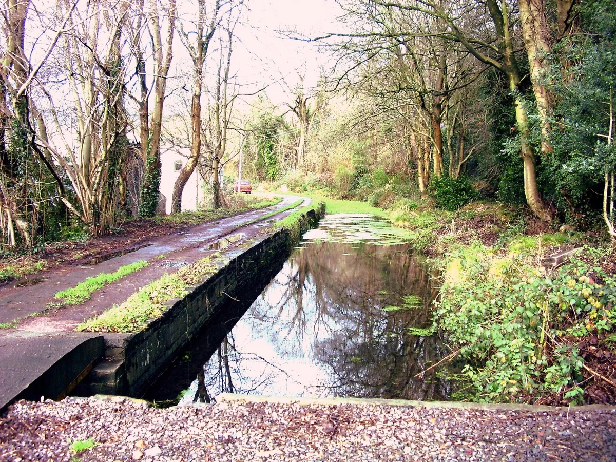
Swansea Canal
Also known as: Camlas Abertawe
In or near Cwmllynfell.
Swansea Canal is a canal in the United Kingdom.

Wikimedia Commons contributors — see linked file page for photographer and licence licence

Plan your visit
- Typical visit
- 1 h–2 h
- Nearest railway station
- Skewen · 8.0 km
- Free entry
- Dog-friendly
Getting there & planning your visit
To visit Swansea Canal, the nearest railway station is Skewen, which is 8 km away. The postcode for navigation is SA8 4QD, and entry to the canal is free.
About
Swansea Canal is a canal in the United Kingdom. Heritage designation: National Monuments of Wales. Coordinates: 51.7328°, -3.8313°.
Photo gallery
From the Wikipedia article
The Swansea Canal (Welsh: Camlas Abertawe) was a canal constructed by the Swansea Canal Navigation Company between 1794 and 1798, running for 16.5 miles (26.6 km) from Swansea to Hen Neuadd, Abercraf in South Wales. It was steeply graded, and 36 locks were needed to enable it to rise 373 feet (114 m) over its length. The main cargos were coal, iron and steel, and the enterprise was profitable. Sold to the Great Western Railway in 1873, it continued to make a profit until 1895. A period of decline followed, with the last commercial traffic using the waterway in 1931. Subsequently, parts of it were closed and filled in under a succession of owners, but around 5 miles (8.0 km) remain in water. The Swansea Canal Society, formed in 1981, is actively involved in plans for its restoration.
Excerpt from Wikipedia under CC BY-SA 4.0. See the source article linked in Sources below.
Background
History
With the development of Swansea harbour from the 1760s, consideration was given as to how the rich mineral resources of the Tawe valley could be moved to the coast. In 1790, William Padley surveyed the valley for a possible canal route, and in 1791 the passing of the Neath Canal Act 1791 (31 Geo. 3. c.85) to authorise the nearby Neath Canal resulted in calls for a public meeting. A meeting held on 5 April 1793 appointed the canal engineer Thomas Sheasby to conduct a survey. The plans were opposed by the Duke of Beaufort and other traders, who wanted the canal to terminate further up the river near Landore and Morriston, where they already had wharfs. Swansea Corporation favoured the route…
Sourced from Wikipedia under CC BY-SA 4.0.
- Coordinates
- 51.7328, -3.8313
- District
- Neath Port Talbot
- Parish
- Pontardawe
- Postcode
- SA8 4QD
- Parliamentary constituency
- Brecon, Radnor and Cwm Tawe
- Established
- 1798
- Nearest railway station
- Skewen — 8 km
Sources
- wikidata: Q7653665 (CC0)
- wikipedia: Swansea Canal (CC BY-SA 4.0)
- commons: Swansea Canal Aqueduct at Ystalyfera - geograph.org.uk - 45095.jpg (CC BY-SA 4.0)
Other places nearby

Ynysmeudwy Ganol Overbridge on Swansea Canal
Historic bridges · 0.5 km

Ynysmeudwy Uchaf Overbridge on Swansea Canal
Historic bridges · 0.5 km

Cilybebyll
Villages · 1.1 km

Ynysmeudwy Isaf Overbridge on Swansea Canal
Historic bridges · 1.1 km

Church of Saint Ciwg
Historic churches · 1.3 km

Llangiwg
Villages · 1.3 km

Canal Overbridge at Cwm-tawe-isaf
Historic bridges · 1.6 km

Pen Alltwen
Mountains & hills · 1.6 km

Pontardawe
Villages · 1.7 km

Pontardawe Arts Centre
Open-air theatres · 1.9 km
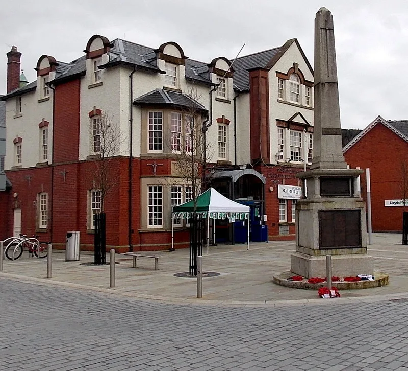
Pontardawe Arts Centre
Theatres · 1.9 km

Pontardawe War Memorial
Memorials & monuments · 2.0 km
Nearby
📷 5Historic bridges · South Wales
Ynysmeudwy Ganol Overbridge on Swansea Canal
Ynysmeudwy Ganol Overbridge on Swansea Canal — Grade II listed building-listed bridge in wales-south, United Kingdom.
📷 5Historic bridges · South Wales
Ynysmeudwy Uchaf Overbridge on Swansea Canal
Ynysmeudwy Uchaf Overbridge on Swansea Canal — Grade II listed building-listed bridge in wales-south, United Kingdom.
📷 5📷 5Historic bridges · South Wales
Ynysmeudwy Isaf Overbridge on Swansea Canal
Ynysmeudwy Isaf Overbridge on Swansea Canal — Grade II listed building-listed bridge in wales-south, United Kingdom.
📷 5Historic churches · South Wales
Church of Saint Ciwg
Church of Saint Ciwg — Grade II listed building-listed church in wales-south, United Kingdom.
📷 5Where to eat & stay near Swansea Canal
Places to stay
 📷 5
📷 5 📷 6
📷 6Hotels · South Wales
Ambassador Hotel
Ambassador Hotel — a hotel in wales south.
 📷 5
📷 5Caravan parks · South Wales
Riverside Caravan Park
Riverside Caravan Park — a caravan park in wales south.
 📷 5
📷 5 📷 5
📷 5Campsites · South Wales
Black Mountain Fishing and Camping
Black Mountain Fishing and Camping — a campsite in wales south.
 📷 5
📷 5Places to eat & drink
 📷 7
📷 7 📷 5
📷 5 📷 5
📷 5 📷 5
📷 5Restaurants · South Wales
Bagle Brook
Bagle Brook — a restaurant in wales south. Cuisine: burger;steak house. Brand: Beefeater.
 📷 5
📷 5 📷 5
📷 5Restaurants · South Wales
Las Iguanas
Las Iguanas — a restaurant in wales south. Cuisine: latin american. Brand: Las Iguanas.
More places in this region
 📷 5
📷 5Canals · South Wales
Glamorganshire Canal
Glamorganshire Canal — Site of Special Scientific Interest in Wales.
 📷 3
📷 3 📷 3
📷 3 📷 3
📷 3Frequently asked questions
- Where is Swansea Canal?
- Swansea Canal is in South Wales, United Kingdom (postcode SA8 4QD), in the parish of Pontardawe.
- What is Swansea Canal?
- Swansea Canal is a canal in the United Kingdom.
- How do I get to Swansea Canal?
- The nearest railway station is Skewen, about 8.0 km away. The nearest town is Cwmllynfell. Drivers can use postcode SA8 4QD.
- When was Swansea Canal built?
- Built or established in 1798.
- Is Swansea Canal a listed building?
- Swansea Canal is officially recognised as National Monuments of Wales listed.
- Is Swansea Canal free to visit?
- Yes, Swansea Canal is free to enter.
- How do I get to Swansea Canal?
- Drivers can navigate to postcode SA8 4QD. It sits within the Brecon, Radnor and Cwm Tawe parliamentary constituency.