Islands · Scottish Islands
Sula Sgeir
Sula Sgeir — island in Outer Hebrides, Scotland, UK.

Wikimedia Commons contributors — see linked file page for photographer and licence licence
Plan your visit
- Typical visit
- 4 h–12 h
- Dog-friendly
About
Sula Sgeir is a island in the United Kingdom. Part of Outer Hebrides. Wikidata describes it as: "island in Outer Hebrides, Scotland, UK". Coordinates: 59.0956°, -6.1565°.
Photo gallery
From the Wikipedia article
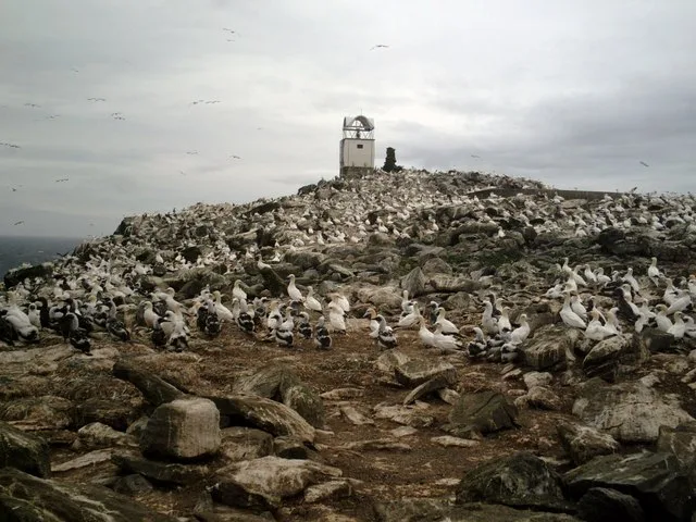
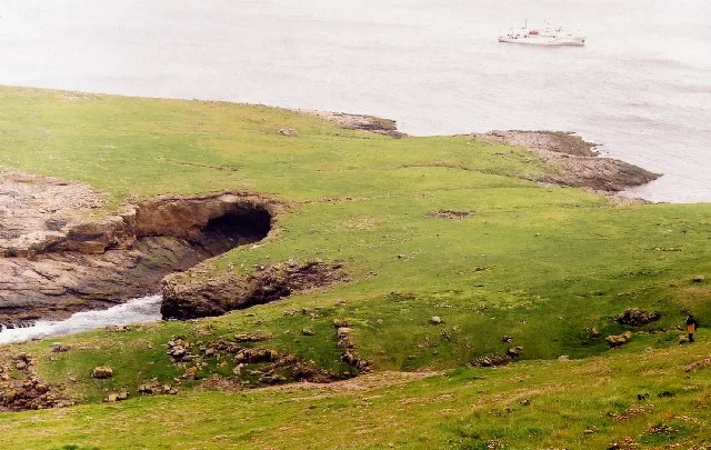
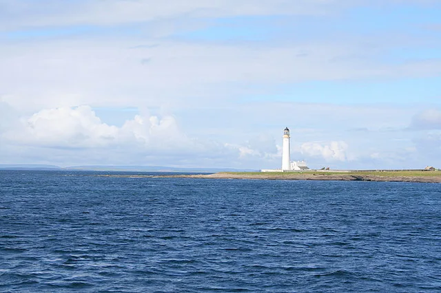
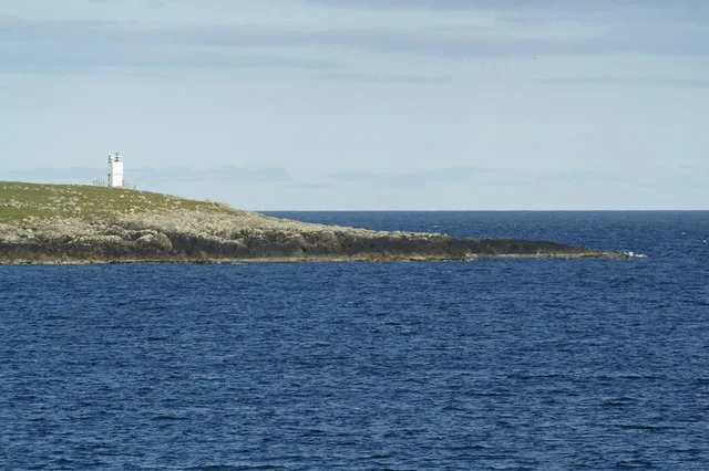
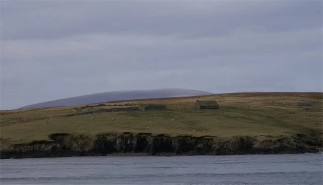
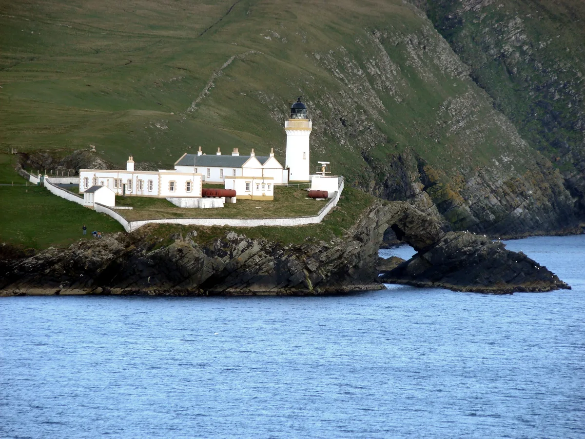
Sula Sgeir is a small, uninhabited Scottish islet in the North Atlantic, 18 kilometres (9+1⁄2 nautical miles) west of Rona. One of the most remote islands of the British Isles, it lies approximately forty nautical miles (seventy kilometres) north of Lewis and is best known for its population of gannets. It has a narrow elongated shape running north-northeast to south-southwest, and is approximately 900 metres (980 yd) long by typically 100 metres (110 yd) wide (apart from a central headland projecting a further 100 metres (110 yd) on the easterly side). A ruined stone bothy called Taigh Beannaichte (Blessed House) is on the east headland, Sgeir an Teampaill. A small automated lighthouse on the south end at Sròn na Lice is regularly damaged by the huge waves which break over the island during rough North Atlantic storms. Despite this, the island has diverse flora.
Excerpt from Wikipedia under CC BY-SA 4.0. See the source article linked in Sources below.
Background
History
Saint Brianhuil or Brenhilda, the sister of St Ronan of Iona and North Rona, is said to have lived on Sula Sgeir as a recluse. Sula Sgeir has a special place in the seafaring history of the men of the Ness district on Lewis. Dean Munro visited the Hebrides in 1549 and his is one of the earliest accounts written about the Western Isles. Together with North Rona, Sula Sgeir was formerly a national nature reserve because of its importance for birdlife and grey seal breeding. It remains a protected area for nature and is a Site of Special Scientific Interest and a Special Protection Area. Sula Sgeir, with North Rona, historically formed part of the Barvas estate on Lewis, but a community…
Sourced from Wikipedia under CC BY-SA 4.0.
- Coordinates
- 59.0956, -6.1565
- Address
- Sula Sgeir
- Official site
- www.mpaglobal.org
Sources
- wikidata: Q151631 (CC0)
- wikipedia: Sula Sgeir (CC BY-SA 4.0)
- commons: Sula Sgeir - geograph.org.uk - 1242208.jpg (CC BY-SA 4.0)
Other places nearby
Loading nearby places…
Nearby
 📷 3
📷 3Lighthouses · Scottish Islands
Sula Sgeir Lighthouse
Sula Sgeir Lighthouse — lighthouse in Outer Hebrides, Scotland, UK.
 📷 3
📷 3Beaches · Scottish Islands
Cladach Crò Iain Dheirg
Cladach Crò Iain Dheirg is a beach in the United Kingdom.
 📷 3
📷 3Beaches · Scottish Islands
Leac na Sgròb
Leac na Sgròb is a beach in the United Kingdom.
📷 3Archaeological sites · Scottish Islands
Teampull Naoimh Ronain
Teampull Naoimh Ronain — a archaeological in scotland-islands, United Kingdom.
📷 5Historic churches · Scottish Islands
St Ronan's Church & village settlement,Rona
St Ronan's Church & village settlement,Rona — scheduled monument-listed church in scotland-islands, United Kingdom.
 📷 3
📷 3Islands · Scottish Islands
Rona
Rona — Scottish island in the North Atlantic.
More places in this region
 📷 3
📷 3Islands · Scottish Islands
Auskerry
Auskerry — small island in eastern Orkney, Scotland, UK.
 📷 3
📷 3Islands · Scottish Islands
Balta
Balta — island of the Shetland Islands, Scotland, UK, east of Unst.
 📷 3
📷 3Islands · Scottish Islands
Bigga
Bigga — an uninhabited island in the Yell Sound between the Mainland and Yell in Shetland, Scotland.
 📷 3
📷 3Islands · Scottish Islands
Bressay
Bressay — populated island in the Shetland Islands, Scotland, UK.
Frequently asked questions
- Where is Sula Sgeir?
- Sula Sgeir is in Scottish Islands, in the United Kingdom — coordinates 59.0956°, -6.1565°.