
Public art & sculpture · South Wales
Stronghold
In or near Weston in Gordano.
Stronghold — a public art in wales-south, United Kingdom.

Colin Pyle — CC BY-SA 2.0 via Wikimedia Commons licence

Plan your visit
- Typical visit
- 1 h–2 h
- Nearest railway station
- Portway Park and Ride · 0.9 km
- Free entry
- Dog-friendly
Getting there & planning your visit
To visit Stronghold, the nearest railway station is Portway Park and Ride, located 0.9 km away. Entry is free.
About
Stronghold is a public art located in wales-south, United Kingdom. Sourced from OpenStreetMap (ODbL licence); see local listings for visitor information, opening hours and admission details.
Photo gallery
360° viewimagery from 2024
Imagery © Mapillary contributors, CC BY-SA 4.0
Protected designations
- Site of Special Scientific Interest: Severn Estuary SSSI
Designations sourced from Natural England open data under OGL v3.
From the Wikipedia article
A fortification (also called a fort, fortress, fastness, or stronghold) is a military construction designed for the defense of territories in warfare, and is used to establish rule in a region during peacetime. The term is derived from Latin fortis ("strong") and facere ("to make"). From very early history to modern times, defensive walls have often been necessary for cities to survive in an ever-changing world of invasion and conquest. Some settlements in the Indus Valley Civilization were the first small cities to be fortified. In ancient Greece, large cyclopean stone walls fitted without mortar had been built in Mycenaean Greece, such as the ancient site of Mycenae. A Greek phrourion was a fortified collection of buildings used as a military garrison, and is the equivalent of the Roman castellum or fortress. These constructions mainly served the purpose of a watch tower, to guard certain roads, passes, and borders. Though smaller than a real fortress, they acted as a border guard rather than a real strongpoint to watch and maintain the border. The art of setting out a military camp or constructing a fortification traditionally has been called "castrametation" since the time of the Roman legions. Fortification is usually divided into two branches: permanent fortification and field fortification. There is also an intermediate branch known as semipermanent fortification. Castles are fortifications which are regarded as being distinct from the generic fort or fortress in that they are a residence of a monarch or noble and command a specific defensive territory. Roman forts and hill forts were the main antecedents of castles in Europe, which emerged in the 9th century in the Carolingian Empire. The Early Middle Ages saw the creation of some towns built around castles. Medieval-style fortifications were largely made obsolete by the arrival of cannons in the 14th century. Fortifications in the age of black powder evolved into much lower structures with greater use of ditches and earth ramparts that would absorb and disperse the energy of cannon fire. Walls exposed to direct cannon fire were very vulnerable, so the walls were sunk into ditches fronted by earth slopes to improve protection. The arrival of explosive shells in the 19th century led to another stage in the evolution of fortification. Star forts did not fare well against the effects of high explosives, and the intricate arrangements of bastions, flanking batteries and the carefully constructed lines of fire for the defending cannon could be rapidly disrupted by explosive shells. Steel-and-concrete fortifications were common during the 19th and early 20th centuries. The advances in modern warfare since World War I have made large-scale fortifications obsolete in most situations.
Excerpt from Wikipedia under CC BY-SA 4.0. See the source article linked in Sources below.
- Coordinates
- 51.4833, -2.6974
- District
- North Somerset
- Parish
- Pill and Easton-in-Gordano
- Postcode
- BS20 0LP
- Parliamentary constituency
- North Somerset
- Nearest railway station
- Portway Park and Ride — 0.9 km
Sources
- osm: node/1759030437 (ODbL)
- wikipedia: Stronghold (CC BY-SA 4.0)
Other places nearby

Avonmouth Bridge Workers Memorial
Memorials & monuments · 0.5 km

Pill Tidal Defences Anchor
Memorials & monuments · 0.7 km

Avonmouth Bridge
Historic bridges · 0.8 km
.jpg?width=1200)
Lamplighter's Marsh Nature Reserve
Forests & woodlands · 0.8 km

The American Monument
Memorials & monuments · 0.9 km

Pill
Villages · 1.0 km

The Lamplighters Public House
Historic pubs · 1.0 km

Sir Robert Stephens
Memorials & monuments · 1.3 km

The Anchor
Restaurants · 1.5 km
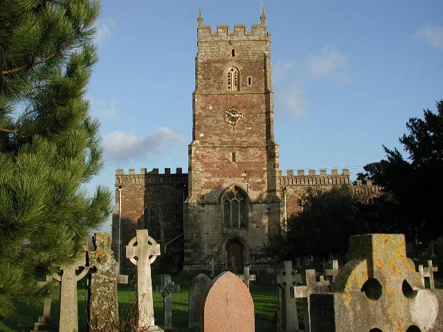
St Mary's Church, Portbury
Historic churches · 1.6 km

Shirehampton
Villages · 1.7 km

St Katherine's School
Historic churches · 1.8 km
Nearby
📷 3Memorials & monuments · South Wales
Avonmouth Bridge Workers Memorial
Avonmouth Bridge Workers Memorial — a memorial in wales-south, United Kingdom.
📷 3Memorials & monuments · South Wales
Pill Tidal Defences Anchor
Pill Tidal Defences Anchor — a memorial in wales-south, United Kingdom.
📷 3Historic bridges · South Wales
Avonmouth Bridge
Avonmouth Bridge is a historic bridge in the United Kingdom.
📷 3Forests & woodlands · South Wales
Lamplighter's Marsh Nature Reserve
Lamplighter's Marsh Nature Reserve is a forest or woodland in the United Kingdom.
📷 3Memorials & monuments · South Wales
The American Monument
The American Monument — a memorial in wales-south, United Kingdom.
📷 5Where to eat & stay near Stronghold
Places to stay
 📷 7
📷 7Hotels · South Wales
ibis budget Portishead Marina
ibis budget Portishead Marina — a hotel in wales south. 2-star. Brand: Ibis Budget.
 📷 5
📷 5 📷 7
📷 7 📷 5
📷 5Campsites · South Wales
Glenny Wood Scout Camp Site
Glenny Wood Scout Camp Site — a campsite in wales south.
 📷 5
📷 5Hotels · South West England
Rodney Hotel
Rodney Hotel — a hotel in wales south.
 📷 7
📷 7Hotels · South West England
OYO The Regency
OYO The Regency — a hotel in wales south.
Places to eat & drink
📷 5Historic pubs · South Wales
The Lamplighters Public House
The Lamplighters Public House in Wales South, United Kingdom.
 📷 5
📷 5Historic pubs · South Wales
The White Lion Public House And Section Of Former Sea Wall To North End Of West Front
The White Lion Public House And Section Of Former Sea Wall To North End Of West Front in Wales South, United Kingdom.
 📷 7
📷 7 📷 7
📷 7Historic pubs · South West England
Blaise Inn Public House
Blaise Inn Public House in Wales South, United Kingdom.
 📷 7
📷 7More places in this region
.jpg?width=1200) 📷 3
📷 3Public art & sculpture · South Wales
Aneurin Bevan
Aneurin Bevan — Public artwork (sculpture).
 📷 3
📷 3Public art & sculpture · South Wales
Betty Campbell
Betty Campbell — Public artwork (statue) by Eve Shepherd.
 📷 3
📷 3.jpg?width=1200) 📷 3
📷 3Public art & sculpture · South Wales
Ecliptica' sculpture and weather vane
Ecliptica' sculpture and weather vane — Public artwork (installation) by Robin Campbell (architect), Robert Conybear, Uta Molling (sculptors).
Frequently asked questions
- Where is Stronghold?
- Stronghold is in South Wales, United Kingdom (postcode BS20 0LP), in the parish of Pill and Easton-in-Gordano.
- What is Stronghold?
- Stronghold — a public art in wales-south, United Kingdom.
- How do I get to Stronghold?
- The nearest railway station is Portway Park and Ride, about 0.9 km away. Drivers can use postcode BS20 0LP.
- Is Stronghold a protected site?
- Yes — Stronghold is part of the Severn Estuary SSSI Site of Special Scientific Interest.
- Is Stronghold free to visit?
- Yes, Stronghold is free to enter.
- How do I get to Stronghold?
- The nearest railway station is Portway Park and Ride, about 0.9 km away. Drivers can navigate to postcode BS20 0LP.