
Forests & woodlands · South Wales
Lamplighter's Marsh Nature Reserve
In or near Easter Compton.
Lamplighter's Marsh Nature Reserve is a forest or woodland in the United Kingdom.
.jpg?width=1200)
Wikimedia Commons licence
Plan your visit
- Typical visit
- 1 h–3 h
- Nearest railway station
- Portway Park and Ride · 0.1 km
- Free entry
- Family-friendly
- Dog-friendly
About
Lamplighter's Marsh Nature Reserve is a named forest, woodland or nature reserve in the United Kingdom. Coordinates: 51.4873°, -2.6872°.
Photo gallery
Protected designations
- Site of Special Scientific Interest: Severn Estuary SSSI
Designations sourced from Natural England open data under OGL v3.
From the Wikipedia article
Lamplighters Marsh (grid reference ST524764) is a public open space and local nature reserve near Shirehampton in the city of Bristol, England. It is a narrow strip of land between the railway line which connects Bristol to Avonmouth, and the River Avon.
Excerpt from Wikipedia under CC BY-SA 4.0. See the source article linked in Sources below.
Background
History
Lamplighter's Marsh was utilised as grazing marsh up to the modern era. In the 18th century the small, brick-making village of West Town took up part of the site, it has gone now but is recalled in the name of the West Town Road. When the First World War broke out the British Army established a remount Depot at Shirehampton. The depot imported, trained and sent out horses on active service with the army and it was very large, extending from Station Road all the way to the Portway roundabout, including the area now known as the Daisy Field. In the Second World War Lamplighter's Marsh was used to tether barrage balloons which were to protect the nearby docks from bombing by the Luftwaffe and…
Sourced from Wikipedia under CC BY-SA 4.0.
- Coordinates
- 51.4873, -2.6872
- District
- Bristol, City of
- Parish
- Bristol, City of, unparished area
- Postcode
- BS11 9QG
- Parliamentary constituency
- Bristol North West
- Nearest railway station
- Portway Park and Ride — 0.1 km
Sources
- osm: w358551398 (ODbL)
- wikipedia: Lamplighters Marsh (CC BY-SA 4.0)
Other places nearby

Pill Tidal Defences Anchor
Memorials & monuments · 0.4 km

Avonmouth Bridge
Historic bridges · 0.4 km

Avonmouth Bridge Workers Memorial
Memorials & monuments · 0.5 km

The Lamplighters Public House
Historic pubs · 0.5 km

Sir Robert Stephens
Memorials & monuments · 0.5 km

The American Monument
Memorials & monuments · 0.8 km

Stronghold
Public art & sculpture · 0.8 km

Shirehampton
Villages · 0.8 km

Penpole Point
Memorials & monuments · 1.0 km

Pill
Villages · 1.0 km

Blaise Museum - Kingsweston Roman Villa
Museums · 1.3 km
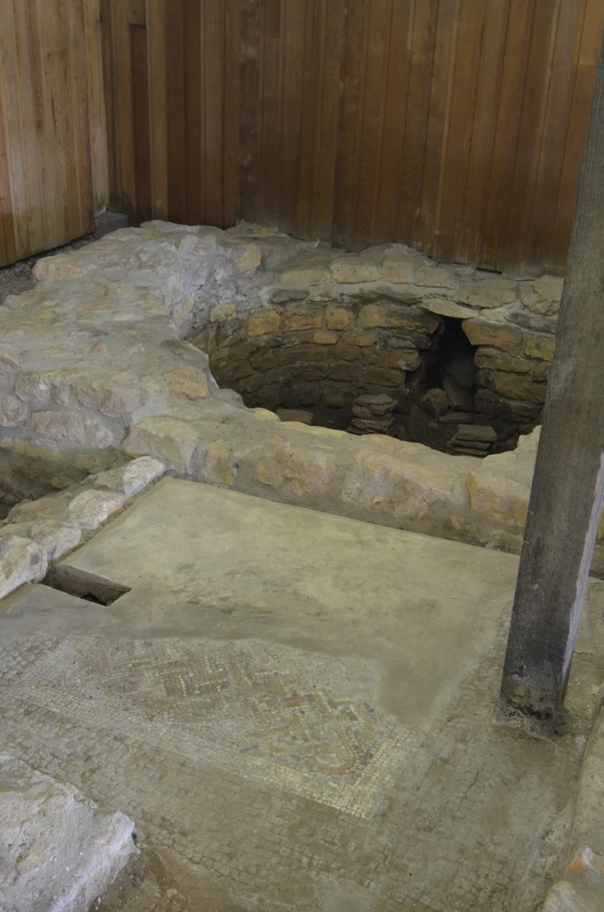
Part of a minor Romano-British villa at Long Cross
Archaeological sites · 1.3 km
Nearby
📷 3Memorials & monuments · South Wales
Pill Tidal Defences Anchor
Pill Tidal Defences Anchor — a memorial in wales-south, United Kingdom.
📷 3Historic bridges · South Wales
Avonmouth Bridge
Avonmouth Bridge is a historic bridge in the United Kingdom.
📷 3Memorials & monuments · South Wales
Avonmouth Bridge Workers Memorial
Avonmouth Bridge Workers Memorial — a memorial in wales-south, United Kingdom.
📷 5Historic pubs · South Wales
The Lamplighters Public House
The Lamplighters Public House in Wales South, United Kingdom.
📷 3Memorials & monuments · South Wales
Sir Robert Stephens
Sir Robert Stephens — a memorial in wales-south, United Kingdom.
📷 3Memorials & monuments · South Wales
The American Monument
The American Monument — a memorial in wales-south, United Kingdom.
Where to eat & stay near Lamplighter's Marsh Nature Reserve
Places to stay
 📷 5
📷 5 📷 7
📷 7B&Bs · South West England
Ferndale Mews
Ferndale Mews — a bed-and-breakfast in wales south.
 📷 7
📷 7Hotels · South Wales
ibis budget Portishead Marina
ibis budget Portishead Marina — a hotel in wales south. 2-star. Brand: Ibis Budget.
 📷 5
📷 5Hotels · South West England
Rodney Hotel
Rodney Hotel — a hotel in wales south.
 📷 7
📷 7Hotels · South West England
OYO The Regency
OYO The Regency — a hotel in wales south.
 📷 5
📷 5Campsites · South West England
Brockmead Scout Camp Site
Brockmead Scout Camp Site — a campsite in wales south.
Places to eat & drink
📷 5Historic pubs · South Wales
The Lamplighters Public House
The Lamplighters Public House in Wales South, United Kingdom.
 📷 5
📷 5 📷 7
📷 7Historic pubs · South West England
Blaise Inn Public House
Blaise Inn Public House in Wales South, United Kingdom.
 📷 7
📷 7 📷 5
📷 5Historic pubs · South Wales
The White Lion Public House And Section Of Former Sea Wall To North End Of West Front
The White Lion Public House And Section Of Former Sea Wall To North End Of West Front in Wales South, United Kingdom.
 📷 5
📷 5Historic pubs · South West England
The Coronation Tap
The Coronation Tap in Wales South, United Kingdom.
More forests in this region
 📷 3
📷 3Forests & woodlands · South Wales
Aberbargoed Grasslands National Nature Reserve
Aberbargoed Grasslands National Nature Reserve is a forest or woodland in the United Kingdom.
 📷 3
📷 3Forests & woodlands · South Wales
Beaufort Hill Ponds & Woodlands
Beaufort Hill Ponds & Woodlands is a forest or woodland in the United Kingdom.
.jpg?width=1200) 📷 3
📷 3Forests & woodlands · South Wales
Blake's Pools Nature Reserve
Blake's Pools Nature Reserve is a forest or woodland in the United Kingdom.
 📷 5
📷 5Forests & woodlands · South Wales
Cardiff Bay Wetlands Reserve
Cardiff Bay Wetlands Reserve is a forest or woodland in the United Kingdom.
Frequently asked questions
- Where is Lamplighter's Marsh Nature Reserve?
- Lamplighter's Marsh Nature Reserve is in South Wales, United Kingdom (postcode BS11 9QG), in the parish of Bristol, City of, unparished area.
- What is Lamplighter's Marsh Nature Reserve?
- Lamplighter's Marsh Nature Reserve is a forest or woodland in the United Kingdom.
- How do I get to Lamplighter's Marsh Nature Reserve?
- The nearest railway station is Portway Park and Ride, about 0.1 km away. The nearest town is Easter Compton. Drivers can use postcode BS11 9QG.
- Is Lamplighter's Marsh Nature Reserve a protected site?
- Yes — Lamplighter's Marsh Nature Reserve is part of the Severn Estuary SSSI Site of Special Scientific Interest.
- Is Lamplighter's Marsh Nature Reserve free to visit?
- Yes, Lamplighter's Marsh Nature Reserve is free to enter.
- How do I get to Lamplighter's Marsh Nature Reserve?
- The nearest railway station is Portway Park and Ride, about 0.1 km away. Drivers can navigate to postcode BS11 9QG.