
Follies · North West England
Stone Arch
In or near Bassenthwaite.
Stone Arch — Folly or eyecatcher.

Alexander P Kapp — CC BY-SA 2.0 via Wikimedia Commons licence

Plan your visit
- Typical visit
- 20 min–45 min
- Free entry
- Dog-friendly
About
Stone Arch is a folly in the Scottish Lowlands — built more for the eye than for any practical purpose, and a reminder of the British landscape's appetite for the eccentric. The site is within the Solway Coast National Landscape (AONB). It sits within the Penrith and Solway parliamentary constituency. Postcode area CA7.
Photo gallery
See it from the streetimagery from 2019
Imagery © Mapillary contributors, CC BY-SA 4.0
Protected designations
- Area of Outstanding Natural Beauty: Solway Coast
Designations sourced from Natural England open data under OGL v3.
Place summary
Stone Arch is a folly located in the Scottish Lowlands, within the parish of Ireby and Uldale, postcode CA7. It is situated in an Area of Outstanding Natural Beauty (AONB) designated as Solway Coast.
AI-generated from the structured facts on this page (operator, designation, listing, era). Not a substitute for visiting.
- Coordinates
- 54.7196, -3.1903
- District
- Cumberland
- Parish
- Ireby and Uldale
- Postcode
- CA7 1HG
- Parliamentary constituency
- Penrith and Solway
Sources
- osm: w554823224 (ODbL)
Other places nearby

High Ireby Grange
Historic houses · 0.4 km

Binsey
Mountains & hills · 1.5 km
Binsey
Mountains & hills · 1.5 km

Uldale
Villages · 1.5 km

Ireby
Villages · 1.6 km

Latrigg
Mountains & hills · 1.7 km
Latrigg
Mountains & hills · 1.7 km

Overwater Hall
Historic houses · 2.3 km
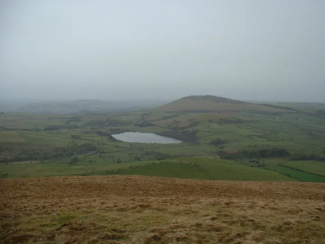
Over Water
Natural landmarks · 2.4 km

Ireby War Memorial
Memorials & monuments · 2.5 km

Green How
Mountains & hills · 2.5 km

Chapelhouse Reservoir
Reservoirs & lochs · 2.8 km
Nearby
📷 3Historic houses · North West England
High Ireby Grange
High Ireby Grange — a historic house in scotland-lowlands, United Kingdom.
📷 5📷 5Mountains & hills · North West England
Binsey
Binsey — mountain in scotland lowlands. Elevation: 446.7 m.
📷 5📷 5📷 5Mountains & hills · North West England
Latrigg
Latrigg — mountain in scotland lowlands. Elevation: 322.1 m.
Where to eat & stay near Stone Arch
Places to stay

Caravan parks · North West England
Keswick Lodge Retreat
Keswick Lodge Retreat — a caravan park in scotland lowlands.
 📷 5
📷 5Caravan parks · North West England
High Close Holiday Homes
High Close Holiday Homes — a caravan park in scotland lowlands.
 📷 5
📷 5Caravan parks · North West England
Robin Hood Park
Robin Hood Park — a caravan park in scotland lowlands.
 📷 5
📷 5Caravan parks · North West England
Coal Beck Caravan Park
Coal Beck Caravan Park — a caravan park in scotland lowlands.
 📷 5
📷 5Caravan parks · North West England
Trafford Caravan Park
Trafford Caravan Park — a caravan park in scotland lowlands.
 📷 4
📷 4Caravan parks · North West England
Skiddaw View Holiday Park
Skiddaw View Holiday Park — a caravan park in scotland lowlands.
Places to eat & drink
 📷 7
📷 7Historic pubs · North West England
The Pheasant Inn
The Pheasant Inn in Scotland Lowlands, United Kingdom.
 📷 4
📷 4Historic pubs · North West England
Oddfellows Arms
Oddfellows Arms — Historic pub — listed building or notable heritage status.
 📷 5
📷 5Historic pubs · North West England
Kings Arms Walter Willsons
Kings Arms Walter Willsons in Scotland Lowlands, United Kingdom.
 📷 5
📷 5 📷 5📷 5
More follies in this region
 📷 5
📷 5Follies · North West England
Shinto Temple
Shinto Temple — a temple folly in england-west-midlands, United Kingdom.
 📷 3
📷 3 📷 3
📷 3 📷 3
📷 3Follies · North West England
Pikestones
Pikestones — Historic tomb, BC 3400-2400.
Frequently asked questions
- Where is Stone Arch?
- Stone Arch is in the Scottish Lowlands, United Kingdom (postcode CA7 1HG), in the parish of Ireby and Uldale.
- What is Stone Arch?
- Stone Arch — Folly or eyecatcher.
- How do I get to Stone Arch?
- Drivers can use postcode CA7 1HG.
- Is Stone Arch a protected site?
- Yes — Stone Arch is part of the Solway Coast National Landscape (AONB).
- Is Stone Arch free to visit?
- Yes, Stone Arch is free to enter.
- How do I get to Stone Arch?
- Drivers can navigate to postcode CA7 1HG. It sits within the Penrith and Solway parliamentary constituency.