
Caves · South West England
Stoke Lane Slocker
In or near Coleford.
Stoke Lane Slocker is a cave in the United Kingdom.

Wikimedia Commons contributors — see linked file page for photographer and licence licence

Plan your visit
- Typical visit
- 45 min–1.5 h
- Nearest railway station
- Cranmore · 4.5 km
- Free entry
- Dog-friendly
Getting there & planning your visit
To visit Stoke Lane Slocker, the nearest railway station is Cranmore, located 4.5 km away. The postcode for the site is BA3 5JT, which you can use for sat-nav. Entry to the cave is free.
About
Stoke Lane Slocker is a named cave entrance in the United Kingdom. Coordinates: 51.2252°, -2.4759°. This entry is part of The Great Britain Guide, a free, ad-free, open-data tourist directory.
Photo gallery
Protected designations
- Site of Special Scientific Interest: St. Dunstan's Well Catchment SSSI
Designations sourced from Natural England open data under OGL v3.
From the Wikipedia article
Stoke Lane Slocker (grid reference ST66874745) is a cave near Stoke St Michael, in the Carboniferous Limestone of the Mendip Hills, in the English county of Somerset. It is 2.18 km in length and reaches a depth of 30m. It was previously known as Stoke Lane Swallet, but now the local name is preferred. The origin of the word "Slocker" is obscure, possibly from "slock" meaning to entice or lure away although the Gaelic word for swallow hole is "sluighaire".
Excerpt from Wikipedia under CC BY-SA 4.0. See the source article linked in Sources below.
Background
History
It is believed that the first person to explore the cave in modern times was a Mr Marshall from Stratton-on-the-Fosse around 1905, but major exploration and measurement of this cave really started in 1947 when Sump 1 was reached. That sump was passed the same year and the decorated chambers of Stoke Two discovered. Sumps 2 to 7 were passed over the course of the 1960s. The Bailey-Ward series of chambers was discovered in 1971. Cases of Weils Disease have been reported in those who have been into the cave.
Description
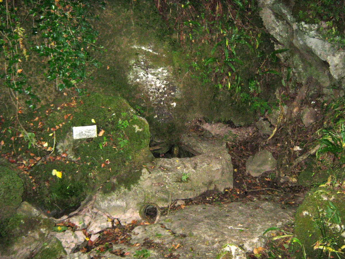
The submerged entrance to the cave lies near the disused Stoke Lane Quarry, and from it an underground stream emerges into daylight to feed a water-source known as St Dunstan's Well. The cave has been designated as a Site of Special Scientific Interest. Stoke One (the length of passage between the entrance and Sump 1), is mainly made up of low passageways. However the Bailey-Ward Series of chambers includes Bernard's Rift, which is 20 m high and contains crystal pools containing calcite-encrusted goniatite snail shells, and cave pearls. The area between Sumps 1 and 2, Stoke 2, contains a number of highly decorated chambers including the Upper Grotto, Traverse Grotto and the Throne Room…
Sourced from Wikipedia under CC BY-SA 4.0.
- Coordinates
- 51.2252, -2.4759
- District
- Somerset
- Parish
- Stoke St Michael
- Postcode
- BA3 5JT
- Parliamentary constituency
- Frome and East Somerset
- Nearest railway station
- Cranmore — 4.5 km
Sources
- osm: n3431344694 (ODbL)
- wikipedia: Stoke Lane Slocker (CC BY-SA 4.0)
- commons: Stoke Lane Slocker entrance.jpg (CC BY-SA 4.0)
Other places nearby
Stoke Lane Slocker
Mountains & hills · 0.0 km

Knatchbull Arms
Historic pubs · 0.7 km

Ten Minute Arete
Viewpoints · 1.0 km
W/L Cave
Mountains & hills · 1.1 km
Shatter Cave
Mountains & hills · 1.1 km

Balch Cave
Mountains & hills · 1.1 km

Fairy Cave
Caves · 1.2 km

Hillier's Cave
Caves · 1.3 km

Withyhill Cave
Caves · 1.3 km
ba35hp
Campsites · 1.3 km

Former Canal Bridge At Ngr St 6687 4880
Historic bridges · 1.4 km

Dinies Camp
Vineyards · 1.8 km
Nearby
📷 5Mountains & hills · South West England
Stoke Lane Slocker
Stoke Lane Slocker — limestone cave in Somerset, England.
📷 7Historic pubs · South West England
Knatchbull Arms
Knatchbull Arms in England South West, United Kingdom.
📷 5Viewpoints · South West England
Ten Minute Arete
Ten Minute Arete is a viewpoint in the United Kingdom.
📷 5📷 5📷 5Where to eat & stay near Stoke Lane Slocker
Places to stay
📷 5 📷 5
📷 5Caravan parks · South West England
Old Down Touring Park
Old Down Touring Park — a caravan park in england south west.
 📷 5
📷 5B&Bs · South West England
The Old Priory
The Old Priory — a bed-and-breakfast in england south east.
 📷 5
📷 5Hotels · South West England
The Radstock Hotel
The Radstock Hotel — a hotel in england south east.
 📷 5
📷 5Campsites · South West England
Old Mills Campsite
Old Mills Campsite — a campsite in england south west.
 📷 5
📷 5Places to eat & drink
📷 7Historic pubs · South West England
Knatchbull Arms
Knatchbull Arms in England South West, United Kingdom.
 📷 5
📷 5Historic pubs · South West England
Strode Arms Inn
Strode Arms Inn in England South West, United Kingdom.
 📷 7
📷 7 📷 7
📷 7Historic pubs · South West England
The Jolliffe Arms And Nos 235 And 236
The Jolliffe Arms And Nos 235 And 236 in England South West, United Kingdom.
📷 5 📷 5
📷 5Historic pubs · South West England
The Talbot Inn
The Talbot Inn in England South West, United Kingdom.
More caves in this region
 📷 5
📷 5Caves · South West England
Ariel Cave (Blacknor Hole)
Ariel Cave (Blacknor Hole) is a cave in the United Kingdom.
 📷 5
📷 5Caves · South West England
Ariel Cave (Blacknor Hole), Queens Entrance
Ariel Cave (Blacknor Hole), Queens Entrance is a cave in the United Kingdom.
 📷 5📷 5
Frequently asked questions
- Where is Stoke Lane Slocker?
- Stoke Lane Slocker is in South-East England, United Kingdom (postcode BA3 5JT), in the parish of Stoke St Michael.
- What is Stoke Lane Slocker?
- Stoke Lane Slocker is a cave in the United Kingdom.
- How do I get to Stoke Lane Slocker?
- The nearest railway station is Cranmore, about 4.5 km away. Drivers can use postcode BA3 5JT.
- Is Stoke Lane Slocker a protected site?
- Yes — Stoke Lane Slocker is part of the St. Dunstan's Well Catchment SSSI Site of Special Scientific Interest.
- Is Stoke Lane Slocker free to visit?
- Yes, Stoke Lane Slocker is free to enter.
- How do I get to Stoke Lane Slocker?
- The nearest railway station is Cranmore, about 4.5 km away. Drivers can navigate to postcode BA3 5JT.