
Natural landmarks · Scottish Highlands
Stob Coire Sgreamhach
In or near Ballachulish.
Stob Coire Sgreamhach — 1072m high mountain in Highland, Scotland, UK.

Wikimedia Commons contributors — see linked file page for photographer and licence licence

Plan your visit
- Typical visit
- 1 h–2 h
- Free entry
- Dog-friendly
About
Stob Coire Sgreamhach is a named natural landmark in the United Kingdom. Wikidata describes it as: "1072m high mountain in Highland, Scotland, UK". Coordinates: 56.6377°, -5.0117°.
Photo gallery
Official information
Stob Coire Sgreamhach is a prominent mountain in the Bidean nam Bian massif, recognized as a Munro since 1997. It features challenging terrain, particularly on the Beinn Fhada ridge, and is typically accessed via the steep Lost Valley route, which involves a climb up scree.
From the Wikipedia article
Stob Coire Sgreamhach (Scottish Gaelic for 'peak of the dreadful corrie') is a mountain in Lorn, south of Glen Coe in the Scottish Highlands. Its height is 1,072 metres (3,517 ft). It is part of the Bidean nam Bian massif and is often considered a subsidiary peak of Bidean, though since the 1997 revision of Munros Tables it has been classified as a separate Munro. To the northeast is the ridge of Beinn Fhada ('the long mountain'). The mountain is usually climbed together with Bidean nam Bian, thus allowing for a traverse of the range. One of the most common routes from Glen Coe is to ascend the head of Coire Gabhail (the 'Hidden Glen' or 'Lost Valley') to reach the bealach between Stob Coire Sgreamhach and Bidean nam Bian. The wide floor of this corrie is hidden from view when seen from Glen Coe, and was used by the local Clan MacDonald to hide livestock, whether their own or stolen on raids. Another route of ascent is via Beinn Fhada, the most easterly of the famous Three Sisters of Glen Coe. This route also starts from Coire Gabhail, but then climbs steeply up the ridge that marks the southeastern edge of the glen. Stob Coire Sgreamhach may also be climbed from Glen Etive to the southeast by way of a steep rocky ridge.
Excerpt from Wikipedia under CC BY-SA 4.0. See the source article linked in Sources below.
- Coordinates
- 56.6377, -5.0117
- Address
- Glen Coe, Scotland
- Official site
- www.walkhighlands.co.uk
Sources
- wikidata: Q7617759 (CC0)
- wikipedia: Stob Coire Sgreamhach (CC BY-SA 4.0)
- commons: Coire Gabhail looking up to Bealach Dearg.jpg (CC BY-SA 4.0)
Other places nearby
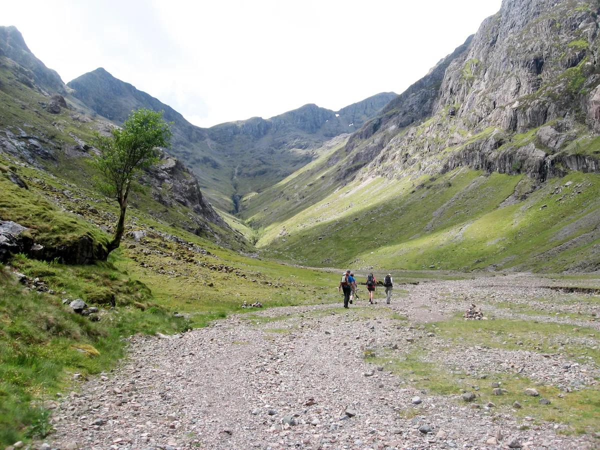
Stob Coire Sgreamhach
Mountains & hills · 0.1 km

Beinn Fhada
Mountains & hills · 0.7 km
Beinn Fhada
Mountains & hills · 0.7 km
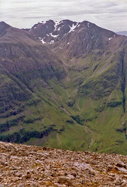
Bidean nam Bian
Mountains & hills · 1.2 km

Beinn Fhada NE Top
Mountains & hills · 1.2 km
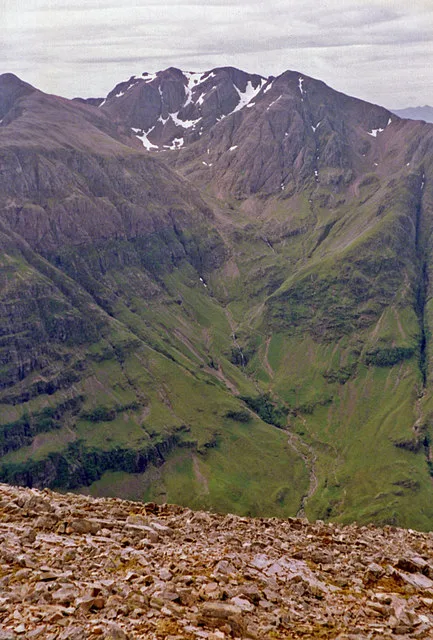
Bidean nam Bian
Natural landmarks · 1.2 km

Beinn Fhada East Top
Mountains & hills · 1.2 km

Stob Coire nan Lochan
Mountains & hills · 1.4 km

Stob Coire nan Easain
Mountains & hills · 1.4 km

Stob Coire nam Beith
Mountains & hills · 1.8 km

Beinn Fhada Far East Top
Mountains & hills · 2.0 km

Coire Gabhail
Mountains & hills · 2.1 km
Nearby
📷 3Mountains & hills · Scottish Highlands
Stob Coire Sgreamhach
Stob Coire Sgreamhach — Named summit at 1072 m.
📷 5Mountains & hills · Scottish Highlands
Beinn Fhada
Beinn Fhada — mountain in scotland highlands. Elevation: 952 m.
📷 5Mountains & hills · Scottish Highlands
Beinn Fhada
Beinn Fhada — a hill or mountain in scotland highlands.
📷 4Mountains & hills · Scottish Highlands
Bidean nam Bian
Bidean nam Bian — Named summit at 1150 m.
📷 3Mountains & hills · Scottish Highlands
Beinn Fhada NE Top
Beinn Fhada NE Top — a mountain in scotland-highlands, United Kingdom.
📷 4Natural landmarks · Scottish Highlands
Bidean nam Bian
Bidean nam Bian — 1149m high mountain in Highland, Scotland, UK.
Where to eat & stay near Stob Coire Sgreamhach
Places to stay
 📷 5
📷 5Campsites · Scottish Highlands
Red Squirrel Campsite
Red Squirrel Campsite — a campsite in scotland highlands.
📷 5Hostels · Scottish Highlands
Glencoe Youth Hostel
Glencoe Youth Hostel — a hostel in scotland highlands.
 📷 5
📷 5Hostels · Scottish Highlands
Glencoe Independent Hostel
Glencoe Independent Hostel — a hostel in scotland highlands.
 📷 5
📷 5Campsites · Scottish Highlands
Glencoe Camping & Caravanning Club
Glencoe Camping & Caravanning Club — a campsite in scotland highlands.
 📷 5
📷 5Campsites · Scottish Highlands
Caolasnacon Caravan & Camping Park
Caolasnacon Caravan & Camping Park — a campsite in scotland highlands.
 📷 5
📷 5Campsites · Scottish Highlands
Invercoe Caravan & Camping Park
Invercoe Caravan & Camping Park — a campsite in scotland highlands.
Places to eat & drink
 📷 4
📷 4Historic pubs · Scottish Highlands
Clachaig Inn
Clachaig Inn in Scotland Islands, United Kingdom.
More natural landmarks in this region
 Flagship📷 3
Natural landmarks · Scottish Highlands
Dunalastair Water
Dunalastair Water — lake in Perth and Kinross, Scotland, UK, on the River Tummel.
 Flagship📷 3
Natural landmarks · Scottish Highlands
Loch Arkaig
Loch Arkaig — lake in Highland, Scotland, UK, outflows east to River Arkaig.
 Flagship📷 3
Natural landmarks · Scottish Highlands
Loch Assynt
Loch Assynt — lake in Highland, Scotland, UK, outflows to the River Inver and Loch na Garbh Uidhe.
 Flagship📷 5
Natural landmarks · Scottish Highlands
Loch Eilt
Loch Eilt — lake in Highland, Scotland, UK, outflows west to River Ailort.
Frequently asked questions
- Where is Stob Coire Sgreamhach?
- Stob Coire Sgreamhach is in the Scottish Highlands, United Kingdom.
- What is Stob Coire Sgreamhach?
- Stob Coire Sgreamhach — 1072m high mountain in Highland, Scotland, UK.
- How do I get to Stob Coire Sgreamhach?
- The nearest town is Ballachulish. Its coordinates are 56.6377°, -5.0117°.
- Is Stob Coire Sgreamhach free to visit?
- Yes, Stob Coire Sgreamhach is free to enter.