
Historic churches · Central Scotland
Steelend
In or near Blairhall.
Steelend in Scotland Islands, United Kingdom.

Richard Webb — CC BY-SA 2.0 via Wikimedia Commons licence

Plan your visit
- Typical visit
- 30 min–1 h
- Nearest railway station
- Eddie's Rest · 5.4 km
- Free entry
Getting there & planning your visit
To visit Steelend, the nearest railway station is Eddie's Rest, located 5.4 km away. The postcode for navigation is KY12 9LX, and entry to the church is free.
About
Steelend is a place of interest in Scotland Islands, United Kingdom — drawn from open-data sources for visitor reference. See the linked Wikipedia article for the full description.
Photo gallery
From the Wikipedia article
Steelend is a former mining village in West Fife, Scotland, located on the B914 road approximately three-quarters of a mile east of the village of Saline and four miles north-west of Dunfermline. The village is home to a community centre and the Steelend Miners Welfare Club. A church was once located in the village but was demolished in the 1980s. In 1991 it had a population of 320. The now-defunct Steelend Victoria F.C. were based at Woodside Park on the east side of the village until 2013 when the club folded due to financial issues. The name comes from a farm on Saline Hill north of Steelend. A goods railway station once existed to the east of the village on the West of Fife Mineral Railway. The station served the several collieries that once operated nearby to Steelend, which included Sunnybraes Colliery, Saline Valley Colliery, Killernie Colliery and North Steelend Colliery. The public transport serves the village in the form of buses which run to Dunfermline, Falkirk or Rosyth. To the south of the village is Bandrum Hill, on top of which is a large standing stone, which are accessible from Steelend by a path. To the north of the village is the eastern end of Saline Glen, which carries the Saline Burn and a footpath which leads west into the centre of Saline.
Excerpt from Wikipedia under CC BY-SA 4.0. See the source article linked in Sources below.
- Coordinates
- 56.1129, -3.5491
- District
- Fife
- Postcode
- KY12 9LX
- Parliamentary constituency
- Dunfermline and Dollar
- Nearest railway station
- Eddie's Rest — 5.4 km
Sources
- wikidata: Q105271747 (CC0)
- wikipedia: Steelend (CC BY-SA 4.0)
Other places nearby

Bandrum
Mountains & hills · 0.5 km
Bandrum
Mountains & hills · 0.5 km

The Temple, Bandrum
Memorials & monuments · 0.5 km
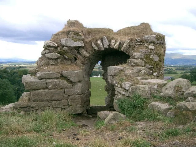
Killernie Castle
Castles · 0.6 km

Saline Hill
Mountains & hills · 1.0 km

Easter Cairn
Mountains & hills · 1.2 km
Saline Hill
Vineyards · 1.3 km

Dunfermline and Dollar
Cathedrals · 1.3 km

Tower In Garden, Glenburn Cottage, 14 Bridge Street, Saline
Memorials & monuments · 1.5 km
15 Bridge Street, Saline
Historic churches · 1.5 km
Bridge, Saline Burn, Bridge Street, Saline
Historic bridges · 1.5 km
Parish Church, Main Street, Saline
Historic churches · 1.5 km
Nearby
📷 5📷 5Mountains & hills · Central Scotland
Bandrum
Bandrum — mountain in scotland central. Elevation: 225 m.
📷 5Memorials & monuments · Central Scotland
The Temple, Bandrum
The Temple, Bandrum — category C listed building-listed memorial in scotland-central, United Kingdom.
📷 3Castles · Central Scotland
Killernie Castle
Killernie Castle — scheduled monument in Scotland.
📷 5Mountains & hills · Central Scotland
Saline Hill
Saline Hill — mountain in scotland central. Elevation: 359 m.
📷 5Mountains & hills · Central Scotland
Easter Cairn
Easter Cairn — mountain in scotland central. Elevation: 355 m.
Where to eat & stay near Steelend
Places to stay
 📷 7
📷 7Hotels · Central Scotland
Adamson Hotel
Adamson Hotel — a hotel in scotland central.
📷 5Hotels · Central Scotland
Keavil House Hotel
Keavil House Hotel — a hotel in scotland central.
 📷 5
📷 5 📷 5
📷 5 📷 5
📷 5Campsites · Central Scotland
Green Oak Nature Retreat
Green Oak Nature Retreat — a campsite in scotland central.
 📷 5
📷 5Places to eat & drink
 📷 7
📷 7Historic pubs · Central Scotland
Red Lion Inn, Low Causeway, Culross
Red Lion Inn, Low Causeway, Culross in Scotland Central, United Kingdom.
 📷 7
📷 7Historic pubs · Central Scotland
Ye Olde House Inn, 25-26 Forth Street, Kincardine On Forth
Ye Olde House Inn, 25-26 Forth Street, Kincardine On Forth in Scotland Central, United Kingdom.
 📷 6
📷 6Historic pubs · Central Scotland
The Burgh Arms
The Burgh Arms in Scotland Islands, United Kingdom.
 📷 5
📷 5Restaurants · Central Scotland
Champany Inn
Champany Inn — a restaurant in scotland central.
 📷 7
📷 7Historic pubs · Central Scotland
Red Lion Inn, 50 High Street, Linlithgow
Red Lion Inn, 50 High Street, Linlithgow in Scotland Central, United Kingdom.
 📷 7
📷 7Historic pubs · Central Scotland
The Crown Arms, 177-179 High Street, Linlithgow
The Crown Arms, 177-179 High Street, Linlithgow in Scotland Central, United Kingdom.
More places in this region
 📷 5
📷 5Historic churches · Central Scotland
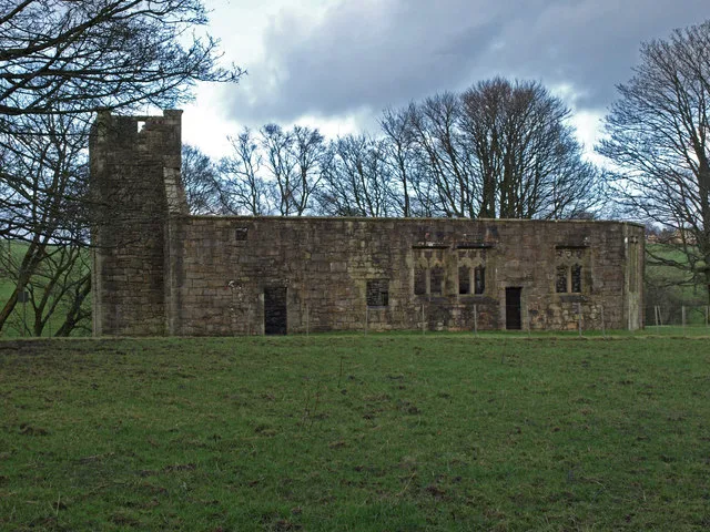
Castle Semple Collegiate Church
Castle Semple Collegiate Church — church building in Renfrewshire, Scotland, UK.
 📷 3
📷 3Historic churches · Central Scotland
Chapel of St Fyndoca, Inishail
Chapel of St Fyndoca, Inishail — architectural structure in Argyll and Bute, Scotland, UK.
 📷 3
📷 3Historic churches · Central Scotland
Chapel of St. Oran, Colonsay
Chapel of St. Oran, Colonsay — chapel on Colonsay, Argyll and Bute, Scotland, UK.
 📷 3
📷 3Historic churches · Central Scotland
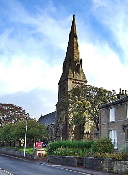
Church of St Mary the Virgin, Arbroath
Church of St Mary the Virgin, Arbroath — church in Arbroath, UK.
Frequently asked questions
- Where is Steelend?
- Steelend is in the Scottish Highlands, United Kingdom (postcode KY12 9LX).
- What is Steelend?
- Steelend in Scotland Islands, United Kingdom.
- How do I get to Steelend?
- The nearest railway station is Eddie's Rest, about 5.4 km away. Drivers can use postcode KY12 9LX.
- Is Steelend free to visit?
- Yes, Steelend is free to enter.
- How do I get to Steelend?
- The nearest railway station is Eddie's Rest, about 5.4 km away. Drivers can navigate to postcode KY12 9LX.