
Other places · North East England
Stanegate
In or near Bardon Mill.
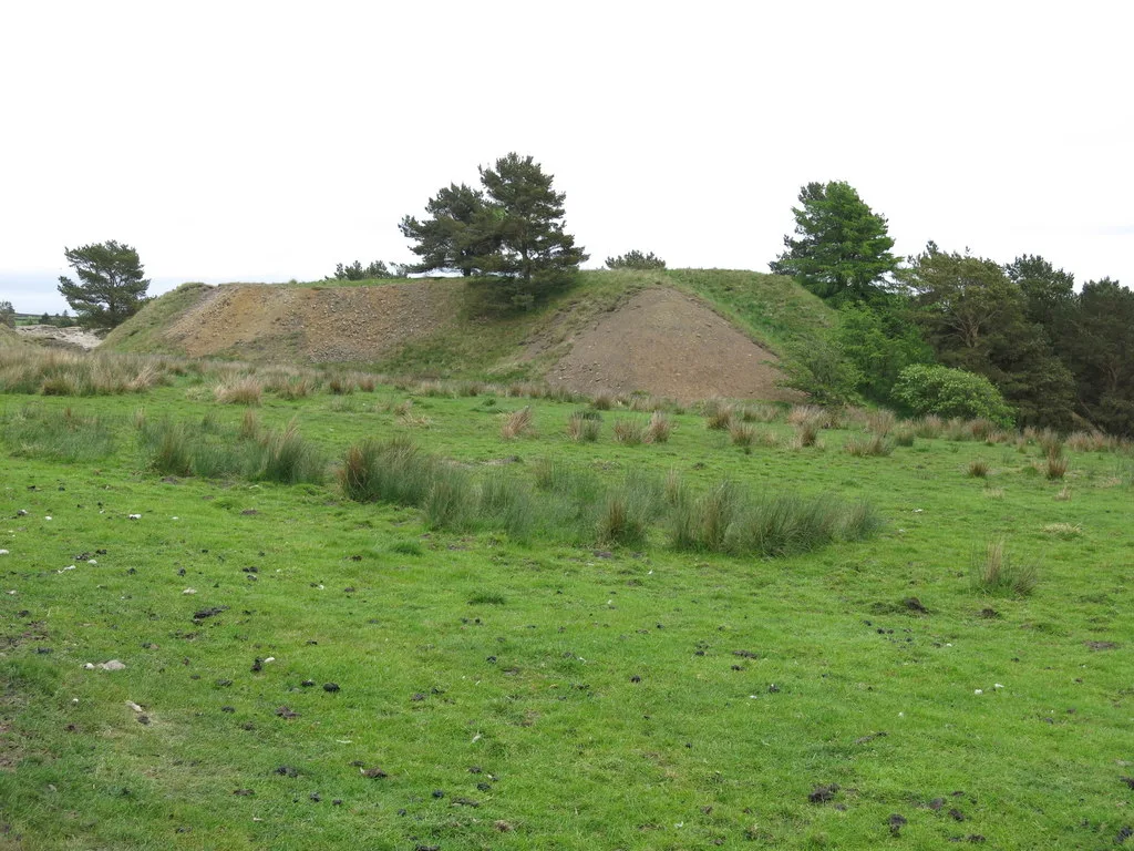
Stanegate in England North East, United Kingdom.

Mike Quinn — CC BY-SA 2.0 via Wikimedia Commons licence
_-_geograph.org.uk_-_473492.jpg)
Plan your visit
- Typical visit
- 1 h–2 h
- Nearest railway station
- Haydon Bridge · 4.0 km
Getting there & planning your visit
To visit Stanegate in Northumberland, the nearest railway station is Haydon Bridge, which is approximately 4 km away. The postcode for navigation is NE47 6NH. Entry details are not provided, so please check locally for accessibility information.
About
Stanegate is a place of interest in England North East, United Kingdom — drawn from open-data sources for visitor reference. See the linked Wikipedia article for the full description.
Photo gallery
Protected designations
- Site of Special Scientific Interest: River Eden and Tributaries SSSI
Designations sourced from Natural England open data under OGL v3.
From the Wikipedia article
The Stanegate (meaning "stone road" in Northumbrian dialect) was an important Roman road and early frontier built in what is now northern England. It linked many forts including two that guarded important river crossings: Corstopitum (Corbridge) on the River Tyne in the east (situated on Dere Street) and Luguvalium (Carlisle) on the River Eden in the west. The Stanegate ran through the natural gap formed by the valleys of the River Tyne in Northumberland and the River Irthing in Cumbria. It predated the Hadrian's Wall frontier by several decades; the Wall would later follow a similar route, albeit slightly to the north. The Stanegate should not be confused with the two Roman roads called Stane Street in the south of England, namely Stane Street (Chichester) and Stane Street (Colchester). In both these cases the meaning is the same as for the northern version, indicating a stone or paved road. The Stanegate differed from most other Roman roads in that it often followed the easiest gradients, and so tended to weave around, whereas typical Roman roads follow a straight path, even if this sometimes involves having punishing gradients to climb. A large section of the Stanegate is still in use today as a modern minor road between Fourstones and Vindolanda in Northumberland.
Excerpt from Wikipedia under CC BY-SA 4.0. See the source article linked in Sources below.
Background
History
The Stanegate is believed to have been built under the governorship of Agricola, from 77 to 85 AD, during the reigns of the emperors Vespasian, Titus, and Domitian. It is also thought that it was built as a strategic road when the northern frontier was on the line of the Forth and Clyde. An indication of this is that it was provided with forts at one-day marching intervals (14 Roman miles or modern 13 mi), sufficient for a strategic non-frontier road. The forts at Vindolanda (Chesterholm) and Nether Denton have been shown to date from about the same time as Corstopitum and Luguvalium, in the 70s and 80s AD. When the Romans decided to withdraw from Scotland starting from around 87 AD, the…
Architecture
Where it left the base of Corstopitum, the Stanegate was 22 ft wide with covered stone gutters and a foundation of 6 in cobbles with 10 in of gravel on top.
Sourced from Wikipedia under CC BY-SA 4.0.
- Coordinates
- 55.0052, -2.2827
- District
- Northumberland
- Parish
- Haydon
- Postcode
- NE47 6NH
- Parliamentary constituency
- Hexham
- Nearest railway station
- Haydon Bridge — 4 km
Sources
Other places nearby

Roman camp, 290m north west of Seldom Seen
Archaeological sites · 0.2 km

Northern England
Other places · 1.2 km

Grindon
Villages · 1.3 km
Langley Barony Mines, Haydon Bridge
Archaeological sites · 1.8 km

Grindon School temporary camp
Archaeological sites · 2.0 km

Grindon School temporary camp
Archaeological sites · 2.0 km
Old Repeater Station
B&Bs · 2.2 km
Coesike West temporary camps
Archaeological sites · 2.2 km
Coesike West temporary camps
Archaeological sites · 2.2 km

Coeksike East temporary camp
Archaeological sites · 2.3 km
Coeksike East temporary camp
Archaeological sites · 2.3 km

Muckle Moss
Wildlife reserves · 2.4 km
Nearby
📷 3Archaeological sites · North East England
Roman camp, 290m north west of Seldom Seen
Roman camp, 290m north west of Seldom Seen — archaeological site in Haydon, Northumberland, England, UK.
📷 4Other places · North East England
Northern England
Northern England in England North East, United Kingdom.
📷 5📷 3Archaeological sites · North East England
Langley Barony Mines, Haydon Bridge
Langley Barony Mines, Haydon Bridge — archaeological site in Haydon, Northumberland, England, UK.
📷 3Archaeological sites · North East England
Grindon School temporary camp
Grindon School temporary camp — a archaeological in scotland-lowlands, United Kingdom.
📷 5Archaeological sites · North East England
Grindon School temporary camp
Grindon School temporary camp — archaeological in scotland lowlands.
Where to eat & stay near Stanegate
Places to stay
📷 5B&Bs · North East England
Old Repeater Station
Old Repeater Station — a bed-and-breakfast in scotland lowlands.
 📷 5
📷 5Caravan parks · North East England
Poplars Riverside Caravan Park
Poplars Riverside Caravan Park — a caravan park in scotland lowlands.
 📷 5
📷 5 📷 5
📷 5Campsites · North East England
Winshields Farm Campsite
Winshields Farm Campsite — a campsite in scotland lowlands.
 📷 5
📷 5Campsites · North East England
Greencarts Campsite
Greencarts Campsite — a campsite in scotland lowlands.
 📷 5
📷 5Campsites · North East England
Stonehaugh Campsite
Stonehaugh Campsite — a campsite in scotland lowlands.
Places to eat & drink
 📷 7
📷 7Historic pubs · North East England
Anchor Hotel
Anchor Hotel in Scotland Lowlands, United Kingdom.
 📷 5
📷 5 📷 5
📷 5 📷 6
📷 6 📷 5
📷 5Historic pubs · North East England
Travellers' Rest Inn
Travellers' Rest Inn in Scotland Lowlands, United Kingdom.
 📷 7
📷 7Historic pubs · North East England
The Vicars Pele
The Vicars Pele in Scotland Lowlands, United Kingdom.
More places in this region
 📷 5
📷 5Other places · North East England
Appleby Horse Fair
The Appleby Horse Fair, previously known as Appleby New Fair, is an annual gathering of Romani people (Gypsies) and Travellers in Appleby-in-Westmorland in Cumbria, England. The horse fair is held eac
 📷 5
📷 5Other places · North East England
Crosby Garrett
Crosby Garrett in England North East, United Kingdom.
 📷 5
📷 5Other places · North East England
Ravenstonedale
Ravenstonedale in England North East, United Kingdom.
 📷 5
📷 5Frequently asked questions
- Where is Stanegate?
- Stanegate is in North-East England, United Kingdom (postcode NE47 6NH), in the parish of Haydon.
- What is Stanegate?
- Stanegate in England North East, United Kingdom.
- How do I get to Stanegate?
- The nearest railway station is Haydon Bridge, about 4.0 km away. Drivers can use postcode NE47 6NH.
- Is Stanegate a protected site?
- Yes — Stanegate is part of the River Eden and Tributaries SSSI Site of Special Scientific Interest.
- How do I get to Stanegate?
- The nearest railway station is Haydon Bridge, about 4.0 km away. Drivers can navigate to postcode NE47 6NH.