
Islands · South East England
St Mary's Island
In or near Hoo St Werburgh.
St Mary's Island — island in Medway, Kent, England, UK.

Wikimedia Commons contributors — see linked file page for photographer and licence licence

Plan your visit
- Typical visit
- 4 h–12 h
- Nearest railway station
- Fort Apache · 2.0 km
- Free entry
- Dog-friendly
Getting there & planning your visit
To visit St Mary's Island, the nearest railway station is Fort Apache, which is 2 km away. The postcode for the island is ME4 3AP, and entry is free.
About
St Mary's Island is a island in the United Kingdom. Wikidata describes it as: "island in Medway, Kent, England, UK". Coordinates: 51.4064°, 0.5450°.
Photo gallery
Protected designations
- Site of Special Scientific Interest: Medway Estuary and Marshes SSSI
- Site of Special Scientific Interest: Tower Hill to Cockham Wood SSSI
- Area of Outstanding Natural Beauty: Kent Downs
Designations sourced from Natural England open data under OGL v3.
From the Wikipedia article
St Mary's Island is part of the Chatham Maritime development area in Medway, South East England. It is located at the northern end of Chatham, adjacent to Brompton and Gillingham. Once part of the Royal Dockyard, Chatham, the area had consisted of a mixture of sports fields and warehousing during the later years of the Royal Navy's time in occupation. St.Mary's Island is divided from mainland Chatham by three basins used by the dockyard.
Excerpt from Wikipedia under CC BY-SA 4.0. See the source article linked in Sources below.
Background
History
The Romans were the first people to use the Island. They constructed a road through the marshy swamp criss-crossed by tidal channels land, and established a ferry route from the Island to the Hoo Peninsula. The ferry was named 'Prince's Bridge' on early maps, it was used until the final years of the last century. The 3 dockyard basins are sited on St Mary's Creek, which passed from the River Medway, near Gillingham to the River Medway (again) near Chatham. In 1575, the creek was blocked with stakes, as a defensive method against the Spanish forces. In 1585, a chain was placed across the River Medway, secured on the island and linked with a Wheelhouse at Upnor Castle. It would have been…
Sourced from Wikipedia under CC BY-SA 4.0.
- Coordinates
- 51.4064, 0.5450
- District
- Medway
- Parish
- Medway, unparished area
- Postcode
- ME4 3AP
- Parliamentary constituency
- Rochester and Strood
- Nearest railway station
- Fort Apache — 2 km
Sources
- wikidata: Q7594499 (CC0)
- wikipedia: St Mary's Island, Kent (CC BY-SA 4.0)
- commons: Aerial view of St Mary's Island, Kent.jpg (CC BY-SA 4.0)
Other places nearby

Yachtsman Artwork
Public art & sculpture · 0.3 km

Universities at Medway
Natural landmarks · 1.0 km
Port Werburgh Concrete Barge
Museums · 1.0 km

Port Werburgh Concrete Barge
Museums · 1.0 km
University of Greenwich - Medway
Natural landmarks · 1.0 km

Copper Rivet Distillery
Distilleries · 1.0 km

Waterfront University Technical College
Natural landmarks · 1.0 km
Bridge, With Railings, Stairs, Abutment And Lamps To South Side Of Central Avenue
Historic bridges · 1.0 km

Odeon Chatham
Theatres · 1.0 km

Medway School of Pharmacy
Natural landmarks · 1.1 km

Odeon
Cinemas · 1.1 km

London Stones
Memorials & monuments · 1.1 km
Nearby
📷 5Public art & sculpture · South East England
Yachtsman Artwork
Yachtsman Artwork — a public art in england-london, United Kingdom.
📷 5Natural landmarks · South East England
Universities at Medway
Universities at Medway — a university in england-london, United Kingdom.
Museums · South East England
Port Werburgh Concrete Barge
Port Werburgh Concrete Barge — a museum in england south east.
📷 5Museums · South East England
Port Werburgh Concrete Barge
Port Werburgh Concrete Barge — a museum in england-london, United Kingdom.
📷 5Natural landmarks · South East England
University of Greenwich - Medway
University of Greenwich - Medway — a university in england-london, United Kingdom.
📷 5Distilleries · South East England
Copper Rivet Distillery
Copper Rivet Distillery — Whisky/spirit distillery.
Where to eat & stay near St Mary's Island
Places to stay
 📷 5
📷 5Hotels · South East England
Travelodge Rochester
Travelodge Rochester — a hotel in england london.
 📷 5
📷 5 📷 5
📷 5 📷 7
📷 7Hotels · South East England
The Royal Victoria and Bull Hotel
The Royal Victoria and Bull Hotel — a hotel in england london.
 📷 5
📷 5 📷 5
📷 5Caravan parks · South East England
The Otterham Park
The Otterham Park — a caravan park in england south east.
Places to eat & drink
 📷 7
📷 7Historic pubs · South East England
The Southern Belle
The Southern Belle — Historic pub — listed building or notable heritage status.
 📷 7
📷 7Historic pubs · South East England
The Ship Public House
The Ship Public House in England South East, United Kingdom.
 📷 5
📷 5Historic pubs · South East England
Command House And Attached Entrance Railings, Stable And Carriage House And Rear Wall
Command House And Attached Entrance Railings, Stable And Carriage House And Rear Wall in England South East, United Kingdom.
 📷 6
📷 6Historic pubs · South East England
The Prince of Wales
The Prince of Wales — Historic pub — listed building or notable heritage status.
 📷 5
📷 5Historic pubs · South East England
White Lion Hotel
White Lion Hotel — Historic pub — listed building or notable heritage status.
 📷 7
📷 7More places in this region
 Flagship📷 10
Islands · South East England
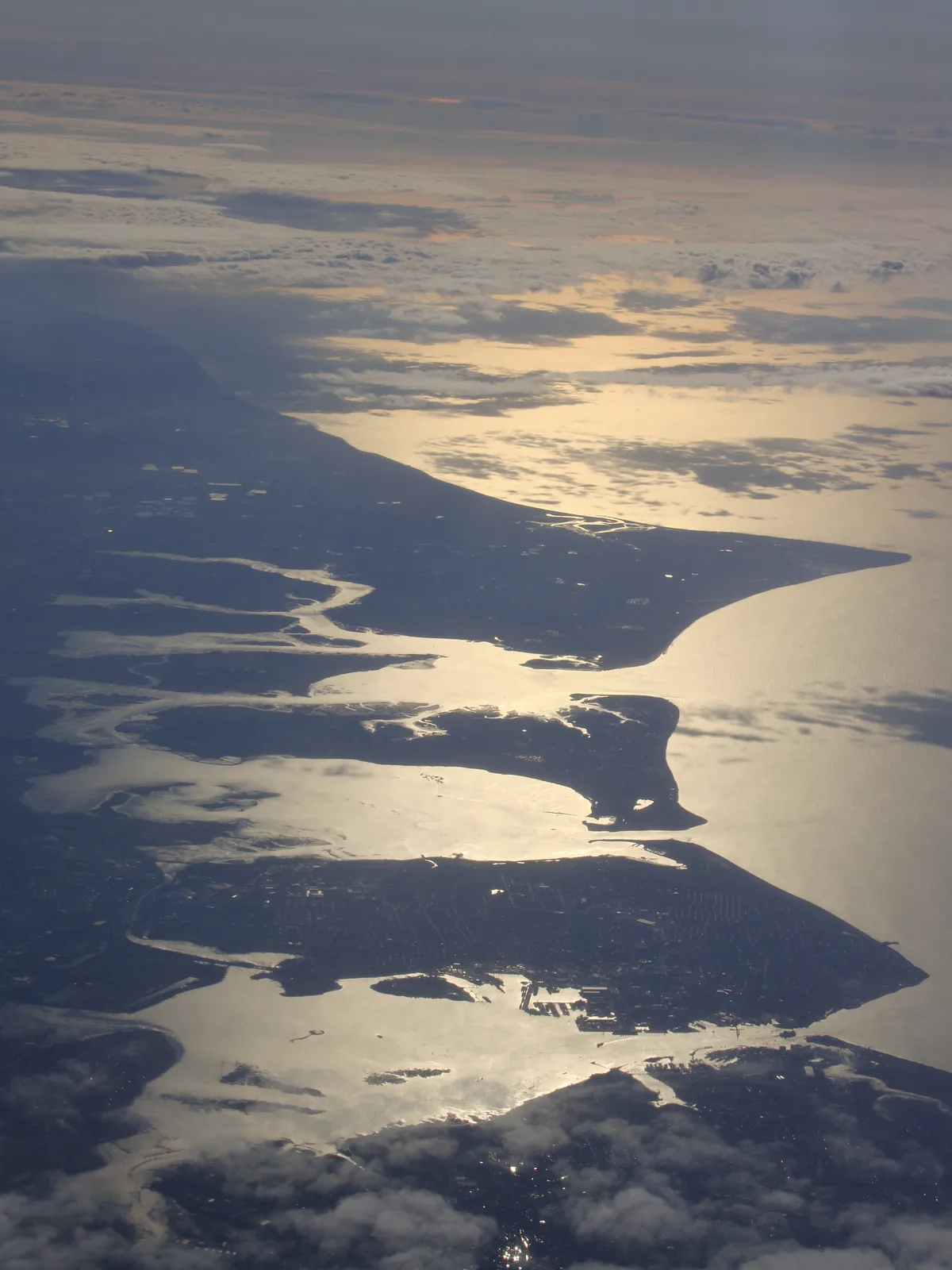
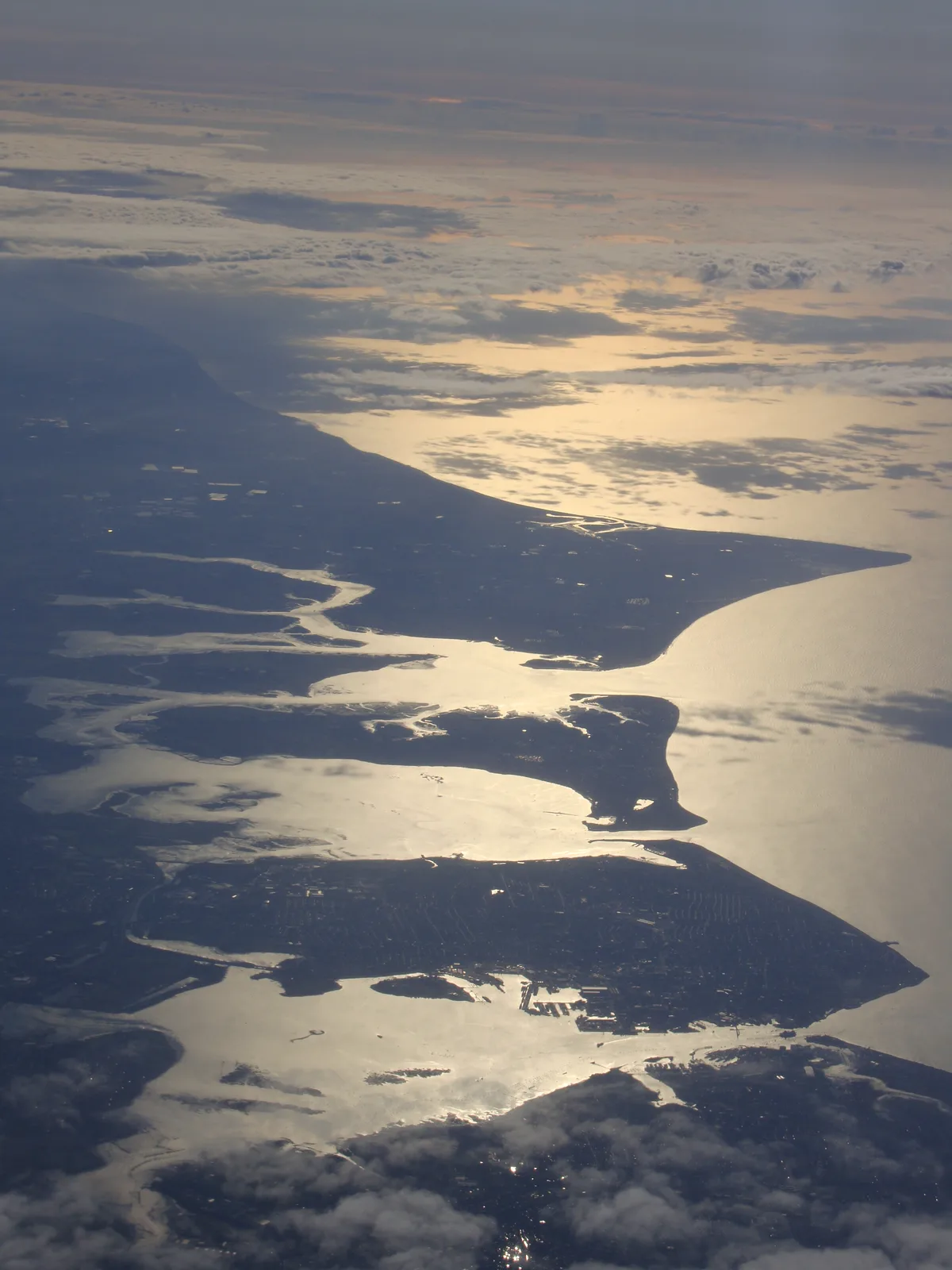
Hayling Island
Hayling Island — island off the south coast of England.
 Flagship📷 7
Islands · South East England
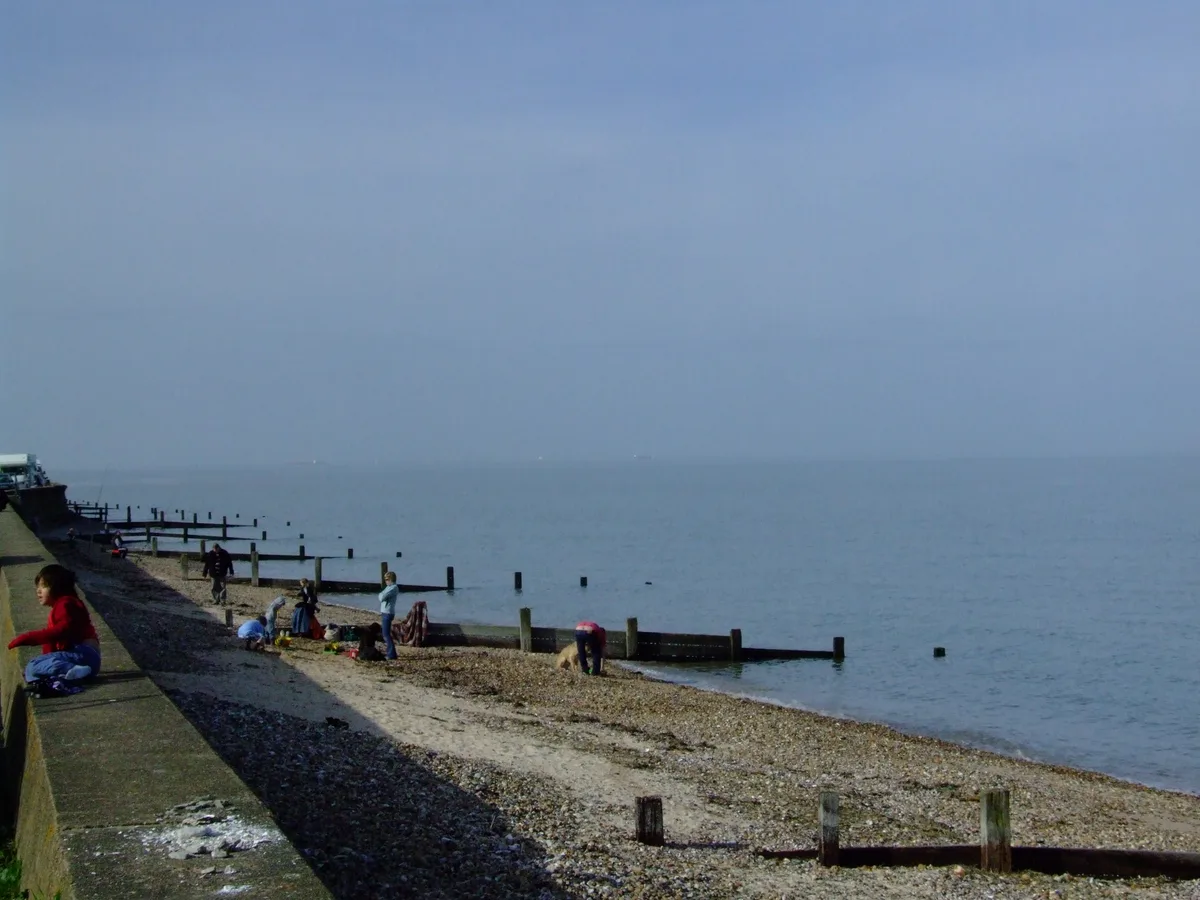
Isle of Sheppey
Isle of Sheppey — island off the northern coast of Kent, England in the Thames Estuary.
 Flagship📷 10
 Flagship📷 10
Islands · South East England
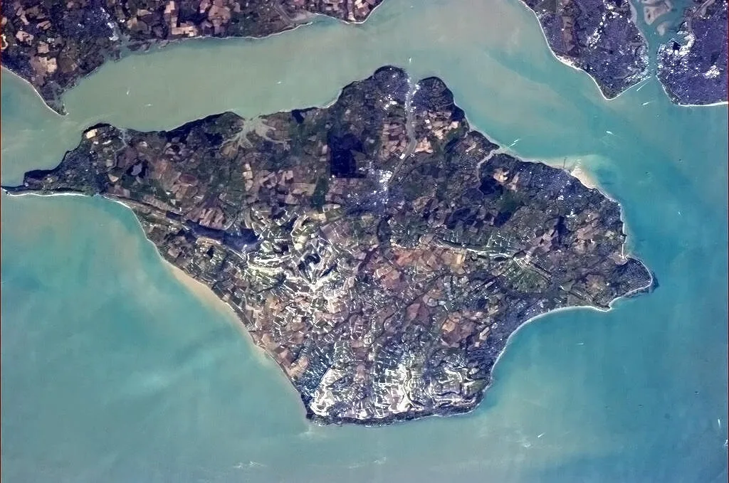
Q9679
Q9679 — island, county and unitary authority area of England, United Kingdom.
Frequently asked questions
- Where is St Mary's Island?
- St Mary's Island is in South-East England, United Kingdom (postcode ME4 3AP), in the parish of Medway, unparished area.
- What is St Mary's Island?
- St Mary's Island — island in Medway, Kent, England, UK.
- How do I get to St Mary's Island?
- The nearest railway station is Fort Apache, about 2.0 km away. The nearest town is Hoo St Werburgh. Drivers can use postcode ME4 3AP.
- Is St Mary's Island a protected site?
- Yes — St Mary's Island is part of the Medway Estuary and Marshes SSSI Site of Special Scientific Interest and the Tower Hill to Cockham Wood SSSI Site of Special Scientific Interest.
- Is St Mary's Island free to visit?
- Yes, St Mary's Island is free to enter.
- How do I get to St Mary's Island?
- The nearest railway station is Fort Apache, about 2.0 km away. Drivers can navigate to postcode ME4 3AP.