
Historic churches · North East England
St Mary's, High Church
In or near Mitford.
St Mary's, High Church in England North East, United Kingdom.

Leanmeanmo — CC BY-SA 2.0 via Wikimedia Commons licence

Plan your visit
- Typical visit
- 30 min–1 h
- Nearest railway station
- Morpeth · 0.6 km
- Free entry
Getting there & planning your visit
To visit St Mary's, High Church in Northumberland, the nearest railway station is Morpeth, located 0.6 km away. Entry is free. The postcode for sat-nav is NE61 2QF.
About
St Mary's, High Church is a place of interest in England North East, United Kingdom — drawn from open-data sources for visitor reference. See the linked Wikipedia article for the full description.
Photo gallery
Protected designations
- Site of Special Scientific Interest: Northumberland Shore SSSI
Designations sourced from Natural England open data under OGL v3.
From the Wikipedia article
St Mary's, also known as St Mary the Virgin, is an ancient Church of England parish church located in Morpeth, Northumberland. It is situated to the south of the River Wansbeck in Morpeth, in an area of Morpeth known as High Church. The oldest surviving parts of the structure belong to the Transitional Early English style of the mid- to late 12th century, but most of the church dates from the 14th century. The church, which was the main Anglican place of worship in the area until the 1840s, has been restored several times after being attacked by the Scandinavians, Scots and Cromwellians in the 10th and later centuries. It is Grade I listed on the National Heritage List for England. The grave of Emily Davison, a suffragette who died in 1913 after being struck by King George V's horse during the Epsom Derby, lies in St Mary's graveyard. Her gravestone bears the slogan of the Women's Social and Political Union: "Deeds not words".
Excerpt from Wikipedia under CC BY-SA 4.0. See the source article linked in Sources below.
- Coordinates
- 55.1597, -1.6922
- District
- Northumberland
- Parish
- Morpeth
- Postcode
- NE61 2QF
- Parliamentary constituency
- North Northumberland
- Established
- 1350
- Nearest railway station
- Morpeth — 0.6 km
Sources
- wikidata: Q17527477 (CC0)
- wikipedia: St Mary's, High Church (CC BY-SA 4.0)
Other places nearby

Rail accidents at Morpeth
Natural landmarks · 0.4 km
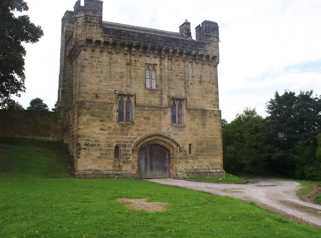
Morpeth Castle
Castles · 0.5 km

Mafeking Park
Parks · 0.6 km

Haw Hill
Castles · 0.6 km
Motte and bailey castle on Haw Hill
Literary houses · 0.6 km
_63.jpg?width=1200)
Ha' Hill
Viewpoints · 0.6 km

Morpeth railway station
Memorials & monuments · 0.7 km

Emily Wilding Davison statue
Public art & sculpture · 0.7 km

Castle Morpeth
Castles · 0.7 km

The Court House
Historic houses · 0.7 km
Viking Warrior
Public art & sculpture · 0.8 km
Northumberland County Council
Historic houses · 0.8 km
Nearby
📷 4Natural landmarks · North East England
Rail accidents at Morpeth
Rail accidents at Morpeth in England North East, United Kingdom.
📷 3Castles · North East England
Morpeth Castle
Morpeth Castle — Grade I listed castle in Morpeth, United Kingdom.
📷 4📷 5📷 5Literary houses · North East England
Motte and bailey castle on Haw Hill
Motte and bailey castle on Haw Hill — a literary house museum in scotland lowlands.
📷 3Viewpoints · North East England
Ha' Hill
Ha' Hill is a viewpoint in the United Kingdom.
Where to eat & stay near St Mary's, High Church
Places to stay
 📷 5
📷 5Campsites · North East England
Tranwell Farm Camp Site
Tranwell Farm Camp Site — a campsite in scotland lowlands.
 📷 5
📷 5Campsites · North East England
Selby Woods Scout Campsite
Selby Woods Scout Campsite — a campsite in scotland lowlands.
 📷 5
📷 5Caravan parks · North East England
Ellington Caravan Park
Ellington Caravan Park — a caravan park in scotland lowlands.
 📷 5
📷 5 📷 5
📷 5 📷 5
📷 5Caravan parks · North East England
Felmoor Park
Felmoor Park — a caravan park in scotland lowlands.
Places to eat & drink
 📷 5
📷 5 📷 5
📷 5Historic pubs · North East England
The Seven Stars Public House
The Seven Stars Public House in Scotland Lowlands, United Kingdom.
 📷 5
📷 5Historic pubs · North East England
Border Minstrel
Border Minstrel in Scotland Lowlands, United Kingdom.
 📷 5
📷 5Historic pubs · North East England
The Anglers Arms
The Anglers Arms in Scotland Lowlands, United Kingdom.
 📷 5
📷 5Historic pubs · North East England
Northumberland Arms
Northumberland Arms in Scotland Lowlands, United Kingdom.
 📷 3
📷 3Historic pubs · North East England
Red House Farm
Red House Farm in England North East, United Kingdom.
More places in this region
 📷 3
📷 3Historic churches · North East England
Church of St Andrew
Church of St Andrew — Grade I listed church in Winston, County Durham, England, UK.
 📷 3
📷 3Historic churches · North East England
Church of St Andrew
Church of St Andrew — Grade I listed church, County Durham, England, UK.
 📷 3
📷 3Historic churches · North East England
Church of St Mary
Church of St Mary — Grade I listed church in Gainford, County Durham, England, UK.
 📷 3
📷 3Historic churches · North East England
Church of St Mary
Church of St Mary — church in Barnard Castle, County Durham, England, UK.
Frequently asked questions
- Where is St Mary's, High Church?
- St Mary's, High Church is in North-East England, United Kingdom (postcode NE61 2QF), in the parish of Morpeth.
- What is St Mary's, High Church?
- St Mary's, High Church in England North East, United Kingdom.
- How do I get to St Mary's, High Church?
- The nearest railway station is Morpeth, about 0.6 km away. Drivers can use postcode NE61 2QF.
- When was St Mary's, High Church built?
- Built or established in 1350.
- Is St Mary's, High Church a protected site?
- Yes — St Mary's, High Church is part of the Northumberland Shore SSSI Site of Special Scientific Interest.
- Is St Mary's, High Church free to visit?
- Yes, St Mary's, High Church is free to enter.
- How do I get to St Mary's, High Church?
- The nearest railway station is Morpeth, about 0.6 km away. Drivers can navigate to postcode NE61 2QF.