
Historic churches · South West England
St Mary's Church, Callington
In or near St Ive.
St Mary's Church, Callington — Grade I listed building-listed church in england-south-west, United Kingdom.

Mutney — CC BY 4.0 via Wikimedia Commons licence

Plan your visit
- Typical visit
- 30 min–1 h
- Nearest railway station
- Gunnislake · 7.0 km
- Free entry
Getting there & planning your visit
St Mary's Church in Callington can be found at postcode PL17 7RE. The nearest railway station is Gunnislake, which is 7 km away. Entry to the church is free.
About
St Mary's Church, Callington is a Grade I listed building-listed church in england-south-west, United Kingdom, registered on the National Heritage List for England (NHLE entry 1140073). Listed status protects buildings and structures of special architectural or historic interest. See the linked Wikipedia article for further details.
Photo gallery
See it from the streetimagery from 2024
Imagery © Mapillary contributors, CC BY-SA 4.0
Heritage listing
St Mary's Church, Callington is a Grade I listed parish church in Callington, Cornwall, England. The present building was consecrated in 1438 on the site of an earlier chapel and was enlarged in the 15th century, with restoration in the 19th century, including work by J.P. St Aubyn and J. D. Sedding. The building is notable for its late medieval Perpendicular fabric, a Norman font, and the alabaster tomb of Sir Robert Willoughby (d.
From the Historic England List Entry under OGL v3.
Protected designations
- Area of Outstanding Natural Beauty: Tamar Valley
- Area of Outstanding Natural Beauty: Cornwall
Designations sourced from Natural England open data under OGL v3.
From the Wikipedia article
St Mary's Church, Callington is a Grade I listed parish church in Callington, Cornwall, England. The present building was consecrated in 1438 on the site of an earlier chapel and was enlarged in the 15th century, with restoration in the 19th century, including work by J.P. St Aubyn and J. D. Sedding. The building is notable for its late medieval Perpendicular fabric, a Norman font, and the alabaster tomb of Sir Robert Willoughby (d. 1502).
Excerpt from Wikipedia under CC BY-SA 4.0. See the source article linked in Sources below.
Background
History
St Mary's Church was consecrated in 1438, although the nave may be slightly earlier; it was originally a chapel of ease to St Sampson's Church in South Hill. Evidence of an earlier chapel on the site is recorded in 1384. In the 15th century the building was enlarged with the addition of the tower, south aisle, south porch, north aisle, and clerestory, and the nave was heightened. The church fell into disrepair in the 19th century and was restored by J.P. St Aubyn in 1858, with a north aisle added by J. D. Sedding in 1882. The tower and bells were destroyed by fire in 1895. The church was designated a Grade I listed building in 1968.
Architecture
The church is built of ashlar granite and rubble with slate roofs and set-back buttresses. The nave and chancel share a continuous roof, while the south aisle has a lower separate roof and the north aisle continues in line with the chancel, later extended by a 19th-century vestry. Much 15th-century stonework was reused in the later north aisle. The tower has freestone dressings, corner turrets with pinnacles, and a battlemented parapet. The windows are predominantly Perpendicular in style, many restored in the 19th century. The chancel east window is largely Victorian work incorporating earlier masonry, and small two-light clerestory windows light the nave from above.
Sourced from Wikipedia under CC BY-SA 4.0.
- Coordinates
- 50.5035, -4.3157
- District
- Cornwall
- Parish
- Callington
- Postcode
- PL17 7RE
- Parliamentary constituency
- South East Cornwall
- Established
- 1438
- Nearest railway station
- Gunnislake — 7 km
Sources
- wikidata: Q17529039 (CC0)
- wikipedia: St Mary's Church, Callington (CC BY-SA 4.0)
Other places nearby

Callington War Memorial
Memorials & monuments · 0.0 km

Callington
Museums · 0.1 km

Callington Heritage Centre
Museums · 0.5 km

Compton Park
Campsites · 1.2 km

Castlewich Henge
Archaeological sites · 1.6 km

South Kithill Mine
Historic houses · 2.1 km

Kithill Castle
Castles · 2.1 km
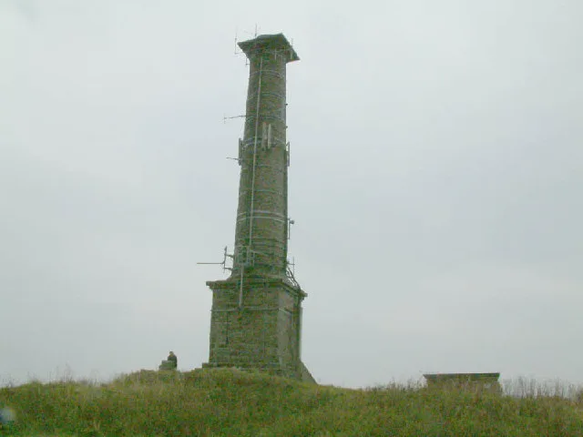
Kit Hill
Mountains & hills · 2.3 km

Mineshaft
Historic houses · 2.4 km

Westcott Cross
Historic houses · 2.6 km

Wheelpit
Historic houses · 2.7 km
East Holmbush Mine
Historic houses · 2.7 km
Nearby
📷 3Memorials & monuments · South West England
Callington War Memorial
Callington War Memorial — Grade II listed building-listed memorial in england-south-west, United Kingdom.
📷 5📷 3Museums · South West England
Callington Heritage Centre
Callington Heritage Centre — a museum in england-south-west, United Kingdom.
📷 5Campsites · South West England
Compton Park
Compton Park — a campsite in england south west.
📷 3Archaeological sites · South West England
Castlewich Henge
Castlewich Henge — a archaeological in england-south-west, United Kingdom.
📷 3Historic houses · South West England
South Kithill Mine
South Kithill Mine — a historic house in england-south-west, United Kingdom.
Where to eat & stay near St Mary's Church, Callington
Places to stay
📷 5Campsites · South West England
Compton Park
Compton Park — a campsite in england south west.
 📷 5
📷 5
Campsites · South West England
Copper Pot Campsite
Copper Pot Campsite — a campsite in england south west.
 📷 2
📷 2Campsites · South West England
Bush Farm Wild Campsite
Bush Farm Wild Campsite — a campsite in england south west.
 📷 5
📷 5
Places to eat & drink
 📷 3
📷 3Historic pubs · South West England
The Royal Inn
The Royal Inn — Historic pub — listed building or notable heritage status.
 📷 7
📷 7 📷 7
📷 7Restaurants · South West England
Himalayan Spice
Himalayan Spice — a restaurant in england south west.
 📷 7
📷 7Historic pubs · South West England
The Barley Sheaf Public House
The Barley Sheaf Public House in England South West, United Kingdom.
 📷 7
📷 7Historic pubs · South West England
The Albion Public House
The Albion Public House in England South West, United Kingdom.
 📷 7
📷 7Historic pubs · South West England
Tavernan Carow Public House
Tavernan Carow Public House in England South West, United Kingdom.
More places in this region
 📷 5
📷 5Historic churches · South West England
Abbey Church of St Gregory the Great, Downside Abbey
Abbey Church of St Gregory the Great, Downside Abbey — church in Stratton-on-the-Fosse, Somerset, England, UK.
 📷 5
📷 5Historic churches · South West England
All Saints Church
All Saints Church — Grade I listed church in Woolley, Somerset, England, UK.
 📷 5
📷 5Historic churches · South West England
All Saints Church, Hampreston
All Saints Church, Hampreston — church in Hampreston, Dorset, England, UK.
 📷 5
📷 5Historic churches · South West England
All Saints Church, Nether Cerne
All Saints Church, Nether Cerne — church in Nether Cerne, Dorset, England, UK.
Frequently asked questions
- Where is St Mary's Church, Callington?
- St Mary's Church, Callington is in South-West England, United Kingdom (postcode PL17 7RE), in the parish of Callington.
- What is St Mary's Church, Callington?
- St Mary's Church, Callington — Grade I listed building-listed church in england-south-west, United Kingdom.
- How do I get to St Mary's Church, Callington?
- The nearest railway station is Gunnislake, about 7.0 km away. Drivers can use postcode PL17 7RE.
- When was St Mary's Church, Callington built?
- Built or established in 1438.
- Is St Mary's Church, Callington a listed building?
- St Mary's Church, Callington is officially recognised as Grade I listed building listed.
- Is St Mary's Church, Callington a protected site?
- Yes — St Mary's Church, Callington is part of the Tamar Valley National Landscape (AONB) and the Cornwall National Landscape (AONB).
- Is St Mary's Church, Callington free to visit?
- Yes, St Mary's Church, Callington is free to enter.
- How do I get to St Mary's Church, Callington?
- The nearest railway station is Gunnislake, about 7.0 km away. Drivers can navigate to postcode PL17 7RE.