
Cathedrals · South East England
St Mary's Abbey: a Benedictine abbey north and east of Water Lane
In or near Mereworth.
St Mary's Abbey: a Benedictine abbey north and east of Water Lane is a cathedral in the United Kingdom.

David Anstiss — CC BY-SA 2.0 via Wikimedia Commons licence

Plan your visit
- Typical visit
- 1 h–2 h
- Best time of year
- Year-round
- Nearest railway station
- West Malling · 0.5 km
- Family-friendly
- Limited wheelchair access
Getting there & planning your visit
St Mary's Abbey is located at postcode ME19 6JX, with the nearest railway station being West Malling, just 0.5 km away. Entry details are not specified, and wheelchair accessibility is limited.
About
St Mary's Abbey: a Benedictine abbey north and east of Water Lane is a cathedral in england south east, United Kingdom — the principal church of its diocese. Cathedrals are seats of bishops in the Church of England, the Roman Catholic Church, and other Christian denominations across Britain.
Photo gallery
Heritage listing
Details The monument includes the known extent of the Benedictine Abbey of St Mary's situated in the town of West Malling. Much of the medieval abbey, which survives as upstanding masonry, has been incorporated into the post- Dissolution buildings which have been reused by, and purposely built for, the modern nunnery which began at the end of the 19th century. The upstanding medieval remains include the 14th-century gatehouse and chapel positioned on the north side of the precinct, the Norman tower, the 13th- century arcade of the south cloisters, the south wall and south transept of the church and various other upstanding remains of the east range comprising parts of the chapter house and dorter undercroft. These are situated in the northern part of the precinct which, when founded, covered an area of 4.8ha. In the southern part of the precinct is a medieval tithe barn converted in 1936-7 for use as a chapel. To the west of the main claustral complex lies the site of the 15th-century guest house. This is believed to have had an associated outer court of which no above-ground remains survive. Further buildings to the south include what are believed to be an infirmary or abbess's apartments, which survive as buried foundations. A stream runs from south to north through the precinct and feeds a fishpond to the south of the guest house. The nunnery was founded c.1090 by Gundulf, Bishop of Rochester. Two earlier dates for the foundation of an abbey at Malling have been put forward, 688 and 944, the latter by King Edmund, but neither has been proved. The land is known to have been in the possession of the Bishop of Rochester in 945 but was then lost to the Church and recovered by Lanfranc in 1076. The church was dedicated in 1106 but in 1190 the abbey and nearly all the town
From the Historic England List Entry under OGL v3.
Protected designations
- Area of Outstanding Natural Beauty: Kent Downs
Designations sourced from Natural England open data under OGL v3.
Place summary
St Mary's Abbey is a Benedictine abbey located north and east of Water Lane in South-East England. It is noted for its historical significance and architectural features typical of abbey structures.
AI-generated from the structured facts on this page (operator, designation, listing, era). Not a substitute for visiting.
- Coordinates
- 51.2929, 0.4109
- County
- Kent
- District
- Tonbridge and Malling
- Parish
- West Malling
- Postcode
- ME19 6JX
- Parliamentary constituency
- Maidstone and Malling
- Nearest railway station
- West Malling — 0.5 km
Sources
- wikidata: Q17646169 (CC0)
Other places nearby

Malling Abbey
Abbeys & priories · 0.1 km

St Mary's Abbey Tower To Original Abbey
Memorials & monuments · 0.1 km

Went House
Historic houses · 0.2 km

The Swan
Restaurants · 0.2 km

The Ancient House
Historic houses · 0.2 km

Five Pointed Star Public House
Historic pubs · 0.2 km

The Joiners Arms Public House
Historic pubs · 0.2 km

West Malling War Memorial
Memorials & monuments · 0.3 km
.jpg?width=1200)
Brome House
Historic houses · 0.3 km

Imperial Dynasty
Restaurants · 0.3 km

West Malling
Historic churches · 0.3 km

Pad Thai Restaurant
Restaurants · 0.3 km
Nearby
📷 5Abbeys & priories · South East England
Malling Abbey
Malling Abbey — monastery in West Malling, Kent, United Kingdom.
📷 5Memorials & monuments · South East England
St Mary's Abbey Tower To Original Abbey
St Mary's Abbey Tower To Original Abbey — Grade I listed building-listed memorial in england-london, United Kingdom.
📷 5Historic houses · South East England
Went House
Went House — house in West Malling, Tonbridge and Malling, England, UK.
📷 7📷 5Historic houses · South East England
The Ancient House
The Ancient House — Grade I listed house in West Malling, Tonbridge and Malling, Kent, England, UK.
📷 5Historic pubs · South East England
Five Pointed Star Public House
Five Pointed Star Public House in England South East, United Kingdom.
Where to eat & stay near St Mary's Abbey: a Benedictine abbey north and east of Water Lane
Places to stay
 📷 5
📷 5Campsites · South East England
Gate House Wood Touring Park
Gate House Wood Touring Park — a campsite in england london.
 📷 5
📷 5Campsites · South East England
Badgells Wood Camping
Badgells Wood Camping — a campsite in england london.
 📷 5
📷 5 📷 5
📷 5 📷 5
📷 5Campsites · South East England
Kits Coty Glamping
Kits Coty Glamping — a campsite in england london.
 📷 7
📷 7Places to eat & drink
📷 7📷 5Historic pubs · South East England
Five Pointed Star Public House
Five Pointed Star Public House in England South East, United Kingdom.
📷 5Historic pubs · South East England
The Joiners Arms Public House
The Joiners Arms Public House in England South East, United Kingdom.
📷 5📷 5Restaurants · South East England
Pad Thai Restaurant
Pad Thai Restaurant — a restaurant in england london.
 📷 7
📷 7Historic pubs · South East England
The King And Queen Public House
The King And Queen Public House in England South East, United Kingdom.
More cathedrals in this region
 📷 5
📷 5Cathedrals · South East England
Old Minster
Old Minster — former Anglo-Saxon cathedral for the diocese of Wessex.
 📷 5
📷 5Cathedrals · South East England
Old Sarum Cathedral
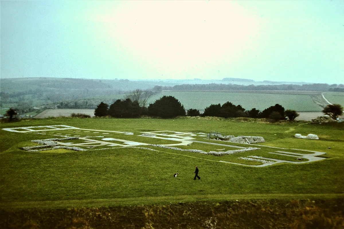
Old Sarum Cathedral — Grade I listed former cathedral in Salisbury, Wiltshire, England, UK.
 📷 5
📷 5 📷 5
📷 5Cathedrals · South East England
Robertsbridge Abbey
Robertsbridge Abbey is a cathedral in the United Kingdom.
Frequently asked questions
- Where is St Mary's Abbey: a Benedictine abbey north and east of Water Lane?
- St Mary's Abbey: a Benedictine abbey north and east of Water Lane is in Kent, South-East England, United Kingdom (postcode ME19 6JX), in the parish of West Malling.
- What is St Mary's Abbey: a Benedictine abbey north and east of Water Lane?
- St Mary's Abbey: a Benedictine abbey north and east of Water Lane is a cathedral in the United Kingdom.
- How do I get to St Mary's Abbey: a Benedictine abbey north and east of Water Lane?
- The nearest railway station is West Malling, about 0.5 km away. Drivers can use postcode ME19 6JX.
- Is St Mary's Abbey: a Benedictine abbey north and east of Water Lane a listed building?
- St Mary's Abbey: a Benedictine abbey north and east of Water Lane is officially recognised as scheduled monument listed.
- Is St Mary's Abbey: a Benedictine abbey north and east of Water Lane a protected site?
- Yes — St Mary's Abbey: a Benedictine abbey north and east of Water Lane is part of the Kent Downs National Landscape (AONB).
- How do I get to St Mary's Abbey: a Benedictine abbey north and east of Water Lane?
- The nearest railway station is West Malling, about 0.5 km away. Drivers can navigate to postcode ME19 6JX.