
Castles · Yorkshire & the Humber
St Martin's Ampleforth
In or near Oswaldkirk.
St Martin's Ampleforth — a castle in england-yorkshire, United Kingdom.

Phil Catterall — CC BY-SA 2.0 via Wikimedia Commons licence

Plan your visit
- Typical visit
- 1.5 h–3 h
- Family-friendly
- Limited wheelchair access
About
St Martin's Ampleforth is a castle in england-yorkshire, United Kingdom, listed in the Wikipedia register of British heritage and tourism sites. See the linked Wikipedia article for full details.
Photo gallery
Protected designations
- Area of Outstanding Natural Beauty: Howardian Hills
Designations sourced from Natural England open data under OGL v3.
Place summary
St Martin's Ampleforth is a castle located in Yorkshire. It is known for its historical significance and architectural features typical of its era. The site reflects the region's rich heritage.
AI-generated from the structured facts on this page (operator, designation, listing, era). Not a substitute for visiting.
Background
Architecture
Gilling Castle dates back to the Medieval era and was originally home to the Etton family. It was Thomas de Etton who built, in the second half of the 14th century, the fortified manor house, a large tower almost square, whose basement still forms the core of the present building. It was later owned by Thomas Fairfax and changed hands a number of times before the Benedictine monks at Ampleforth Abbey bought the property in 1929. The buildings were refurbished over the years to accommodate growing pupil numbers. A playground for the nursery and pre-prep department was added in 2004. In January 2018 a proposal was made to close the site, with the remaining pupils moved to a new junior house…
Sourced from Wikipedia under CC BY-SA 4.0.
- Coordinates
- 54.1833, -1.0649
- District
- North Yorkshire
- Parish
- Gilling East
- Postcode
- YO62 4HP
- Parliamentary constituency
- Thirsk and Malton
- Established
- 1930
Sources
- wikipedia: St Martin's Ampleforth (CC BY-SA 4.0)
Other places nearby
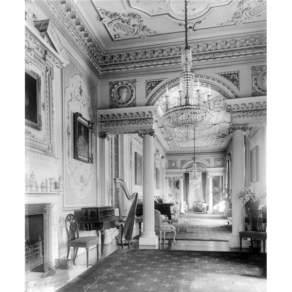
Gilling Castle
Castles · 0.0 km

Gilling East
Villages · 0.4 km

Gilling East War Memorial Gate
Memorials & monuments · 0.4 km
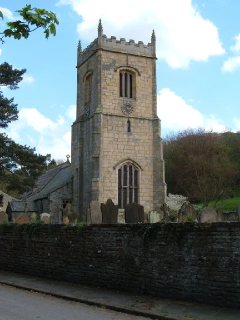
Holy Cross Church, Gilling
Historic churches · 0.5 km

Gilling Bridge
Historic bridges · 0.8 km

Antony Gormley sculpture of a figure
Public art & sculpture · 1.3 km

Grimston Manor
Manor houses · 1.8 km

Gilling Abbey
Abbeys & priories · 1.9 km
Gilling Abbey
Cathedrals · 1.9 km

Oswaldkirk
Towns & cities · 2.1 km

Oswaldkirk Hall
Historic houses · 2.3 km
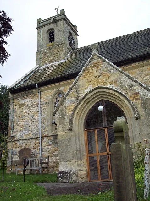
Church of Saint Oswald, King and Martyr, Oswaldkirk
Historic churches · 2.3 km
Nearby
📷 5Castles · Yorkshire & the Humber
Gilling Castle
Gilling Castle — Grade I listed country house in North Yorkshire, England, UK.
📷 5📷 3Memorials & monuments · Yorkshire & the Humber
Gilling East War Memorial Gate
Gilling East War Memorial Gate — Grade II listed building-listed memorial in england-yorkshire, United Kingdom.
📷 4Historic churches · Yorkshire & the Humber
Holy Cross Church, Gilling
Holy Cross Church, Gilling — church in Ryedale, UK.
📷 3Historic bridges · Yorkshire & the Humber
Gilling Bridge
Gilling Bridge — Grade II listed building-listed bridge in england-yorkshire, United Kingdom.
📷 3Public art & sculpture · Yorkshire & the Humber
Antony Gormley sculpture of a figure
Antony Gormley sculpture of a figure — a public art in england-yorkshire, United Kingdom.
Where to eat & stay near St Martin's Ampleforth
Places to stay
 📷 5
📷 5Campsites · Yorkshire & the Humber
Golden Square Caravan Park
Golden Square Caravan Park — a campsite in england yorkshire.
 📷 5
📷 5Hotels · Yorkshire & the Humber
The Worsley Arms Hotel
The Worsley Arms Hotel — a hotel in england yorkshire.
 📷 5
📷 5 📷 3
📷 3Caravan parks · Yorkshire & the Humber
Brenk House Farm Caravan Park
Brenk House Farm Caravan Park — a caravan park in england yorkshire.
 📷 6
📷 6 📷 5
📷 5B&Bs · Yorkshire & the Humber
Newburgh House B&B
Newburgh House B&B — a bed-and-breakfast in england yorkshire.
Places to eat & drink
 📷 5
📷 5Restaurants · Yorkshire & the Humber
The Stapylton Arms
The Stapylton Arms — a restaurant in england yorkshire.
 📷 5
📷 5Restaurants · Yorkshire & the Humber
The Star Inn
The Star Inn — a restaurant in england yorkshire.
 📷 5
📷 5Historic pubs · Yorkshire & the Humber
The Abbey Inn
The Abbey Inn in England Yorkshire, United Kingdom.
 📷 7
📷 7Historic pubs · Yorkshire & the Humber
The Black Swan And Railings To Front
The Black Swan And Railings To Front in England Yorkshire, United Kingdom.
 📷 5
📷 5Historic pubs · Yorkshire & the Humber
Fauconberg Arms Inn
Fauconberg Arms Inn in England Yorkshire, United Kingdom.
 📷 5
📷 5Historic pubs · Yorkshire & the Humber
The Commercial Public House
The Commercial Public House in England Yorkshire, United Kingdom.
More castles in this region
 📷 5
📷 5Castles · Yorkshire & the Humber
Ashton-under-Lyne
Ashton-under-Lyne, also known simply as Ashton, is a market town in Tameside, Greater Manchester, United Kingdom. The population was 48,604 at the 2021 census. Historically a part of Lancashire, it is
 📷 5
📷 5Castles · Yorkshire & the Humber
Audenshaw
Audenshaw is a town in Tameside, Greater Manchester, England, 4.9 miles (7.9 km) east of Manchester. Historically part of Lancashire, in 2011 it had a population of 11,419. The name derives from Aldwi
 📷 5
📷 5Castles · Yorkshire & the Humber
Bramhall
Bramhall is a large village in the Metropolitan Borough of Stockport, Greater Manchester, England. It was formerly a civil parish in Cheshire. At the 2021 census, the built-up area, as defined by the
 📷 5
📷 5Castles · Yorkshire & the Humber
Bredbury
Bredbury is a town in the Metropolitan Borough of Stockport, Greater Manchester, England; it lies 8 miles (12.9 km) south-east of Manchester, 2 miles (3.2 km) east of Stockport and 3 miles (4.8 km) so
Frequently asked questions
- Where is St Martin's Ampleforth?
- St Martin's Ampleforth is in Yorkshire, United Kingdom (postcode YO62 4HP), in the parish of Gilling East.
- What is St Martin's Ampleforth?
- St Martin's Ampleforth — a castle in england-yorkshire, United Kingdom.
- How do I get to St Martin's Ampleforth?
- Drivers can use postcode YO62 4HP.
- When was St Martin's Ampleforth built?
- Built or established in 1930.
- Is St Martin's Ampleforth a protected site?
- Yes — St Martin's Ampleforth is part of the Howardian Hills National Landscape (AONB).
- Does St Martin's Ampleforth charge admission?
- St Martin's Ampleforth typically charges admission. Check the official site for current ticket prices and opening hours.
- How do I get to St Martin's Ampleforth?
- Drivers can navigate to postcode YO62 4HP. It sits within the Thirsk and Malton parliamentary constituency.