
Historic churches · South East England
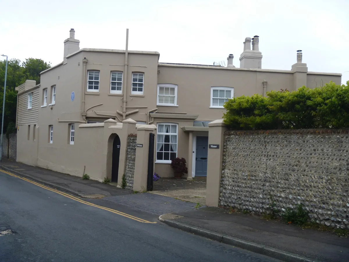
St Cyprian's School
In or near Westham.
St Cyprian's School — a school heritage in england-south-east, United Kingdom.

Robin Webster — CC BY-SA 2.0 via Wikimedia Commons licence

Plan your visit
- Typical visit
- 30 min–1 h
- Nearest railway station
- Eastbourne · 1.2 km
- Free entry
About
St Cyprian's School is a school heritage located in england-south-east, United Kingdom. Catalogued from Wikidata's UK heritage register; see the Wikipedia article for further historical and visitor details.
Photo gallery
Protected designations
- Site of Special Scientific Interest: Seaford to Beachy Head SSSI
- National Nature Reserve: SEVEN SISTERS
Designations sourced from Natural England open data under OGL v3.
Place summary
St Cyprian's School is located in South-East England. It is an independent educational institution known for its commitment to academic excellence and holistic development. Further details regarding its history or architectural significance are not provided.
AI-generated from the structured facts on this page (operator, designation, listing, era). Not a substitute for visiting.
Background
History
St Cyprian's was founded in 1899 by Lewis Vaughan Wilkes and his wife Cicely Comyn, a newly married couple in their twenties. It originally operated in a large house in Carlisle Road, but by 1906 had grown sufficiently to move into new purpose-built facilities with extensive playing fields behind Summerdown Road. The school ran with the prevailing ethos of Muscular Christianity which had typified private education since the time of Thomas Arnold of Rugby, and placed much emphasis on developing self-reliance and integrity ("Character"). In these and many other respects St Cyprian's was little different from the other leading prep schools of the time. The school submitted itself annually to…
Sourced from Wikipedia under CC BY-SA 4.0.
- Coordinates
- 50.7685, 0.2641
- County
- East Sussex
- District
- Eastbourne
- Parish
- Eastbourne, unparished area
- Postcode
- BN20 8DG
- Parliamentary constituency
- Eastbourne
- Established
- 1899
- Nearest railway station
- Eastbourne — 1.2 km
Sources
- wikidata: Q7592927 (CC0)
- wikipedia: St Cyprian's School (CC BY-SA 4.0)
Other places nearby

WMG Academy for Young Engineers, Solihull
Natural landmarks · 0.2 km

Old Town
Villages · 0.5 km

Lamb Theatre
Open-air theatres · 0.5 km
The Lamb Inn
Historic pubs · 0.5 km

The Rainbow
Historic pubs · 0.6 km

Ascham St Vincent War Memorial Arch
Memorials & monuments · 0.9 km

South Downs Club House
Hostels · 1.0 km

Alternative, Old South Downs Way Bridleway Route
Mountain bike trails · 1.0 km

Our Lady of Ransom Church, Eastbourne
Historic churches · 1.0 km

Ocklynge Cemetery
Cemeteries · 1.0 km

Roedean Moira House
Historic houses · 1.0 km
Ocklynge Manor
Stately homes · 1.1 km
Nearby
📷 5Natural landmarks · South East England
WMG Academy for Young Engineers, Solihull
WMG Academy for Young Engineers, Solihull — a school heritage in england-south-east, United Kingdom.
📷 5📷 5Open-air theatres · South East England
Lamb Theatre
Lamb Theatre — a open-air theatre in england south east.
📷 7📷 5📷 5Memorials & monuments · South East England
Ascham St Vincent War Memorial Arch
Ascham St Vincent War Memorial Arch — Grade II listed building-listed memorial in england-south-east, United Kingdom.
Where to eat & stay near St Cyprian's School
Places to stay
📷 5Hostels · South East England
South Downs Club House
South Downs Club House — a hostel in england south east.
 📷 5
📷 5Hotels · South East England
The Pier Hotel
The Pier Hotel — a hotel in england south east.
 📷 5
📷 5Hotels · South East England
Chalk Farm Hotel
Chalk Farm Hotel — a hotel in england south east.
 📷 5
📷 5Campsites · South East England
Bramley Park Camping
Bramley Park Camping — a campsite in england south east.
 📷 5
📷 5Campsites · South East England
Bramley Park Camping - Check In
Bramley Park Camping - Check In — a campsite in england south east.
 📷 5
📷 5Campsites · South East England
Bramley Park Camping
Bramley Park Camping — a campsite in england south east.
Places to eat & drink
📷 7📷 5 📷 5
📷 5Historic pubs · South East England
The Eight Bells Inn
The Eight Bells Inn in England South East, United Kingdom.
 📷 5
📷 5Historic pubs · South East England
The Plough And Harrow Inn
The Plough And Harrow Inn in England South East, United Kingdom.
 📷 5
📷 5Historic pubs · South East England
The George Hotel
The George Hotel in England South East, United Kingdom.
 📷 5
📷 5Historic pubs · South East England
Rose Cottage Inn
Rose Cottage Inn in England South East, United Kingdom.
More places in this region
 📷 5
📷 5Historic churches · South East England
All Saints Church, Frindsbury
All Saints Church, Frindsbury — church in Medway, UK.
 📷 5
📷 5Historic churches · South East England
All Saints Church, Maidstone
All Saints Church, Maidstone — parish church associated with the Archbishop's Palace, Maidstone, Kent, England, UK.
 📷 5
📷 5Historic churches · South East England
All Saints Church, West Farleigh
All Saints Church, West Farleigh — Grade I listed church in West Farleigh, Maidstone, Kent, England, UK.
 📷 5
📷 5Historic churches · South East England
All Souls' Church, Sutton Green
All Souls' Church, Sutton Green — church in Guildford, England.
Frequently asked questions
- Where is St Cyprian's School?
- St Cyprian's School is in East Sussex, South-East England, United Kingdom (postcode BN20 8DG), in the parish of Eastbourne, unparished area.
- What is St Cyprian's School?
- St Cyprian's School — a school heritage in england-south-east, United Kingdom.
- How do I get to St Cyprian's School?
- The nearest railway station is Eastbourne, about 1.2 km away. Drivers can use postcode BN20 8DG.
- When was St Cyprian's School built?
- Built or established in 1899.
- Is St Cyprian's School a protected site?
- Yes — St Cyprian's School is part of the Seaford to Beachy Head SSSI Site of Special Scientific Interest and the SEVEN SISTERS National Nature Reserve.
- Is St Cyprian's School free to visit?
- Yes, St Cyprian's School is free to enter.
- How do I get to St Cyprian's School?
- The nearest railway station is Eastbourne, about 1.2 km away. Drivers can navigate to postcode BN20 8DG.