
Historic houses · South East England
Roedean Moira House
In or near Westham.
Roedean Moira House — a school heritage in england-south-east, United Kingdom.

Ian S — CC BY-SA 2.0 via Wikimedia Commons licence

Plan your visit
- Typical visit
- 1 h–2 h
- Nearest railway station
- Eastbourne · 1.7 km
- Family-friendly
- Limited wheelchair access
About
Roedean Moira House is a school heritage located in england-south-east, United Kingdom. Catalogued from Wikidata's UK heritage register; see the Wikipedia article for further historical and visitor details.
Photo gallery
Protected designations
- Site of Special Scientific Interest: Seaford to Beachy Head SSSI
- National Nature Reserve: SEVEN SISTERS
Designations sourced from Natural England open data under OGL v3.
Place summary
Roedean Moira House is located in South-East England. It is a notable educational establishment, distinguished for its unique approach to education and community involvement. The institution contributes to the diverse landscape of schools in the region.
AI-generated from the structured facts on this page (operator, designation, listing, era). Not a substitute for visiting.
Background
History
The school was established in 1875 by Charles Ingham at Moira House in Surrey. In March 2020, Andrew Pianca, chairman of governors of Roedean Moira House, announced: “It is with great sadness and regret that we have taken the difficult decision to close Roedean Moira House. Our legal advisors tell us it is the only route available to us.” The decision was blamed on falling numbers of pupils and “financial losses that we cannot sustain”. An Educational Needs Assessment explored the reasons behind the closure, finding that the school “suffered material operational losses for the financial year ending 2019” and that economic difficulties had been caused by lower demand for independent school…
Sourced from Wikipedia under CC BY-SA 4.0.
- Coordinates
- 50.7592, 0.2627
- County
- East Sussex
- District
- Eastbourne
- Parish
- Eastbourne, unparished area
- Postcode
- BN20 7TH
- Parliamentary constituency
- Eastbourne
- Established
- 1875
- Nearest railway station
- Eastbourne — 1.7 km
- Official site
- www.moirahouse.co.uk
Sources
- wikidata: Q11021895 (CC0)
- wikipedia: Moira House School (CC BY-SA 4.0)
Other places nearby

Alternative, Old South Downs Way Bridleway Route
Mountain bike trails · 0.4 km

Ascham St Vincent War Memorial Arch
Memorials & monuments · 0.6 km

St Cyprian's School
Historic churches · 1.0 km

Ascham St. Vincent's School
Natural landmarks · 1.1 km

WMG Academy for Young Engineers, Solihull
Natural landmarks · 1.2 km

Our Lady of Ransom Church, Eastbourne
Historic churches · 1.3 km

South Downs Club House
Hostels · 1.4 km

Eastbourne Freemasons
Memorials & monuments · 1.4 km

The Birley Centre
Theatres · 1.4 km

Towner Art Gallery
Galleries · 1.5 km
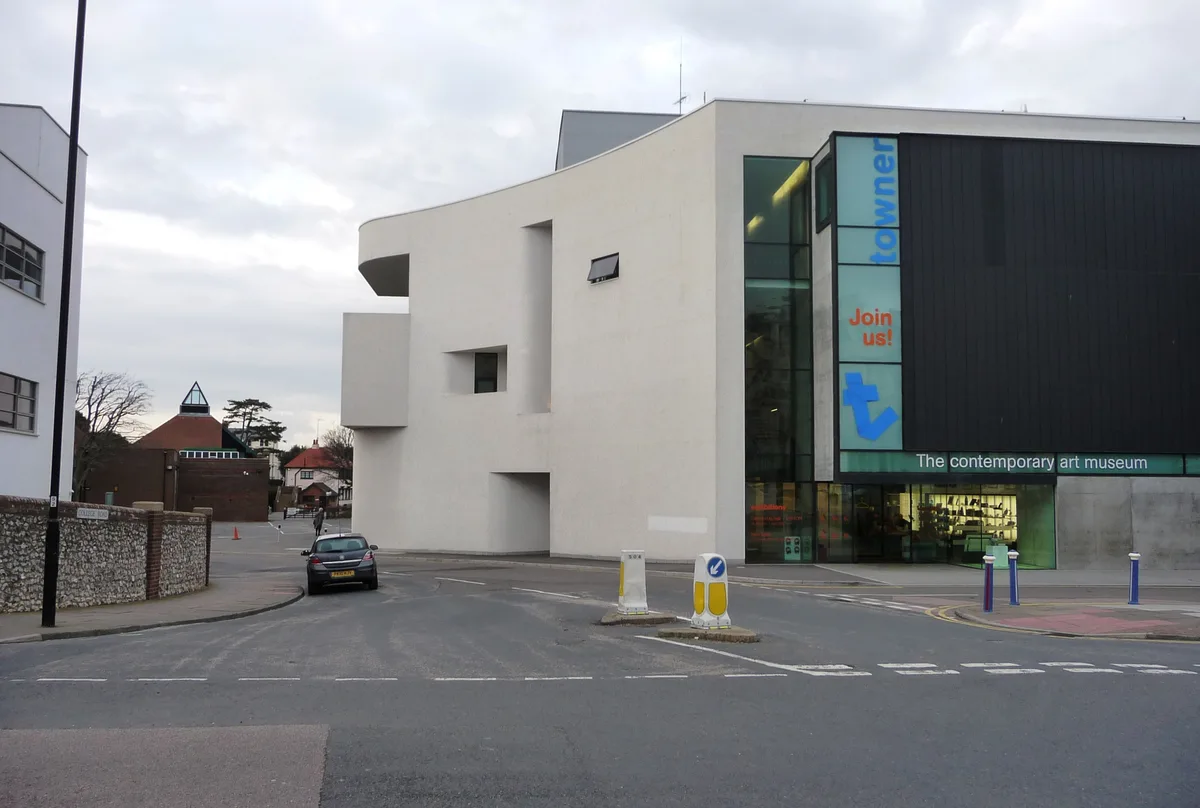
Towner Eastbourne
Galleries · 1.5 km

Old Town
Villages · 1.5 km
Nearby
📷 5Mountain bike trails · South East England
Alternative, Old South Downs Way Bridleway Route
Alternative, Old South Downs Way Bridleway Route — a mtb trail in england south east.
📷 5Memorials & monuments · South East England
Ascham St Vincent War Memorial Arch
Ascham St Vincent War Memorial Arch — Grade II listed building-listed memorial in england-south-east, United Kingdom.
📷 5Historic churches · South East England
St Cyprian's School
St Cyprian's School — a school heritage in england-south-east, United Kingdom.
📷 5Natural landmarks · South East England
Ascham St. Vincent's School
Ascham St. Vincent's School — a school heritage in england-south-east, United Kingdom.
📷 5Natural landmarks · South East England
WMG Academy for Young Engineers, Solihull
WMG Academy for Young Engineers, Solihull — a school heritage in england-south-east, United Kingdom.
📷 5Historic churches · South East England
Our Lady of Ransom Church, Eastbourne
Our Lady of Ransom Church, Eastbourne — a Grade II*-listed church in england-south-east, United Kingdom.
Where to eat & stay near Roedean Moira House
Places to stay
📷 5Hostels · South East England
South Downs Club House
South Downs Club House — a hostel in england south east.
 📷 5
📷 5Hotels · South East England
The Pier Hotel
The Pier Hotel — a hotel in england south east.
 📷 5
📷 5Hotels · South East England
Chalk Farm Hotel
Chalk Farm Hotel — a hotel in england south east.
 📷 5
📷 5Campsites · South East England
Bramley Park Camping
Bramley Park Camping — a campsite in england south east.
 📷 5
📷 5Campsites · South East England
Bramley Park Camping - Check In
Bramley Park Camping - Check In — a campsite in england south east.
 📷 5
📷 5Campsites · South East England
Bramley Park Camping
Bramley Park Camping — a campsite in england south east.
Places to eat & drink
 📷 7
📷 7 📷 5
📷 5 📷 5
📷 5Historic pubs · South East England
The Eight Bells Inn
The Eight Bells Inn in England South East, United Kingdom.
 📷 5
📷 5Historic pubs · South East England
The Plough And Harrow Inn
The Plough And Harrow Inn in England South East, United Kingdom.
 📷 5
📷 5Historic pubs · South East England
The George Hotel
The George Hotel in England South East, United Kingdom.
 📷 5
📷 5Historic pubs · South East England
Rose Cottage Inn
Rose Cottage Inn in England South East, United Kingdom.
More historic houses in this region
 📷 5
📷 5Historic houses · South East England
12 and 14 High Street, Rochester
12 and 14 High Street, Rochester — building in Rochester, Kent, England, UK.
 📷 5
📷 5Historic houses · South East England
Berkeley House
Berkeley House — house in Rochester, Kent, England, UK.
.jpg?width=1200) 📷 5
📷 5Historic houses · South East England
Betchworth House
Betchworth House — house in Betchworth, Mole Valley, England, UK.
 📷 5
📷 5Historic houses · South East England
Bookham Grove
Bookham Grove — building in Mole Valley, Surrey, England, UK.
Frequently asked questions
- Where is Roedean Moira House?
- Roedean Moira House is in East Sussex, South-East England, United Kingdom (postcode BN20 7TH), in the parish of Eastbourne, unparished area.
- What is Roedean Moira House?
- Roedean Moira House — a school heritage in england-south-east, United Kingdom.
- How do I get to Roedean Moira House?
- The nearest railway station is Eastbourne, about 1.7 km away. Drivers can use postcode BN20 7TH.
- When was Roedean Moira House built?
- Built or established in 1875.
- Is Roedean Moira House a protected site?
- Yes — Roedean Moira House is part of the Seaford to Beachy Head SSSI Site of Special Scientific Interest and the SEVEN SISTERS National Nature Reserve.
- How do I get to Roedean Moira House?
- The nearest railway station is Eastbourne, about 1.7 km away. Drivers can navigate to postcode BN20 7TH.