Canals · South West England
St Columb Canal
Also known as: Dowrgleudh Sen Kolom
In or near St Mawgan.
St Columb Canal — canal in Cornwall, England.

Wikimedia Commons contributors — see linked file page for photographer and licence licence
Plan your visit
- Typical visit
- 1 h–2 h
- Nearest railway station
- Newquay · 6.5 km
- Free entry
- Dog-friendly
About
St Columb Canal is a canal in the United Kingdom. Wikidata describes it as: "canal in Cornwall, England". Coordinates: 50.4667°, -5.0333°.
Photo gallery
Protected designations
- Area of Outstanding Natural Beauty: Cornwall
Designations sourced from Natural England open data under OGL v3.
From the Wikipedia article
St Columb Canal sometimes referred to as Edyvean's Canal, was an abortive canal scheme in Cornwall, England, designed for the carriage of sea sand for use as manure. It was authorised in 1773, and part of it may have been briefly used around 1780.
Excerpt from Wikipedia under CC BY-SA 4.0. See the source article linked in Sources below.
Background
History
| repeal_date = | repealing_legislation = | related_legislation = | status = Current | original_text = https://books.google.co.uk/books?id=WrmXQpgmfMAC&pg=PA319 | collapsed = yes }} The canal was first proposed by the Cornish engineer, John Edyvean in 1773. His idea was to run a canal from Mawgan Porth through parishes inland and to return to Newquay. Its purpose was to import sea-sand, seaweed and stone for manuring to improve land. Edyvean obtained an act of Parliament, the (13 Geo. 3. c. 93) on 1 April 1773, which authorised a 30 mi canal, although it appears that the clerk must have misheard what was said, as the plans were for a 13 mi canal. The engineer John Harris gave evidence to a…
Sourced from Wikipedia under CC BY-SA 4.0.
- Coordinates
- 50.4667, -5.0333
- District
- Cornwall
- Parish
- Mawgan-in-Pydar
- Postcode
- TR8 4BL
- Parliamentary constituency
- North Cornwall
- Established
- 1781
- Nearest railway station
- Newquay — 6.5 km
Sources
- wikidata: Q7592851 (CC0)
- wikipedia: St Columb Canal (CC BY-SA 4.0)
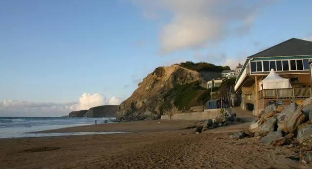
- commons: Lusty Glaze Beach, Newquay - geograph.org.uk - 31613.jpg (CC BY-SA 4.0)
Other places nearby

Mawgan Porth
Villages · 0.0 km

River Menalhyl
Museums · 0.0 km
Dunes
Beaches · 0.1 km

Natural Shower
Natural landmarks · 0.3 km

Marver
Campsites · 0.5 km

Magic Cove
Campsites · 0.5 km

St Mawgan Monastery
Abbeys & priories · 0.7 km

Beacon Cove
Beaches · 0.9 km

High Cove
Beaches · 1.0 km

Liveloe, later prehistoric cliff castle with hut circles on Griffin's Point, and prehistoric round barrow 600m south west of Bre
Vineyards · 1.1 km
Watergate Bay
Mountains & hills · 1.2 km

Stem
Beaches · 1.2 km
Nearby
📷 5📷 5Museums · South West England
River Menalhyl
River Menalhyl — a museum in england-south-west, United Kingdom.
📷 5📷 3Natural landmarks · South West England
Natural Shower
Natural Shower — a other in england-south-west, United Kingdom.
📷 5Campsites · South West England
Marver
Marver — a campsite in england south west.
📷 5Campsites · South West England
Magic Cove
Magic Cove — a campsite in england south west.
Where to eat & stay near St Columb Canal
Places to stay
📷 5Campsites · South West England
Marver
Marver — a campsite in england south west.
📷 5Campsites · South West England
Magic Cove
Magic Cove — a campsite in england south west.
 📷 5
📷 5Caravan parks · South West England
Sun Valley Caravan Park
Sun Valley Caravan Park — a caravan park in england south west.
 📷 4
📷 4Caravan parks · South West England
Trevarrian Holiday Park
Trevarrian Holiday Park — a caravan park in england south west.
 📷 5
📷 5Caravan parks · South West England
Bedruthan House Caravan Park
Bedruthan House Caravan Park — a caravan park in england south west.
📷 5Campsites · South West England
Bedruthan House Camping
Bedruthan House Camping — a campsite in england south west.
Places to eat & drink
 📷 6
📷 6Historic pubs · South West England
The Shipwrights
The Shipwrights in England South West, United Kingdom.
 📷 7
📷 7Restaurants · South West England
Slipway Hotel
Slipway Hotel — a restaurant in england south west.
 📷 7
📷 7Restaurants · South West England
Outlaws Fish Kitchen
Outlaws Fish Kitchen — a restaurant in england south west.
 📷 7
📷 7Restaurants · South West England
Nathan Outlaw
Nathan Outlaw — a restaurant in england south west.
 📷 7
📷 7Historic pubs · South West England
Methodist Chapel
Methodist Chapel in England South West, United Kingdom.
 📷 5
📷 5Historic pubs · South West England
The Wig And Pen Public House And Attached Forecourt Walls And Railings
The Wig And Pen Public House And Attached Forecourt Walls And Railings in England South West, United Kingdom.
More places in this region
 📷 5
📷 5Canals · South West England
Kennet and Avon Canal
Kennet and Avon Canal — South-England east-west coastal linking waterway via London, Reading & Bristol.
 📷 5
📷 5Canals · South West England
Somerset Coal Canal
Somerset Coal Canal — canal in Somerset, England.
 📷 5
📷 5Canals · South West England
Weston Cut
Weston Cut — navigation cut on the River Avon in Bath, Somerset, England, UK.
 📷 5
📷 5Frequently asked questions
- Where is St Columb Canal?
- St Columb Canal is in South-West England, United Kingdom (postcode TR8 4BL), in the parish of Mawgan-in-Pydar.
- What is St Columb Canal?
- St Columb Canal — canal in Cornwall, England.
- How do I get to St Columb Canal?
- The nearest railway station is Newquay, about 6.5 km away. Drivers can use postcode TR8 4BL.
- When was St Columb Canal built?
- Built or established in 1781.
- Is St Columb Canal a protected site?
- Yes — St Columb Canal is part of the Cornwall National Landscape (AONB).
- Is St Columb Canal free to visit?
- Yes, St Columb Canal is free to enter.
- How do I get to St Columb Canal?
- The nearest railway station is Newquay, about 6.5 km away. Drivers can navigate to postcode TR8 4BL.