
Towns & cities · South West England
St Buryan
St Buryan — village and former civil parish in Cornwall, England.

Wikimedia Commons contributors — see linked file page for photographer and licence licence

Plan your visit
- Typical visit
- 3 h–6 h
- Nearest railway station
- Penzance · 8.3 km
- Free entry
- Family-friendly
- Dog-friendly
Getting there & planning your visit
To visit St Buryan, the nearest railway station is Penzance, located 8.3 km away. Entry to the town is free, and it is accessible via postcode TR19.
About
St Buryan is a town, city, village or settlement in the United Kingdom. Recent population estimates put it at around 1,215 people. Address: TR19. Wikidata describes it as: "village and former civil parish in Cornwall, England". Coordinates: 50.0750°, -5.6210°.
Photo gallery
See it from the streetimagery from 2024
Imagery © Mapillary contributors, CC BY-SA 4.0
Protected designations
- Area of Outstanding Natural Beauty: Cornwall
Designations sourced from Natural England open data under OGL v3.
From the Wikipedia article
St Buryan (Cornish: Pluwveryan) is a village and former civil parish, now in the parish of St Buryan, Lamorna and Paul in Cornwall, England, United Kingdom. In 2011 the parish had a population of 1412. The village of St Buryan is situated approximately 5 miles (8.0 km) west of Penzance along the B3283 towards Land's End. Three further minor roads also meet at St Buryan, two link the village with the B3315 towards Lamorna, and the third rejoins the A30 at Crows-an-Wra. St Buryan parish encompassed the villages of St. Buryan, Lamorna, and Crows-an-Wra and shared boundaries with the parishes of Sancreed and St Just to the north, Sennen and St Levan (with which it has close ties) to the west, with Paul to the east and by the sea in the south. An electoral parish also exists stretching from Land's End to the north coast but avoiding St Just. The population of this ward at the 2011 census was 4,589. Named after the Irish Saint Buriana, the parish is situated in an area of outstanding natural beauty and is a popular tourist destination. It has been a designated conservation area since 1990 and is near many sites of special scientific interest in the surrounding area. The parish is dotted with evidence of Neolithic activity, from stone circles and Celtic crosses to burial chambers and ancient holy wells. The village of St Buryan itself is also a site of special historic interest, and contains many listed buildings including the famous grade I listed church. The bells of St Buryan's Church, which have recently undergone extensive renovation, are the heaviest full circle peal of six anywhere in the world. The parish also has a strong cultural heritage. Many painters of the Newlyn School including Samuel John "Lamorna" Birch were based at Lamorna in the south-east of the parish. St Buryan Village Hall was also the former location of Pipers Folk Club, created in the late 1960s by celebrated Cornish singer Brenda Wootton.
Excerpt from Wikipedia under CC BY-SA 4.0. See the source article linked in Sources below.
Background
History
St Buryan and the surrounding area is rich in history and has been a centre of human activity for several thousand years.
Description
A church has stood on the current site since ca. 930 AD, built by King Athelstan in thanks for his successful conquest of Cornwall on the site of the oratory of Saint Buriana (probably founded in the 6th century). The Charter from Athelstan endowed the building of collegiate buildings and the establishment of one of the earliest monasteries in Cornwall, and was subsequently enlarged and rededicated to the saint in 1238 by Bishop William Briwere. The collegiate establishment consisted of a dean and three prebendaries. Owing to the nature of the original Charter from King Athelstan, the parish of St Buryan was long regarded as a Royal Peculiar thus falling directly under the jurisdiction of…
Sourced from Wikipedia under CC BY-SA 4.0.
- Coordinates
- 50.0750, -5.6210
- District
- Cornwall
- Parish
- St. Buryan, Lamorna and Paul
- Postcode
- TR19
- Parliamentary constituency
- St Ives
- Population
- 1,215
- Nearest railway station
- Penzance — 8.3 km
Sources
- wikidata: Q652930 (CC0)
- wikipedia: St Buryan (CC BY-SA 4.0)
- commons: StBuryanChurchBehind.jpg (CC BY-SA 4.0)
Other places nearby

Churchyard Walls And Adjoining War Memorial
Memorials & monuments · 0.1 km

Saint Buryan
Villages · 0.1 km

Churchyard cross in St Buryan churchyard
Historic churches · 0.1 km

St Buryan churchtown cross
Historic churches · 0.1 km
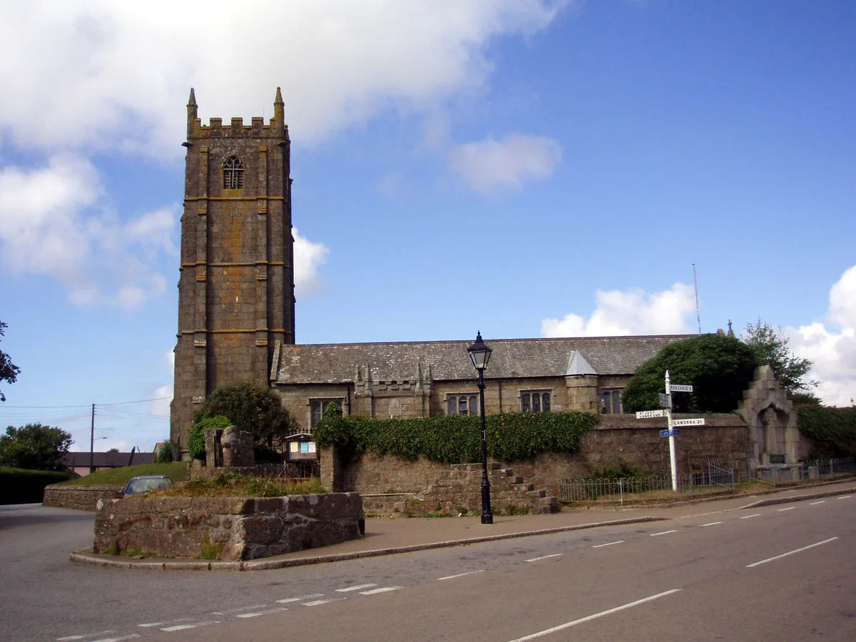
St Buryan's Church
Historic churches · 0.1 km

Tower Park
Campsites · 0.5 km

West Kernow Way Part 1
Mountain bike trails · 0.9 km

Medieval wayside cross 150m ESE of Lower Alsia
Historic houses · 1.5 km

Boscawen-Un Stone Circle
Stone circles · 1.7 km
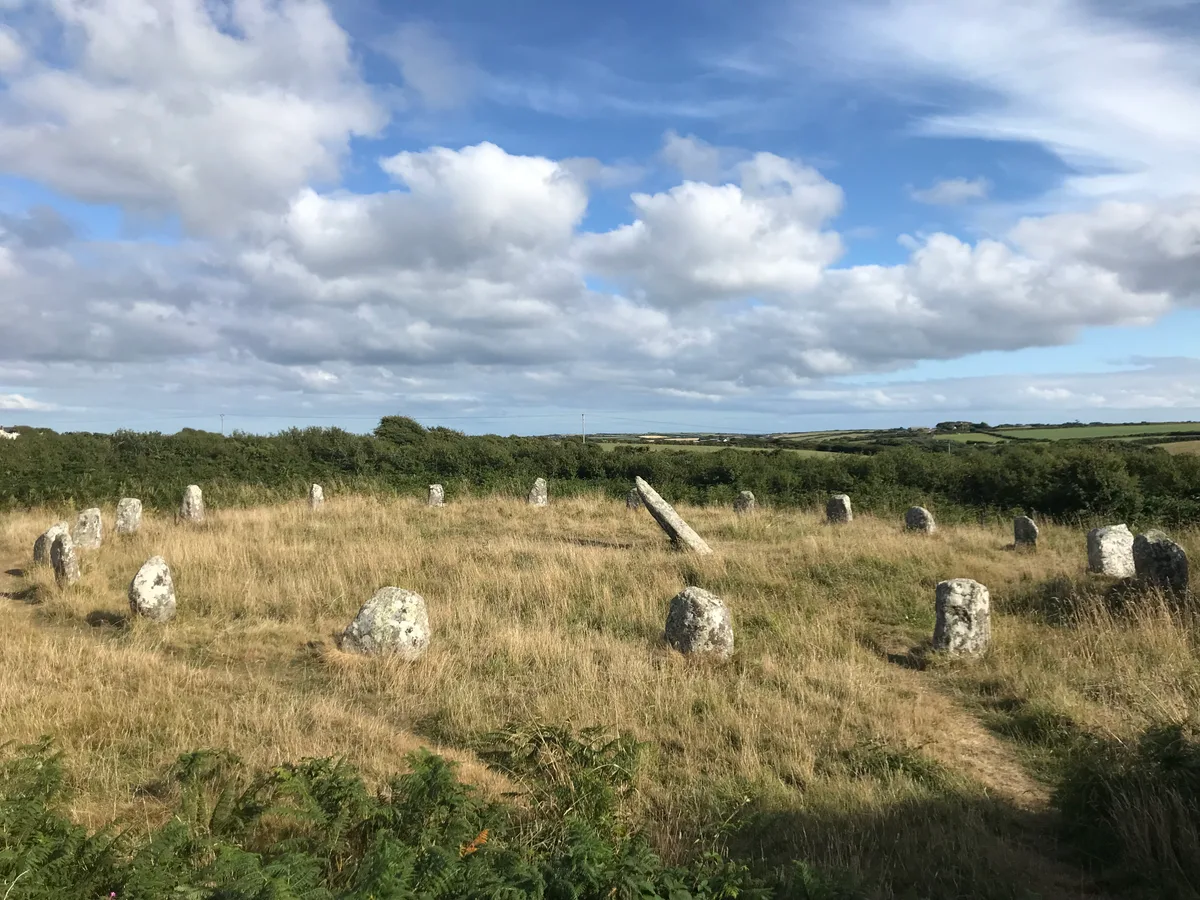
Boscawen-Un
Hill forts · 1.7 km

Boskenna Gate Cross
Historic houses · 1.9 km

Treverven Touring Park
Campsites · 2.0 km
St Buryan is a village located in South West England, with a population of 1,215. Our guide lists N attractions within reach.
At a glance
- Population
- 1,215
- Constituency
- St Ives
- Top categories near here
Things to see in St Buryan
18 attractions within 12 km. Full guide: things to do in St Buryan →
📷 5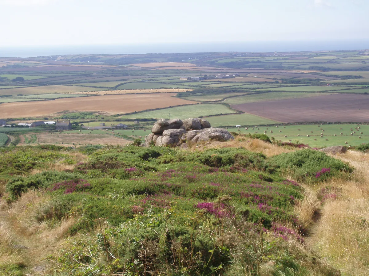 📷 5
📷 5Mountains & hills · South West England
Chapel Carn Brea
Chapel Carn Brea — Named summit at 198 m.
📷 5Historic churches · South West England
St Buryan's Church
St Buryan's Church — church in Cornwall, England, UK.
 📷 4📷 3
Stone circles · South West England
Boscawen-Un Stone Circle
Boscawen-Un Stone Circle — a stone circle in england-south-west, United Kingdom.
📷 3Historic churches · South West England
Churchyard cross in St Buryan churchyard
Churchyard cross in St Buryan churchyard — a Grade II*-listed church in england-south-west, United Kingdom.
📷 3Historic houses · South West England
Medieval wayside cross 150m ESE of Lower Alsia
Medieval wayside cross 150m ESE of Lower Alsia — a Grade II*-listed historic house in england-south-west, United Kingdom.
📷 3Historic churches · South West England
St Buryan churchtown cross
St Buryan churchtown cross — a Grade II*-listed church in england-south-west, United Kingdom.
📷 3Historic houses · South West England
Boskenna Gate Cross
Boskenna Gate Cross — a Grade II*-listed historic house in england-south-west, United Kingdom.
 📷 3
📷 3Historic bridges · South West England
Bridge At Approximately 70 Metres South East Of Rissick Farmhouse
Bridge At Approximately 70 Metres South East Of Rissick Farmhouse — Grade II listed building-listed bridge in england-south-west, United Kingdom.
📷 3Memorials & monuments · South West England
Churchyard Walls And Adjoining War Memorial
Churchyard Walls And Adjoining War Memorial — Grade II listed building-listed memorial in england-south-west, United Kingdom.
📷 5Mountain bike trails · South West England
West Kernow Way Part 1
West Kernow Way Part 1 — a mtb trail in england south west.
 📷 5📷 5
Campsites · South West England
Treverven Touring Park
Treverven Touring Park — a campsite in england south west.
 📷 5
📷 5Campsites · South West England
Cardinney Car. & Camp Park
Cardinney Car. & Camp Park — a campsite in england south west.
📷 5Campsites · South West England
Tower Park
Tower Park — a campsite in england south west.
 📷 5
📷 5Campsites · South West England
St Loy's Camp Site
St Loy's Camp Site — a campsite in england south west.
📷 5Nearby
📷 3Memorials & monuments · South West England
Churchyard Walls And Adjoining War Memorial
Churchyard Walls And Adjoining War Memorial — Grade II listed building-listed memorial in england-south-west, United Kingdom.
📷 5📷 3Historic churches · South West England
Churchyard cross in St Buryan churchyard
Churchyard cross in St Buryan churchyard — a Grade II*-listed church in england-south-west, United Kingdom.
📷 3Historic churches · South West England
St Buryan churchtown cross
St Buryan churchtown cross — a Grade II*-listed church in england-south-west, United Kingdom.
📷 5Historic churches · South West England
St Buryan's Church
St Buryan's Church — church in Cornwall, England, UK.
📷 5Campsites · South West England
Tower Park
Tower Park — a campsite in england south west.
Where to eat & stay near St Buryan
Places to stay
📷 5Campsites · South West England
Tower Park
Tower Park — a campsite in england south west.
📷 5Campsites · South West England
Treverven Touring Park
Treverven Touring Park — a campsite in england south west.
📷 5Campsites · South West England
St Loy's Camp Site
St Loy's Camp Site — a campsite in england south west.
📷 5Campsites · South West England
Cardinney Car. & Camp Park
Cardinney Car. & Camp Park — a campsite in england south west.
 📷 5
📷 5Campsites · South West England
Boleigh Farm Campsite
Boleigh Farm Campsite — a campsite in england south west.
📷 5Places to eat & drink
 📷 5
📷 5Historic pubs · South West England
Tolcarne Inn Public House
Tolcarne Inn Public House in England South West, United Kingdom.
 📷 5
📷 5Historic pubs · South West England
First And Last Inn
First And Last Inn in England South West, United Kingdom.
 📷 7
📷 7Restaurants · South West England
The Old Lifeboat House Bistro
The Old Lifeboat House Bistro — a restaurant in england south west. Cuisine: seafood.
 📷 5
📷 5 📷 5
📷 5 📷 5
📷 5Historic pubs · South West England
The Bucket of Blood
The Bucket of Blood in England South West, United Kingdom.
More towns in this region
 Flagship📷 10
Towns & cities · South West England
Shoscombe
Shoscombe — village and civil parish in Somerset, UK.
 Flagship📷 10
Towns & cities · South West England
Tarrant Keyneston
Tarrant Keyneston — village and civil parish in Dorset, United Kingdom.
 📷 5
📷 5 📷 5
📷 5Towns & cities · South West England
Arne
Arne — village in Purbeck, Dorset, United Kingdom.
Frequently asked questions
- Where is St Buryan?
- St Buryan is in South-West England, United Kingdom (postcode TR19), in the parish of St. Buryan, Lamorna and Paul.
- What is St Buryan?
- St Buryan — village and former civil parish in Cornwall, England.
- How do I get to St Buryan?
- The nearest railway station is Penzance, about 8.3 km away. Drivers can use postcode TR19.
- Is St Buryan a protected site?
- Yes — St Buryan is part of the Cornwall National Landscape (AONB).
- Is St Buryan free to visit?
- Yes, St Buryan is free to enter.
- How do I get to St Buryan?
- Drivers can navigate to postcode TR19. It sits within the St Ives parliamentary constituency.