Mountains & hills · South West England
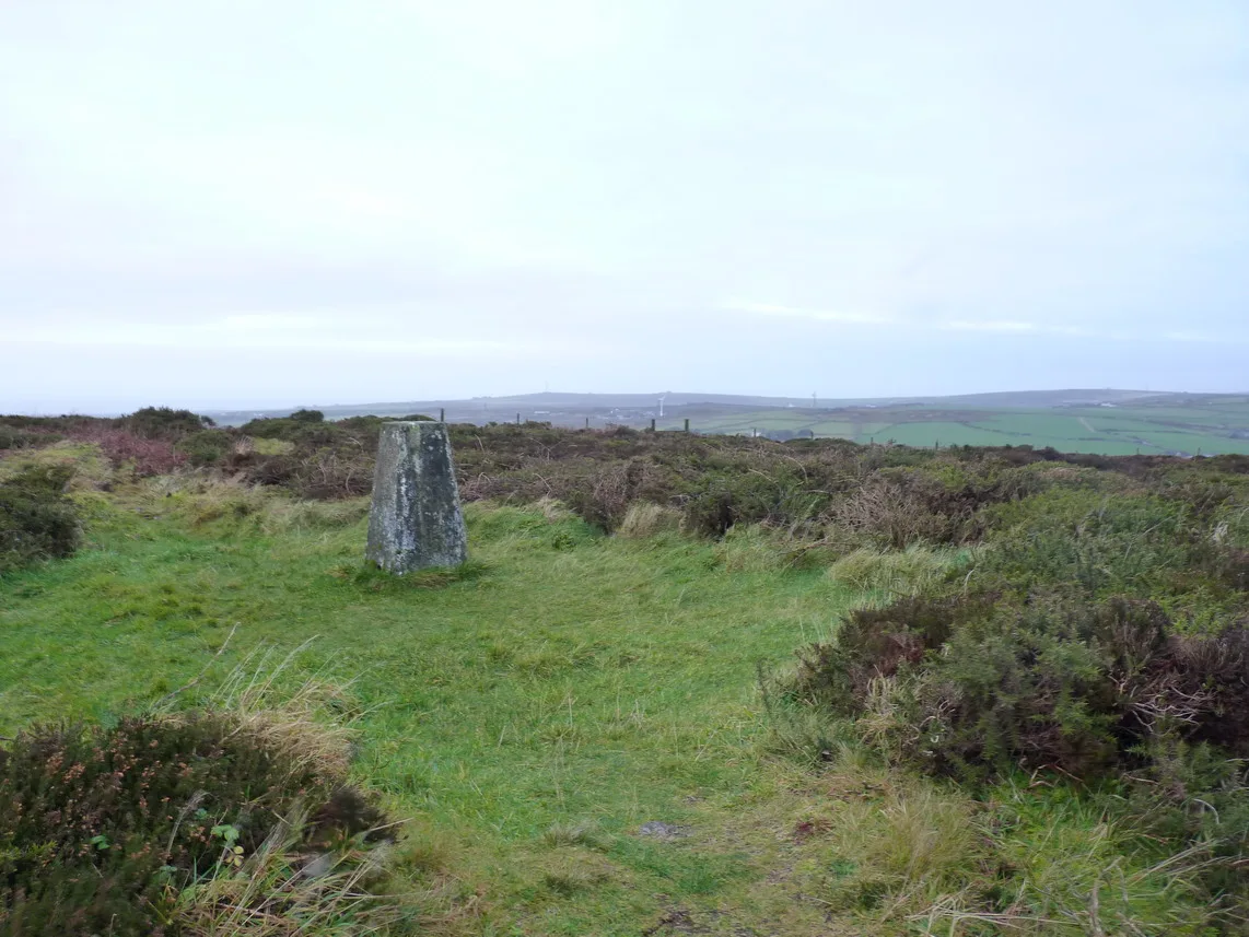
Chapel Carn Brea
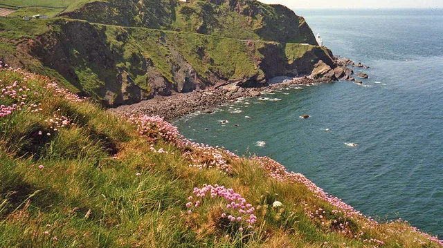
Chapel Carn Brea — Named summit at 198 m.

Wikimedia Commons contributors — see linked file page for photographer and licence licence
Plan your visit
- Typical visit
- 3 h–8 h
- Best time of year
- Late spring – early autumn (May–Oct)
- Nearest railway station
- Penzance · 9.4 km
- Free entry
- Dog-friendly
About
Chapel Carn Brea is a named summit in the United Kingdom. Wikidata describes it as: "Named summit at 198 m.". Coordinates: 50.0950°, -5.6564°.
Photo gallery
Protected designations
- Site of Special Scientific Interest: Aire Point to Carrick Du SSSI
- Site of Special Scientific Interest: West Penwith Moors and Downs SSSI
- Area of Outstanding Natural Beauty: Cornwall
Designations sourced from Natural England open data under OGL v3.
From the Wikipedia article
Chapel Carn Brea is an elevated Hercynian granite outcrop, owned by the National Trust at the southern edge of the civil parish of St Just, Cornwall, England, United Kingdom. The hill is 5 kilometres (3.1 mi) south of St Just and 3.5 kilometres (2.2 mi) east of Sennen Cove, and just to the north of the A30 London to Land's End road, which runs through the village of Crows-an-Wra. It should not be confused with another Carn Brea, the hill overlooking the Camborne–Redruth area. Chapel Carn Brea is often described as the first hill in Cornwall (from a westerly perspective) and rises 198 metres (650 ft) above sea level.
Excerpt from Wikipedia under CC BY-SA 4.0. See the source article linked in Sources below.
Background
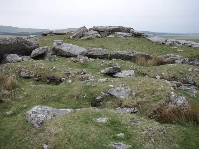
History
remains at the summit of Chapel Carn Brea]] The hill is an important historical site showing evidence of Neolithic and early Bronze Age activity, as well as the remains of the thirteenth century chapel from which it is named. On the slopes and summit there were once eleven barrows, but only seven now remain, mostly in a poor state. To the west of the summit is an early Neolithic long cairn with dimensions of 11 m long and built within a natural granite outcrop which extends it length by 26 m. On the summit is a 9 m diameter entrance grave (also known as chambered cairn) which had a south-facing entrance and was built in the late Neolithic. The chamber was 2.7 m long, 1.1 m wide and 1.2 m…
Sourced from Wikipedia under CC BY-SA 4.0.
- Coordinates
- 50.0950, -5.6564
- District
- Cornwall
- Parish
- St. Buryan, Lamorna and Paul
- Postcode
- TR19 6JD
- Parliamentary constituency
- St Ives
- Nearest railway station
- Penzance — 9.4 km
Sources
- osm: n538907003 (ODbL)
- wikipedia: Chapel Carn Brea (CC BY-SA 4.0)
- commons: ChapelCarnBreaview.JPG (CC BY-SA 4.0)
Other places nearby
Loading nearby places…
Nearby
 📷 5
📷 5Windmills · South West England
Standing stone 200yds (180m) W of Chycarne
Standing stone 200yds (180m) W of Chycarne — a post mill in england-south-west, United Kingdom.
Campsites · South West England
Lower Treave
Lower Treave — a campsite in england south west.
Campsites · South West England
Sennen Cove Camping and Caravanning Club Site
Sennen Cove Camping and Caravanning Club Site — a campsite in england south west.
Campsites · South West England
Cardinney Car. & Camp Park
Cardinney Car. & Camp Park — a campsite in england south west.
 📷 3
📷 3Castles · South West England
Bartine Castle
Bartine Castle — a castle in england-south-west, United Kingdom.
 📷 5
📷 5Hill forts · South West England
Bartinney Castle
Bartinney Castle — Iron Age enclosure in Cornwall, England, UK.
More mountains in this region
 📷 5
📷 5Mountains & hills · South West England
Alex Tor
Alex Tor — Named summit at 291 m.
 📷 5
📷 5Mountains & hills · South West England
Ash Hole Cavern
Ash Hole Cavern — cave in Brixham, Devon, England, UK.
 📷 5
📷 5Mountains & hills · South West England
Babbacombe Bay
Babbacombe Bay — bay in Devon, England.
 📷 5
📷 5Mountains & hills · South West England
Barley Bay
Barley Bay — bay in the United Kingdom.
Frequently asked questions
- Where is Chapel Carn Brea?
- Chapel Carn Brea is in South-West England, United Kingdom (postcode TR19 6JD), in the parish of St. Buryan, Lamorna and Paul.
- Is Chapel Carn Brea a protected site?
- Yes — Chapel Carn Brea is part of the Aire Point to Carrick Du SSSI Site of Special Scientific Interest and the West Penwith Moors and Downs SSSI Site of Special Scientific Interest.
- Is Chapel Carn Brea free to visit?
- Yes, Chapel Carn Brea is free to enter.
- How do I get to Chapel Carn Brea?
- Drivers can navigate to postcode TR19 6JD. It sits within the St Ives parliamentary constituency.