Skip to content
WordPress site playing up? Vincony fixes it — today, from $5.Get it fixed →
The Great Britain Guide logoThe Great Britain Guide

Towns & cities · Scottish Lowlands

St Boswells

Also known as: Cille Bhoisil

Free admission🐾 Dog-friendly👪 Family-friendly

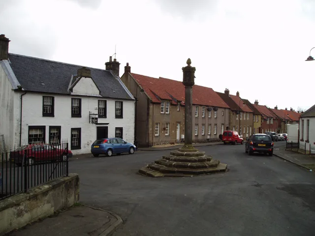
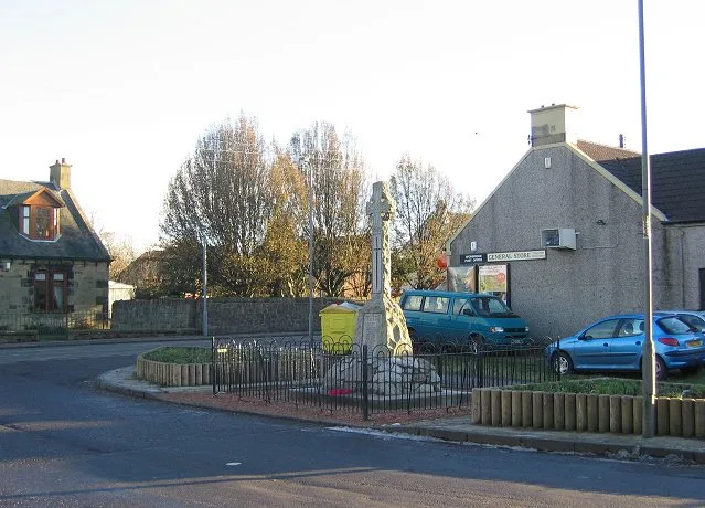
St Boswells — village in Scottish Borders, Scotland, UK; historical County of Roxburgh.

St Boswells, towns & cities in Scottish Lowlands

Wikimedia Commons contributors — see linked file page for photographer and licence licence

Plan your visit

Typical visit
3 h–6 h
Nearest railway station
Tweedbank · 8.1 km
  • Free entry
  • Family-friendly
  • Dog-friendly

Getting there & planning your visit

St Boswells is located in central Scotland, with the postcode TD6 0AA. The nearest railway station is Tweedbank, which is 8.1 km away. Entry to the town is free.

Directions on Google Maps →

About

St Boswells is a town, city, village or settlement in the United Kingdom. Recent population estimates put it at around 1,470 people. Wikidata describes it as: "village in Scottish Borders, Scotland, UK; historical County of Roxburgh". Coordinates: 55.5708°, -2.6458°.

Photo gallery

See it from the streetimagery from 2023

Imagery © Mapillary contributors, CC BY-SA 4.0

From the Wikipedia article

St Boswells (Scots: Bosels / Bosells [ˈboːzəɫz]; Scottish Gaelic: Cille Bhoisil [ˈçiʎəˈvɔʃɪl]) is a village on the south side of the River Tweed in the Scottish Borders, about 1 mile (2 kilometres) southeast of Newtown St Boswells on the A68 road. It lies within the boundaries of the historic county of Roxburghshire. It has a hotel, post office, award-winning butcher, garage, fish and chip shop, bookshop and café and several convenience stores. There is also a golf course next to the River Tweed, a cricket club, football club, rugby club and tennis club. The village is mostly known for being on the route of St Cuthbert's Way, a long distance footpath linking Melrose Abbey (5 miles or 8 kilometres northwest) to the Holy Island of Lindisfarne off the Northumberland coast in north east England. The name commemorates Saint Boisil, an Abbot of Melrose. The village has an annual gypsy fair, originally a focus for the trade of horses. This fair once attracted Gypsies from most parts of Scotland, northern England and Ireland. However, today it is little more than a two-day get-together on the village green. Fair day is on 18 July each year. It remains a popular opportunity for many locals to have their fortunes predicted.

Excerpt from Wikipedia under CC BY-SA 4.0. See the source article linked in Sources below.

Background

History

The Romans came to this area almost two thousand years ago, leaving Dere Street and the nearby fort of Trimontium as evidence of their occupation. Following the departure of the Romans, the area came under the sway of the Anglian kingdom of Northumbria. In the 7th century Northumbria was ruled by the pagan leader Oswald who, upon converting to Christianity, established, with the help of St Aidan, a monastery at Lindisfarne. Under his leadership a monastery was built at Old Melrose. One of the monks from this new religious centre was Boisil, and it was he who gave his name to the village and parish of Saint Boswells. It is suggested that some of the dwellings were on the flat haugh below…

Description

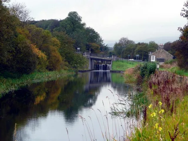
It is not possible to speak of St Boswells village without thinking of the river which bends and twists on its swift flowing course north of the village. Famous for its salmon and brown trout it has given satisfaction to anglers over the years. Many of the local houses were built of stones from the river bed. The riverside walks are at all times pleasant and sometimes spectacular. Walkers on St Cuthbert's Way through the village on pilgrimage from Melrose to Lindisfarne see the same view of the Eildon Hills as was seen by such men as Modan who established a religious cell at Dryburgh; Aidan who brought twelve young monks from Lindisfarne to Old Melrose as missionaries; Cuthbert who became…

Sourced from Wikipedia under CC BY-SA 4.0.

Coordinates
55.5708, -2.6458
Postcode
TD6 0AA
Parliamentary constituency
Berwickshire, Roxburgh and Selkirk
Population
1,470
Nearest railway station
Tweedbank8.1 km

Sources

Other places nearby

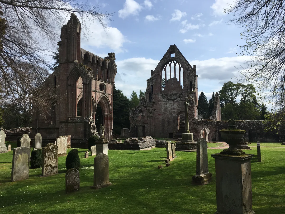
St Boswells is a charming town located in the Scottish Lowlands. Visitors can explore the historic grounds of Dryburgh Abbey and its adjacent bridge. The town also offers a peaceful retreat at Mertoun Mill, a traditional watermill.

At a glance

Population
1,470
Constituency
Berwickshire, Roxburgh and Selkirk

Things to see in St Boswells

39 attractions within 12 km — showing the 24 most editorially-significant. Full guide: things to do in St Boswells

Standing stone and the Eildon Hills - geograph.org.uk - 588593📷 4

Historic houses · Scottish Lowlands

Bemersyde

Bemersyde in England North East, United Kingdom.

👶
George V postbox, Clintmains - geograph.org.uk - 5011960📷 4

Abbeys & priories · Scottish Lowlands

Clintmains

Clintmains in England North East, United Kingdom.

👶
Walkway to hide on Bemersyde Moss Wildlife Reserve - geograph.org.uk - 6957715📷 4

Other places · Scottish Lowlands

Mertoun

Mertoun in England North East, United Kingdom.

Northbound View At Charlesfield Halt - geograph.org.uk - 3917601📷 4

Heritage railway stations · Scottish Lowlands

Charlesfield Halt railway station

Charlesfield Halt railway station in England North East, United Kingdom.

Free
Footbridge over the River Tweed at Dryburgh - geograph.org.uk - 1862053📷 4

Abbeys & priories · Scottish Lowlands

Dryburgh Bridge

Dryburgh Bridge in England North East, United Kingdom.

👶
Unique sandstone gateway on back road at Dryburgh - geograph.org.uk - 409881📷 4

Abbeys & priories · Scottish Lowlands

Dryburgh

Dryburgh in England North East, United Kingdom.

👶
Orchard Gate, Dryburgh - geograph.org.uk - 8089073📷 4

Abbeys & priories · Scottish Lowlands

Dryburgh Abbey Hotel

Dryburgh Abbey Hotel in England North East, United Kingdom.

👶dryburgh.co.uk
Close up, Edward VII postbox, Benrig - geograph.org.uk - 5112273Flagship📷 3

Abbeys & priories · Scottish Lowlands

Greycrook

Greycrook in England North East, United Kingdom.

👶
Classical funeral-style urn - geograph.org.uk - 6954084📷 4

Parks · Scottish Lowlands

Statue of William Wallace

Statue of William Wallace in England North East, United Kingdom.

Free🐕👶
Footbridge over the River Tweed at Dryburgh - geograph.org.uk - 1862053📷 4

Abbeys & priories · Scottish Lowlands

Dryburgh Abbey Bridge

Dryburgh Abbey Bridge in England North East, United Kingdom.

👶
The River Tweed from Mertoun Bridge - geograph.org.uk - 604801📷 4

Historic bridges · Scottish Lowlands

Mertoun Bridge

Mertoun Bridge in England North East, United Kingdom.

Free🐕
Bemersyde Moss📷 3

Forests & woodlands · Scottish Lowlands

Bemersyde Moss

Bemersyde Moss is a forest or woodland in the United Kingdom.

Free🐕👶
Bemersyde Moss📷 3

Wildlife reserves · Scottish Lowlands

Bemersyde Moss

Bemersyde Moss — nature reserve in the Scottish Borders.

Free🐕👶
Brotherstone Hill📷 3

Mountains & hills · Scottish Lowlands

Brotherstone Hill

Brotherstone Hill — Named summit at 247 m.

Free🐕
Dryburgh Abbey★ Iconic📷 5

Abbeys & priories · Scottish Lowlands

Dryburgh Abbey

Dryburgh Abbey — category A listed building in Scottish Borders, Scotland, UK.

👶historicenvironment.scot
Lessudden House📷 3

Historic houses · Scottish Lowlands

Lessudden House

Lessudden House — house in Scottish Borders, Scotland, UK.

👶
A carved figure at Dryburgh Abbey - geograph.org.uk - 795079📷 3

Follies · Scottish Lowlands

Walter Scott's Tomb

Walter Scott's Tomb is a folly in the United Kingdom.

Free🐕👶
Classical funeral-style urn - geograph.org.uk - 6954084📷 3

Natural landmarks · Scottish Lowlands

Wallace Statue

Wallace Statue — a other in scotland-central, United Kingdom.

Free🐕👶
Feeding Time At The Scottish Borders Donkey Sanctuary - geograph.org.uk - 3154859📷 3

Natural landmarks · Scottish Lowlands

Scottish Borders Donkey Sanctuary

Scottish Borders Donkey Sanctuary — a other in scotland-central, United Kingdom.

Free🐕👶
A symbolic gravestone at Longnewton Burial Ground - geograph.org.uk - 8083623📷 3

Archaeological sites · Scottish Lowlands

Longnewton Village (Site of)

Longnewton Village (Site of) — a archaeological in scotland-central, United Kingdom.

Free🐕
Frosty conditions on Brotherstone Hill South - geograph.org.uk - 3248548📷 3

Archaeological sites · Scottish Lowlands

The Cow Stone

The Cow Stone — a archaeological in scotland-central, United Kingdom.

Free🐕
Whitrighill Farm - geograph.org.uk - 264182📷 3

Historic houses · Scottish Lowlands

Whitrigbog Tileworks

Whitrigbog Tileworks — a historic house in scotland-central, United Kingdom.

👶
Whitrighill Farm - geograph.org.uk - 264182📷 3

Historic houses · Scottish Lowlands

Clay Mill

Clay Mill — a historic house in scotland-central, United Kingdom.

👶
Path, St Boswells - geograph.org.uk - 4671855📷 3

Memorials & monuments · Scottish Lowlands

St Boswells Drinking Fountain

St Boswells Drinking Fountain — a memorial in scotland-central, United Kingdom.

Free🐕

Nearby

Braeheads Road, St Boswells - geograph.org.uk - 8074449📷 5

Villages · Scottish Lowlands

Saint Boswells

Saint Boswells — a village in scotland central.

Path, St Boswells - geograph.org.uk - 4671855📷 3

Memorials & monuments · Scottish Lowlands

St Boswells Drinking Fountain

St Boswells Drinking Fountain — a memorial in scotland-central, United Kingdom.
Free🐕
Dryburgh Abbey★ Iconic📷 5

Abbeys & priories · Scottish Lowlands

Dryburgh Abbey

Dryburgh Abbey — category A listed building in Scottish Borders, Scotland, UK.

👶historicenvironment.scot
Lessudden House📷 3

Historic houses · Scottish Lowlands

Lessudden House

Lessudden House — house in Scottish Borders, Scotland, UK.

👶
JAMES-YE-I-OF-SCOTS - geograph.org.uk - 4071270📷 3

Memorials & monuments · Scottish Lowlands

Monument to James I of Scotland

Monument to James I of Scotland — a memorial in scotland-central, United Kingdom.

Free🐕
Looking over to the South Range and its Rose Window, Dryburgh Abbey - geograph.org.uk - 8185483📷 5

Memorials & monuments · Scottish Lowlands

Dryburgh Abbey, Chapter House

Dryburgh Abbey, Chapter House — category A listed building-listed memorial in scotland-central, United Kingdom.

Free🐕👶

Where to eat & stay near St Boswells

Places to stay

Dryburgh Abbey (1) - geograph.org.uk - 6251031📷 5

Hotels · Scottish Lowlands

Dryburgh Abbey Hotel

Dryburgh Abbey Hotel — a hotel in scotland central.

A symbolic gravestone at Bowden Kirkyard - geograph.org.uk - 8286913📷 5

Caravan parks · Scottish Lowlands

Roulotte Retreat

Roulotte Retreat — a caravan park in scotland central.

Old Milepost by Craighouse Farm, Earlston Parish - geograph.org.uk - 6045736📷 5

Caravan parks · Scottish Lowlands

Springlee

Springlee — a caravan park in scotland central.

Winter cereals, Lilliards Edge - geograph.org.uk - 7988786📷 5

Caravan parks · Scottish Lowlands

Lilliardsedge Park

Lilliardsedge Park — a caravan park in scotland central.

Roxburghshire Townscape , The Ship Inn, East Port, Melrose - geograph.org.uk - 3573044📷 5

Hotels · Scottish Lowlands

Station Hotel

Station Hotel — a hotel in scotland central.

stationhotelmelrose.com
Roxburghshire Townscape , Lunchtime In Melrose - geograph.org.uk - 3572088📷 7

Hotels · Scottish Lowlands

Burt's Hotel

Burt's Hotel — a hotel in scotland central.

burtshotel.co.uk

Places to eat & drink

The 2025 Selkirk Standard Bearer, Darren Knox rides into Selkirk Market Square on his big day - geograph.org.uk - 8071243📷 6

Historic pubs · Scottish Lowlands

Town Arms Inn, 1 Market Place, Selkirk

Town Arms Inn, 1 Market Place, Selkirk in Scotland Central, United Kingdom.

Roundabout in Clovenfords where the A72 and B710 meet - geograph.org.uk - 4775002📷 7

Historic pubs · Scottish Lowlands

Clovenfords Hotel, Clovenfords

Clovenfords Hotel, Clovenfords in Scotland Central, United Kingdom.

barrelandstone.co.uk

More towns in this region

Former Road Bridge Over The Berwickshire Railway - geograph.org.uk - 3063917📷 4

Towns & cities · Scottish Lowlands

Greenlaw

Greenlaw in England North East, United Kingdom.

Daffodils at The Hirsel Coldstream - geograph.org.uk - 6120607📷 4

Towns & cities · Scottish Lowlands

Coldstream

Coldstream in England North East, United Kingdom.

Freecoldstreamcommunity.com
War Memorial at Gordon Scottish Borders - geograph.org.uk - 7869264📷 5

Towns & cities · Scottish Lowlands

Gordon

Gordon in England North East, United Kingdom.

Entrance to Eccles Parish Church - geograph.org.uk - 3636120📷 4

Towns & cities · Scottish Lowlands

Eccles

Eccles in England North East, United Kingdom.

Frequently asked questions

Where is St Boswells?
St Boswells is in central Scotland, United Kingdom (postcode TD6 0AA).
What is St Boswells?
St Boswells — village in Scottish Borders, Scotland, UK; historical County of Roxburgh.
How do I get to St Boswells?
The nearest railway station is Tweedbank, about 8.1 km away. Drivers can use postcode TD6 0AA.
Is St Boswells free to visit?
Yes, St Boswells is free to enter.
How do I get to St Boswells?
Drivers can navigate to postcode TD6 0AA. It sits within the Berwickshire, Roxburgh and Selkirk parliamentary constituency.