
Historic churches · East Midlands
South Kelsey
In or near Osgodby.
South Kelsey is a village and civil parish in the West Lindsey district of Lincolnshire, England. It is situated on the B1205, 5 miles (8.0 km) east from the A15 and 4.5 miles (7 km) south-west from C

J.Hannan-Briggs — CC BY-SA 2.0 via Wikimedia Commons licence

Plan your visit
- Typical visit
- 30 min–1 h
- Nearest railway station
- Brigg · 9.5 km
- Free entry
About
South Kelsey is a village and civil parish in the West Lindsey district of Lincolnshire, England. It is situated on the B1205, 5 miles (8.0 km) east from the A15 and 4.5 miles (7 km) south-west from Caistor. According to the 2001 Census the village had a population of 571, increasing to 604 at the 2011 census. South Kelsey has an Anglican church, St. Mary's and a village hall.
Photo gallery
Protected designations
- Site of Special Scientific Interest: Humber Estuary SSSI
- Ramsar wetland: Humber Estuary
Designations sourced from Natural England open data under OGL v3.
From the Wikipedia article
South Kelsey is a village and civil parish in the West Lindsey district of Lincolnshire, England. It is situated on the B1205, 5 miles (8.0 km) east from the A15 and 4.5 miles (7 km) south-west from Caistor. According to the 2001 Census the village had a population of 571, increasing to 604 at the 2011 census. South Kelsey has an Anglican church, St. Mary's and a village hall.
Excerpt from Wikipedia under CC BY-SA 4.0. See the source article linked in Sources below.
- Coordinates
- 53.4702, -0.4321
- County
- Lincolnshire
- District
- West Lindsey
- Parish
- South Kelsey
- Postcode
- LN7 6PW
- Parliamentary constituency
- Gainsborough
- Nearest railway station
- Brigg — 9.5 km
Sources
- wikipedia: South Kelsey (CC BY-SA 4.0)
Other places nearby

Tower At South Kelsey Hall
Memorials & monuments · 0.6 km

Thornton le Moor
Villages · 2.5 km

Old Tollgate Bridge
Historic bridges · 2.5 km

Brandy Wharf Leisure Park
Campsites · 3.0 km

Ancholme Tow Path Bridge At Tf 010990, Caistor Canal
Historic bridges · 3.2 km

Moortown
Villages · 3.5 km

North Kelsey
Villages · 3.7 km

North Kelsey War Memorial
Memorials & monuments · 3.8 km

Holton le Moor
Historic churches · 3.9 km

The Skipworth Arms Campsite
Campsites · 4.1 km

Owersby
Historic churches · 4.2 km

North Owersby
Villages · 4.2 km
Nearby
📷 3Memorials & monuments · East Midlands
Tower At South Kelsey Hall
Tower At South Kelsey Hall — Grade II listed building-listed memorial in england-east-midlands, United Kingdom.
📷 5📷 3Historic bridges · East Midlands
Old Tollgate Bridge
Old Tollgate Bridge — Grade II listed building-listed bridge in england-east-midlands, United Kingdom.
📷 5Campsites · East Midlands
Brandy Wharf Leisure Park
Brandy Wharf Leisure Park — a campsite in england east midlands.
📷 3Historic bridges · East Midlands
Ancholme Tow Path Bridge At Tf 010990, Caistor Canal
Ancholme Tow Path Bridge At Tf 010990, Caistor Canal — Grade II listed building-listed bridge in england-east-midlands, United Kingdom.
📷 5Where to eat & stay near South Kelsey
Places to stay
📷 5Campsites · East Midlands
Brandy Wharf Leisure Park
Brandy Wharf Leisure Park — a campsite in england east midlands.
📷 5Campsites · East Midlands
The Skipworth Arms Campsite
The Skipworth Arms Campsite — a campsite in england east midlands.
 📷 5
Caravan parks · East Midlands
Nettleton Park
Nettleton Park — a caravan park in england east midlands.
 📷 5
B&Bs · Yorkshire & the Humber
The White Hart (Closed as a pub)
The White Hart (Closed as a pub) — a bed-and-breakfast in england yorkshire.
 📷 5
Campsites · East Midlands
Walesby Woodlands
Walesby Woodlands — a campsite in england east midlands.
📷 5Caravan parks · East Midlands
Walesby Woodlands Caravan Park
Walesby Woodlands Caravan Park — a caravan park in england east midlands.
Places to eat & drink
 📷 7
Historic pubs · Yorkshire & the Humber
The Berkeley
The Berkeley in England Yorkshire, United Kingdom.
 📷 5
Historic pubs · Yorkshire & the Humber
The Cross Keys
The Cross Keys in England Yorkshire, United Kingdom.
More places in this region
 📷 5
Historic churches · East Midlands
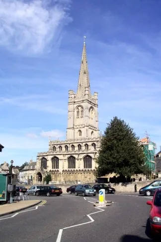
All Saints' Church, Stamford
All Saints' Church, Stamford — church in Stamford, Lincolnshire, England, UK.
 📷 5
Historic churches · East Midlands
Church of All Saints
Church of All Saints — church in Little Casterton, Rutland, United Kingdom.
 📷 5
Historic churches · East Midlands
Church of All Saints
Church of All Saints — church in Fenland, UK.
 📷 5
Historic churches · East Midlands
Church of St Leonard
Church of St Leonard — church in Fenland, UK.
Frequently asked questions
- Where is South Kelsey?
- South Kelsey is in Lincolnshire, the East Midlands, United Kingdom (postcode LN7 6PW), in the parish of South Kelsey.
- What is South Kelsey?
- South Kelsey is a village and civil parish in the West Lindsey district of Lincolnshire, England. It is situated on the B1205, 5 miles (8.0 km) east from the A15 and 4.5 miles (7 km) south-west from C
- How do I get to South Kelsey?
- The nearest railway station is Brigg, about 9.5 km away. The nearest town is Osgodby. Drivers can use postcode LN7 6PW.
- Is South Kelsey a protected site?
- Yes — South Kelsey is part of the Humber Estuary SSSI Site of Special Scientific Interest and the Humber Estuary Ramsar wetland.
- Is South Kelsey free to visit?
- Yes, South Kelsey is free to enter.
- How do I get to South Kelsey?
- Drivers can navigate to postcode LN7 6PW. It sits within the Gainsborough parliamentary constituency.