Mountains & hills · North West England
Sour Howes
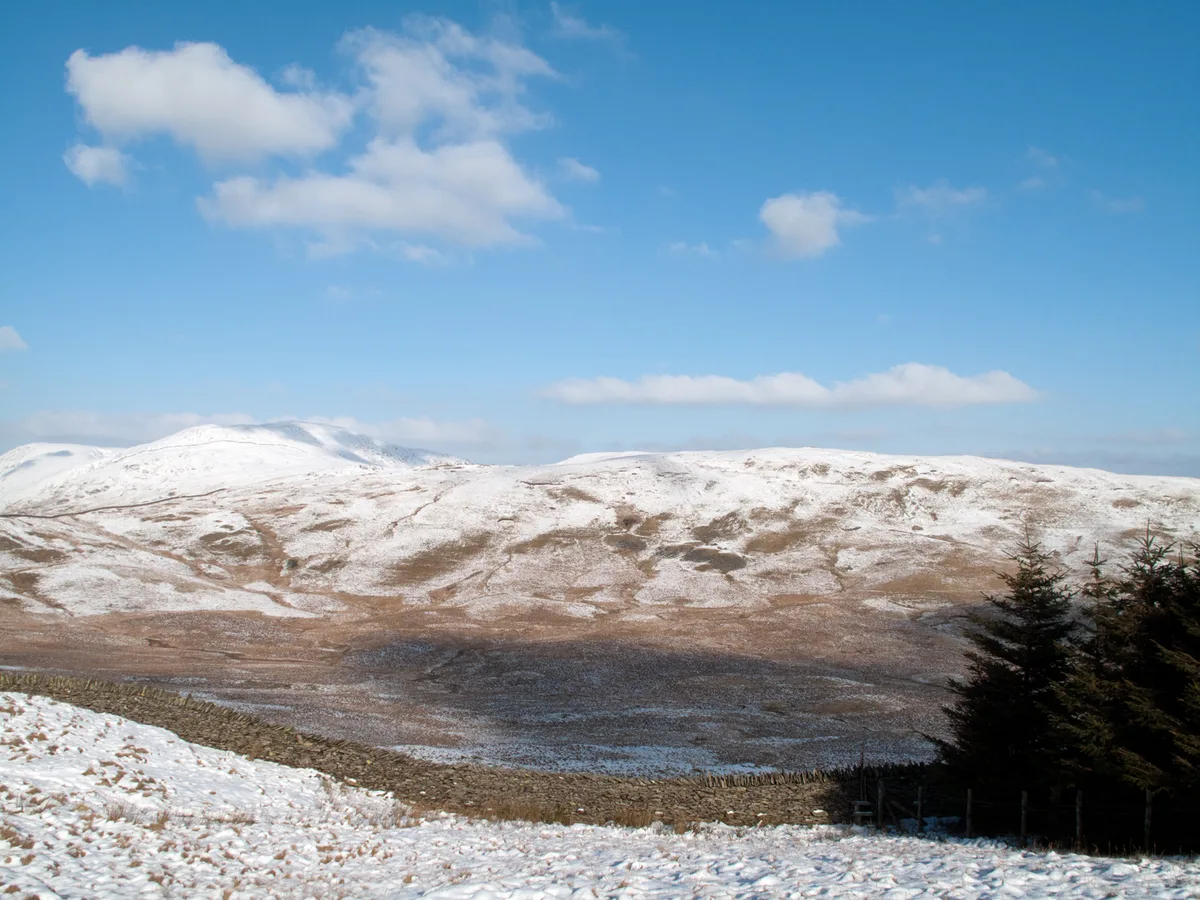
Sour Howes — Named summit at 483 m.

Wikimedia Commons contributors — see linked file page for photographer and licence licence
Plan your visit
- Typical visit
- 3 h–8 h
- Best time of year
- Late spring – early autumn (May–Oct)
- Nearest railway station
- Windermere · 4.8 km
- Free entry
- Dog-friendly
About
Sour Howes is a named summit in the United Kingdom. Wikidata describes it as: "Named summit at 483 m.". Coordinates: 54.4212°, -2.8836°.
Photo gallery
Protected designations
- Site of Special Scientific Interest: River Kent and Tributaries SSSI
- Site of Special Scientific Interest: River Eden and Tributaries SSSI
Designations sourced from Natural England open data under OGL v3.
From the Wikipedia article
Sour Howes is a small fell in the English Lake District. It is situated five kilometres east of Ambleside, between the Troutbeck and Kentmere valleys and is one of the two separate fells on Applethwaite Common (the other being Sallows).
Excerpt from Wikipedia under CC BY-SA 4.0. See the source article linked in Sources below.
- Coordinates
- 54.4212, -2.8836
- District
- Westmorland and Furness
- Parish
- Lakes
- Postcode
- LA23 1PR
- Parliamentary constituency
- Westmorland and Lonsdale
- Nearest railway station
- Windermere — 4.8 km
Sources
- osm: n4429492813 (ODbL)
- wikipedia: Sour Howes (CC BY-SA 4.0)
- commons: Sour Howes from Sallows.jpg (CC BY-SA 4.0)
Other places nearby
Loading nearby places…
Nearby
Caravan parks · North West England
Limefitt Holiday Park
Limefitt Holiday Park — a caravan park in england north west. Brand: Parkdean Resorts.
 📷 5
📷 5Mountains & hills · North West England
Sallows
Sallows — Named summit at 516 m.
 📷 5
📷 5Other places · North West England
Troutbeck, Lakes
Troutbeck, Lakes — a other in england-north-west, United Kingdom.
 📷 3
📷 3Reservoirs & lochs · North West England
Borrans Reservoir
Borrans Reservoir — reservoir in Cumbria, England, UK.
 📷 3
📷 3Natural landmarks · North West England
Townend
Townend — a other in england-north-west, United Kingdom.
 📷 3
📷 3Archaeological sites · North West England
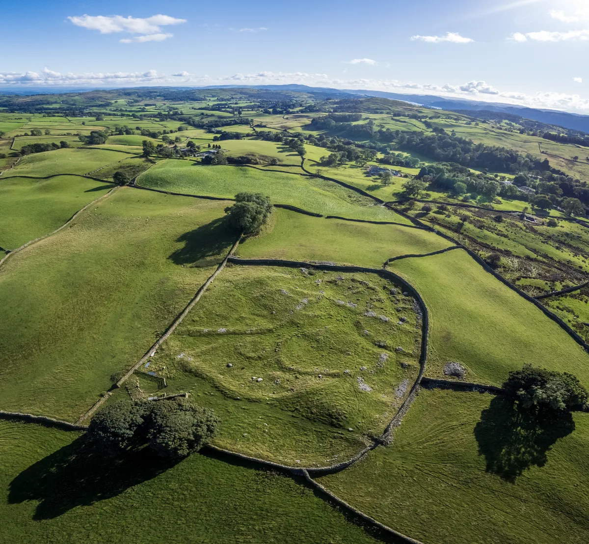
Romano-British settlement, 450m east of High Borrans
Romano-British settlement, 450m east of High Borrans — archaeological site in Hugill, South Lakeland, England, UK.
More mountains in this region
 📷 3
📷 3Mountains & hills · North West England
Allen Crags
Allen Crags — Named summit at 785 m.
 📷 3
📷 3Mountains & hills · North West England
Alum Pot
Alum Pot — Open shaft pothole in North Yorkshire.
 📷 3
📷 3Mountains & hills · North West England
Arnside Knott
Arnside Knott — Named summit at 159 m.
 📷 3
📷 3Mountains & hills · North West England
Aye Gill Pike
Aye Gill Pike — Named summit at 556.3 m.
Frequently asked questions
- Where is Sour Howes?
- Sour Howes is in North-West England, United Kingdom (postcode LA23 1PR), in the parish of Lakes.
- Is Sour Howes a protected site?
- Yes — Sour Howes is part of the River Kent and Tributaries SSSI Site of Special Scientific Interest and the River Eden and Tributaries SSSI Site of Special Scientific Interest.
- Is Sour Howes free to visit?
- Yes, Sour Howes is free to enter.
- How do I get to Sour Howes?
- The nearest railway station is Windermere, about 4.8 km away. Drivers can navigate to postcode LA23 1PR.