Mountains & hills · Northern Ireland
Slievenaglogh
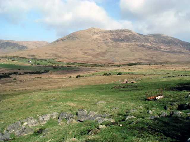
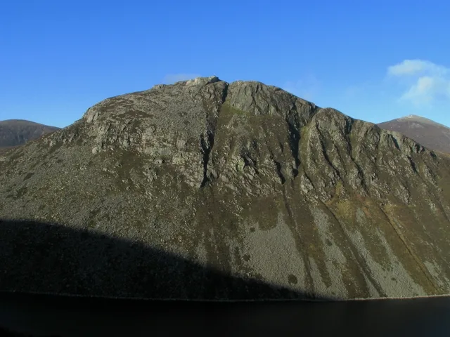
Slievenaglogh — mountain in northern ireland. Elevation: 584.4 m.

Eric Jones — CC BY-SA 2.0 via Wikimedia Commons licence
Plan your visit
- Typical visit
- 3 h–8 h
- Best time of year
- Late spring – early autumn (May–Oct)
About
Slievenaglogh is a mountain located in northern ireland. Elevation: 584.4 m. A named British peak recorded in OpenStreetMap. Peaks are typically named on Ordnance Survey 1:50k mapping.
Photo gallery
- Coordinates
- 54.1937, -5.9661
Sources
- osm: n332372846 (ODbL)
Other places nearby
Loading nearby places…
Nearby
 📷 5
📷 5Mountains & hills · Northern Ireland
Slievenaglogh East Top
Slievenaglogh East Top — mountain in northern ireland. Elevation: 571 m.
 📷 5
📷 5Mountains & hills · Northern Ireland
Slieve Corragh
Slieve Corragh — mountain in northern ireland. Elevation: 641.9 m.
 📷 5
📷 5Mountains & hills · Northern Ireland
Luke's Mountain
Luke's Mountain — mountain in northern ireland. Elevation: 391 m.
 📷 5
📷 5Mountains & hills · Northern Ireland
Slieve Bearnagh North Tor
Slieve Bearnagh North Tor — mountain in northern ireland. Elevation: 680 m.
 📷 3
📷 3Natural landmarks · Northern Ireland
Slieve Muck
Slieve Muck — mountain in Northern Ireland.
 📷 3
📷 3Natural landmarks · Northern Ireland
Slieve Bearnagh
Slieve Bearnagh — mountain in the United Kingdom.
Where to eat & stay near Slievenaglogh
Places to stay
 📷 5
📷 5Campsites · Northern Ireland
Meelmore Lodge
Meelmore Lodge — a campsite in northern ireland.
📷 5Hostels · Northern Ireland
Meelmore Lodge
Meelmore Lodge — a hostel in northern ireland.
 📷 5
📷 5Caravan parks · Northern Ireland
The Rock Caravan Site
The Rock Caravan Site — a caravan park in northern ireland.
 📷 5
📷 5Campsites · Northern Ireland
Tollymore Forest Park - Campsite
Tollymore Forest Park - Campsite — a campsite in northern ireland.
 📷 5
📷 5Caravan parks · Northern Ireland
Tollymore Forest
Tollymore Forest — a caravan park in northern ireland.
 📷 5
📷 5Campsites · Northern Ireland
1st Newcastle Scouts Camp Site
1st Newcastle Scouts Camp Site — a campsite in northern ireland.

More mountains in this region
 📷 5
📷 5Mountains & hills · Northern Ireland
Belfast Lough
Belfast Lough — intertidal inlet in Northern Ireland.
 📷 5
📷 5Mountains & hills · Northern Ireland
Belmore Mountain
Belmore Mountain — Named summit at 398 m.
 📷 4
📷 4Mountains & hills · Northern Ireland
Ben Crom
Ben Crom — Named summit at 526 m.
 📷 3
📷 3Mountains & hills · Northern Ireland
Benbradagh
Benbradagh — Named summit at 465 m.
Frequently asked questions
- Where is Slievenaglogh?
- Slievenaglogh is in Northern Ireland, United Kingdom.
- What is Slievenaglogh?
- Slievenaglogh — mountain in northern ireland. Elevation: 584.4 m.
- How do I get to Slievenaglogh?
- Its coordinates are 54.1937°, -5.9661°.