
Mountains & hills · Northern Ireland
Slieve Donard
Also known as: Sliabh Dónairt
In or near Kilcoo.
Slieve Donard — Named summit at 849 m.

Wikimedia Commons contributors — see linked file page for photographer and licence licence

Plan your visit
- Typical visit
- 3 h–8 h
- Best time of year
- Late spring – early autumn (May–Oct)
- Free entry
- Family-friendly
- Dog-friendly
About
Slieve Donard is a named summit in the United Kingdom. Also known as: Sliabh Dónairt. Wikidata describes it as: "Named summit at 849 m.". Coordinates: 54.1802°, -5.9210°.
Photo gallery
Official information
Slieve Donard is the highest peak in Northern Ireland, standing at 850 meters. It is part of the Mourne Mountains and offers stunning views and various walking routes for outdoor enthusiasts.
From the Wikipedia article
Slieve Donard ( SLEEV DON-ərd; from Irish Sliabh Dónairt, meaning 'Dónairt's mountain') is the highest mountain in Northern Ireland, the highest in Ulster, and the seventh-highest in Ireland, with a height of 850 metres (2,790 ft). The highest of the Mourne Mountains, it is near the town of Newcastle on the eastern coast of County Down, overlooking the Irish Sea. It is also the highest mountain in the northern half of Ireland. The Mourne Wall – built in the early 20th century – runs up the western and southern slopes of the mountain, joining a small stone tower at the summit. Also on the summit are the remains of two ancient burial cairns, one of which is the remains of the highest known passage tomb in Ireland. In Irish mythology the mountain was associated with the mythical figures Boirche and Slángha. It was later associated with, and named after, Saint Donard, who was said to have made the summit his hermitage. Up until the 1830s, people would climb the mountain as part of a yearly pilgrimage, which may have originally been a Lughnasadh (harvest) ritual. Royal Engineers camped on the summit for four months in 1826 as part of the Ordnance Survey's Principal Triangulation. It is located in the southeastern part of Northern Ireland.
Excerpt from Wikipedia under CC BY-SA 4.0. See the source article linked in Sources below.
Background
History
It is likely that Slieve Donard was seen as a sacred mountain in the far past. Irish mythology identifies the Great Cairn as being the tomb or abode of mythical figures, and an entrance to the Otherworld. In Cath Maige Tuired ('The Battle of Moytura'), Slieve Donard is called one of the "twelve chief mountains" of Ireland, while in the Triads of Ireland it is called one of the "three great heights" of Ireland, along with Croagh Patrick and Great Sugar Loaf. Beann Boirche means 'Boirche's Peak', referring to a mythical cowherd and king who had seemingly supernatural powers. The plural name Beanna Boirche ('Boirche's Peaks') was given to the Mourne Mountains. The name Sliabh Slángha means…
Sourced from Wikipedia under CC BY-SA 4.0.
- Coordinates
- 54.1802, -5.9210
- Address
- County Down, Northern Ireland
- Official site
- www.highpointireland.com
Sources
- osm: n332372503 (ODbL)
- wikipedia: Slieve Donard (CC BY-SA 4.0)
- commons: Slieve Donard - geograph.org.uk - 1138189.jpg (CC BY-SA 4.0)
Other places nearby
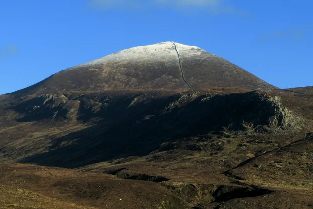
Slieve Donard
Natural landmarks · 0.0 km

Crossone
Mountains & hills · 1.0 km

Glen River, County Down
Natural landmarks · 1.2 km

Annalong Buttress
Climbing & bouldering crags · 1.2 km
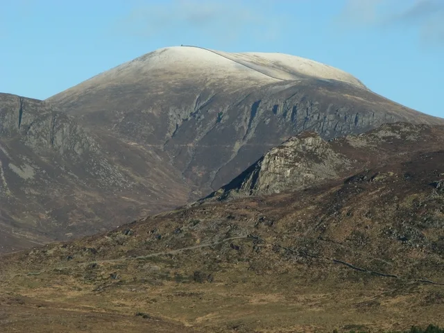
Slieve Commedagh
Mountains & hills · 1.5 km

Sliabh Coimheideach
Mountains & hills · 1.5 km
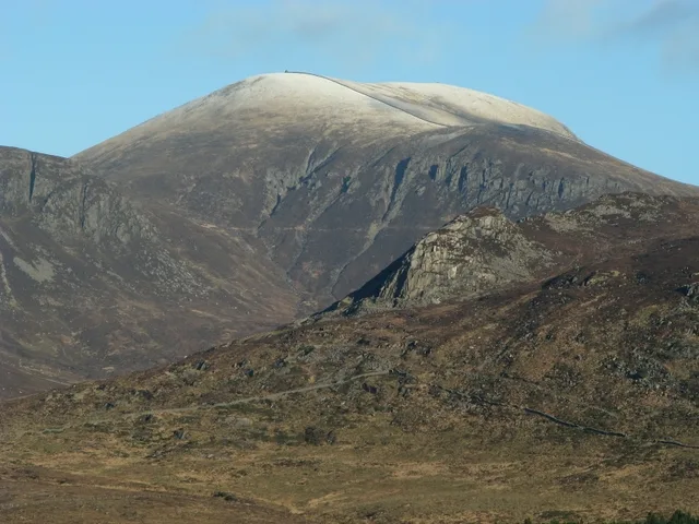
Slieve Commedagh
Natural landmarks · 1.5 km

Black Stairs
Waterfalls · 1.7 km
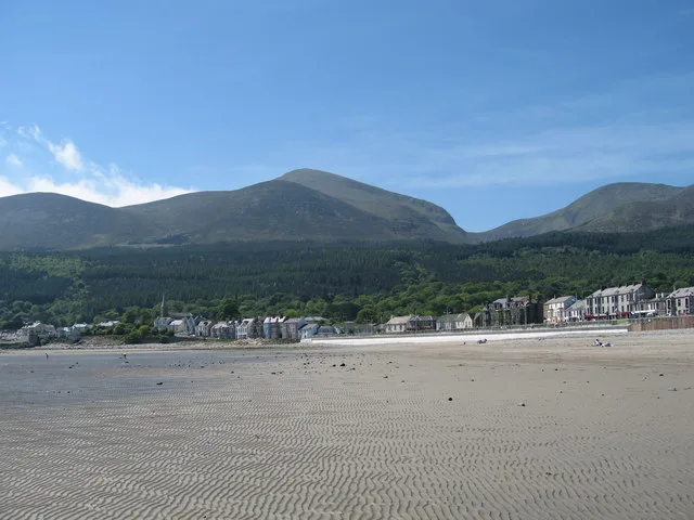
Millstone Mountain
Mountains & hills · 1.7 km

Sliabh Beag
Mountains & hills · 1.7 km
Slieve Beg
Mountains & hills · 1.7 km

Chimney Rock Mtn
Mountains & hills · 2.1 km
Nearby
📷 3Natural landmarks · Northern Ireland
Slieve Donard
Slieve Donard — mountain in County Down, Northern Ireland, UK.
📷 5Mountains & hills · Northern Ireland
Crossone
Crossone — mountain in northern ireland. Elevation: 540.0 m.
📷 4Natural landmarks · Northern Ireland
Glen River, County Down
Glen River, County Down in Northern Ireland, United Kingdom.
📷 5Climbing & bouldering crags · Northern Ireland
Annalong Buttress
Annalong Buttress — a climbing crag in northern ireland.
📷 4📷 5Mountains & hills · Northern Ireland
Sliabh Coimheideach
Sliabh Coimheideach — a hill or mountain in northern ireland.
Where to eat & stay near Slieve Donard
Places to stay
 📷 5
📷 5Campsites · Northern Ireland
Millstone Motorhome, Caravan and Camping Park
Millstone Motorhome, Caravan and Camping Park — a campsite in northern ireland.
 📷 5
📷 5 📷 5
📷 5 📷 5
📷 5Campsites · Northern Ireland
1st Newcastle Scouts Camp Site
1st Newcastle Scouts Camp Site — a campsite in northern ireland.
 📷 5
📷 5Hostels · Northern Ireland
Hutt Backpackers Hostel
Hutt Backpackers Hostel — a hostel in northern ireland.
 📷 5
📷 5Hotels · Northern Ireland
Slieve Donard
Slieve Donard — a hotel in northern ireland. 5-star. Brand: Marine & Lawn Hotels & Resorts.
Places to eat & drink
 📷 3
📷 3Historic pubs · Northern Ireland
Soma Festival
The Soma Festival (Sanskrit: सोम, or sóma, meaning drink of the Gods, see Soma (drink); Irish: Féile Soma) is an annual music, arts, and cultural festival. The festival includes concerts, musical perf
More mountains in this region
 📷 5
📷 5Mountains & hills · Northern Ireland
Belfast Lough
Belfast Lough — intertidal inlet in Northern Ireland.
 📷 5
📷 5 📷 4
📷 4 📷 3
📷 3Mountains & hills · Northern Ireland
Benbradagh
Benbradagh — Named summit at 465 m.
Frequently asked questions
- Where is Slieve Donard?
- Slieve Donard is in Northern Ireland, United Kingdom.
- What is Slieve Donard?
- Slieve Donard — Named summit at 849 m.
- How do I get to Slieve Donard?
- The nearest town is Kilcoo. Its coordinates are 54.1802°, -5.9210°.
- Is Slieve Donard free to visit?
- Yes, Slieve Donard is free to enter.