
Wildlife reserves · North East England
Sleightholme Beck Gorge – The Troughs
In or near Gilmonby.
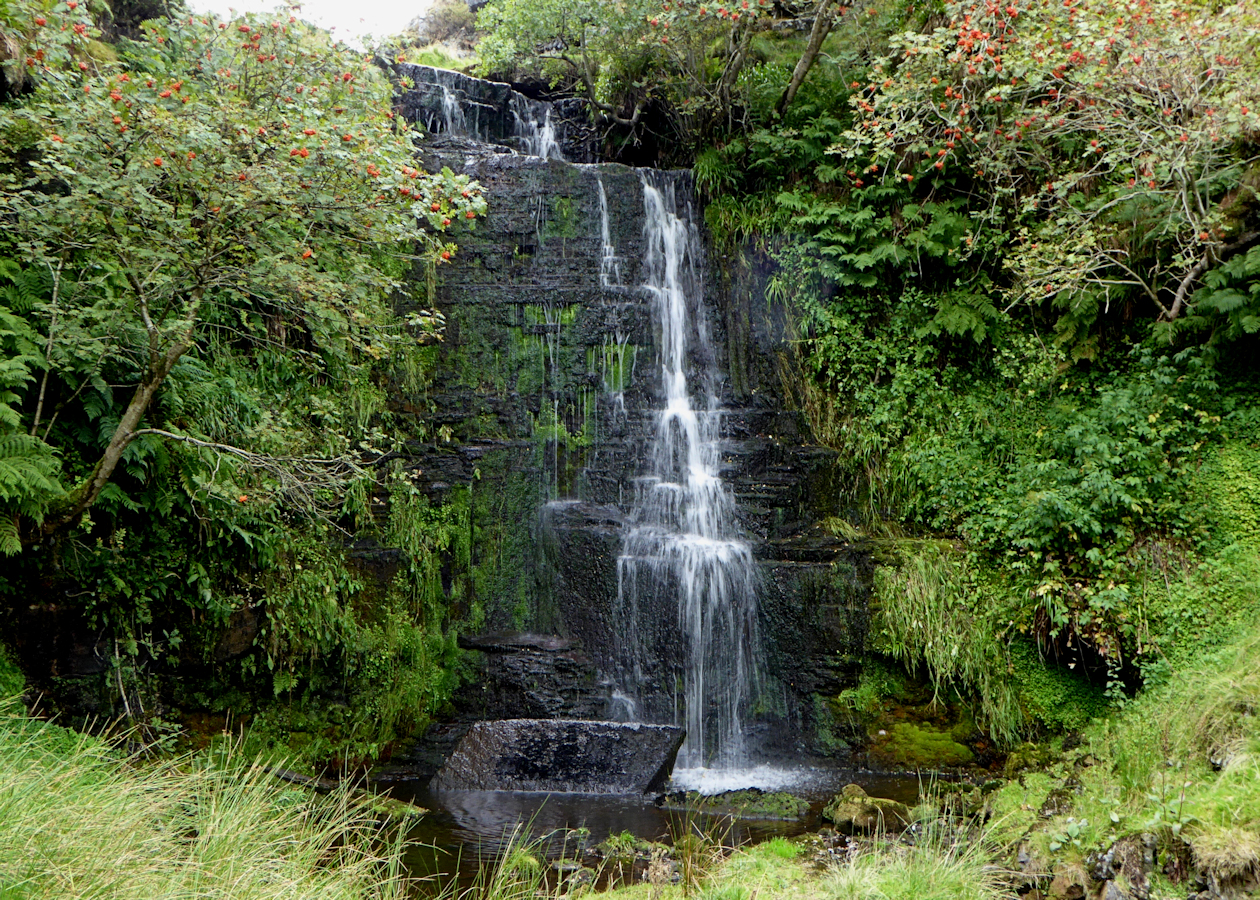
Sleightholme Beck Gorge – The Troughs in England North East, United Kingdom.

Oliver Dixon — CC BY-SA 2.0 via Wikimedia Commons licence

Plan your visit
- Typical visit
- 2 h–4 h
- Best time of year
- Autumn & winter (migration & wildfowl)
- Free entry
- Dog-friendly
About
Sleightholme Beck Gorge – The Troughs is a place of interest in England North East, United Kingdom — drawn from open-data sources for visitor reference. See the linked Wikipedia article for the full description.
Photo gallery
Official information
Sleightholme Beck Gorge - The Troughs is a Site of Special Scientific Interest (SSSI) located in County Durham. It features a mix of habitats and is recognized for its ecological importance.
Protected designations
- Site of Special Scientific Interest: Bowes Moor SSSI
- Site of Special Scientific Interest: Sleightholme Beck Gorge - The Troughs SSSI
- Area of Outstanding Natural Beauty: North Pennines
Designations sourced from Natural England open data under OGL v3.
From the Wikipedia article
Sleightholme Beck Gorge – The Troughs is a Site of Special Scientific Interest in the County Durham district of south-west County Durham, England. The site covers a gorge in the valley of Sleightholme Beck between the hamlet of Sleightholme and the confluence with the River Greta, some 3 km upriver from the village of Bowes. The trough is 200m east of the border with Wytham Moor, part of the neighbouring Bowes Moor SSSI. The site has both biological and geological interest and has been designated of national importance in the Geological Conservation Review. The gorge is incised through the Namurian Great Limestone and is of particular interest because beds of sandstone in the middle of the section show structures characteristic of a shoreline, with the features of a river delta and barrier bar. The shallow soils that have developed on ledges and crevices in the limestone and on the scree slopes support a vegetation in which ferns such as maidenhair spleenwort, Asplenium trichomanes, green spleenwort, A. viride, and brittle bladder fern, Cystopteris fragilis, are prominent. Woodland plants such as wood sorrel, Oxalis acetosella, wood millet, Milium effusum, and dog's mercury, Mercurialis perennis, have established themselves in the shadier crevices, while rue-leaved saxifrage, Saxifraga tridactylites, shining cranesbill Geranium lucidum, and common whitlow grass, Erophila verna, occur in the most exposed situations. On the most inaccessible valley slopes, there is open woodland in which yew, Taxus baccata, is abundant. Dipper and common sandpiper have been recorded from the site and probably breed in the area.
Excerpt from Wikipedia under CC BY-SA 4.0. See the source article linked in Sources below.
- Coordinates
- 54.5028, -2.0533
- District
- County Durham
- Parish
- Gilmonby
- Postcode
- DL12 9NA
- Parliamentary constituency
- Bishop Auckland
- Established
- 1976
- Official site
- designatedsites.naturalengland.org.uk
Sources
- wikidata: Q7540030 (CC0)
- wikipedia: Sleightholme Beck Gorge – The Troughs (CC BY-SA 4.0)
Other places nearby

Late prehistoric settlement
Archaeological sites · 0.3 km

Late prehistoric settlement
Archaeological sites · 0.3 km

Late prehistoric walled settlement
Archaeological sites · 0.6 km
Late prehistoric walled settlement
Archaeological sites · 0.6 km
Romano-British settlement
Archaeological sites · 0.7 km
Bridge, 220 Metres North Of East Mellwaters Farmhouse
Historic bridges · 0.9 km
Huggill Force
Waterfalls · 1.1 km

God's Bridge
Wildlife reserves · 1.1 km

Citron Seat
Mountains & hills · 2.0 km

Sleightholme
Other places · 2.0 km

Roman Signal Station
Archaeological sites · 2.1 km

Ivy Hall Farm Campsite
Campsites · 2.8 km
Nearby
📷 3Archaeological sites · North East England
Late prehistoric settlement
Late prehistoric settlement — a archaeological in england-north-east, United Kingdom.
📷 5Archaeological sites · North East England
Late prehistoric settlement
Late prehistoric settlement — archaeological in england north east.
📷 3Archaeological sites · North East England
Late prehistoric walled settlement
Late prehistoric walled settlement — a archaeological in england-north-east, United Kingdom.
📷 5Archaeological sites · North East England
Late prehistoric walled settlement
Late prehistoric walled settlement — archaeological in england north east.
📷 5Archaeological sites · North East England
Romano-British settlement
Romano-British settlement — archaeological in england north east.
📷 3Historic bridges · North East England
Bridge, 220 Metres North Of East Mellwaters Farmhouse
Bridge, 220 Metres North Of East Mellwaters Farmhouse — Grade II listed building-listed bridge in england-north-east, United Kingdom.
Where to eat & stay near Sleightholme Beck Gorge – The Troughs
Places to stay
📷 5Campsites · North East England
Ivy Hall Farm Campsite
Ivy Hall Farm Campsite — a campsite in england north east.
 📷 5
📷 5Campsites · North East England
The Old Armoury Campsite
The Old Armoury Campsite — a campsite in england north east.
 📷 5
📷 5Caravan parks · North East England
Bowfield Farm Camping and Caravaning
Bowfield Farm Camping and Caravaning — a caravan park in england north east.
 📷 5
📷 5Campsites · North East England
The Wilderness Company
The Wilderness Company — a campsite in england north east.
 📷 5
📷 5Campsites · North East England
Barnard Castle Camping and Caravanning Club Site
Barnard Castle Camping and Caravanning Club Site — a campsite in england north east.
 📷 5
📷 5Caravan parks · North East England
Pecknell Farm Caravan Site
Pecknell Farm Caravan Site — a caravan park in england north east.
Places to eat & drink
 📷 5
📷 5 📷 5
📷 5Historic pubs · North East England
The White Swan Public House And Swan Cottage
The White Swan Public House And Swan Cottage in England North East, United Kingdom.
 📷 5
📷 5Historic pubs · North East England
Blue Bell Public House
Blue Bell Public House in England North East, United Kingdom.
 📷 5
📷 5Historic pubs · North East England
Turk's Head Public House
Turk's Head Public House in England North East, United Kingdom.
 📷 5
📷 5 📷 6
📷 6Historic pubs · North East England
Commercial Hotel
Commercial Hotel in England North East, United Kingdom.
More places in this region
 📷 3
📷 3Wildlife reserves · North East England
Augill Pasture
Augill Pasture — nature reserve in Cumbria, England.
 📷 4
📷 4Wildlife reserves · North East England
Ash Fell Edge
Ash Fell Edge in England North East, United Kingdom.
 📷 4
📷 4Wildlife reserves · North East England
Sunbiggin Tarn
Sunbiggin Tarn in England North East, United Kingdom.
 📷 3
📷 3Wildlife reserves · North East England
Aules Hill Meadows
Aules Hill Meadows in England North East, United Kingdom.
Frequently asked questions
- Where is Sleightholme Beck Gorge – The Troughs?
- Sleightholme Beck Gorge – The Troughs is in North-East England, United Kingdom (postcode DL12 9NA), in the parish of Gilmonby.
- What is Sleightholme Beck Gorge – The Troughs?
- Sleightholme Beck Gorge – The Troughs in England North East, United Kingdom.
- How do I get to Sleightholme Beck Gorge – The Troughs?
- Drivers can use postcode DL12 9NA.
- When was Sleightholme Beck Gorge – The Troughs built?
- Built or established in 1976.
- Is Sleightholme Beck Gorge – The Troughs a protected site?
- Yes — Sleightholme Beck Gorge – The Troughs is part of the Bowes Moor SSSI Site of Special Scientific Interest and the Sleightholme Beck Gorge - The Troughs SSSI Site of Special Scientific Interest.
- Is Sleightholme Beck Gorge – The Troughs free to visit?
- Yes, Sleightholme Beck Gorge – The Troughs is free to enter.
- How do I get to Sleightholme Beck Gorge – The Troughs?
- Drivers can navigate to postcode DL12 9NA. It sits within the Bishop Auckland parliamentary constituency.
- Are dogs allowed at Sleightholme Beck Gorge – The Troughs?
- Most wildlife reserves allow dogs on lead only, with restrictions during ground-nesting bird season (March-July). Check signage at the reserve.