
Manor houses · South West England
Site of the medieval manor house and associated buildings of Kingston Lacy
In or near Corfe Mullen.
Site of the medieval manor house and associated buildings of Kingston Lacy — scheduled monument-listed manor in england-south-east, United Kingdom.

Chris Gunns — CC BY-SA 2.0 via Wikimedia Commons licence

Plan your visit
- Typical visit
- 1 h–2 h
- Nearest railway station
- Hamworthy · 9.7 km
- Limited wheelchair access
Getting there & planning your visit
To visit the Site of the medieval manor house and associated buildings of Kingston Lacy, the nearest railway station is Hamworthy, located 9.7 km away. The postcode for sat-nav is BH21 4EA. Accessibility is limited for wheelchair users.
About
Site of the medieval manor house and associated buildings of Kingston Lacy is a scheduled monument-listed manor in england-south-east, United Kingdom, registered on the National Heritage List for England (NHLE entry 1463802). Listed status protects buildings and structures of special architectural or historic interest. See the linked Wikipedia article for further details.
Photo gallery
Heritage listing
Details PRINCIPAL ELEMENTS The monument includes the slight earthworks and buried remains of the medieval manor house and associated ancillary buildings of the inner court at Kingston Lacy. The site is situated within gently undulating parkland, in an area known historically as Court Close, to the north and north-west of the present Kingston Lacy House. DESCRIPTION A number of earthworks, including a low platform that is roughly square on plan, slight terraces and several smaller platforms, are visible in the area to the north of the current Kingston Lacy House. These correspond broadly with the location of the high resistance features recorded during the geophysical survey undertaken in 1996. This confirmed the location of the house which was found to have approximate dimensions of 40m north-south and 25m west-east. It also identified further buried features which have been interpreted as the remains of other possible buildings within the inner court and the boundary walls of this enclosure. A small excavation in 1997 on the site of the manor house itself uncovered a length of walling, some 1.3m wide, that was faced with Heathstone ashlar and had a flint rubble core. Building debris such as dressed stone, roofing tiles, mortar and fragments of painted plaster and a series of floor surfaces were also uncovered. Artefacts found during the excavation included medieval and post-medieval pottery sherds, glazed floor tiles, animal and fish bones and shells. EXTENT OF SCHEDULING The area of protection aims to include the earthworks and buried archaeological remains relating to the buildings of the inner court of the medieval house at Kingston Lacy. The scheduled area therefore forms a roughly-triangular shaped parcel with maximum dimensions of 200m from north-west to south-ea
From the Historic England List Entry under OGL v3.
Protected designations
- Site of Special Scientific Interest: River Avon System SSSI
- Area of Outstanding Natural Beauty: Dorset
- Area of Outstanding Natural Beauty: Cranborne Chase & West Wiltshire Downs
Designations sourced from Natural England open data under OGL v3.
Place summary
The Site of the medieval manor house and associated buildings of Kingston Lacy is located in Pamphill, South-East England, postcode BH21. It is designated as a scheduled monument, reflecting its historical significance.
AI-generated from the structured facts on this page (operator, designation, listing, era). Not a substitute for visiting.
- Coordinates
- 50.8125, -2.0313
- District
- Dorset
- Parish
- Pamphill
- Postcode
- BH21 4EA
- Parliamentary constituency
- Mid Dorset and North Poole
- Phone
- +44 1202 883402
- Nearest railway station
- Hamworthy — 9.7 km
- Official site
- www.nationaltrust.org.uk
Sources
- wikidata: Q97440477 (CC0)
Other places nearby

Kingston Lacy
Manor houses · 0.2 km

Philae Obelisk
Memorials & monuments · 0.3 km

Obelisk 230 M South-East Of Kingston Lacy House
Forts · 0.4 km

Obelisk 330 Metres South West Of Kingston Lacy House
Forts · 0.5 km

Abbott Street Wood
Literary houses · 1.0 km
Pamphill
Castles · 1.0 km
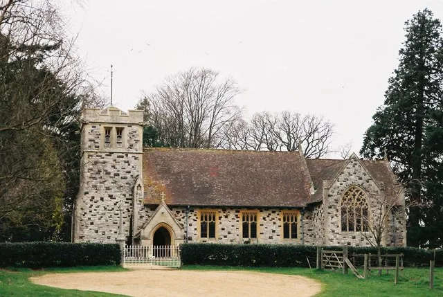
St Stephen's Church, Pamphill
Historic churches · 1.1 km

Pamphill Manor House
Historic houses · 1.4 km

The Vine, Pamphill
Historic pubs · 1.9 km
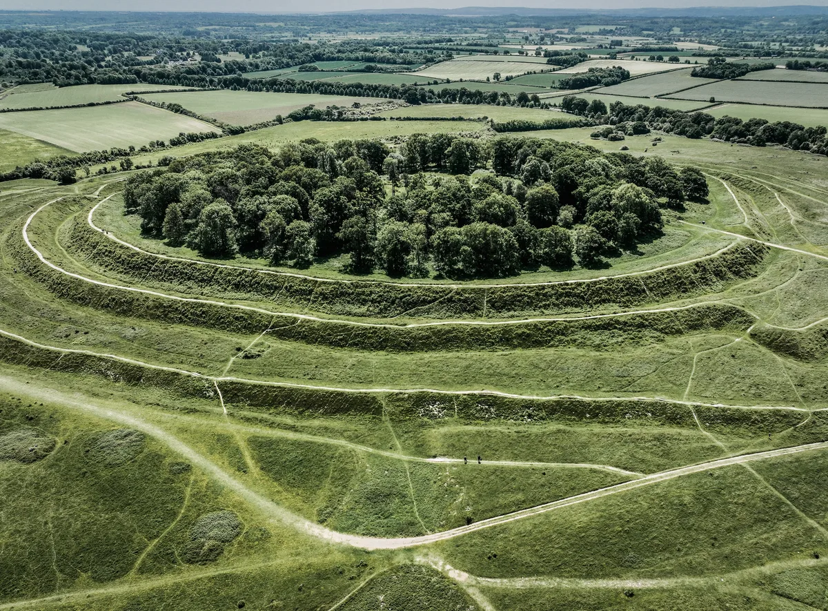
Badbury Rings
Hill forts · 2.1 km

Farrs Meadow
Campsites · 2.1 km

Badbury Rings
Mountains & hills · 2.2 km
Nearby
📷 5Manor houses · South West England
Kingston Lacy
Kingston Lacy — a manor in england-south-east, United Kingdom.
📷 5Memorials & monuments · South West England
Philae Obelisk
Philae Obelisk is a memorial in the United Kingdom.
📷 5Forts · South West England
Obelisk 230 M South-East Of Kingston Lacy House
Obelisk 230 M South-East Of Kingston Lacy House — a martello broad in england-south-east, United Kingdom.
📷 5Forts · South West England
Obelisk 330 Metres South West Of Kingston Lacy House
Obelisk 330 Metres South West Of Kingston Lacy House — a martello broad in england-south-east, United Kingdom.
📷 5Literary houses · South West England
Abbott Street Wood
Abbott Street Wood — a literary house museum in england south east.
📷 5Where to eat & stay near Site of the medieval manor house and associated buildings of Kingston Lacy
Places to stay
📷 5Campsites · South West England
Farrs Meadow
Farrs Meadow — a campsite in england south east.
 📷 5
📷 5Campsites · South West England
Charris Car.& Camp. Park
Charris Car.& Camp. Park — a campsite in england south east.
 📷 5
📷 5Campsites · South West England
Wilksworth Farm C.P.
Wilksworth Farm C.P. — a campsite in england south east.
📷 5Caravan parks · South West England
Springfield Touring Park
Springfield Touring Park — a caravan park in england south east.
 📷 5
📷 5Caravan parks · South West England
Merley Court Holiday Park
Merley Court Holiday Park — a caravan park in england south east.
 📷 5
📷 5Campsites · South West England
Merley Court Touring Park
Merley Court Touring Park — a campsite in england south east.
Places to eat & drink
📷 5Historic pubs · South West England
The Vine, Pamphill
The Vine, Pamphill in England South West, United Kingdom.
 📷 7
📷 7Historic pubs · South West England
The Green Man Inn
The Green Man Inn in England South West, United Kingdom.
 📷 7
📷 7Historic pubs · South West England
The Man in the Wall
The Man in the Wall in England South West, United Kingdom.
 📷 5
📷 5Historic pubs · South West England
Albion Hotel And Chandlers Wine Shop
Albion Hotel And Chandlers Wine Shop in England South West, United Kingdom.
 📷 5
📷 5Historic pubs · South West England
The Rising Sun
The Rising Sun in England South West, United Kingdom.
 📷 7
📷 7Restaurants · South West England
Three Kings
Three Kings — a restaurant in england south east.
More places in this region
 📷 5
📷 5Manor houses · South West England
Westwood Manor, National Trust
Westwood Manor, National Trust — a manor in england-south-east, United Kingdom.
 📷 5
📷 5Manor houses · South West England
Great Chalfield Manor
Great Chalfield Manor — a manor in england-south-east, United Kingdom.
 📷 5
📷 5Manor houses · South West England
Wolfeton House
Wolfeton House — a manor in england-south-east, United Kingdom.
 📷 5
📷 5Frequently asked questions
- Where is Site of the medieval manor house and associated buildings of Kingston Lacy?
- Site of the medieval manor house and associated buildings of Kingston Lacy is in South-East England, United Kingdom (postcode BH21 4EA), in the parish of Pamphill.
- What is Site of the medieval manor house and associated buildings of Kingston Lacy?
- Site of the medieval manor house and associated buildings of Kingston Lacy — scheduled monument-listed manor in england-south-east, United Kingdom.
- How do I get to Site of the medieval manor house and associated buildings of Kingston Lacy?
- The nearest railway station is Hamworthy, about 9.7 km away. Drivers can use postcode BH21 4EA.
- Is Site of the medieval manor house and associated buildings of Kingston Lacy a listed building?
- Site of the medieval manor house and associated buildings of Kingston Lacy is officially recognised as scheduled monument listed.
- Is Site of the medieval manor house and associated buildings of Kingston Lacy a protected site?
- Yes — Site of the medieval manor house and associated buildings of Kingston Lacy is part of the River Avon System SSSI Site of Special Scientific Interest and the Dorset National Landscape (AONB).
- How do I get to Site of the medieval manor house and associated buildings of Kingston Lacy?
- Drivers can navigate to postcode BH21 4EA. It sits within the Mid Dorset and North Poole parliamentary constituency.