Mountains & hills · Scottish Highlands
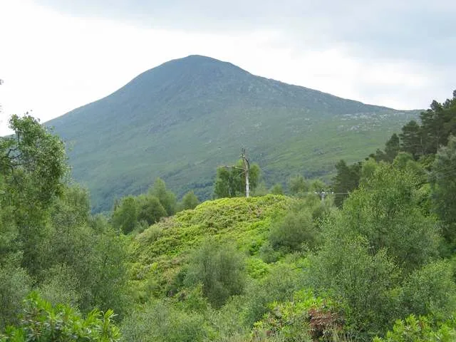
Sgurr a' Mheadhain
Sgurr a' Mheadhain — a hill or mountain in scotland highlands.

Graham Cole — CC BY-SA 2.0 via Wikimedia Commons licence
Plan your visit
- Typical visit
- 3 h–8 h
- Best time of year
- Late spring – early autumn (May–Oct)
About
A British hill or mountain, named on Ordnance Survey maps and walked by hill-baggers. Sgurr a' Mheadhain is a named hill or mountain in scotland highlands, recorded in the GeoNames UK gazetteer. British landmarks of this type are typically marked on Ordnance Survey maps and recorded in the national gazetteer for cartographic and navigational reference. Coordinates and feature classification are sourced from the GeoNames open dataset.
Photo gallery
Place summary
Sgurr a' Mheadhain is a mountain located in the Scottish Highlands. It is part of the Skye Cuillin range, known for its rugged terrain and dramatic peaks. The mountain offers challenging hiking routes and stunning views of the surrounding landscape, making it a notable destination for experienced walkers and climbers.
AI-generated from the structured facts on this page (operator, designation, listing, era). Not a substitute for visiting.
- Coordinates
- 56.8260, -5.6920
Sources
- manual: geonames-12616595 (CC BY 4.0)
Other places nearby
Loading nearby places…
Nearby
 📷 3
📷 3Reservoirs & lochs · Scottish Islands
Moidart
Moidart in Scotland Islands, United Kingdom.
📷 5Mountains & hills · Scottish Highlands
Sgùrr Dhomhuill Mòr
Sgùrr Dhomhuill Mòr — mountain in scotland highlands. Elevation: 713 m.
📷 5Mountains & hills · Scottish Highlands
Sgurr Dhomhuill Mor
Sgurr Dhomhuill Mor — a hill or mountain in scotland highlands.
 📷 5
📷 5Mountains & hills · Scottish Highlands
Rois-Bheinn West Top
Rois-Bheinn West Top — a hill or mountain in scotland highlands.
 📷 3
📷 3Natural landmarks · Scottish Highlands
Rois-bheinn
Rois-bheinn — mountain in Highland, Scotland, UK.
 📷 3
📷 3Mountains & hills · Scottish Highlands
Rois-Bheinn
Rois-Bheinn — Named summit at 882 m.
Where to eat & stay near Sgurr a' Mheadhain
Places to stay
 📷 5
📷 5Hostels · Scottish Highlands
Ariundle Centre
Ariundle Centre — a hostel in scotland highlands.
 📷 5
📷 5Campsites · Scottish Highlands
Tigh na Mara
Tigh na Mara — a campsite in scotland highlands.
 📷 5
📷 5Campsites · Scottish Highlands
Invercaimbe caravan and campsite
Invercaimbe caravan and campsite — a campsite in scotland highlands.
 📷 5
📷 5Hostels · Scottish Highlands
The Sleeping Car
The Sleeping Car — a hostel in scotland highlands.
 📷 5
📷 5Campsites · Scottish Highlands
Sunnyside Croft Touring Site
Sunnyside Croft Touring Site — a campsite in scotland highlands.
 📷 5
📷 5Campsites · Scottish Highlands
Silversands Holiday Park, Portnaluchaig
Silversands Holiday Park, Portnaluchaig — a campsite in scotland highlands.
More mountains in this region
 📷 3
📷 3Mountains & hills · Scottish Highlands
A' Bhuidheanach Bheag
A' Bhuidheanach Bheag — Named summit at 936 m.
 📷 3
📷 3Mountains & hills · Scottish Highlands
A' Chailleach
A' Chailleach — Named summit at 997 m.
 📷 3
📷 3Mountains & hills · Scottish Highlands
A' Chailleach
A' Chailleach — Named summit at 930 m.
 📷 3
📷 3Mountains & hills · Scottish Highlands
A' Chaoirnich
A' Chaoirnich — Named summit at 875 m.
Frequently asked questions
- Where is Sgurr a' Mheadhain?
- Sgurr a' Mheadhain is in the Scottish Highlands, United Kingdom.
- What is Sgurr a' Mheadhain?
- Sgurr a' Mheadhain — a hill or mountain in scotland highlands.
- How do I get to Sgurr a' Mheadhain?
- Its coordinates are 56.8260°, -5.6920°.