
Historic bridges · South West England
Severn Bridge
Also known as: Pont Hafren, Severn–Wye Bridge
In or near Aust.
Severn Bridge is a historic bridge in the United Kingdom.

Wikimedia Commons contributors — see linked file page for photographer and licence licence

Plan your visit
- Typical visit
- 15 min–30 min
- Nearest railway station
- Chepstow · 4.1 km
- Free entry
- Dog-friendly
Getting there & planning your visit
To visit Severn Bridge, the nearest railway station is Chepstow, located 4.1 km away. The postcode for the bridge is NP16 7HH, which you can use for sat-nav coordinates. Entry to the bridge is free.
About
Severn Bridge is a named historic bridge in the United Kingdom. Records date its origin to 1966. Also known as: Pont Hafren, Severn–Wye Bridge. Coordinates: 51.6093°, -2.6387°.
Photo gallery
360° viewimagery from 2025
Imagery © Mapillary contributors, CC BY-SA 4.0
Heritage listing
The Severn Bridge (Welsh: Pont Hafren) is a motorway suspension bridge that spans the River Severn between South Gloucestershire in England and Monmouthshire in South East Wales. It is the original Severn road crossing between England and Wales, and took three and a half years to build, at a cost of £8 million. It replaced the 137-year-old Aust Ferry. The bridge was opened in 1966 by Queen Elizabeth II. For thirty years, the bridge carried the M4 motorway. It was granted Grade I listed status in 1999. Following the completion of the Prince of Wales Bridge, the section of motorway from Olveston in England to Magor in Wales was designated the M48. In addition to carrying the motorway, the bridge has service paths on each side which are open to pedestrians and cyclists.
From the Historic England List Entry under OGL v3.
Official information
The Severn Bridge is a notable suspension bridge that spans the River Severn, connecting England and Wales. It offers scenic views and is a popular spot for walking and cycling.
Protected designations
- Site of Special Scientific Interest: Severn Estuary SSSI
- Ramsar wetland: Severn Estuary
Designations sourced from Natural England open data under OGL v3.
From the Wikipedia article
The Severn Bridge (Welsh: Pont Hafren) is a motorway suspension bridge that spans the River Severn between South Gloucestershire in England and Monmouthshire in South East Wales. It is the original Severn road crossing between England and Wales, and took three and a half years to build, at a cost of £8 million. It replaced the 137-year-old Aust Ferry. The bridge was opened in 1966 by Queen Elizabeth II. For thirty years, the bridge carried the M4 motorway. It was granted Grade I listed status in 1999. Following the completion of the Prince of Wales Bridge, the section of motorway from Olveston in England to Magor in Wales was designated the M48. In addition to carrying the motorway, the bridge has service paths on each side which are open to pedestrians and cyclists. These carry National Cycle Route 4 and EuroVelo cycle routes, as well as hosting a weekly parkrun.
Excerpt from Wikipedia under CC BY-SA 4.0. See the source article linked in Sources below.
Background
History
The first proposal for a bridge across the Severn, approximately in the same location as that eventually constructed, was in 1824 by Thomas Telford, who had been asked to advise on how to improve mail coach services between London and Wales. No action was taken, and over the next few decades the railways became the dominant mode of long-distance travel, with the Severn Railway Bridge at Sharpness being opened in 1879 and the main line Severn Tunnel in 1886. The growth of road traffic in the early 20th century led to further calls for improvements, and in the early 1920s Chepstow Urban District Council convened a meeting of neighbouring local authorities to consider a Severn crossing to ease…
Architecture
Construction started in May 1961; construction of the superstructure started 12 months later. At the time, there was also discussion in Liverpool of a similar suspension bridge over the River Mersey. The first construction equipment arrived on the banks of the Severn on Monday 17 April 1961, at Beachley and Aust. Equipment of John Howard Ltd would arrive by train at Chepstow railway station, from the Forth Road Bridge site. The same equipment for making the cables on the Forth Road Bridge was brought down to the Severn site. The bridge parapet, with two miles of railing and 1,200 steel safety barrier posts, was built by Bayliss Jones & Bayliss (BJB), part of GKN, of Cable Street,…
Sourced from Wikipedia under CC BY-SA 4.0.
- Coordinates
- 51.6093, -2.6387
- County
- Gloucestershire
- District
- Forest of Dean
- Parish
- Tidenham
- Postcode
- NP16 7HH
- Parliamentary constituency
- Forest of Dean
- Established
- 1966
- Nearest railway station
- Chepstow — 4.1 km
- Opening
- {{Start date and age|1966|09|08|df=y}}
- Official site
- web.archive.org
Sources
- osm: w470680885 (ODbL)
- wikipedia: Severn Bridge (CC BY-SA 4.0)
- commons: Severn Bridge near to Beachley-cropped.jpg (CC BY-SA 4.0)
Other places nearby

Severn Road Bridge
Historic bridges · 0.3 km
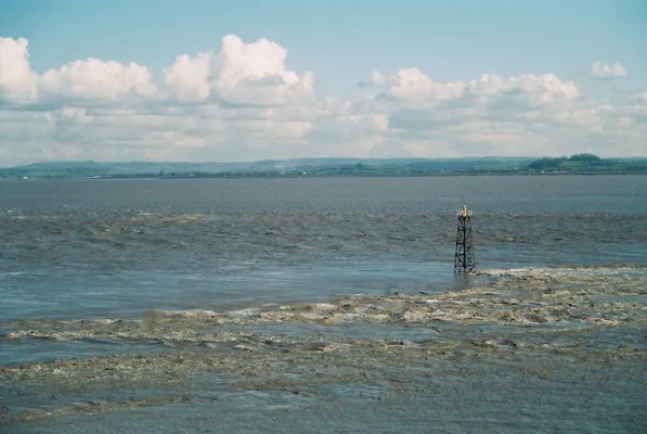
Lyde Rock lighthouse
Lighthouses · 0.7 km

Aust Cliff
Natural landmarks · 1.0 km
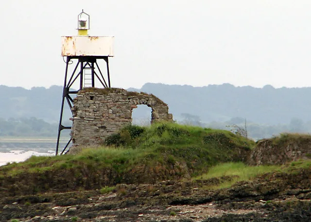
Chapel Rock Lighthouse
Lighthouses · 1.0 km

Aust Cliff
Mountains & hills · 1.2 km

Cliff Farm
Caravan parks · 1.3 km

Wye Bridge and Beachley Viaduct, First Severn Crossing
Historic bridges · 1.5 km

Welcome To Aust
Memorials & monuments · 1.8 km

Wye Bridge
Historic bridges · 1.8 km

Aust
Towns & cities · 1.8 km

The Boar's Head
Historic pubs · 2.0 km

Start / End of Offa's dyke
Memorials & monuments · 2.7 km
Nearby
📷 5Historic bridges · South West England
Severn Road Bridge
Severn Road Bridge — a bridge in wales south.
📷 3Lighthouses · South West England
Lyde Rock lighthouse
Lyde Rock lighthouse — lighthouse in Severn Estuary.
📷 5📷 3Lighthouses · South Wales
Chapel Rock Lighthouse
Chapel Rock Lighthouse — lighthouse in Gloucestershire, England.
📷 5📷 5Where to eat & stay near Severn Bridge
Places to stay
📷 5 📷 5
📷 5Caravan parks · South West England
Vine Farm Caravan Park
Vine Farm Caravan Park — a caravan park in wales south.
 📷 5
📷 5Hotels · South Wales
St Pierre Country Club
St Pierre Country Club — a hotel in wales south.
 📷 5
📷 5 📷 5
📷 5Campsites · South West England
Woodhouse Park Activity Centre
Woodhouse Park Activity Centre — a campsite in england south west.
 📷 5
📷 5Campsites · South West England
The Wave Campsite
The Wave Campsite — a campsite in wales south.
Places to eat & drink
📷 7Historic pubs · South West England
The Boar's Head
The Boar's Head in Wales South, United Kingdom.
 📷 6
📷 6 📷 5
📷 5Restaurants · South Wales
Mint & Mustard
Mint & Mustard — a restaurant in wales south.
 📷 7
📷 7 📷 5
📷 5 📷 5
📷 5Restaurants · South West England
Casa
Casa — a restaurant in england west midlands.
Other bridges from this era
 📷 5
📷 5.jpg?width=1200) 📷 5
📷 5Historic bridges · London
Blue Bridge
Blue Bridge is a historic bridge in the United Kingdom.
 📷 5
📷 5 📷 5
📷 5Historic bridges · London
Chiswick Bridge
Chiswick Bridge is a historic bridge in the United Kingdom.
More bridges in this region
 📷 5
📷 5Historic bridges · South West England
Avoncliff Aqueduct
Avoncliff Aqueduct is a historic bridge in the United Kingdom.
📷 5Historic bridges · South West England
Avoncliff Aqueduct
Avoncliff Aqueduct is a historic bridge in the United Kingdom.
 📷 5
📷 5Historic bridges · South West England
Bradford Viaduct
Bradford Viaduct is a historic bridge in the United Kingdom.
 📷 5
📷 5Historic bridges · South West England
Chippenham Viaduct
Chippenham Viaduct is a historic bridge in the United Kingdom.
Frequently asked questions
- Where is Severn Bridge?
- Severn Bridge is in Gloucestershire, South Wales, United Kingdom (postcode NP16 7HH), in the parish of Tidenham.
- What is Severn Bridge?
- Severn Bridge is a historic bridge in the United Kingdom.
- How do I get to Severn Bridge?
- The nearest railway station is Chepstow, about 4.1 km away. Drivers can use postcode NP16 7HH.
- When was Severn Bridge built?
- Built or established in 1966.
- Is Severn Bridge a listed building?
- Severn Bridge is officially recognised as Grade I listed building listed.
- Is Severn Bridge a protected site?
- Yes — Severn Bridge is part of the Severn Estuary SSSI Site of Special Scientific Interest and the Severn Estuary Ramsar wetland.
- Is Severn Bridge free to visit?
- Yes, Severn Bridge is free to enter.
- How do I get to Severn Bridge?
- The nearest railway station is Chepstow, about 4.1 km away. Drivers can navigate to postcode NP16 7HH.