
Campsites · East of England
Sedgeford Historical and Archaeological Research Project
In or near Snettisham.
Sedgeford Historical and Archaeological Research Project — a campsite in england east midlands.

Martin Pearman — CC BY-SA 2.0 via Wikimedia Commons licence

Plan your visit
- Typical visit
- 1 h–2 h
About
Sedgeford Historical and Archaeological Research Project is a campsite located in england east midlands. Campsite listed with verified location and OSM metadata. Pitch availability, facilities (toilets, showers, electric hookup) and seasonal opening vary — confirm directly.
Photo gallery
Protected designations
- Area of Outstanding Natural Beauty: Norfolk Coast
Designations sourced from Natural England open data under OGL v3.
Place summary
Sedgeford Historical and Archaeological Research Project is a campsite located in the East Midlands. It serves as a base for archaeological activities and research, attracting those interested in history and excavation. Visitors can expect a setting that combines outdoor camping with opportunities to engage in archaeological projects. Facilities likely cater to both novice campers and those with an interest in historical research.
AI-generated from the structured facts on this page (operator, designation, listing, era). Not a substitute for visiting.
- Coordinates
- 52.8968, 0.5422
- County
- Norfolk
- District
- King's Lynn and West Norfolk
- Parish
- Sedgeford
- Postcode
- PE36 5LN
- Parliamentary constituency
- North West Norfolk
Sources
- osm: w1428314959 (ODbL)
Other places nearby

Anglo Saxon settlement
Archaeological sites · 0.1 km

The Boneyard
Archaeological sites · 0.1 km
Anglo Saxon Kilns
Archaeological sites · 0.2 km

Sedgeford War Memorial
Memorials & monuments · 0.3 km

Sedgeford
Villages · 0.3 km
Wethered Manor
Stately homes · 0.5 km

Sedgeford Village Sign
Public art & sculpture · 0.8 km

Norfolk Lavender
Natural landmarks · 2.8 km

Heacham Village Sign
Public art & sculpture · 2.9 km

Fring Village Sign
Public art & sculpture · 3.0 km

Fring War Memorial
Memorials & monuments · 3.0 km

Bridge Over Loo Water On Line Of Former Heacham-Hunstanton Road.
Historic bridges · 3.0 km
Nearby
📷 3Archaeological sites · East of England
Anglo Saxon settlement
Anglo Saxon settlement — an archaeological site in East of England, United Kingdom.
📷 3Archaeological sites · East of England
The Boneyard
The Boneyard — an archaeological site in East of England, United Kingdom.
📷 3Archaeological sites · East of England
Anglo Saxon Kilns
Anglo Saxon Kilns — an archaeological site in East of England, United Kingdom.
📷 3Memorials & monuments · East of England
Sedgeford War Memorial
Sedgeford War Memorial — Grade II listed building-listed memorial in england-east-midlands, United Kingdom.
📷 5Flagship📷 3Stately homes · East of England
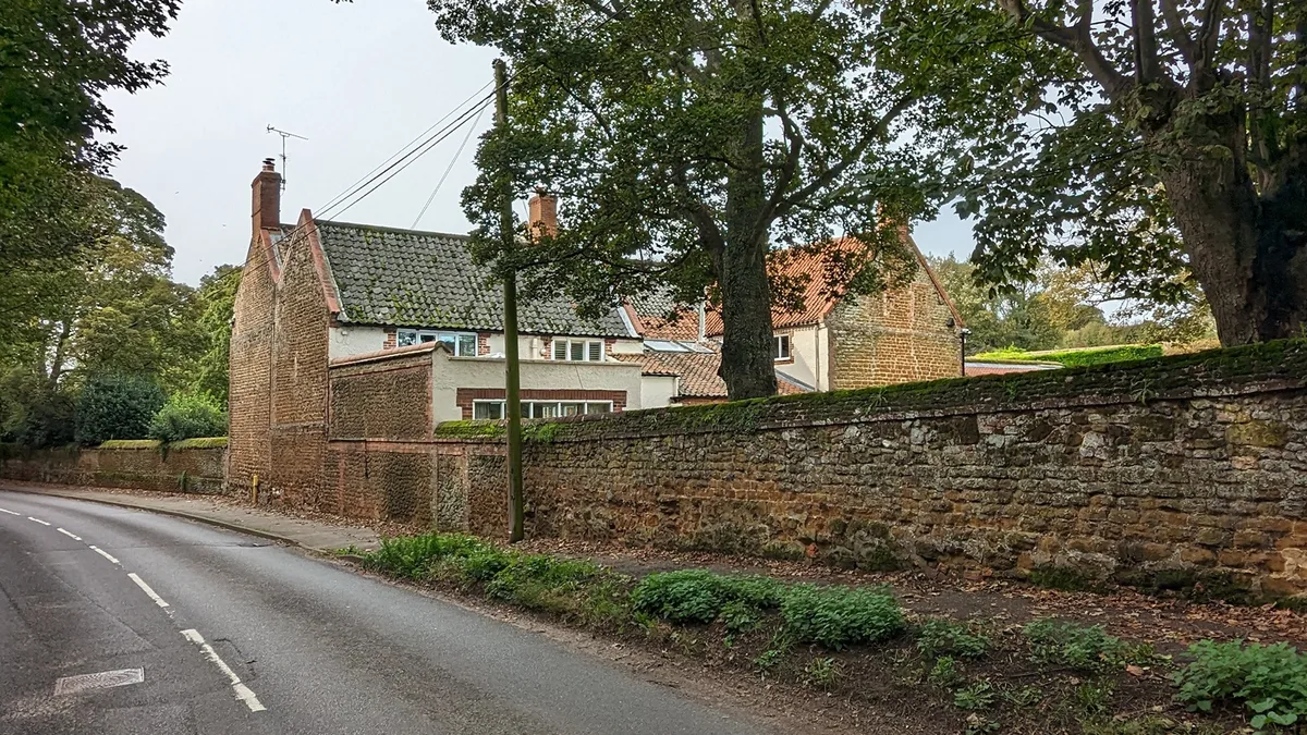
Wethered Manor
Wethered Manor — manor house in Sedgeford, King's Lynn and West Norfolk, Norfolk, England, UK.
Where to eat & stay near Sedgeford Historical and Archaeological Research Project
Places to stay
 📷 5
 📷 5
Campsites · East of England
The Queen Victoria
The Queen Victoria — a campsite in england east midlands.
 📷 5📷 5📷 5
Caravan parks · East of England
Long Acres Holiday Home Park
Long Acres Holiday Home Park — a caravan park in england east midlands.
 📷 5
Caravan parks · East of England
Tall Trees Caravan Park
Tall Trees Caravan Park — a caravan park in england east midlands.
Places to eat & drink
 📷 5
Historic pubs · East of England
The Hare Public House
The Hare Public House in England East, United Kingdom.
 📷 5
Restaurants · East of England
The Lifeboat Inn
The Lifeboat Inn — a restaurant in england east midlands.
 📷 7
 📷 7
Historic pubs · East of England
Hoste Arms Public House
Hoste Arms Public House in England East, United Kingdom.
 📷 5
Historic pubs · East of England
The Lord Nelson Public House
The Lord Nelson Public House in England East, United Kingdom.
 📷 5
More places in this region
 📷 5
Campsites · East of England
Sacrewell Farm
Sacrewell Farm — a campsite in england london.
 📷 5
Campsites · East of England
Jordans Close Scout Activity Centre
Jordans Close Scout Activity Centre — a campsite in england london.
 📷 5
 📷 5
Campsites · East of England
Ashwell House
Ashwell House — a campsite in england london.
Frequently asked questions
- Where is Sedgeford Historical and Archaeological Research Project?
- Sedgeford Historical and Archaeological Research Project is in Norfolk, East of England, United Kingdom (postcode PE36 5LN), in the parish of Sedgeford.
- What is Sedgeford Historical and Archaeological Research Project?
- Sedgeford Historical and Archaeological Research Project — a campsite in england east midlands.
- How do I get to Sedgeford Historical and Archaeological Research Project?
- The nearest town is Snettisham. Drivers can use postcode PE36 5LN.
- Is Sedgeford Historical and Archaeological Research Project a protected site?
- Yes — Sedgeford Historical and Archaeological Research Project is part of the Norfolk Coast National Landscape (AONB).
- How do I get to Sedgeford Historical and Archaeological Research Project?
- Drivers can navigate to postcode PE36 5LN. It sits within the North West Norfolk parliamentary constituency.