Castles · North West England
Sebergham
In or near Thursby.
Sebergham is a village and civil parish in the Cumberland district, in the ceremonial county of Cumbria, England. It is located on the B5305, south of Carlisle and south-east of Wigton. The civil pari

Adrian Taylor — CC BY-SA 2.0 via Wikimedia Commons licence
Plan your visit
- Typical visit
- 1.5 h–3 h
- Nearest railway station
- Dalston · 8.8 km
- Family-friendly
- Limited wheelchair access
Getting there & planning your visit
To visit Sebergham, the nearest railway station is Dalston, located 8.8 km away. The postcode for sat-nav is CA5 7HR. Accessibility is limited for wheelchair users.
About
Sebergham is a village and civil parish in the Cumberland district, in the ceremonial county of Cumbria, England. It is located on the B5305, south of Carlisle and south-east of Wigton. The civil parish population at the 2011 Census was 365. The parish includes Welton. St Mary's Church is medieval in origin, repaired in the 18th century and with a tower added in the 1820s. It is a Grade II* listed building and lies on the Cumbria Way walk. The parish formed part of Inglewood Forest. Sebergham Bridge dates from 1689 and Bell Bridge dated from 1772: both were Grade II listed. Bell Bridge collapsed and was swept away by the River Caldew during the passing of the remnants of Storm Jonas on 27 January 2016. It had previously been damaged by Storm Desmond in December 2015. The replacement Bell Bridge, incorporating stone from its Georgian predecessor, was opened to the public on 19 December 2017. Sebergham Castle is a farmhouse, formerly known as Colerigg Hall, transformed in the Gothic Revival style in the late eighteenth century. A mile to the south-west of the village is Warnell Hall, a fortified house which is now a farmhouse. It was built in the 16th century incorporating part of a 14th-century pele tower.
Photo gallery
Protected designations
- Site of Special Scientific Interest: River Eden and Tributaries SSSI
Designations sourced from Natural England open data under OGL v3.
From the Wikipedia article
Sebergham is a village and civil parish in the Cumberland district, in the ceremonial county of Cumbria, England. It is located on the B5305, south of Carlisle and south-east of Wigton. The civil parish population at the 2011 Census was 365. The parish includes Welton. St Mary's Church is medieval in origin, repaired in the 18th century and with a tower added in the 1820s. It is a Grade II* listed building and lies on the Cumbria Way walk. The parish formed part of Inglewood Forest. Sebergham Bridge dates from 1689 and Bell Bridge dated from 1772: both were Grade II listed. Bell Bridge collapsed and was swept away by the River Caldew during the passing of the remnants of Storm Jonas on 27 January 2016. It had previously been damaged by Storm Desmond in December 2015. The replacement Bell Bridge, incorporating stone from its Georgian predecessor, was opened to the public on 19 December 2017. Sebergham Castle is a farmhouse, formerly known as Colerigg Hall, transformed in the Gothic Revival style in the late eighteenth century. A mile to the south-west of the village is Warnell Hall, a fortified house which is now a farmhouse. It was built in the 16th century incorporating part of a 14th-century pele tower.
Excerpt from Wikipedia under CC BY-SA 4.0. See the source article linked in Sources below.
- Coordinates
- 54.7670, -2.9990
- District
- Cumberland
- Parish
- Sebergham
- Postcode
- CA5 7HR
- Parliamentary constituency
- Penrith and Solway
- Nearest railway station
- Dalston — 8.8 km
Sources
- wikipedia: Sebergham (CC BY-SA 4.0)
Other places nearby
Sebergham Bridge
Historic bridges · 0.1 km

Sebergham
Villages · 0.5 km

Warnell Hall
Historic houses · 0.9 km

Bell Bridge
Historic bridges · 1.4 km

Fellhill Pods
Campsites · 1.7 km
Fellhill pods
Campsites · 1.7 km

Welton
Villages · 1.8 km
Warnell Fell
Mountains & hills · 2.1 km
Warnell Fell
Mountains & hills · 2.1 km

Newlands
Villages · 2.2 km

Banks
Mountains & hills · 3.0 km
Banks
Mountains & hills · 3.0 km
Nearby
📷 3Historic bridges · North West England
Sebergham Bridge
Sebergham Bridge — Grade II listed building-listed bridge in scotland-lowlands, United Kingdom.
📷 5📷 3Historic houses · North West England
Warnell Hall
Warnell Hall — house in Sebergham, Allerdale, England, UK.
📷 4Historic bridges · North West England
Bell Bridge
Bell Bridge — Grade II listed building-listed bridge in scotland-lowlands, United Kingdom.
📷 5📷 5Where to eat & stay near Sebergham
Places to stay
📷 5📷 5 📷 5
📷 5B&Bs · North West England
Denton House
Denton House — a bed-and-breakfast in scotland lowlands.
📷 5 📷 5
📷 5Campsites · North West England
Caldbeck Camping
Caldbeck Camping — a campsite in scotland lowlands.
 📷 5
📷 5Hostels · North West England
Caldbeck Glamping Barns & Bothy
Caldbeck Glamping Barns & Bothy — a hostel in scotland lowlands.
Places to eat & drink
 📷 4
📷 4Historic pubs · North West England
Oddfellows Arms
Oddfellows Arms — Historic pub — listed building or notable heritage status.
 📷 5📷 5
 📷 5
📷 5Historic pubs · North West England
Spinners Arms
Spinners Arms in Scotland Lowlands, United Kingdom.
 📷 5
📷 5Historic pubs · North West England
Kings Arms Walter Willsons
Kings Arms Walter Willsons in Scotland Lowlands, United Kingdom.
 📷 5
📷 5Historic pubs · North West England
Horse And Farrier Public House
Horse And Farrier Public House in Scotland Lowlands, United Kingdom.
More castles in this region
 📷 3
📷 3Castles · North West England
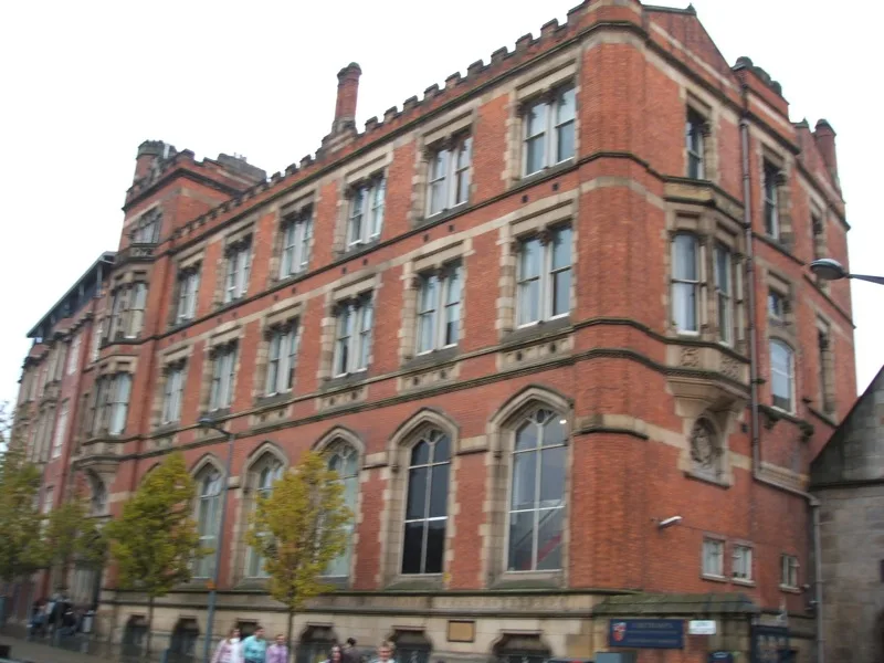
Manchester Castle
Manchester Castle — medieval fortified manor house in England.
 📷 5
📷 5Castles · North West England
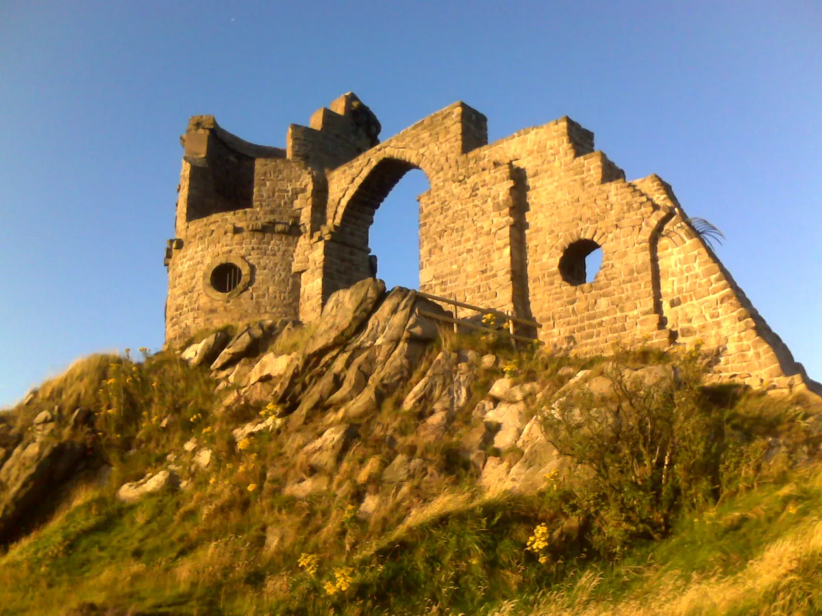
Mow Cop Castle
Mow Cop Castle — folly on the Cheshire and Staffordshire border, England, UK.
 📷 3
📷 3 📷 3
📷 3Castles · North West England
Ullerwood Castle
Ullerwood Castle — castle in Greater Manchester, England.
Frequently asked questions
- Where is Sebergham?
- Sebergham is in the Scottish Lowlands, United Kingdom (postcode CA5 7HR), in the parish of Sebergham.
- What is Sebergham?
- Sebergham is a village and civil parish in the Cumberland district, in the ceremonial county of Cumbria, England. It is located on the B5305, south of Carlisle and south-east of Wigton. The civil pari
- How do I get to Sebergham?
- The nearest railway station is Dalston, about 8.8 km away. Drivers can use postcode CA5 7HR.
- Is Sebergham a protected site?
- Yes — Sebergham is part of the River Eden and Tributaries SSSI Site of Special Scientific Interest.
- Does Sebergham charge admission?
- Sebergham typically charges admission. Check the official site for current ticket prices and opening hours.
- How do I get to Sebergham?
- Drivers can navigate to postcode CA5 7HR. It sits within the Penrith and Solway parliamentary constituency.