
Wildlife reserves · London
Sarratt Bottom nature reserve
In or near Chenies.
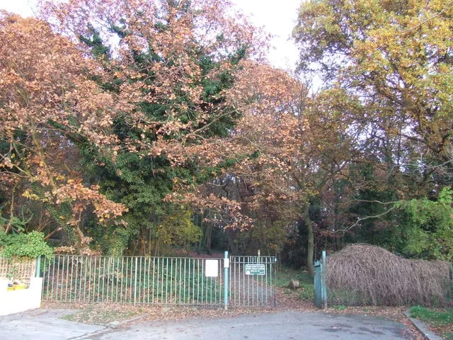
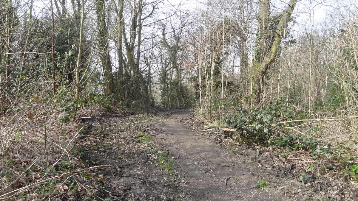
Sarratt Bottom nature reserve — biological Site of Special Scientific Interest in England.

Wikimedia Commons contributors — see linked file page for photographer and licence licence

Plan your visit
- Typical visit
- 2 h–4 h
- Best time of year
- Autumn & winter (migration & wildfowl)
- Nearest railway station
- Chorleywood · 2.9 km
- Free entry
- Dog-friendly
Getting there & planning your visit
To visit Sarratt Bottom nature reserve, the nearest railway station is Chorleywood, located 2.9 km away. Entry to the reserve is free.
About
Sarratt Bottom nature reserve is a wildlife reserve in the United Kingdom. Heritage designation: Site of Special Scientific Interest. Wikidata describes it as: "biological Site of Special Scientific Interest in England". Coordinates: 51.6794°, -0.5102°.
Photo gallery
Protected designations
- Site of Special Scientific Interest: Sarratt Bottom SSSI
- Area of Outstanding Natural Beauty: Chilterns
Designations sourced from Natural England open data under OGL v3.
From the Wikipedia article
Sarratt Bottom nature Reserve in Hertfordshire is a 3.2-hectare (7.9-acre) biological Site of Special Scientific Interest. The site is a meadow beside the River Chess. It is an example of damp grassland which has been traditionally managed for grazing. There are also areas of swamp and marsh. The main plants in grassland areas include sweet vernal grass and meadow foxtail, and marsh horsetail and common spike-rush are common in damper areas. The site has hedgehogs and a wide variety of wetland birds and invertebrates. There is no public access but the site can be viewed from Moor Lane. The local planning authority is Three Rivers District Council.
Excerpt from Wikipedia under CC BY-SA 4.0. See the source article linked in Sources below.
- Coordinates
- 51.6794, -0.5102
- County
- Hertfordshire
- District
- Three Rivers
- Parish
- Sarratt
- Postcode
- WD3 6DA
- Parliamentary constituency
- South West Hertfordshire
- Nearest railway station
- Chorleywood — 2.9 km
Sources
- wikidata: Q20740394 (CC0)
- wikipedia: Sarratt Bottom nature reserve (CC BY-SA 4.0)
- commons: Sarratt Bottom SSSI 2.JPG (CC BY-SA 4.0)
Other places nearby

paradigm brewery
Breweries · 1.0 km

Frogmore Meadow
Forests & woodlands · 1.1 km

Chenies Chapel (baptist)
Chapels · 1.2 km

The Boot Public House
Historic pubs · 1.3 km

Chorleywood Car Boot
Farmers’ markets · 1.4 km

North Hill Farm Overflow Camp Site
Campsites · 1.5 km

Bridge On Axis Of Formal Garden At Chenies Place
Historic bridges · 1.5 km

Woodside House Gardens
Gardens · 1.6 km

Chenies
Towns & cities · 1.6 km
Church of St Michael, Chenies
Historic churches · 1.6 km

Sarratt
Towns & cities · 1.6 km

North Hill Farm Campsite
Campsites · 1.6 km
Nearby
📷 5📷 5Forests & woodlands · London
Frogmore Meadow
Frogmore Meadow is a forest or woodland in the United Kingdom.
📷 3Chapels · London
Chenies Chapel (baptist)
Chenies Chapel (baptist) — chapel in Chenies, Buckinghamshire, England, UK.
📷 5📷 5Farmers’ markets · London
Chorleywood Car Boot
Chorleywood Car Boot — a UK farmers' market in england west midlands.
📷 5Campsites · London
North Hill Farm Overflow Camp Site
North Hill Farm Overflow Camp Site — a campsite in england west midlands.
Where to eat & stay near Sarratt Bottom nature reserve
Places to stay
📷 5Campsites · London
North Hill Farm Overflow Camp Site
North Hill Farm Overflow Camp Site — a campsite in england west midlands.
📷 5Campsites · London
North Hill Farm Campsite
North Hill Farm Campsite — a campsite in england west midlands.
📷 5Caravan parks · London
North Hill Farm RV Park
North Hill Farm RV Park — a caravan park in england west midlands.
 📷 5
📷 5 📷 5
📷 5Campsites · London
Lees Wood Scout & Guide Activity Centre
Lees Wood Scout & Guide Activity Centre — a campsite in england london.
 📷 5
📷 5Places to eat & drink
📷 5 📷 5
📷 5Historic pubs · East of England
The Green Dragon, Flaunden
The Green Dragon, Flaunden in England East, United Kingdom.
 📷 5
📷 5Historic pubs · East of England
The Bricklayer Arms Public House
The Bricklayer Arms Public House in England East, United Kingdom.
 📷 5
📷 5 📷 5
📷 5Historic pubs · East of England
The Swan Public House
The Swan Public House in England East, United Kingdom.
 📷 5
📷 5Historic pubs · East of England
The Old Palace Public House
The Old Palace Public House in England East, United Kingdom.
More places in this region
 Flagship📷 10
Wildlife reserves · London
Bedfords Park
Bedfords Park — Havering London Borough green landscape, also an Essex Wildlife Trust Nature reserve.
 Flagship📷 10
 Flagship📷 10
Wildlife reserves · London
Bramley Bank
Bramley Bank — Nature reserve in Upper Shirley.
 Flagship📷 10
Wildlife reserves · London
Chafford Gorges Nature Park
Chafford Gorges Nature Park — Essex Wildlife Trust Nature reserve.
Frequently asked questions
- Where is Sarratt Bottom nature reserve?
- Sarratt Bottom nature reserve is in Hertfordshire, London, United Kingdom (postcode WD3 6DA), in the parish of Sarratt.
- What is Sarratt Bottom nature reserve?
- Sarratt Bottom nature reserve — biological Site of Special Scientific Interest in England.
- How do I get to Sarratt Bottom nature reserve?
- The nearest railway station is Chorleywood, about 2.9 km away. The nearest town is Chenies. Drivers can use postcode WD3 6DA.
- Is Sarratt Bottom nature reserve a listed building?
- Sarratt Bottom nature reserve is officially recognised as Site of Special Scientific Interest listed.
- Is Sarratt Bottom nature reserve a protected site?
- Yes — Sarratt Bottom nature reserve is part of the Sarratt Bottom SSSI Site of Special Scientific Interest and the Chilterns National Landscape (AONB).
- Is Sarratt Bottom nature reserve free to visit?
- Yes, Sarratt Bottom nature reserve is free to enter.
- How do I get to Sarratt Bottom nature reserve?
- The nearest railway station is Chorleywood, about 2.9 km away. Drivers can navigate to postcode WD3 6DA.
- Are dogs allowed at Sarratt Bottom nature reserve?
- Most wildlife reserves allow dogs on lead only, with restrictions during ground-nesting bird season (March-July). Check signage at the reserve.