
Mountains & hills · Yorkshire & the Humber
Saltwick Bay
In or near Whitby.
Saltwick Bay — north-east facing bay near Whitby, North Yorkshire, England.

Wikimedia Commons contributors — see linked file page for photographer and licence licence

Plan your visit
- Typical visit
- 3 h–8 h
- Best time of year
- Late spring – early autumn (May–Oct)
- Nearest railway station
- Whitby · 1.9 km
- Free entry
- Dog-friendly
Getting there & planning your visit
To visit Saltwick Bay, the nearest railway station is Whitby, located 1.9 km away. The postcode for sat-nav is YO22 4JX, and entry is free.
About
Saltwick Bay is a named summit in the United Kingdom. Part of North Sea. Wikidata describes it as: "north-east facing bay near Whitby, North Yorkshire, England". Coordinates: 54.4847°, -0.5857°.
Photo gallery
Protected designations
- Site of Special Scientific Interest: North York Moors SSSI
Designations sourced from Natural England open data under OGL v3.
From the Wikipedia article
Saltwick Bay is a north-east facing bay approximately one mile (1.6 km) to the east of Whitby, on the east coast of North Yorkshire, England. The bay contains the Saltwick Nab alum quarries, listed under the Ancient Monuments and Archaeological Areas Act 1979. The bay is part of the Saltwick Formation and known for its collections of fossils. The SS Rohilla hospital ship sank in the bay in 1914, and the fishing trawler Admiral Van Tromp was shipwrecked there in 1976. The bay is accessible through Whitby Holiday Park.
Excerpt from Wikipedia under CC BY-SA 4.0. See the source article linked in Sources below.
Background
History
grounded in Saltwick Bay|alt=Black and white photo of a ship sinking into the water, with multiple people running towards it.]] in Saltwick Bay in 1983|alt=Wooden boat in a derelict state on a calm blue water.]] Alum was quarried at Saltwick Bay, with the first recorded quarrying being by Sir Hugh Chomley, who lived at Whitby Abbey, in the 17th century. The alum quarries were built on promontories and were 590 ft in length and 115 ft in depth. The quarries eventually closed in 1791. Fossils commonly found at Saltwick Bay include the Dactylioceras and Hildoceras, as well as fossilised plant remains. Cuspiteuthis tubularis fossils can be found near the Black Nab, an island in the bay. In…
Sourced from Wikipedia under CC BY-SA 4.0.
- Coordinates
- 54.4847, -0.5857
- District
- North Yorkshire
- Parish
- Hawsker-cum-Stainsacre
- Postcode
- YO22 4JX
- Parliamentary constituency
- Scarborough and Whitby
- Nearest railway station
- Whitby — 1.9 km
Sources
- wikidata: Q26854043 (CC0)
- wikipedia: Saltwick Bay (CC BY-SA 4.0)
- commons: Saltwick Bay - geograph.org.uk - 768353.jpg (CC BY-SA 4.0)
Other places nearby

Whitby Holiday Park
Caravan parks · 0.4 km

Stoupe Cross Caravan Site
Caravan parks · 0.7 km

Highgate Howe Holiday Home Park
Caravan parks · 0.9 km

MV Creteblock
Museums · 1.1 km

Manor House Farm Touring Site
Caravan parks · 1.2 km

Ling Hill
Mountains & hills · 1.3 km
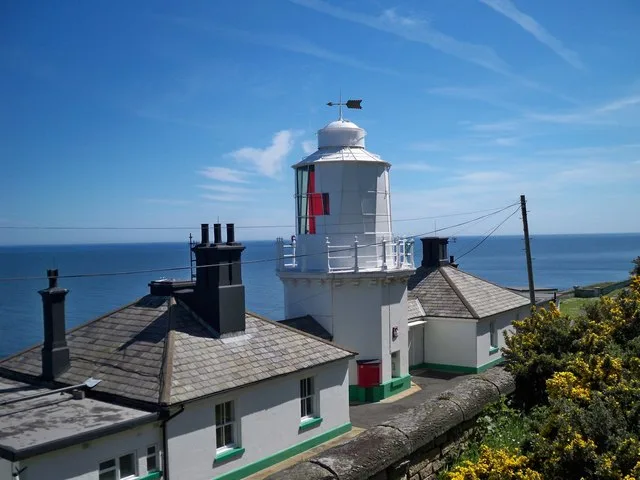
Whitby Lighthouse
Lighthouses · 1.4 km
Whitby High Lighthouse
Lighthouses · 1.4 km

Whitby Abbey
Archaeological sites · 1.4 km

Folly Gardens
Campsites · 1.4 km
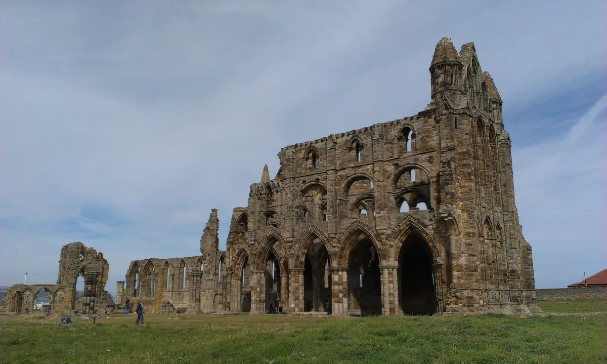
Whitby Abbey
Abbeys & priories · 1.5 km

The Abbey House
Gardens · 1.5 km
Nearby
📷 5Caravan parks · Yorkshire & the Humber
Whitby Holiday Park
Whitby Holiday Park — a caravan park in england yorkshire.
📷 5Caravan parks · Yorkshire & the Humber
Stoupe Cross Caravan Site
Stoupe Cross Caravan Site — a caravan park in england yorkshire.
📷 5Caravan parks · Yorkshire & the Humber
Highgate Howe Holiday Home Park
Highgate Howe Holiday Home Park — a caravan park in england yorkshire.
📷 5Museums · Yorkshire & the Humber
MV Creteblock
MV Creteblock — a museum in england-yorkshire, United Kingdom.
📷 5Caravan parks · Yorkshire & the Humber
Manor House Farm Touring Site
Manor House Farm Touring Site — a caravan park in england yorkshire.
📷 5Mountains & hills · Yorkshire & the Humber
Ling Hill
Ling Hill — a hill or mountain in england yorkshire.
Where to eat & stay near Saltwick Bay
Places to stay
📷 5Caravan parks · Yorkshire & the Humber
Whitby Holiday Park
Whitby Holiday Park — a caravan park in england yorkshire.
📷 5Caravan parks · Yorkshire & the Humber
Stoupe Cross Caravan Site
Stoupe Cross Caravan Site — a caravan park in england yorkshire.
📷 5Caravan parks · Yorkshire & the Humber
Highgate Howe Holiday Home Park
Highgate Howe Holiday Home Park — a caravan park in england yorkshire.
📷 5Caravan parks · Yorkshire & the Humber
Manor House Farm Touring Site
Manor House Farm Touring Site — a caravan park in england yorkshire.
📷 5Campsites · Yorkshire & the Humber
Folly Gardens
Folly Gardens — a campsite in england yorkshire.
 📷 5
📷 5Hostels · Yorkshire & the Humber
YHA Whitby
YHA Whitby — a hostel in england yorkshire.
Places to eat & drink
 📷 7
📷 7Historic pubs · Yorkshire & the Humber
The Ship Inn Flats
The Ship Inn Flats in England Yorkshire, United Kingdom.
 📷 5
📷 5Restaurants · Yorkshire & the Humber
Hadleys Fish Restaurant
Hadleys Fish Restaurant — a restaurant in england yorkshire. Cuisine: fish and chips.
 📷 5
📷 5Restaurants · Yorkshire & the Humber
Magpie Cafe
Magpie Cafe — a restaurant in england yorkshire.
 📷 5
📷 5Historic pubs · Yorkshire & the Humber
The Wilson Arms
The Wilson Arms in England Yorkshire, United Kingdom.
 📷 6
📷 6Restaurants · North East England
Estbek House
Estbek House — a restaurant in england north east.
 📷 5
📷 5More mountains in this region
 📷 3
📷 3 📷 5
📷 5Mountains & hills · Yorkshire & the Humber
Whaley Moor
Whaley Moor — a hill or mountain in england west midlands.
 📷 5
📷 5Mountains & hills · Yorkshire & the Humber
Idle Hill
Idle Hill — a hill or mountain in england west midlands.
 📷 5
📷 5Mountains & hills · Yorkshire & the Humber
Hollingworthhall Moor
Hollingworthhall Moor — a hill or mountain in england west midlands.
Frequently asked questions
- Where is Saltwick Bay?
- Saltwick Bay is in Yorkshire, United Kingdom (postcode YO22 4JX), in the parish of Hawsker-cum-Stainsacre.
- What is Saltwick Bay?
- Saltwick Bay — north-east facing bay near Whitby, North Yorkshire, England.
- How do I get to Saltwick Bay?
- The nearest railway station is Whitby, about 1.9 km away. Drivers can use postcode YO22 4JX.
- Is Saltwick Bay a protected site?
- Yes — Saltwick Bay is part of the North York Moors SSSI Site of Special Scientific Interest.
- Is Saltwick Bay free to visit?
- Yes, Saltwick Bay is free to enter.
- How do I get to Saltwick Bay?
- The nearest railway station is Whitby, about 1.9 km away. Drivers can navigate to postcode YO22 4JX.