
Hostels · North West England
Saint Johns
In or near Threlkeld.
Saint Johns — a hostel in scotland lowlands.

Michael Graham — CC BY-SA 2.0 via Wikimedia Commons licence

Plan your visit
- Typical visit
- 1 h–2 h
- Nearest railway station
- Threlkeld Quarry Station · 2.6 km
About
Saint Johns is a hostel located in scotland lowlands. Hostel listed with verified location and OSM metadata. Most British hostels offer dorm beds and private rooms; check current availability before arriving.
Photo gallery
See it from the streetimagery from 2020
Imagery © Mapillary contributors, CC BY-SA 4.0
Protected designations
- Site of Special Scientific Interest: River Derwent and Tributaries SSSI
- Site of Special Scientific Interest: Skiddaw Group SSSI
Designations sourced from Natural England open data under OGL v3.
Place summary
Saint Johns is a hostel located in the Scottish Lowlands. It offers budget accommodation suitable for a range of travellers. Guests can expect basic amenities and communal facilities in a setting that reflects the local character of the region. The hostel serves as a practical base for exploring the surrounding countryside and attractions.
AI-generated from the structured facts on this page (operator, designation, listing, era). Not a substitute for visiting.
- Coordinates
- 54.6204, -3.0810
- District
- Westmorland and Furness
- Parish
- Threlkeld
- Postcode
- CA12 4SG
- Parliamentary constituency
- Westmorland and Lonsdale
- Nearest railway station
- Threlkeld Quarry Station — 2.6 km
Sources
- osm: w175928146 (ODbL)
Other places nearby
Blencathra Field Centre (Main House)
Hostels · 0.0 km
Lonscale
Hostels · 0.0 km

Blencathra Centre Mosaic
Public art & sculpture · 0.1 km

Burns Farm Caravan Site
Campsites · 1.3 km
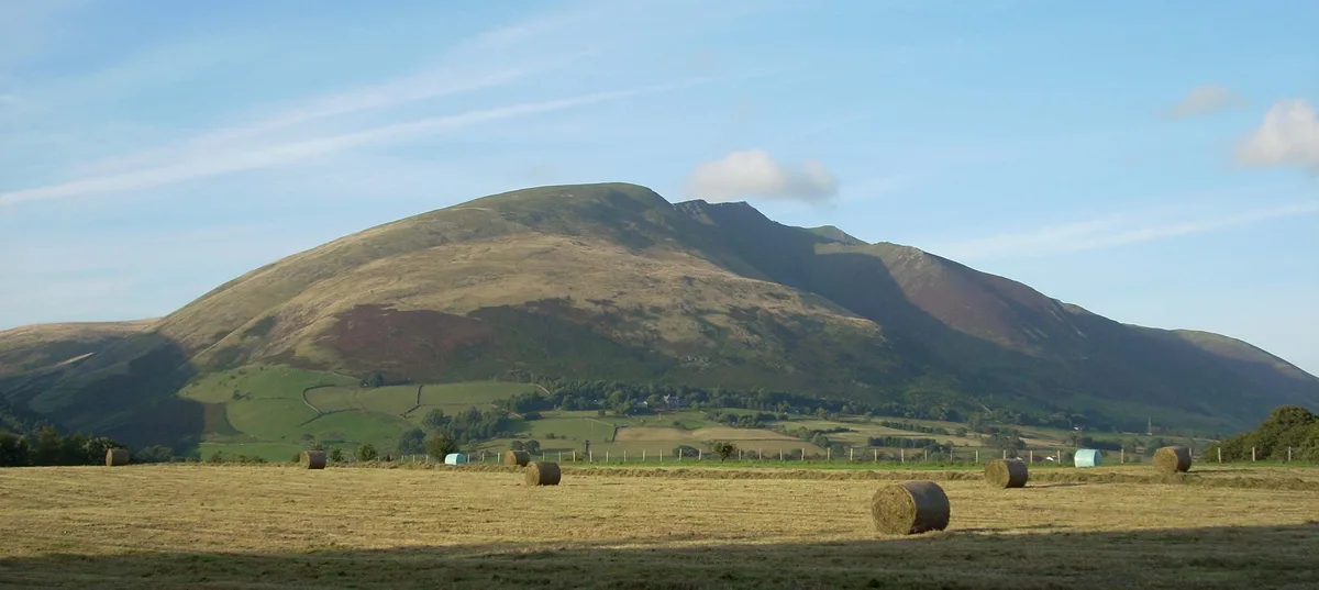
Blease Fell
Mountains & hills · 1.7 km

In the Vale (Holiday Park)
Caravan parks · 1.9 km

Threlkeld
Towns & cities · 1.9 km

Mire House Short Breaks
Caravan parks · 2.0 km

Hawell Monument
Memorials & monuments · 2.0 km

Goosewell Farm Activities Centre
Farms (open to visitors) · 2.1 km

Setmabanning Caravan Park
Campsites · 2.1 km
Mire House Short Breaks
Caravan parks · 2.1 km
Nearby
📷 5Hostels · North West England
Blencathra Field Centre (Main House)
Blencathra Field Centre (Main House) — a hostel in scotland lowlands.
📷 5📷 3Public art & sculpture · North West England
Blencathra Centre Mosaic
Blencathra Centre Mosaic — a public art in North West England, United Kingdom.
📷 5Campsites · North West England
Burns Farm Caravan Site
Burns Farm Caravan Site — a campsite in scotland lowlands.
📷 5📷 5Caravan parks · North West England
In the Vale (Holiday Park)
In the Vale (Holiday Park) — a caravan park in scotland lowlands.
Where to eat & stay near Saint Johns
Places to stay
📷 5Hostels · North West England
Blencathra Field Centre (Main House)
Blencathra Field Centre (Main House) — a hostel in scotland lowlands.
📷 5📷 5Campsites · North West England
Burns Farm Caravan Site
Burns Farm Caravan Site — a campsite in scotland lowlands.
📷 5Caravan parks · North West England
In the Vale (Holiday Park)
In the Vale (Holiday Park) — a caravan park in scotland lowlands.
📷 5Caravan parks · North West England
Mire House Short Breaks
Mire House Short Breaks — a caravan park in scotland lowlands.
📷 5Campsites · North West England
Setmabanning Caravan Park
Setmabanning Caravan Park — a campsite in scotland lowlands.
Places to eat & drink
 📷 5
 📷 7
Cafés · North West England
Grange Bridge Cottage
Grange Bridge Cottage — a café in england north east.
 📷 7
Historic pubs · North West England
The Pheasant Inn
The Pheasant Inn in Scotland Lowlands, United Kingdom.
 📷 4
Historic pubs · North West England
Oddfellows Arms
Oddfellows Arms — Historic pub — listed building or notable heritage status.
 📷 5
Historic pubs · North West England
Horse And Farrier Inn And Stables
Horse And Farrier Inn And Stables in Scotland Lowlands, United Kingdom.
 📷 7
Historic pubs · North West England
The Travellers Rest
The Travellers Rest in England North West, United Kingdom.
More places in this region
 📷 5
 📷 5
 📷 5
Hostels · North West England
Malacuna
Malacuna — a hostel in england west midlands.
 📷 5
Frequently asked questions
- Where is Saint Johns?
- Saint Johns is in North-West England, United Kingdom (postcode CA12 4SG), in the parish of Threlkeld.
- What is Saint Johns?
- Saint Johns — a hostel in scotland lowlands.
- How do I get to Saint Johns?
- The nearest railway station is Threlkeld Quarry Station, about 2.6 km away. The nearest town is Threlkeld. Drivers can use postcode CA12 4SG.
- Is Saint Johns a protected site?
- Yes — Saint Johns is part of the River Derwent and Tributaries SSSI Site of Special Scientific Interest and the Skiddaw Group SSSI Site of Special Scientific Interest.
- How do I get to Saint Johns?
- The nearest railway station is Threlkeld Quarry Station, about 2.6 km away. Drivers can navigate to postcode CA12 4SG.