
Stadiums · South East England
Rushmoor Stadium
In or near Hartfordbridge.
Rushmoor Stadium — football stadium in Farnborough, England.

Wikimedia Commons licence
Plan your visit
- Typical visit
- 1.5 h–3 h
- Nearest railway station
- Frimley · 1.1 km
Getting there & planning your visit
Rushmoor Stadium is located in Rushmoor, Hampshire, with the postcode GU14 8UD. The nearest railway station is Frimley, which is approximately 1.1 km away. Entry details are not provided, so please check in advance for accessibility options.
About
Rushmoor Stadium is a stadium in the United Kingdom. Owned by Farnborough F.C.. Wikidata describes it as: "football stadium in Farnborough, England". Coordinates: 51.3104°, -0.7623°.
Photo gallery
Protected designations
- Site of Special Scientific Interest: Basingstoke Canal SSSI
Designations sourced from Natural England open data under OGL v3.
From the Wikipedia article
Cherrywood Road, known as the Saunders Transport Community Stadium for sponsorship purposes, is the ground of Farnborough F.C. and the former home of Farnborough Town F.C. before the club went out of business in 2007. It lies in the town of Farnborough, Hampshire. The capacity of the ground is 6,500. Up to the mid-1970s Farnborough Town F.C. had played at Queens Road but moved due to the lack of facilities. Cherrywood Road was newly built with the help of a local company Worldwide Carpets. The ground was originally called The John Roberts Ground but the name is rarely used with fans simply referring to the stadium as Cherrywood Road. For a period in the early 2000s it was known as the Aimita Stadium after the company of chairman/manager Graham Westley. The fans were against the renaming of the stadium by Westley and the name reverted to Cherrywood Road following his departure in 2003. The ground was briefly called the Rushmoor Stadium at the beginning the 2010–11 season to entice the local council but confusion with the local Rushmoor Arena and the departure of chairman Simon Hollis resulted in a return, once again, to Cherrywood Road. In 2013, the stadium was known as Paddy Power Park, after a sponsorship deal was signed with the bookmaking firm Paddy Power.
Excerpt from Wikipedia under CC BY-SA 4.0. See the source article linked in Sources below.
Background
Description
On one side of the ground is the Main Stand, named in 2009 the Charles Mortimore Stand after the long-serving club president. This stand comprises covered seating and was extended and improved during summer 2008. The total length of the stand is approximately half that of the pitch and on either side there are small terraced areas. Opposite is another covered stand which runs the length of the pitch, this was previously a covered terrace but was converted to seating during the 2009 close season. This stand does not have an official name, however, many fans refer to it as the SWAN, an acronym which stands for Stand Without A Name . This additional work has brought the amount of seating at…
Sourced from Wikipedia under CC BY-SA 4.0.
- Coordinates
- 51.3104, -0.7623
- County
- Hampshire
- District
- Rushmoor
- Parish
- Rushmoor, unparished area
- Postcode
- GU14 8UD
- Parliamentary constituency
- Aldershot
- Nearest railway station
- Frimley — 1.1 km
Sources
- wikidata: Q7380853 (CC0)
- wikipedia: Cherrywood Road (CC BY-SA 4.0)
Other places nearby

Cove Brook Greenway, Farnborough
Mountain bike trails · 0.9 km

Hawley
Villages · 0.9 km

Main Building To Farnborough Hill Convent
Historic houses · 1.4 km

Henry Tyndale School
Natural landmarks · 1.5 km

Frimley
Museums · 1.7 km

Abbey Church of St Michael
Historic churches · 1.7 km

St Michael's Abbey, Farnborough
Abbeys & priories · 1.8 km
St Michael's Abbey, Farnborough
Cathedrals · 1.8 km

Frimley Milestone
Memorials & monuments · 1.8 km

The Tumble Down Dick Pub
Historic pubs · 2.0 km

Vue Farnborough
Theatres · 2.1 km

Blackwater, Hampshire
Museums · 2.1 km
Nearby
📷 5Mountain bike trails · South East England
Cove Brook Greenway, Farnborough
Cove Brook Greenway, Farnborough — a mtb trail in england south east.
📷 5📷 5Historic houses · South East England
Main Building To Farnborough Hill Convent
Main Building To Farnborough Hill Convent — Grade I listed building in Rushmoor, Hampshire, England, UK.
📷 5Natural landmarks · South East England
Henry Tyndale School
Henry Tyndale School — a school heritage in england-south-east, United Kingdom.
📷 5Museums · South East England
Frimley
Frimley — a museum in england-south-east, United Kingdom.
📷 5Historic churches · South East England
Abbey Church of St Michael
Abbey Church of St Michael — Grade I listed building-listed church in england-south-east, United Kingdom.
Where to eat & stay near Rushmoor Stadium
Places to stay
 📷 6
📷 6Hotels · South East England
Lakeside Leisure Complex
The Lakeside Leisure Complex is a hotel, conferencing, entertainment and associated leisure complex in Frimley Green in west Surrey, England. It hosted the open/men's and women's BDO World Darts Champ
 📷 5
📷 5Caravan parks · South East England
Mytchett Farm (Mobile Home Park)
Mytchett Farm (Mobile Home Park) — a caravan park in england south east.
 📷 5
📷 5Caravan parks · South East England
Basingstoke Canal Caravan and Camp Site
Basingstoke Canal Caravan and Camp Site — a caravan park in england south east.
 📷 5
📷 5Caravan parks · South East England
Grove Farm Park Mobile Home Park
Grove Farm Park Mobile Home Park — a caravan park in england south east.
 📷 5
📷 5Campsites · South East England
Runways End Outdoor Centre
Runways End Outdoor Centre — a campsite in england south east.
 📷 5
📷 5Campsites · South East England
Stoney Castle Camping Ground
Stoney Castle Camping Ground — a campsite in england south east.
Places to eat & drink
📷 5Historic pubs · South East England
The Tumble Down Dick Pub
The Tumble Down Dick Pub in England South East, United Kingdom.
 📷 7
📷 7 📷 5
📷 5 📷 7
📷 7Historic pubs · South East England
The Queen's Oak
The Queen's Oak in England South East, United Kingdom.
 📷 7
📷 7Historic pubs · South East England
8 And 9 (The Queens Head), The Borough
8 And 9 (The Queens Head), The Borough in England South East, United Kingdom.
 📷 5
📷 5Restaurants · South East England
Peacock Farm
Peacock Farm — a restaurant in england south east.
More places in this region
 📷 5
📷 5Stadiums · South East England
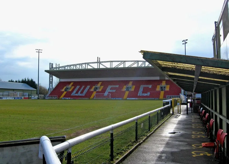
Gallagher Stadium
Gallagher Stadium — Football stadium in Kent, England.
 📷 5
📷 5Stadiums · South East England
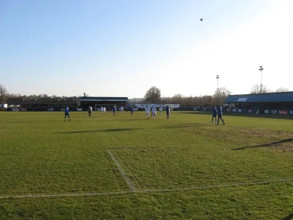
Kingfield Stadium
Kingfield Stadium — football stadium in Woking, Surrey, England.
 📷 5
📷 5 📷 5
📷 5Stadiums · South East England
Aldershot Military Stadium
Aldershot Military Stadium — British sports venue.
Frequently asked questions
- Where is Rushmoor Stadium?
- Rushmoor Stadium is in Hampshire, South-East England, United Kingdom (postcode GU14 8UD), in the parish of Rushmoor, unparished area.
- What is Rushmoor Stadium?
- Rushmoor Stadium — football stadium in Farnborough, England.
- How do I get to Rushmoor Stadium?
- The nearest railway station is Frimley, about 1.1 km away. The nearest town is Hartfordbridge. Drivers can use postcode GU14 8UD.
- Who owns Rushmoor Stadium?
- Rushmoor Stadium is owned by Farnborough F.C..
- Is Rushmoor Stadium a protected site?
- Yes — Rushmoor Stadium is part of the Basingstoke Canal SSSI Site of Special Scientific Interest.
- How do I get to Rushmoor Stadium?
- The nearest railway station is Frimley, about 1.1 km away. Drivers can navigate to postcode GU14 8UD.