Archaeological sites · South West England
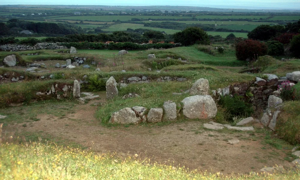
Round, courtyard house settlement and field system 140m WNW of Goldherring
In or near Sancreed.
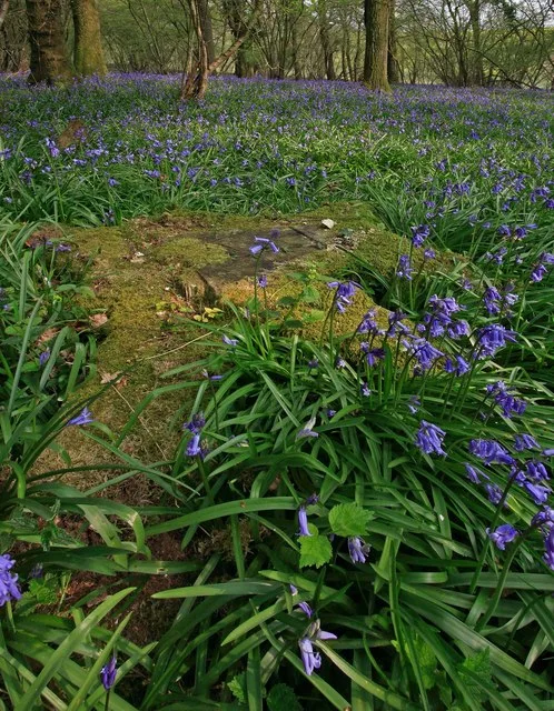
Round, courtyard house settlement and field system 140m WNW of Goldherring — archaeological site in Sancreed, Cornwall, England, UK.

Wikimedia Commons contributors — see linked file page for photographer and licence licence
.jpg)
Plan your visit
- Typical visit
- 45 min–1.5 h
- Nearest railway station
- Penzance · 7.0 km
- Free entry
- Dog-friendly
About
Round, courtyard house settlement and field system 140m WNW of Goldherring is a place of interest in South-West England. Officially recognised as scheduled monument. The site is within the Cornwall National Landscape (AONB), and is a designated Site of Special Scientific Interest. It sits within the St Ives parliamentary constituency. The nearest railway station is Penzance, about 7.0 km away. Postcode area TR20.
Photo gallery
Protected designations
- Site of Special Scientific Interest: Aire Point to Carrick Du SSSI
- Site of Special Scientific Interest: West Penwith Moors and Downs SSSI
- Area of Outstanding Natural Beauty: Cornwall
Designations sourced from Natural England open data under OGL v3.
Place summary
The Round courtyard house settlement and field system, located 140m WNW of Goldherring in Sancreed, South-West England, is a scheduled monument. This archaeological site is part of the Aire Point to Carrick Du SSSI and the West Penwith Moors and Downs SSSI, and lies within the Cornwall Area of Outstanding Natural Beauty (AONB).
AI-generated from the structured facts on this page (operator, designation, listing, era). Not a substitute for visiting.
- Coordinates
- 50.0971, -5.6212
- District
- Cornwall
- Parish
- Sancreed
- Postcode
- TR20 8RE
- Parliamentary constituency
- St Ives
- Nearest railway station
- Penzance — 7 km
Sources
- wikidata: Q17642703 (CC0)
- commons: Goldherring - after clearance (2020).jpg (CC BY-SA 4.0)
Other places nearby

Brane Cross
Historic houses · 0.6 km
Boscawen-Un
Hill forts · 0.8 km

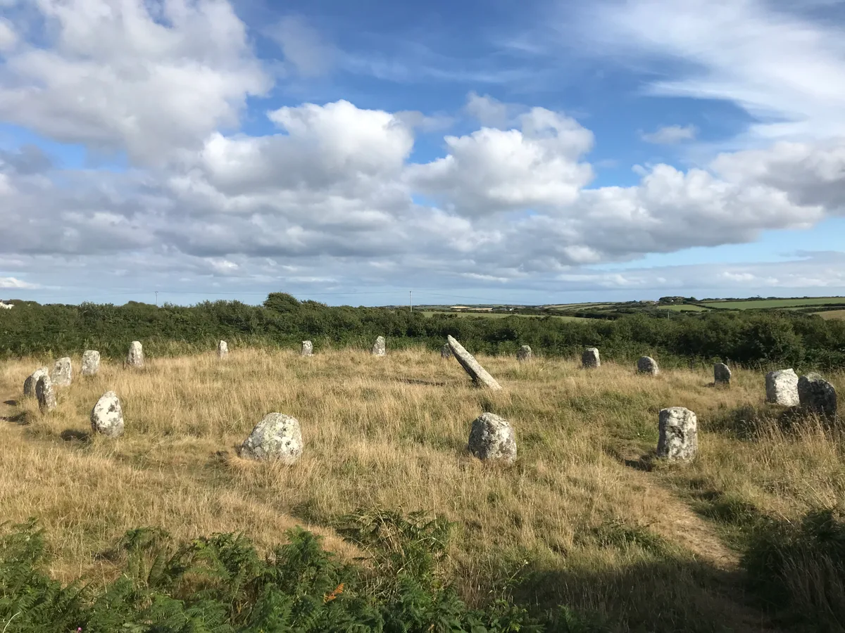
Boscawen-Un Stone Circle
Stone circles · 0.8 km

enclosure
Archaeological sites · 0.9 km
Caer Bran
Archaeological sites · 0.9 km

Caer Bran
Archaeological sites · 0.9 km
Caer Bran
Vineyards · 0.9 km

Brane Barrow
Memorials & monuments · 1.0 km

Cardinney Car. & Camp Park
Campsites · 1.1 km
Carn Euny
Hill forts · 1.1 km
Sancreed Beacon
Hill forts · 1.4 km

Standing stone known as the 'Blind Fiddler', 405m south east of Lesbew Farm
Windmills · 1.4 km
Nearby
📷 3Historic houses · South West England
Brane Cross
Brane Cross — a Grade II*-listed historic house in england-south-west, United Kingdom.
📷 5📷 3Stone circles · South West England
Boscawen-Un Stone Circle
Boscawen-Un Stone Circle — a stone circle in england-south-west, United Kingdom.
📷 3Archaeological sites · South West England
enclosure
enclosure — a archaeological in england-south-west, United Kingdom.
📷 3Archaeological sites · South West England
Caer Bran
Caer Bran — a archaeological in england-south-west, United Kingdom.
📷 5Where to eat & stay near Round, courtyard house settlement and field system 140m WNW of Goldherring
Places to stay
📷 5Campsites · South West England
Cardinney Car. & Camp Park
Cardinney Car. & Camp Park — a campsite in england south west.
 📷 5
📷 5Campsites · South West England
Tower Park
Tower Park — a campsite in england south west.
 📷 5
📷 5Campsites · South West England
Treganhoe Farm
Treganhoe Farm — a campsite in england south west.
 📷 5
📷 5 📷 5
📷 5Campsites · South West England
Sennen Cove Camping and Caravanning Club Site
Sennen Cove Camping and Caravanning Club Site — a campsite in england south west.
 📷 5
📷 5Campsites · South West England
Boleigh Farm Campsite
Boleigh Farm Campsite — a campsite in england south west.
Places to eat & drink
 📷 5
📷 5Historic pubs · South West England
Tolcarne Inn Public House
Tolcarne Inn Public House in England South West, United Kingdom.
 📷 5
📷 5Historic pubs · South West England
First And Last Inn
First And Last Inn in England South West, United Kingdom.
 📷 7
📷 7Restaurants · South West England
The Old Lifeboat House Bistro
The Old Lifeboat House Bistro — a restaurant in england south west. Cuisine: seafood.
 📷 5
📷 5 📷 5
📷 5 📷 5
📷 5Historic pubs · South West England
The Bucket of Blood
The Bucket of Blood in England South West, United Kingdom.
More archaeological sites in this region
 📷 5
📷 5Archaeological sites · South West England
Battlesbury Camp Monuments: hillfort, settlement, cemetery, barrows, enclosure, and field systems
Battlesbury Camp Monuments: hillfort, settlement, cemetery, barrows, enclosure, and field systems — archaeological site in Warminster, Wiltshire, England, UK.
 📷 2
📷 2Archaeological sites · South West England
Blandford Forest
Blandford Forest — forest in Blandford Forum, England.
 📷 5
📷 5Archaeological sites · South West England
Boulsbury Wood
Boulsbury Wood — protected area in Dorset and Hampshire, England.
.jpg?width=1200) 📷 5
📷 5Archaeological sites · South West England
Cranborne Chase
Cranborne Chase — Plateau in southern England.
Frequently asked questions
- Where is Round, courtyard house settlement and field system 140m WNW of Goldherring?
- Round, courtyard house settlement and field system 140m WNW of Goldherring is in South-West England, United Kingdom (postcode TR20 8RE), in the parish of Sancreed.
- What is Round, courtyard house settlement and field system 140m WNW of Goldherring?
- Round, courtyard house settlement and field system 140m WNW of Goldherring — archaeological site in Sancreed, Cornwall, England, UK.
- How do I get to Round, courtyard house settlement and field system 140m WNW of Goldherring?
- The nearest railway station is Penzance, about 7.0 km away. Drivers can use postcode TR20 8RE.
- Is Round, courtyard house settlement and field system 140m WNW of Goldherring a listed building?
- Round, courtyard house settlement and field system 140m WNW of Goldherring is officially recognised as scheduled monument listed.
- Is Round, courtyard house settlement and field system 140m WNW of Goldherring a protected site?
- Yes — Round, courtyard house settlement and field system 140m WNW of Goldherring is part of the Aire Point to Carrick Du SSSI Site of Special Scientific Interest and the West Penwith Moors and Downs SSSI Site of Special Scientific Interest.
- Is Round, courtyard house settlement and field system 140m WNW of Goldherring free to visit?
- Yes, Round, courtyard house settlement and field system 140m WNW of Goldherring is free to enter.
- How do I get to Round, courtyard house settlement and field system 140m WNW of Goldherring?
- The nearest railway station is Penzance, about 7.0 km away. Drivers can navigate to postcode TR20 8RE.