Mountains & hills · North West England
Rough Crag (Birker Moor)
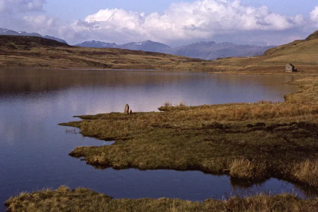
Rough Crag (Birker Moor) — a hill or mountain in england north west.

Michael Graham — CC BY-SA 2.0 via Wikimedia Commons licence
Plan your visit
- Typical visit
- 3 h–8 h
- Best time of year
- Late spring – early autumn (May–Oct)
About
A British hill or mountain, named on Ordnance Survey maps and walked by hill-baggers. Rough Crag (Birker Moor) is a named hill or mountain in england north west, recorded in the GeoNames UK gazetteer. British landmarks of this type are typically marked on Ordnance Survey maps and recorded in the national gazetteer for cartographic and navigational reference. Coordinates and feature classification are sourced from the GeoNames open dataset.
Photo gallery
Place summary
Rough Crag is a mountain located in North-West England, situated within the Birker Moor area. It is characterised by its rugged terrain and offers various opportunities for outdoor activities such as hiking and climbing. The landscape features typical moorland vegetation and scenic views of the surrounding countryside. This location is suitable for those seeking a natural environment for exploration and adventure.
AI-generated from the structured facts on this page (operator, designation, listing, era). Not a substitute for visiting.
- Coordinates
- 54.3684, -3.2927
Sources
- manual: geonames-12612339 (CC BY 4.0)
Other places nearby
Loading nearby places…
Nearby
📷 5Mountains & hills · North West England
Rough Crag
Rough Crag — mountain in england north west. Elevation: 319 m.
.jpg?width=1200) 📷 3
📷 3Archaeological sites · North West England
Prehistoric cairnfield, associated field system and hut circle east of Water Crag
Prehistoric cairnfield, associated field system and hut circle east of Water Crag — archaeological site in Eskdale, Copeland, England, UK.
 📷 5
📷 5Mountains & hills · North West England
Seat How
Seat How — mountain in england north west. Elevation: 311 m.
📷 5Mountains & hills · North West England
Seat How (Birker Moor)
Seat How (Birker Moor) — a hill or mountain in england north west.
 📷 5
📷 5Mountains & hills · North West England
Water Crag
Water Crag — mountain in england north west. Elevation: 305 m.
 📷 3
📷 3Natural landmarks · North West England
Devoke Water
Devoke Water — lake in the United Kingdom.
Where to eat & stay near Rough Crag (Birker Moor)
Places to stay
 📷 5
📷 5Campsites · North West England
Fisherground Campsite
Fisherground Campsite — a campsite in england north west.
 📷 5
📷 5Campsites · North West England
Eskdale Campsite
Eskdale Campsite — a campsite in england north west.
 📷 5
📷 5Campsites · North West England
The Barn Campsite
The Barn Campsite — a campsite in england north west.
 📷 5
📷 5Hostels · North West England
YHA Eskdale
YHA Eskdale — a hostel in england north west.
 📷 5
📷 5Campsites · North West England
Parkgate Farm
Parkgate Farm — a campsite in england north west.
 📷 5
📷 5B&Bs · North West England
Irton Hall
Irton Hall — a bed-and-breakfast in england north west.
Places to eat & drink
 📷 5
📷 5Historic pubs · North West England
Blacksmiths Arms
Blacksmiths Arms in England North West, United Kingdom.
 📷 5
📷 5Historic pubs · North West England
Church House Public House
Church House Public House in England North West, United Kingdom.
 📷 5
📷 5Restaurants · North West England
The Terrace Coffee House and Restaurant
The Terrace Coffee House and Restaurant — a restaurant in england north west. Cuisine: sandwich;lunch.
 📷 5
📷 5Historic pubs · North West England
Sun Cottage Sun Inn Public House
Sun Cottage Sun Inn Public House in England North West, United Kingdom.
 📷 5
📷 5Historic pubs · North West England
The Travellers Rest
The Travellers Rest in England North West, United Kingdom.
 📷 5
📷 5Cafés · North East England
Grange Bridge Cottage
Grange Bridge Cottage — a café in england north east.
More mountains in this region
 📷 3
📷 3Mountains & hills · North West England
Allen Crags
Allen Crags — Named summit at 785 m.
 📷 3
📷 3Mountains & hills · North West England
Alum Pot
Alum Pot — Open shaft pothole in North Yorkshire.
 📷 3
📷 3Mountains & hills · North West England
Arnside Knott
Arnside Knott — Named summit at 159 m.
 📷 3
📷 3Mountains & hills · North West England
Aye Gill Pike
Aye Gill Pike — Named summit at 556.3 m.
Frequently asked questions
- Where is Rough Crag (Birker Moor)?
- Rough Crag (Birker Moor) is in North-West England, United Kingdom.
- What is Rough Crag (Birker Moor)?
- Rough Crag (Birker Moor) — a hill or mountain in england north west.
- How do I get to Rough Crag (Birker Moor)?
- Its coordinates are 54.3684°, -3.2927°.