
Memorials & monuments · South West England
Roston Monument, In The Churchyard, About 8 Metres South Of South East Corner Of The Tower, Church Of St Mary
In or near Luxley.
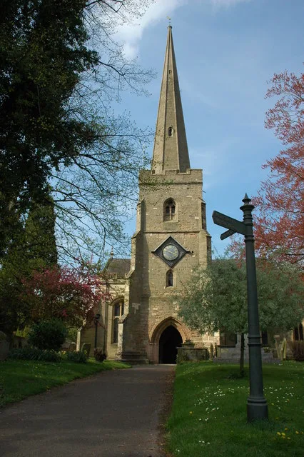
Roston Monument, In The Churchyard, About 8 Metres South Of South East Corner Of The Tower, Church Of St Mary — Grade II listed building-listed memorial in england-west-midlands, United Kingdom.

Philip Halling — CC BY-SA 2.0 via Wikimedia Commons licence

Plan your visit
- Typical visit
- 15 min–45 min
- Free entry
- Dog-friendly
About
Roston Monument, In The Churchyard, About 8 Metres South Of South East Corner Of The Tower, Church Of St Mary is a Grade II listed building-listed memorial in england-west-midlands, United Kingdom, registered on the National Heritage List for England (NHLE entry 1078653). Listed status protects buildings and structures of special architectural or historic interest. See the linked Wikipedia article for further details.
Photo gallery
See it from the streetimagery from 2020
Imagery © Mapillary contributors, CC BY-SA 4.0
Heritage listing
Details SO 7225-7325 NEWENT CHURCH STREET (north side) 13/116 Roston monument, in the churchyard, about 8m south of south-east corner of the tower, Church of St. Mary GV II Chest tomb; Edward Roston, died 1731; stone. Flat lid, moulded edge, quarter-square corner balusters, fielded panel with segmental ends to sides, scrolling in corners; ends fielded rectangular panels. Chamfered top to base. Good lettering, mixed upper and lower case, long 's'. Listing NGR: SO7235025926 Legacy The contents of this record have been generated from a legacy data system. Legacy System number: 125648 Legacy System: LBS
From the Historic England List Entry under OGL v3.
Protected designations
- Area of Outstanding Natural Beauty: Cotswolds
Designations sourced from Natural England open data under OGL v3.
Place summary
Roston Monument is a Grade II listed memorial located in the churchyard of St Mary’s Church in Newent, Gloucestershire, in the West Midlands. It stands approximately 8 metres south of the southeast corner of the church tower.
AI-generated from the structured facts on this page (operator, designation, listing, era). Not a substitute for visiting.
- Coordinates
- 51.9312, -2.4035
- County
- Gloucestershire
- District
- Forest of Dean
- Parish
- Newent
- Postcode
- GL18 1YN
- Parliamentary constituency
- Forest of Dean
Sources
- wikidata: Q26349217 (CC0)
Other places nearby

Hartland Monument In The Churchyard,About 9 1/2 Metres South Of The Tower, Church Of St Mary
Memorials & monuments · 0.0 km
Tayler Monument, In The Churchyard, About 18 Metres Along Path To South From South Chancel Porch, Church Of St Mary
Memorials & monuments · 0.0 km
Church of St Mary
Historic churches · 0.0 km

Astman Monument In The Churchyard, About 5 Metres South East Of South Chancel Porch, Church Of St Mary
Memorials & monuments · 0.0 km
Shepard Monument, In The Churchyard, About 12 Metres South East Of South East Corner Of South Aisle, Church Of St Mary
Memorials & monuments · 0.0 km
Warne Monument, In The Churchyard About 4 Metres West Of South West Corner Of Nave, Church Of St Mary
Memorials & monuments · 0.0 km

Hill Monument, In The Churchyard About 1 Metre North Of North East Corner Of Vestry Wing, Church Of St Mary
Memorials & monuments · 0.0 km
Loveridge Monument, In The Churchyard, About 8 Metres East North East Of North East Corner Of Chancel, Church Of St Mary
Memorials & monuments · 0.1 km

Newent
Museums · 0.3 km

Newent
Villages · 0.4 km

Pelerine Caravan & Camping Site
Campsites · 1.6 km

Boulsdon Manor
Literary houses · 1.9 km
Nearby
📷 3Memorials & monuments · South West England
Hartland Monument In The Churchyard,About 9 1/2 Metres South Of The Tower, Church Of St Mary
Hartland Monument In The Churchyard,About 9 1/2 Metres South Of The Tower, Church Of St Mary — Grade II listed building-listed memorial in england-west-midlands, United Kingdom.
📷 3Memorials & monuments · South West England
Tayler Monument, In The Churchyard, About 18 Metres Along Path To South From South Chancel Porch, Church Of St Mary
Tayler Monument, In The Churchyard, About 18 Metres Along Path To South From South Chancel Porch, Church Of St Mary — Grade II listed building-listed memorial in england-west-midlands, United Kingdom.
📷 3Historic churches · South West England
Church of St Mary
Church of St Mary — church in Newent Forest of Dean District United Kingdom.
📷 3Memorials & monuments · South West England
Astman Monument In The Churchyard, About 5 Metres South East Of South Chancel Porch, Church Of St Mary
Astman Monument In The Churchyard, About 5 Metres South East Of South Chancel Porch, Church Of St Mary — Grade II listed building-listed memorial in england-west-midlands, United Kingdom.
📷 3Memorials & monuments · South West England
Shepard Monument, In The Churchyard, About 12 Metres South East Of South East Corner Of South Aisle, Church Of St Mary
Shepard Monument, In The Churchyard, About 12 Metres South East Of South East Corner Of South Aisle, Church Of St Mary — Grade II listed building-listed memorial in england-west-midlands, United Kingd
📷 3Memorials & monuments · South West England
Warne Monument, In The Churchyard About 4 Metres West Of South West Corner Of Nave, Church Of St Mary
Warne Monument, In The Churchyard About 4 Metres West Of South West Corner Of Nave, Church Of St Mary — Grade II listed building-listed memorial in england-west-midlands, United Kingdom.
Where to eat & stay near Roston Monument, In The Churchyard, About 8 Metres South Of South East Corner Of The Tower, Church Of St Mary
Places to stay
📷 5Campsites · South West England
Pelerine Caravan & Camping Site
Pelerine Caravan & Camping Site — a campsite in england west midlands.
 📷 5
📷 5Campsites · West Midlands
Haywood Farm Caravan and Camping Park
Haywood Farm Caravan and Camping Park — a campsite in england west midlands.
 📷 5
📷 5Campsites · South West England
Forest Road Camping
Forest Road Camping — a campsite in england west midlands.
 📷 5
📷 5Caravan parks · South West England
Woodgreen Farm CL
Woodgreen Farm CL — a caravan park in england west midlands.
 📷 5
📷 5Campsites · West Midlands
Greenacres Camping & Caravan Site
Greenacres Camping & Caravan Site — a campsite in england west midlands.
 📷 5
📷 5Campsites · West Midlands
Cwtch Cabins and Camping
Cwtch Cabins and Camping — a campsite in england west midlands.
Places to eat & drink
 📷 7
📷 7Restaurants · South West England
The Dark Barn
The Dark Barn — a restaurant in england west midlands. Cuisine: gastropub. 4-star.
 📷 7
📷 7Historic pubs · West Midlands
Seven Stars Inn
Seven Stars Inn in England West Midlands, United Kingdom.
 📷 7
📷 7 📷 5
📷 5Historic pubs · West Midlands
Farmers Arms Public House
Farmers Arms Public House in England West Midlands, United Kingdom.
 📷 5
📷 5 📷 5
📷 5More memorials in this region
 📷 5
📷 5Memorials & monuments · South West England
Bath Cenotaph
Bath Cenotaph is a memorial in the United Kingdom.
 📷 5
📷 5Memorials & monuments · South West England
Cross of Sacrifice
Cross of Sacrifice is a memorial in the United Kingdom.
 📷 5
📷 5Memorials & monuments · South West England
Grange Arch
Grange Arch is a memorial in the United Kingdom.
.jpg?width=1200) 📷 5
📷 5Memorials & monuments · South West England
King Alfred Memorial
King Alfred Memorial is a memorial in the United Kingdom.
Frequently asked questions
- Where is Roston Monument, In The Churchyard, About 8 Metres South Of South East Corner Of The Tower, Church Of St Mary?
- Roston Monument, In The Churchyard, About 8 Metres South Of South East Corner Of The Tower, Church Of St Mary is in Gloucestershire, the West Midlands, United Kingdom (postcode GL18 1YN), in the parish of Newent.
- What is Roston Monument, In The Churchyard, About 8 Metres South Of South East Corner Of The Tower, Church Of St Mary?
- Roston Monument, In The Churchyard, About 8 Metres South Of South East Corner Of The Tower, Church Of St Mary — Grade II listed building-listed memorial in england-west-midlands, United Kingdom.
- How do I get to Roston Monument, In The Churchyard, About 8 Metres South Of South East Corner Of The Tower, Church Of St Mary?
- Drivers can use postcode GL18 1YN.
- Is Roston Monument, In The Churchyard, About 8 Metres South Of South East Corner Of The Tower, Church Of St Mary a listed building?
- Roston Monument, In The Churchyard, About 8 Metres South Of South East Corner Of The Tower, Church Of St Mary is officially recognised as Grade II listed building listed.
- Is Roston Monument, In The Churchyard, About 8 Metres South Of South East Corner Of The Tower, Church Of St Mary a protected site?
- Yes — Roston Monument, In The Churchyard, About 8 Metres South Of South East Corner Of The Tower, Church Of St Mary is part of the Cotswolds National Landscape (AONB).
- Is Roston Monument, In The Churchyard, About 8 Metres South Of South East Corner Of The Tower, Church Of St Mary free to visit?
- Yes, Roston Monument, In The Churchyard, About 8 Metres South Of South East Corner Of The Tower, Church Of St Mary is free to enter.
- How do I get to Roston Monument, In The Churchyard, About 8 Metres South Of South East Corner Of The Tower, Church Of St Mary?
- Drivers can navigate to postcode GL18 1YN. It sits within the Forest of Dean parliamentary constituency.