
Memorials & monuments · Yorkshire & the Humber
Robin Hood's Well
In or near Burghwallis.
Robin Hood's Well is a memorial in the United Kingdom.

Wikimedia Commons contributors — see linked file page for photographer and licence licence

Plan your visit
- Typical visit
- 15 min–45 min
- Nearest railway station
- Adwick · 4.0 km
- Free entry
- Dog-friendly
About
Robin Hood's Well is a public memorial or monument in the United Kingdom. Coordinates: 53.5998°, -1.2172°. This entry is part of The Great Britain Guide, a free, ad-free, open-data tourist directory.
Photo gallery
See it from the streetimagery from 2025
Imagery © Mapillary contributors, CC BY-SA 4.0
From the Wikipedia article
Robin Hood's Well is a historic structure beside the A1 road near Burghwallis, South Yorkshire, England. It was originally built in 1710 as a well house over a spring alongside the old Great North Road, but the structure was moved to its present location alongside the Doncaster By-Pass in what is known as Barnsdale (sometimes Barnsdale Forest).
Excerpt from Wikipedia under CC BY-SA 4.0. See the source article linked in Sources below.
Background
History
The ballad "Robin Hood and the Curtal Friar" gives the figure of Robin Hood a connection to fountains, which may account for the original naming of the spring where the well was established. The well itself was given the name "Robin Hood's Well" by Charles Howard, 3rd Earl of Carlisle, who had the well named after the figure in an attempt to solidify the area's identity as the home of the legends. When in its original location, according to letters by Roger Gale in John Nichols topographical book of Britain, recorded that there was an epigram in Latin that read: and translates as: The site next to the Great North Road was shown on the maps for the journey from London to in tourist guide,…
Description
Robin Hood's Well is an ornamental well cover that was designed by Sir John Vanbrugh in 1710 for the 3rd Earl of Carlisle. The stone that makes up the well cover is finely cut, ashlar Magnesian Limestone. Three of its sides are made up of arched entrances with pendant keystones. After its relocation the structure was rehabilitated in 1993 with a stainless-steel frame to ensure its prolonged survival.
Sourced from Wikipedia under CC BY-SA 4.0.
- Coordinates
- 53.5998, -1.2172
- District
- Doncaster
- Parish
- Burghwallis
- Postcode
- DN6 8LS
- Parliamentary constituency
- Doncaster North
- Established
- 1710
- Nearest railway station
- Adwick — 4 km
Sources
- osm: n3970918279 (ODbL)
- wikipedia: Robin Hood's Well (CC BY-SA 4.0)
- commons: Robin hoods well.JPG (CC BY-SA 4.0)
Other places nearby

Burghwallis War Memorial
Memorials & monuments · 1.4 km

Hampole Castle Hill
Castles · 1.5 km
Castle Hill
Literary houses · 1.6 km

Skellow
Villages · 1.6 km
Cromwell's Batteries
Literary houses · 1.7 km
Skellow
Castles · 1.7 km

Skellow Market Cross
Historic houses · 1.8 km
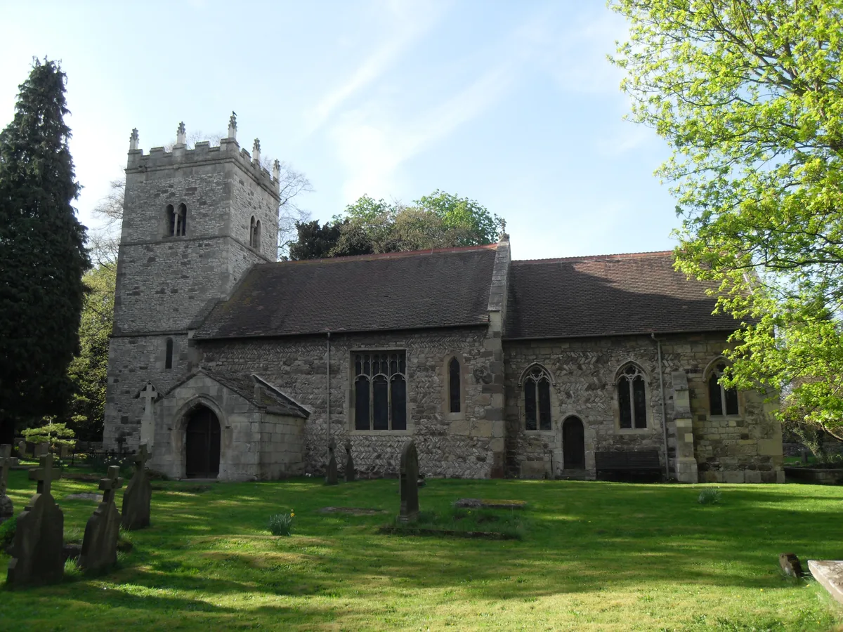
Church of St Helen
Historic churches · 1.8 km

Little John's Well
Memorials & monuments · 2.2 km

Burghwallis
Towns & cities · 2.5 km

Bridge At South Entrance To Farmyard Of Campsmount Home Farm
Historic bridges · 3.0 km

Sutton
Villages · 3.3 km
Nearby
📷 3Memorials & monuments · Yorkshire & the Humber
Burghwallis War Memorial
Burghwallis War Memorial — Grade II listed building-listed memorial in england-yorkshire, United Kingdom.
📷 5Castles · Yorkshire & the Humber
Hampole Castle Hill
Hampole Castle Hill — a castle in england yorkshire.
📷 5Literary houses · Yorkshire & the Humber
Castle Hill
Castle Hill — a literary house museum in england yorkshire.
📷 5📷 3Literary houses · Yorkshire & the Humber
Cromwell's Batteries
Cromwell's Batteries — a literary house museum in england yorkshire.
📷 5Where to eat & stay near Robin Hood's Well
Places to stay
 📷 5
📷 5Caravan parks · Yorkshire & the Humber
Tilts Farm Caravan Site
Tilts Farm Caravan Site — a caravan park in england yorkshire.
 📷 5
📷 5Caravan parks · Yorkshire & the Humber
The Pony Paddock
The Pony Paddock — a caravan park in england yorkshire.
 📷 6
📷 6 📷 5
📷 5Caravan parks · Yorkshire & the Humber
The Stables Caravan Park
The Stables Caravan Park — a caravan park in england yorkshire.
 📷 5
📷 5Caravan parks · Yorkshire & the Humber
Riverside Mobile Home Park
Riverside Mobile Home Park — a caravan park in england yorkshire.
 📷 5
📷 5Hotels · Yorkshire & the Humber
Hilton Garden Inn Doncaster Racecourse
Hilton Garden Inn Doncaster Racecourse — a hotel in england yorkshire. 4-star. Brand: Hilton Garden Inn.
Places to eat & drink
 📷 7
📷 7Historic pubs · Yorkshire & the Humber
Pontefract Barracks
Pontefract Barracks in England Yorkshire, United Kingdom.
 📷 7
📷 7Historic pubs · Yorkshire & the Humber
The Horse Vaults Public House
The Horse Vaults Public House in England Yorkshire, United Kingdom.
 📷 7
📷 7Historic pubs · Yorkshire & the Humber
The Green Dragon Public House
The Green Dragon Public House in England Yorkshire, United Kingdom.
 📷 7
📷 7Historic pubs · Yorkshire & the Humber
The Plough Inn
The Plough Inn in England Yorkshire, United Kingdom.
 📷 7
📷 7Restaurants · East Midlands
Miller & Carter
Miller & Carter — a restaurant in england east midlands. Cuisine: steak. Brand: Miller & Carter.
 📷 7
📷 7Historic pubs · Yorkshire & the Humber
Cooperative Store (Barnsley British)
Cooperative Store (Barnsley British) in England Yorkshire, United Kingdom.
More memorials in this region
 📷 3
📷 3Memorials & monuments · Yorkshire & the Humber
Disley War Memorial
Disley War Memorial — War memorial, dating to 1920.
 📷 3
📷 3Memorials & monuments · Yorkshire & the Humber
Hyde war memorial
Hyde war memorial is a memorial in the United Kingdom.
 📷 3
📷 3Memorials & monuments · Yorkshire & the Humber
Audenshaw War Memorial
Audenshaw War Memorial — Grade II listed building-listed memorial in england-west-midlands, United Kingdom.
 📷 3
📷 3Memorials & monuments · Yorkshire & the Humber
War memorial to front of Church of St Paul
War memorial to front of Church of St Paul — Grade II listed building-listed memorial in england-west-midlands, United Kingdom.
Frequently asked questions
- Where is Robin Hood's Well?
- Robin Hood's Well is in Yorkshire, United Kingdom (postcode DN6 8LS), in the parish of Burghwallis.
- What is Robin Hood's Well?
- Robin Hood's Well is a memorial in the United Kingdom.
- How do I get to Robin Hood's Well?
- The nearest railway station is Adwick, about 4.0 km away. The nearest town is Burghwallis. Drivers can use postcode DN6 8LS.
- When was Robin Hood's Well built?
- Built or established in 1710.
- Who owns Robin Hood's Well?
- Robin Hood's Well is owned by | designation1 = Grade II Listed Building.
- Is Robin Hood's Well free to visit?
- Yes, Robin Hood's Well is free to enter.
- How do I get to Robin Hood's Well?
- The nearest railway station is Adwick, about 4.0 km away. Drivers can navigate to postcode DN6 8LS.